Showing posts with label Minnesota. Show all posts

Friday, August 28, 2020

Tettegouche

Friday morning, I woke up early again and went down to the lake just before sunrise.  It was too cloudy this morning, however.  Since I was up, I headed over to Cascade River State River to see the Cascades and Cascade Falls again.


The waterfalls were beautiful in the early morning light.


Wearing water shoes, I went down to Cascade River to see if I could creek walk up to the base, but there was a deep spot I couldn't get around.  I spotted some fireweed as I was hiking back out.


By the time I got back to the cabin, Sandy was awake and it was almost time for breakfast.


We had breakfast at the restaurant then started getting packed up.  We were heading west today, but made our first stop at Tettegouche State Park.  Before reaching the main part of the park, we turned on County Road 1 and stopped at a pull off.  It was a just a short walk down to Baptism River at the top of Illgen Falls.


There were some cascades just above the main drop.


The view from the trail was pretty good, but of course I wanted to get to the base.


There was a very steep scramble path to get down to the river level for a view from the bottom.


After some pictures, we headed back and drove to the main part of the park.  Heading down the High Falls Trail, we passed under the highway and continued for about a mile to a steep set of stairs heading down to Two Step Falls.


As the name suggests, the waterfall is in two sections.  It was rather scenic, but nothing compared to what was just upstream.  A short ways further on the trail we came to a path leading down to the base of High Falls.


High Falls is the highest waterfall completely in the state of Minnesota and was really spectacular.


After some pictures from the base, we continued on the main trail towards the top.


There was a nice view from the trail as it led past the top.


A suspension bridge led over the river here, but this was as far as we were going today.


Back at the car, we made the short drive to the visitor center parking and hiked the Shovel Point Trail.


There were great views of the rugged Lake Superior shoreline with crashing waves.


The trail climbed up to Shovel Point with elevated views.


From here, it dropped down towards the shore with numerous spots to go out for views.
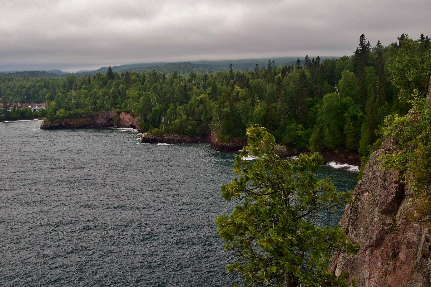

The trail ended at a wooden overlook with gorgeous views of the choppy waters.


It was extremely windy out here at the overlook, though much less so everywhere else on the trail.


Due to the wind, we didn't stay long.  Tettegouche was a really beautiful and diverse park, but we needed to get going as we had a long drive towards North Dakota.


It was several hours to drive across Minnesota.  When we were almost to Fargo, we made a quick stop at Buffalo River State Park to stretch our legs and let the dog out.


It was a beautiful tallgrass prairie but we didn't have time for a long hike and the mosquitoes were bad.  We finished up the drive to Fargo and checked into the La Quinta Inn for the night.  Tired from the long drive, we just ordered a pizza to the room.

Thursday, August 27, 2020

Eagle Mountain

Thursday morning, we woke up before sunset and hiked across the road to the rocks along Lake Superior to watch the sunrise.


It was really beautiful as the sky lit up with orange and pink.  The lake was beautiful as well some pretty big waves.


Cascade Restaurant didn't open for breakfast until 8, so we took the short hike from the cabins into Cascade River State Park towards the waterfalls.  There was some western pearly everlasting blooming along the trail.


We first came to the Cascades, a series of 5 small waterfalls crashing through a narrow gorge.


A bridge across the provided views of more of the drops.


Looking downstream, the bigger drop was just out of sight.


We followed the trail down the gorge on river right side.


There were several smaller cascades on the river.


But no mistaking when we got to the big one.


The view from the trail was pretty good and it didn't look like any feasible way to get to the base.


After some pictures we hiked back.  Some common tansy was blooming along the trail.


We stopped at the cabin and enjoyed the cool morning.


At 8, we met with Chris and Mel at the restaurant and had breakfast.  Then we drove north into Superior National Forest to the trailhead for Eagle Mountain.  The trail headed north and entered Boundary Waters Canoe Area Wilderness after about a mile.  In another mile, we came to Whale Lake.


The lake was very scenic and Pyro played in the water some.


Right past the lake, the trail turned and climbed up Eagle Mountain.  There was an viewpoint part of the ways up.


A little further was the best viewing spot on the mountain.


The actual summit was just a little ways further up, but no view from up here.  At 2,301 feet above sea level, it's the highest point in Minnesota.


We headed back down to the lower viewpoint and had lunch here.  I scrambled around on the rocks to find some more views.


After lunch, we made the hike back down the mountain and back to the trailhead.


From here, we headed back to the paved roads and continued up the North Shore to Judge C. R. Magney State Park.  From the parking area, the trail crossed Brule River above some scenic cascades.


It then followed Brule River upstream high above.  In just under a mile, a set of stairs descended down to the river at the base of Upper Falls.


Upper Falls is about 25 feet and just downstream of Devil's Kettle.  I think there's a lower falls downstream, but not sure how to reach it.  After some pictures, we climbed back up the stairs and it was just a short ways further to an overlook of Devil's Kettle Falls.


The Brule River splits into two streams.  The river left stream tumbles down about 50 feet like a typical waterfall.  But the river right stream falls into a pothole, the Devil's Kettle, and no one knows for sure where the water goes.  I continued on the trail to the top of the falls and climbed out on the rocks for a close up view.


Then we started making our way back.  I spotted some scaly pholiota on a tree on the hike back.


By the time we finished, it was getting pretty late.


We drove back to Cascade River Lodge and had dinner at the restaurant again.  After dinner, I ran across the street to the lake for sunset.  Couldn't see the sun itself from here, but the sky lit up in beautiful colors.


After sunset, we headed back and started getting packed up.

Wednesday, August 26, 2020

Run for the Border

Wednesday, we checked out of the hotel and started making our way up the North Shore.  Our first stop was at Gooseberry Falls State Park.  We parked at the rest area and hiked down the paved path that led to the Middle and Lower Falls.  The water level was low enough that it was possible to walk out in the river bed to see the waterfalls close up.


Between Middle Falls and Lower Falls was a rock arch.


Climbing under, I had a nice view looking downstream.


There was a nice view of Lower Falls here as well.


I could see Middle Falls the bridge just upstream.


Climbing further down, I crossed the river to get up to Lower Falls from the base.


The Lower Falls was really scenic.


There are actually two sections of the Lower Falls, but the river-right had low water flow.


As we were scrambling on the rocks, there was some lightning, so we headed back to the rest area and sat under a shelter for the storm to pass.  We talked to a local guy whose wife's brother died jumping from the Upper Falls.  Swimming near there is now prohibited.  After the storm passed, we headed back to the river and spotted some mountain-ash berries.


There was a nice view of the Middle Falls from above here.


Then we crossed under the highway to view the Upper Falls.


The view from the trail was pretty good.


And there were some cool cliffs along the trail as well.


As we got around to the other side, there was a memorial to the young man who died jumping from the Upper Falls.  I climbed down from here to get a good view of Upper Falls from the base.


There was a little green frog down here.


Then we continued upstream along the river.  There were some more caves along the river just upstream of the falls.


We soon crossed the river and it was about a mile to Fifth Falls.


There were a lot of cool caves along the river here.


The lower section, a chute was difficult to get a good view of.


But the upper cascades were very scenic.


All of these waterfalls on Gooseberry River were really scenic with beautiful volcanic rock and small caves.  We texted Chris and suggested they stop here as well on their way up the North Shore.  Above Fifth Falls was a footbridge over the river.


We crossed on the bridge for the views of the river and hiked back on the opposite side.


On the hike back, we spotted a big yellow fly agaric mushroom.


There were some bigleaf aster flowering.


Rose hips are the fruit of a wild rose.


Soon we were back to the car.


From here, we continued driving northeast all the way to the Canadian border.  Just before the border, we made the last turn to enter Grand Portage State Park.  A half-mile paved trail led from the visitor center to a boardwalk out to see High Falls, the highest waterfall in Minnesota.


There were three overlooks from which to view this spectacular waterfall on the Canadian border.


From the highest, the lower cascades were visible.


We could see down the Pigeon River gorge as well.


After some pictures, we got on the Middle Falls Trail.  In about a half-mile, there was a bench with a nice view of Lake Superior.


Shortly past here was a spur that led up to a nice overlook.


From one side we could see south towards Lake Superior and from the other side, north into Canada.


Continuing on, there were some pear-shaped puffball mushrooms growing on rotting wood.


We soon came to the split and went left to head down to the Pigeon River.  We came out near Little Falls, a small cascading waterfall.


Just downstream was Middle Falls.


There was a nice view from the top to see how powerful the water was.


A little further down the trail we got out into the river for a more distant view from the base.


The views of the Pigeon River gorge were very nice despite the clouds.


Then we started making our way back.  Along the way, some bigleaf aster was blooming.


Some scaly pholiota mushrooms had popped up along the trail.


When we reached the parking lot, we ran into Chris and Mel.  They had taken our advice and stopped at Goooseberry Falls and so were late getting up here.  They were going to run out to see High Falls while we started making our way back.


We checked into Cabin 2 at Cascade River and had dinner at the restaurant.  There was potential for a good sunrise so we went to bed early.