Saturday, July 27, 2024

Watauga Lake AT Hike

Saturday morning, I got packed up and checked out early and started heading east.  I stopped at the Appalachian Trailhead along US-321 at Watauga Lake around sunrise for a hike before driving home.  Heading northbound along the AT, there were a couple spots to go out on the lake.


The lake was really beautiful in the early morning light.


There are several backcountry campsites along the trail here and those campers really had some great views to wake up to.


I saw more lilies blooming along the trail.


The trail then started heading further away from the lake.


In about 3 miles, I crossed the Watauga Dam.


The dam had great views of the lake and looking downstream towards Wilbur Lake.


In about another mile, I crossed a road and the trail entered Big Laurel Branch Wilderness.


From here, the trail headed steeply up the ridge.


I went about a mile or so and turned back.


The hike back was mostly downhill and I made it back to the car around 1130.


I drove back into North Carolina and stopped at Little Richards for barbecue in Yadkinville before finishing the drive home.

Friday, July 26, 2024

Sampson Mountain Hike

Friday, I headed to Horse Creek Recreation Area in Cherokee National Forest and parked where the pavement ended.  Hiking up the gravel road, a footbridge crossed Horse Creek and led into Sampson Mountain Wilderness.  There were two footbridges over Squibb Creek and then the first rock hop crossing next to an A-frame cabin in the woods.


Turkeypen Gap Trail and then Middle Spring Ridge Trail split off while I stayed on Squibb Creek Trail following the creek upstream.  There were numerous creek crossings but I was able to rock hop all of them.


A couple were a little difficult, but not too bad.


Finally, the trail ended at the base of Squibb Creek Falls.


The recent rains must have boosted the water level as it was looking very nice.


I really liked the mossy rocks around the base.


I took a break up here to enjoy the falls then started hiking back down.


There were flowers and mushrooms popping up along the creek.


Near the bottom, I got on Middle Spring Ridge Trail and started hiking up.  It was really steep and just kept going up and up.


In a little over a mile, the trail ended at Turkeypen Gap Trail and I took that back down to make a loop.


There were a few nice views from near the top, but not really worth the steep climb up.


The trail ended back at Squibb Creek and I took that back to the road.  Turning left on FR-94, the road shortly came to a ford and this one I could not rock hop.  Then there was another one in another half mile.  I had to wade again at the third but could rock hop and use a log to get across the fourth dry.  After this one, I got on Poplar Grove Trail to Pete's Branch Trail and followed its namesake up.  The trail ended at Pete's Branch Falls.


It's on a small creek, so probably a good thing I had to get wet at the fords.


With higher water, the waterfall split into two streams surrounded by massive cliffs.


I had lunch up here and then started heading back.


I was getting hungry so headed into downtown Johnson City for one more taco dinner at White Duck and then returned to the hotel to start getting packed up.

Thursday, July 25, 2024

Rocky Fork Hike

Thursday, I headed to Lamar Alexander Rocky Fork State Park.  It was raining lightly when I arrived, but not too heavy.  I first hiked up Whitehouse Cliffs Trail.  It was pretty steep but only about a mile up to the top.


It was cloudy at the overlook, but not a complete whiteout, so the views were pretty cool.


But it was still raining and I didn't have the cover of the trees, so didn't linger too long.  Back at the trailhead, I got on Rocky Fork Trail and followed the creek upstream.


There were lots of nice cascades along the trail but it was raining so I didn't stop much for pictures.  I would have to come back down this way and was hoping the rain would have ended by then.  At the end of the trail, I went right on Whiteoak Flats Trail and continued heading up.


Less than a mile up, there was a really nice overlook of the Rocky Fork drainage.  At the end of this trail, I got on Birchfield Camp Trail.


This trail headed steeply up and up but the rain finally stopped.


Near the top, a spur led to the highest point in Tennessee State Parks, but there was no view and probably not worth the steep climb up.


So I hiked back down.  I went down Headwaters Trail to the end, passing near the upper portion of Rocky Fork.


Heading back down, the view was more open from the Whiteoak Flats Trail overlook.


Then I got on Flint Creek Trail and crossed Rocky Fork.


Just ahead was the Flint Creek Battle Site, where John Sevier battled the Cherokee.


I went a little further and then turned back.


There were some beebalm flowering along the creek.


I took Flint Creek Trail back to Rocky Fork Trail.


Since the rain had finally stopped, I stopped to see some of the numerous cascades on Rocky Fork on the hike back.


None were big enough to be a waterfall, but it was very scenic.


Back at the car, I made a quick stop on Rocky Fork Road.  Rocky Fork Falls, the only drop big enough to be a waterfall, was just along the side of the road.


I saw it on the drive in, but missed the the very limited parking on this narrow road.


I got some pictures then headed back as the sun was starting to poke out.


I drove back to Johnson City and had barbecue for dinner at Southern Craft and then headed back to the hotel

Wednesday, July 24, 2024

Dick Creek Waterfalls

Wednesday, I headed to Rock Creek Recreation Area in Cherokee National Forest to find some waterfalls.  After paying the day use fee and parking by the swimming area, I got on the Rock Creek Falls Trail.  The trail soon split with the other trails and headed into Unaka Mountains Wilderness.  Following Rock Creek upstream, there were several crossings though all were easy rock hops in low water.


After a mile and a half or so, a scramble path led down to Lower Rock Creek Falls.


It's not as impressive as the main waterfall, but the rock that the water flows over is very scenic


There was another nice cascade above here.


Soon, I came to Rock Creek Falls.


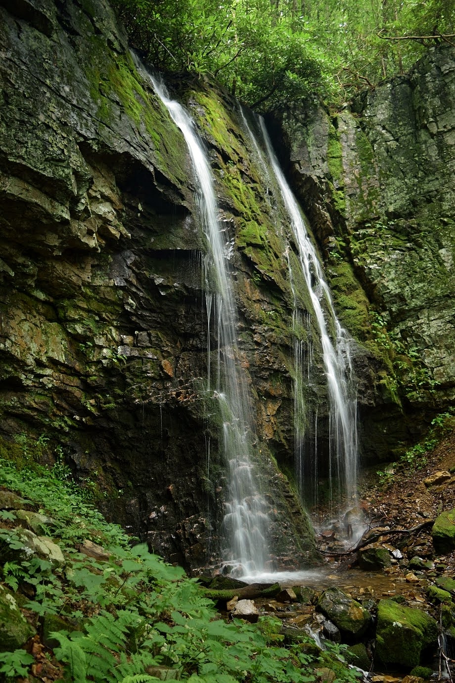
With two drops in a massive rock amphitheater, it's a really nice waterfall.


I had been here before, but the lighting was poor, so glad to get some nice shots.


After some pictures, I headed back down.  After leaving the wilderness, I got on Bicycle Trail to Rattlesnake Ridge Trail and took that one up.  The trail climbed up to Dick Creek Gap where I got on Dick Creek Trail heading down towards its namesake.  In about 3/4 mile, I had to rock hop Dick Creek and then turn right on another old road.  In less than half a mile, a well-worn path turned right and led to a campsite with a scramble path leading down to Lower Dick Creek Falls.


The first waterfall on the creek, it's only about 20 feet and looked really nice despite the low water.


The little pool at the base was really scenic.


I scrambled on the rocks to get some pictures and then headed back up.  The old road continued through an open area and then made another crossing of Dick Creek, which I could rock hop again.  There was a campsite fire ring after the crossing and I got off the road and followed a path to the left.  It headed up and followed the creek upstream.  Despite bushwhacking, it was quite easy as I stayed on the most obvious path that was closest to the creek.  In a quarter-mile or so, I came to Upper Dick Creek Falls.


It was tricky getting down to this one and I would bring a rope if I came back.  Unfortunately, the water level was low and this one was not looking as good as possible.


I will definitely have to come back.  I couldn't get back up the way I went down and had to find another way back up.  The faint path continued another 1/10 of a mile or so and ended at another crossing of Dick Creek.  A path to the right went to Upper Upper Dick Creek Falls, a very impressive 60-foot drop through a narrow cleft in the rock.


This one too really needed more water to look its best.


Back at the creek crossing, a super steep path headed up along the waterfall.  After climbing up a ways, the last part was through a narrow notch at the top of the cliff.  Someone had tied a rope, though I don't think it was necessary.  Past the notch, it was just 100 feet or so through a very overgrown path to Upper Upper Upper Dick Creek Falls.


It was about a 20-foot drop and looked pretty nice despite low water.


It was just above the previous waterfall.  From here, I started making my way back, it was all downhill back to Dick Creek Trail and then a gradual climb back up to the gap.  There was some Indian pipe flowering along the creek.


It was still pretty early so I hiked a ways up on Rattlesnake Ridge Trail back into the wilderness.


There were a couple spots on the trail with decent views but it would need to be winter for good views.


After a couple miles, I turned back and headed back to the start.  I had gotten pretty sweaty with all the climbing and bushwhacking so changed into a bathing suit and took a dip in the outdoor pool, which was basically Rock Creek diverted into a concrete pool.  The water sure felt good.


After changing back, I headed into Erwin and got dinner at Red Fork.  They had a map of Unicoi County on the wall with numerous waterfalls marked.  I took it as a personal challenge.  After dinner, I returned to the hotel.