Sunday, July 3, 2022

Clingmans Dome MST Hike

Sunday, we needed to complete the only hike for #mst40hike that Alex is unable to do.  Heading west from Maggie Valley, we entered Great Smoky Mountains National Park at the Oconaluftee Visitor Center.  There was only appeared to be one elk in the field and we weren't going to stop initially, but then realized there were two - a mother with her nursing baby.  So we made a stop to view the baby elk that still had spots, like a fawn.


Then we drove up to the parking lot at Clingmans Dome to do the first MST hike without Alex, since dogs aren't allowed.


Despite bright sun down in the valley, it was very foggy at the top with no views so we got right on the combined MST/Appalachian Trail.


The high elevation forest was really beautiful in the fog.


We followed the combined trail for several miles in the fog with only a few sprinkles here and there.


Some mountain woodsorrel was blooming among the ferns.


We crossed over the summit of Mount Collins and hiked as far as the Fork Ridge Trailhead, where the MST splits from the AT to complete hike 1 and then started making our way back.  Sandy spotted a bird's nest with some babies.


We also saw a cool mushroom on the hike back too.


Although it rained a little, the skies cleared by the time we made it back to the summit.


So we stopped at Clingmans for a couple pictures before returning to the car.  With the clearing weather, it had gotten really crowded up here.


Driving back down US-441, we made a quick stop at Cliff Branch Falls.


It's a small roadside waterfall, but worth a quick stop after the recent rains.


Then we continued back to Maggie Valley.  BearWaters had been really good and close to the hotel, so we stopped there for dinner again and got burgers.  Then we headed back to the hotel to start getting packed up.

Saturday, July 2, 2022

Middle Creek Waterfalls

Saturday, we headed to the mountains for the Independence Day weekend.  We took my new car as I wanted to get a good picture out here.  We drove out to Highlands through Cullasaja Gorge and first stopped at Bridal Veil Falls, hands down the best place for a new car picture in NC.


After a couple photos, we continued on NC-107 to near the Georgia state line and parked at a school bus sign.  A thin strip of Nantahala National Forest leads from the road to Middle Creek.  After passing power lines, we turned right on a short path that led to a view of Upper Middle Creek Falls.


It was very foggy and quite a beautiful scene.  The rosebay rhododendron were putting on a show.  Little did we know that they would nearly be the death of us before the hike was over.


We scrambled down to the creek level for some pictures as the sun started breaking through the fog, making a really cool scene.


After some pictures, we headed back to the split and turned right to continue down along Middle Creek.  The trail was overgrown and hard to follow in places, but at least it was a trail.  In a quarter-mile or so, we came to the top of Middle Creek Falls.


There's a huge boulder up at the top and some nice cascades, but no way to get further down.


More rhododendron flowering up here as well.


We backtracked 50 feet or so and continued down to a view point of the main upper drop of the waterfall.


The clouds were cooperating and we could get some nice pictures of this beautiful waterfall.


I scrambled down on the rocks down to creek level for one more shot and then we continued on.


There was essentially no trail further down the creek.  We found a slightly open path through the dense rhododendron and slowly started making our way down.  It took nearly an hour to get down to the very bottom of Middle Creek Falls.  I think there used to be an old logging road around here, but we never found it, just incredibly dense rhododendron.  We creek-walked a ways to avoid some of the worst rhododendron and heard what we thought was the waterfall, but it was not.


This small waterfall was just above our target and I actually liked it better.  More brutal rhododendron and we finally made it to Dome Falls.


It's an interesting waterfall where the water flows over a big rock dome, which splits the flow.


Most of the water was on the river-left side.  There was an island immediately down from the falls, but it was too close to get a picture of the whole thing.


Interesting or not, this was excruciatingly difficult and I would not ever want to return.  Now, we just had to make the climb back up, which was just as miserable.  After a total of almost 8 hours, we made it back to the car.


From here, we drove to Maggie Valley through a big storm.  We checked into Stony Creek Lodge and then went to BearWaters Brewing for dinner.  They had excellent food and good beer.  After dinner, we went back to the room and checked out the swollen creek from the storms.  We took a quick shower and then went to bed after a very long and difficult day.

Sunday, June 26, 2022

Haw River Hikes

Sunday, I headed to Alamance County for some hikes along the Haw River.  My first stop was at Saxapahaw Island Park.  The short Saxapahaw Island Loop was a short trail around the perimeter of the island.


The river was very rocky and scenic in the vicinity of the island.


After finishing up the loop, I got on the Haw River Trail.  Heading northbound, the trail ran behind a private campground then ended before reaching the dam.  Going the other way, it passed behind the Saxapahaw Rivermill and continued following the river downstream for more than a mile.


The lower portion went through farm land that had been cleared to benefit wildlife.


After reaching the current end of the trail, I turned around and headed back.


From here, I drove a few miles north Swepsonville River Park and another access point to the Haw River Trail at Big Alamance Creek.  This section is about 1 mile along the west side of the river.


There were some rocky parts where I could get out in the river.


After hiking under the bridge to the end, I headed back.


There was one more section I wanted to visit before leaving and parked at the Longmeadow Trailhead in Graham.  This section is almost 2 miles, crossing under I-85/I40.


It looks like the northern terminus of this section is less than a mile from Red Slide Park, so hopefully the segments can be connected in the near future.


By the time I finished around noon, it had gotten quite hot and I was ready to return to air conditioning.

Sunday, June 12, 2022

Summer Hikes at Jordan Lake

Sunday, I went for a couple hikes at Jordan Lake.  My first stop was the Mason Point Trailhead in Jordan Game Land.  I followed the Horse Trail to the powerline clearing and then took that down to the point.  Some morning glory were blooming along the clearing.


The trail ends at the lake where the Durham-Duncan rail line used to cross New Hope Creek.  Across the lake was the terminus of Eagle Spur Trail.


It was a nice view from here, but a kayaker was birdwatching in the nude.


Giving the kayaker some privacy, I back to the mainland part.


Although an unofficial trail, the old rail line made a trail across Mason Point that I followed for several miles.


On one side of the trail, a prescribed burn had recently been performed.


There were a lot of lizard's tail blooming in the swampy area along the trail.


I also saw a patch of cornflower, a pretty but non-native flower.


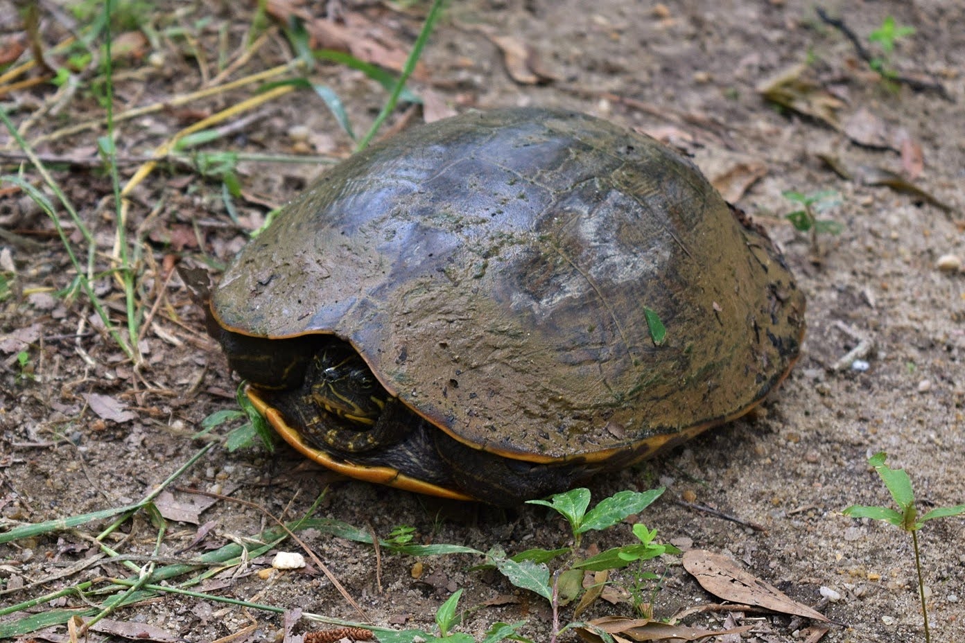
A yellow-bellied slider was right in the middle of the trail.  He retreated to the safety of his carapace as I passed.


After crossing the road, the trail became very overgrown, though easy to follow.  It ended abruptly back at the lake.


I turned around here and headed back.


There was a nice path of orange day-lily, another invasive species, flowering near the parking lot.


From here, I continued another 20 minutes to Jordan Lake Educational State Forest.  I started off on Forest Demonstration Trail that led around the peninsula with several spurs leading out to the lake.


At one, I saw a pair of osprey nesting over the water.


One was collecting sticks for nesting material while the other stood guard.


After finishing up the loop, I took the short Talking Tree Trail.


The Low Lands Trail led out to another scenic spot on the lake.


Wildlife Trail was the last in the forest and started from next to the parking lot.  I saw some butterfly weed along here.


After finishing the loop, I stopped to see the Forest Service helicopter.


It was after noon and really hot by this point, so I finished up my hike and headed home to air conditioning.