Showing posts with label Pisgah Ranger District. Show all posts

Sunday, August 31, 2025

Cove Creek Hike

On Sunday, we savored a hearty breakfast before setting off for the Blue Ridge Parkway. Along NC-151, we paused to admire a charming roadside waterfall.


From the parkway, we wound down US-276 and turned onto Yellow Gap Road, reaching a small parking area about a mile in, where vibrant yellow wildflowers brightened the scene.


Just up the road, we joined the Barnett Branch Trail, turning left to ascend.


More wildflowers were blooming along the trail.


In less than half a mile, we reached the serene Barnett Branch Trail Falls, a hidden gem on a tributary of Barnett Branch.


Its beauty was striking for such an easy hike.


We lingered, clambering over rocks to snap photos before heading back.


Next, we drove to Davidson River Road and parked at Cove Creek Group Camp.


We hiked up the gated road, soon encountering a stunning small waterfall on Cove Creek just before the campground.


From there, we followed Caney Bottom Trail, then connected to Cove Creek Trail. In under a mile, a spur trail led us to Cove Creek Falls.


A light rain fell as we arrived, prompting me to shed my boots and wade for a better view.


Back on the main trail, we let Harper stretch her legs and hike a bit.


About a mile later, we crossed Cove Creek via a bridge and paused for a scenic lunch.


Some mushrooms were popping along here.


Continuing, we looped back via Caney Bottom Trail.


Roughly a mile in, we passed Caney Bottom Falls, but with no safe way down, we settled for a view from the trail.


There was a nice cascade on Caney Bottom Creek downstream of the falls.


The trail led us back to the campground, and we hiked the road to our car just as the rain intensified.


We capped the day with a cozy dinner at Stone Ridge Tavern before returning to the cabin to start packing.

Tuesday, July 4, 2023

Bent Creek Hike on Independence Day

Monday, I checked out of the hotel and started heading east.  I drove to the Rice Pinnacle Trailhead at Bent Creek Experimental Forest and started out on Deer Lake Lodge Trail.


I then got on Wolf Branch Trail and headed up until I got to Ingles Field Gap Trail.


This trail along the upper section of the forest led about 2 miles to its namesake gap, where I got on Little Hickory Top Trail.


This trail gradually descended down into the forest.  I saw some phlox blooming.


At the end, I took a forest road to get on Boyd Branch Trail, following its namesake stream down.


A little copperhead was on the trail.


I then got on Campground Connector Trail to head towards the lake.


There was a nice spot to go out on Bent Creek here.


I then took Homestead Trail to go around the lake.  Lots of rosebay rhododendron were blooming throughout the forest.


I made a short loop on Small Creek and Deerfield Loop back to Homestead and then finished this trail out.


  Finally, I took Hardtimes Connector to head back to the parking lot and started making my way home.


Sunday, January 1, 2023

First Day Hike on Art Loeb

Sunday, I had breakfast at the hotel and headed to Gloucester Gap to continue hiking Art Loeb Trail.  The trail started off steep and climbed up, crossing Pilot Mountain Road after about 3/4 mile and again shortly thereafter.  The trail got really steep from here with tight switchbacks all the way up Pilot Mountain.  Some joggers passed and I was impressed anyone could run up such a steep slope.


I took a short break at the top then descended to Deep Gap.  The shelter was just before the trail climbed up Sassafras Knob.


After the knob, which had no view whatsoever, I descended back down to Farlow Gap and a steady climb further up to the parkway along Shuck Ridge.  After crossing,the trail got super steep again climbing up Silvermine Bald.  At the top, it joined the Mountains-to-Sea Trail and finally leveled off for a bit.


The high elevation forest was very pretty.  In another mile or so, the trail crossed Black Balsam Road to complete section 2.


This part of the trail was open and had spectacular views.


The trail was very different than the green tunnel leading up to this point.


I continued a little further to the summit of Black Balsam Knob with more amazing view above 6000 feet.


I had the entire area to myself with the parkway closed, which is very unusual for such a popular location.


It was very windy so I didn't linger long.


The hike back was long but at least it was almost all downhill.  At Farlow Gap, I took the forest roads back to Gloucester Gap to avoid the steepness of Art Loeb.


Driving back to Brevard, I had dinner at Twin Dragons China Buffet and then stopped at the Pisgah Ranger District Office.  Before heading back to the hotel, I wanted to go for another short walk on Andy Cove Nature Trail.  The trail headed up and crossed some boardwalks.


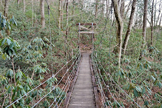
Then I crossed a suspension bridge that reminded me of the one at Eno.


The trail then looped back through Andy Cove.


I took Exercise Trail back to the parking area.

Saturday, December 31, 2022

Art Loeb Long Branch Loop

Saturday, I had breakfast at the hotel then headed to the Pisgah Center for Wildlife Education by Davidson River and parked around dawn.  I got on Cat Gap Loop Trail (#120) and hiked to Cedar Rock Falls.  There were some big icicles next to the falls.


Most of the ice at the waterfall had melted however.


I scrambled on the rocks for some pictures but didn't spend too long.


Back on the main trail, I heard something and scrambled down to a campsite.  There was an Upper Cedar Rock Falls here.


It was about 15 feet and pretty scenic.


Just past here, I got on Butter Gap Trail and hiked through Picklesimer Fields.


It started raining lightly as I got to Grogan Creek Falls.


In good lighting, this was a really scenic waterfall.


I spent some time here getting some photos.


Then I got back on the trail and continued hiking up.  Near the top of Grogan Creek was another nice little drop.


Butter Gap Trail ended at Art Loeb Trail so I could finish up section 1.  It was steep up to Chestnut Mountain then not too bad after that.  At Gloucester Gap, I turned on FR-475.  There was a seasonal waterfall on a small drainage along the road.


I continued on FR-475 to Long Branch Trail and in about a mile, I took a detour on Cemetery Loop to the McCall Cemetery.


Then back to Long Branch Trail.  I took another detour on FR5095 to Long Branch Falls.  There was a lot of downfall preventing a good picture.  


It didn't look like it would be going anywhere soon so I hiked back to Long Branch Trail.


Long Branch Trail ended back at Butter Gap Trail to finish up the loop.


Before leaving the forest, I did one more short hike on Estatoe Trail from Art Loeb Trailhead.


The trail followed Davidson River downstream to Brevard on boardwalks and a wide trail.


Then I went to Oskar Blues for dinner and some good beer on New Years Eve.