Saturday, October 31, 2020

Nantahala Gorge Waterfalls

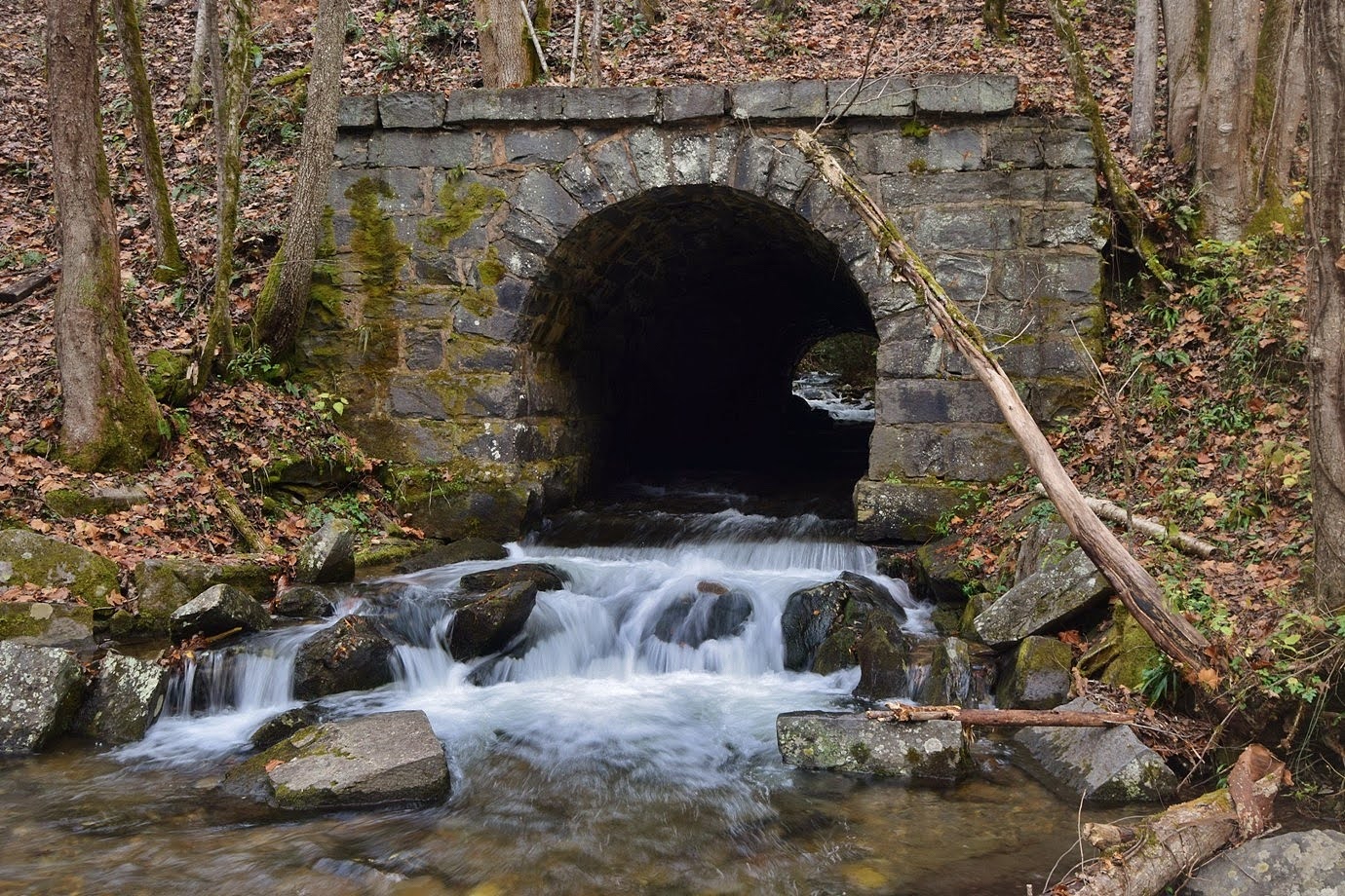
For Halloween this year, we headed to the mountains for some scary difficult waterfalls.  We left super early and got to the Nantahala Outdoor Center to attempt Townhouse Branch Falls but looks like it is closed to public now.  So we headed up the river and parked at the access for Bartram Trail heading to the Cheoah Backcountry Area in Nantahala National Forest.  Ledbetter Canyon flowed under the railroad tracks here and the little bridge was scenic.


A path from the picnic area led across the tracks and to the Bartram Trail.  Instead of getting on the trail, we went straight to start following Ledbetter Creek upstream.


There were a lot of cascades and small falls all the way up the creek.


With the water level very high, we had to go around some cascades by climbing way up then had to head back down to the creek.


As we got closer to the creek, we came out at Inside Passage Falls.  There was significant water flowing through the passage, preventing any chance of climbing up through it, which we needed to continue upstream to Ledbetter Canyon Falls.


We then tried climbing the steep cliffs to see if we could get around the passage but it was just to steep, so we decided not to risk it.  Heading back, we got on Bartram Trail and started a steep climb up the ridge.  Near the top, an overgrown road to the left split off and descended to Handpole Branch.  The road petered out but it was an easy bushwhack to the top of Handpole Branch Falls.  A side stream flowed in with a nice 12-foot waterfall at the confluence with Handpole Branch.


From here, we made the extremely steep descent on river right side to a viewpoint 50 or so feet down.  The view was mostly obscured by rhododendron.


The waterfall keeps going down, but it was so difficult getting here, we didn't descend any further.  The climb back up was equally strenuous and difficult.  We finally made it back to the top then back to Bartram Trail.  Sandy spotted a grizzly spur-throat grasshopper along the trail.


Continuing on, the trail descended to Ledbetter Creek where we had to wade in high water.  Shortly after, was another crossing where we had to wade again.  There were more nice cascades along Ledbetter Creek up here.


Then we crossed some side streams before reaching Bartram Falls.


In high water, it was very scenic though rhododendron blocked the view from the trail.  The top of the waterfall was very interesting, but the lighting was poor.


I also climbed down to the base, but way to overgrown for any view of the falls.  After some pictures, we made the hike back.


From here, we drove to Robbinsville and checked into the Quality Inn and went to bed after a very long day.

Sunday, October 18, 2020

Williamson Preserve

Sunday, we took Alex for a hike at Triangle Land Conservancy's recently opened Williamson Preserve.  The past few weekends had been rainy and the trails were closed, so we were excited to finally visit.  And Alex has visited the rest of TLC's nature preserves for the #hikeTLC challenge, so wanted to visit this one too.


We got there right after sunrise to avoid the crowds.  The open fields were beautiful in the early morning light.


There was a little church next to the parking area, but not part of the preserve.


We took Walnut Hill Way out to the trail and started on Pine Warbler Trail to Little Falls Loop.  The trail winds around a small tributary and it looks like there would be a little waterfall here after a heavy rain, but the trails would likely be closed.


We then took Longleaf Pine Loop to Salamander Loop and hiked the spur out to Neuse River Greenway.


On the hike back, we spotted a whole bunch of Indian pipes along the trail.


I've never seen such large patches of them.


There were also a lot of mushrooms along the trail.


Heading back, we started to see more bikers and then hiked near the trailhead.  We took Two Pond Loop, a hiking only trail around the two small farm ponds.


They were very scenic.


By the time we got back to the parking lot, it was completely full with plenty of cars illegally parked.


Glad we got here early.  It was such a nice day, on the way home, I stopped at Forest Ridge Park for a short hike on Falls Lake.  I took the Ridgeline Trail up to a ridge over the lake.


There was a spot to go down to the lake.  Just a hint of fall color at this point.  Then I took Rocky Point Trail, which led to another nice view of the lake.


I then took Old 98 Trail and made a loop with the peninsula trail heading back.


Monday, October 12, 2020

Julian Price to Moses Cone Hike

Monday morning, we woke up and the rain had finally ended!  We took advantage of dry conditions and packed up camp and left.  We got on the Blue Ridge Parkway and made a quick stop at View Osborne Mountain.


The clouds lingering in the valley were beautiful.  We continued southbound to Julian Price Memorial Park.  Parking at the picnic area, we got on Boone Fork Trail.


Following the creek downstream, there was a lot of beautiful fall color.


In about a mile, we turned right on Mountains-to-Sea Trail and crossed Boone Fork on a footbridge.  The trail crossed Old John's River Road and continued around Martin Knob.  After crossing the Shulls Mill Road, the trail entered Moses Cone Memorial Park and climbed steeply up towards Rich Mountain.  There were some jack in the pulpit berries along the trail.


After a steep climb, we had to cross a stile to reach Rich Mountain Road and went right to stay on the MST.


Soon the trail went through an open area.


Even in cloudy weather, the views of the fall colors were beautiful.


After passing through the open area, the trail headed down towards Trout Lake.  With broad switchbacks, the descent was gentle.


Although the sun was poking out at a few times and we even saw a path of blue sky, it was very cloudy and foggy when we reached Trout Lake.  Hiking along the lake, the clouds cleared a bit.


By the time we made it to the other side, the clouds had mostly cleared again.


From here, we got on the Blue Ridge Parkway to hike back to the start.


There were nice views on the bridge crossing over Sims Branch.


We made a quick stop at Sims Pond.


The fall color was really beautiful here, reflecting off the pond.


Right past here, we found an old dilapidated barn of some type right off Old John's River Road.


It was just a short hike on the Blue Ridge Parkway back to the Price Park Picnic Area.


We went slowly to enjoy the beautiful fall color and a day without rain.


After finishing out hike, we made the drive home.

Sunday, October 11, 2020

Rainy Day on Blue Ridge Parkway

Sunday morning, we woke up to a light drizzle.  We hiked to the car and drove to West Jefferson to get breakfast and then headed up to the Blue Ridge Parkway.  Driving northbound, we soon came to Doughton Park.  As we passed Bluff Mountain, there were a couple of beautiful ephemeral waterfalls crashing down below the road and down the mountain, eventually flowing into Meadow Creek.


I hopped out of the car and walked along the stone wall to see the impressive drops that only existed because it was so rainy.


Continuing on, we made a stop at Brinegar Cabin.  It was closed but looked pretty in the fog.


And we wouldn't be getting any long distance views today.  Continuing on, we made a stop at Devil's Garden Overlook.


Although cloudy, the views were very pretty.


Fall color along the parkway was really popping.


We continued a little further to Bullhead Mountain Overlook, which also had cloudy views.


A little further, we made a stop near Horse Cove Branch.  There's a waterfall along the creek here, but it was too cloudy to see anything at all.  We could definitely hear it in the high water even if it wasn't visible.  Our next stop was at Cumberland Knob Recreation Area.  We waited for a few minutes for the rain to subside then set out on Gully Creek Trail.  It descended very steeply to its namesake at the base of Gully Creek Waterfall.


It's a small waterfall, but scenic in high water.


So high, in fact, that the creek crossing immediately downstream would have been a wade.  With the rain picking back up, we decided to just head back.  Up at the top, I made a quick run to Cumberland Knob, but not much of a view here.


Then we hiked back to the parking lot.


From here, we continued north on the parkway into Virginia.  We drove about 10 miles or so to Piedmont Overlook.


Too cloudy for much of a view down to the Piedmont but the parkway was pretty in the fog.


From here, we turned back and headed back into North Carolina.  We made a quick stop at Little Glade Mill Pond.


A short trail led around the small pond and the fall color here was really beautiful.


Further down the parkway, we made another stop at the seasonal waterfalls flowing down Bluff Mountain.


It was a really spectacular sight and very rare I suspect.  From here, we headed back to New River State Park.  The rain had finally died down, so we took Alex for a hike down the River Run Trail.  The water level of the river was really up.  The trail passed by the Stump Family Home Site.


The trail then climbed back up and ended at Hickory Trail, which led back towards camp to make a loop.


The fall color was really beautiful, even with the cloudy views.


We made it back to camp just before sunset.


Everything was too wet to bother with a fire and the rain started back after dark, so we just went to bed.