Saturday, May 28, 2022

Backbone Rock

Saturday, we took Alex to the mountains of northeast Tennessee for the long weekend.  We left early and headed to Cherokee National Forest, arriving at the trailhead for Gentry Creek Falls around 830.  With all the recent rain, the creek was way up.  Even the crossing of Cut Laurel Branch at the start of the hike required wading.  In about half a mile, we came to the first creek crossing of Gentry Creek and it was very deep and fast moving.


There was no safe way to cross, especially with the dog, so we turned around and headed back.  We'll have to return when the water level is lower.


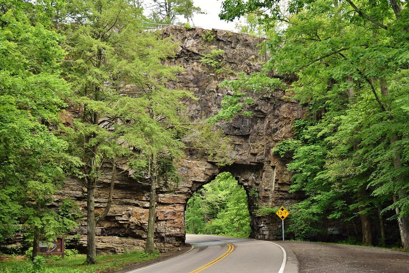
From here, we drove to Backbone Rock Recreation Area and parked just south of the tunnel.

The short Backbone Falls Trail (#198) made a quick loop.  We climbed up from the parking area and soon crossed over the top of the falls.


We then came to a nice view of Backbone Falls.


With all the recent rains, it was really flowing through a narrow crevasse in the huge rock walls.


I scrambled down to the base but it was hard to see the upper portion of the falls.


After some pictures, we continued down more stairs to return to the parking lot.


Crossing the street, we picked up Backbone Rock Trail (#53) and climbed up to the ridge.


A spur trail went right out across the ridge.


There were nice views from atop the ridge above the tunnel.


A lot of mountain laurel was flowering up here.


We found a nice spot to take a break and eat lunch above the creek.


Then we hiked a little further up the trail.  Some galax was flowering along the way.


American cancer-root is an interesting-looking parasitic plant.


We also spotted a cute little mushroom popping up above the moss.


After about a mile, we turned around and headed back to the trailhead.


From here, we continued further west to Laurel Run Park in Hawkins County.  After getting our stuff together, we set off on the Laurel Run Trail.  We crossed the creek on a bridge and passed an old log building.


There was a cool tree along the creek a little further up.


At just over half a mile, we came to the unbridged crossing of Laurel Run.  In normal flows, this is an easy rock hop, but not today.  We had to wade and Alex got pretty wet.


It was just a short ways further to the scenic Laurel Run Falls.


Although only 12 feet, it was really pretty with a narrow cave going behind the falls.


Continuing on, there were some more scenic cascades above the falls.


Right past here, the trail turned left and started heading up.  Instead, we crossed Kiner Creek and followed a very overgrown path heading up along that creek.  There were some nice cascades along this creek too.


Shortly, the path ended at Kiner Creek Falls.


It was looking really good in the high water.


This one falls down an overhang with a small rockhouse behind.


We got some pictures and then made our way back.


We drove to Johnson City and checked into the Hampton Inn.  Then we went downtown and had tacos from White Duck and beer from Yee Haw brewing.  After dinner, we headed back to the hotel and went to bed after a long day.

Saturday, May 21, 2022

Neuse River MST Hike

Saturday, we took Alex to get another hike for #mst40hikes, this one local in Raleigh along the Neuse River Trail.


We parked at the Buffaloe Road Canoe Launch and started hiking south along the trail.  Soon we passed by Buffaloe Road Athletic Park.


The trail then crossed over to the other side of the river.  Since Milburnie Dam was removed, the river has restored to its natural state and many of the artificial wetlands upstream of the dam have dried out and grown over.


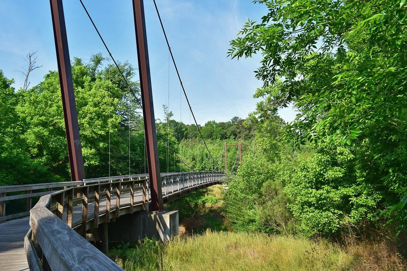
After about 2 miles, we crossed back over to the other side on the largest pedestrian suspension bridge in North Carolina.


It was about another 2 miles to Milburnie Park, the terminus of this hike.  I went a little further to see what became of the dam.  There was an overlook to the rapids on the river, now called Milburnie Falls.


From here, we made the hike back to the car as it was getting quite warm.

Sunday, May 1, 2022

Buffalo Mountain Wildflowers

Sunday morning, we checkout out of the hotel and headed to Buffalo Mountain Natural Area Preserve.  We started out on the Oak Trail that went through an area with a tremendous amount of wildflowers.


We also spotted a little snail along the trail.


There were a lot of trillium as well as rue anemone.


Wild geraniums were flowering in large patches.


It was a really scenic trail as the leaves hadn't popped out so we had nice views.


There was some Virginia saxifrage flowering along the trail.


At the top, we went left on Barrens Loop Trail to head to the summit.


Some birdsfoot violets were flowering up here.


The trail was roped off to keep visitors on the trail to avoid trampling sensitive vegetation.


The views from the summit, highest point in Floyd County, were beautiful.


From the top, it was a short scramble down to make the loop and then we headed back down the Ridge Trail, spotting more wildflowers along the way.


We spotted some mountain timbleweed.


And some star chickweed.


There were lots of trillium, but only the white and rose species, I didn't see any red trillium.


We saw bloodroot along the trail, but all were done flowering.  Near the end we finally spotted a flowering bloodroot.


Then we finished up the hike back at the car.


From here, we started making our way home along US-58.  We made a quick stop at Fred Clifton Park next to Lover's Leap.


There were two overlooks here with really nice views of the Blue Ridge Mountains and valleys.


Continuing east on US-58, we got off in Martinsville and parked at Gravely Nature Preserve.  We started off on Jones Cliff Trail and passed an old tobacco barn next to the parking lot.


As we headed into the woods, we started seeing a fair number of wildflowers.


Geraniums and may apples were flowing on the forest floor.


In about a quarter-mile, we got on Rhododendron Trail and started heading down towards the river.  There were even more wildflowers as we got closer to the river, but the trillium were done.


Along the river, we found a nice bench with a view to take a short break.  A water snake was enjoying the nice weather as well.


Continuing on the trail, there as a lot of rhododendron along the steep slopes, but it was too early for blooms.


There were a number of spots to go out and get a view of the river.


The trail then headed back up and ended near the parking area.  Finishing our hike, we next went to the Marrowbone Creek River Access just up the road.  It was a short walk to Eggleston Falls or Fishers Dam.


Although it's not a natural waterfall, it was rather scenic.


We got a few pictures and then headed back.


It was just 2 hours back to Raleigh from here.