Estimated Time: < 1 hour
Difficulty: Easy
Location: Backbone Rock Recreation Area (Watauga Ranger District of Cherokee National Forest)
Trail Users: Hiking only
Dogs: Yes
Features: Waterfalls (1)
Crowds: Moderate
Warnings: The rocks around waterfalls are slippery.
Trailhead GPS: 36.59337,-81.81508
Waterfall GPS: 36.59220,-81.81547
Directions:
From Bristol, head south on US-421 for about 19 miles to Shady Valley. Turn left on TN-133 north and go 9.6 miles to a small parking area on the right immediately before the tunnel. Additional parking is available on the left just before the tunnel.
Map:
Hike Description:
From the trailhead, follow Backbone Falls Trail (#198) along the guardrail next to the road, then climb up the steps to lead to a view of the waterfall.
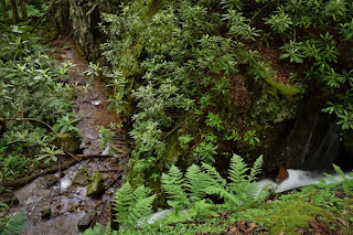
The water falls through a cleft in the rock between massive rock cliffs. There is a scramble path down to the base, but it's hard to see the upper part of the waterfall from the base.
The trail continues up to the top of the waterfall then loops back down to the parking lot.
The tributary is small, so best to visit after a good rain. Here's a video of the falls.
External Links:
US Forest Service website: https://www.fs.usda.gov/recarea/cherokee/recreation/recarea/?recid=34940


No comments:
Post a Comment