Showing posts with label Capital Area Greenway. Show all posts

Saturday, July 6, 2024

Dix Park Sunflowers 2024

Saturday, we took Harper to the sunflowers at Dorothea Dix Park for her first time.  It's been so hot this summer, we got there right around sunrise to beat the heat and crowds.


And it was still pretty warm and muggy at 6 in the morning, but the sunflowers were beautiful in the early morning light.


The sunflowers seemed shorter this year than when visiting the past, maybe because of the very dry June we had.


We weren't the only ones enjoying the sunflowers first thing in the morning.  Bees, butterflies and other pollinators were busy at work in the field.


We got some pictures of Harper with the flowers and made a loop around the field, but it was warming up quickly.


Sandy and Harper took off and I continued hiking for a while on the Capital Area Greenway.  I took Rocky Branch Trail to Walnut Creek Trail and made a partial loop with Centennial Campus Connector.  By 10, it was really hot and I was glad to get back to air conditioning.


Saturday, June 29, 2024

Crabtree Creek West

The final segment of Crabtree Creek Trail was recently finished, completing the 17-mile trail in the Capital Area Greenway.  Saturday was going to be really hot, so I got an early start at the trailhead for Crabtree Creek West along Ebenezer Church Road before 7.  The trail starts where Crabtree Creek leaves Umstead State Park, where the multi-use trail bridge has been removed.


Following the trail, it crosses Richland Creek on a footbridge just above the confluence.


Past here, it heads away from the creek and climbs up a ridge via an elaborate switchback structure.


In about a mile, the greenway comes out on Duraleigh Road and follows the sidewalk back to the creek.  Where the road crosses, the trail goes down and under the bridge.


Shortly past here was a large suspension bridge over the river.


I believe this was the last piece of the trail to be constructed.


In about 2 miles, the trail reaches Lindsey Drive, the former western terminus of the trail.  They made another bridge over the river that connects to Picardy Drive.


Past here, it was existing trail.  I went a few more miles, past the mall and beltline and then turned around as it was really warming up.


Saturday, May 21, 2022

Neuse River MST Hike

Saturday, we took Alex to get another hike for #mst40hikes, this one local in Raleigh along the Neuse River Trail.


We parked at the Buffaloe Road Canoe Launch and started hiking south along the trail.  Soon we passed by Buffaloe Road Athletic Park.


The trail then crossed over to the other side of the river.  Since Milburnie Dam was removed, the river has restored to its natural state and many of the artificial wetlands upstream of the dam have dried out and grown over.


After about 2 miles, we crossed back over to the other side on the largest pedestrian suspension bridge in North Carolina.


It was about another 2 miles to Milburnie Park, the terminus of this hike.  I went a little further to see what became of the dam.  There was an overlook to the rapids on the river, now called Milburnie Falls.


From here, we made the hike back to the car as it was getting quite warm.

Saturday, April 23, 2022

Lady's Slippers at Williamson Preserve

Saturday I headed to check out a new trail off the Neuse River.  I parked at the Mial Plantation Trailhead for Neuse River Trail and took that towards Johnston County.  After crossing the line, the trail became Claytons River Walk and I turned onto Bootleggers' Loop to enter Williamson Preserve.


The trail crossed a small creek on a footbridge and then came to some old barrels right off the trail, presumably from moonshine production.


There were some atamasco lilies blooming around here.


The trail soon came to a split and I went right to hike the loop portion.  After finishing up the trail, I went back in the preserve on Neuse River Connector and hiked the Salamander Loop.  In about a mile, I spotted a pink lady's slipper.


I've never seen one in the Piedmont, just a couple times in the mountains.  Continuing on, I spotted another patch a little further.


There were a lot of these beautiful orchids all along the northern half of Salamander.  I was really excited to see so many.


After finishing up the loop, I hiked back to Neuse River Trail to head back to the car.

Saturday, June 27, 2020

Lake Johnson and Yates Mill

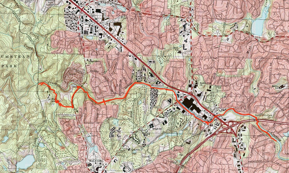
Saturday morning, we took Alex for a hike at Lake Johnson.  We got an early start to avoid the heat and crowds.  Parking along Avent Ferry Road, we first hiked the unpaved west loop.


The lake was really pretty in the early morning light.


A boardwalk in the northwest corner led to a gravel road to hike back.


Back at Avent Ferry Road, we crossed and took the paved Lake Johnson East Loop along the north shore of the lake.  It was more crowded on this side, but plenty of places for a nice view of the lake.


When we got the dam, a great blue heron was out in the lake.


There were some Canada geese along the dam as well.


Alex was getting hot at this point so he and Sandy headed back while I went east on the Capital Area Greenway following Walnut Creek Trail.  Where the trail passed the headwaters of Lake Raleigh, I got off the trail and bushwhacked into Lake Raleigh Woods.  This NC State University property has some trails along the south shore of the lake.


Several boats were out on the lake and there were lots of nice views from the trail.


The trail ended near the dam and I found a spot to rock hop the creek below the dam.  Once across I got back on Walnut Creek Trail and started heading back.  At Lake Johnson, I went left to finish up the east loop.


I finished the hike back up at the parking on Avent Ferry Road.


Before heading home, I wanted to get in another hike, so made the short drive over to Historic Yates Mill County Park.  After parking, I hiked down to the millpond.


It was bright sunlight and the water level was low, but the old mill was scenic.


There were a lot of people hanging out here, so I climbed up for to avoid the crowds.


I continued along the millpond.


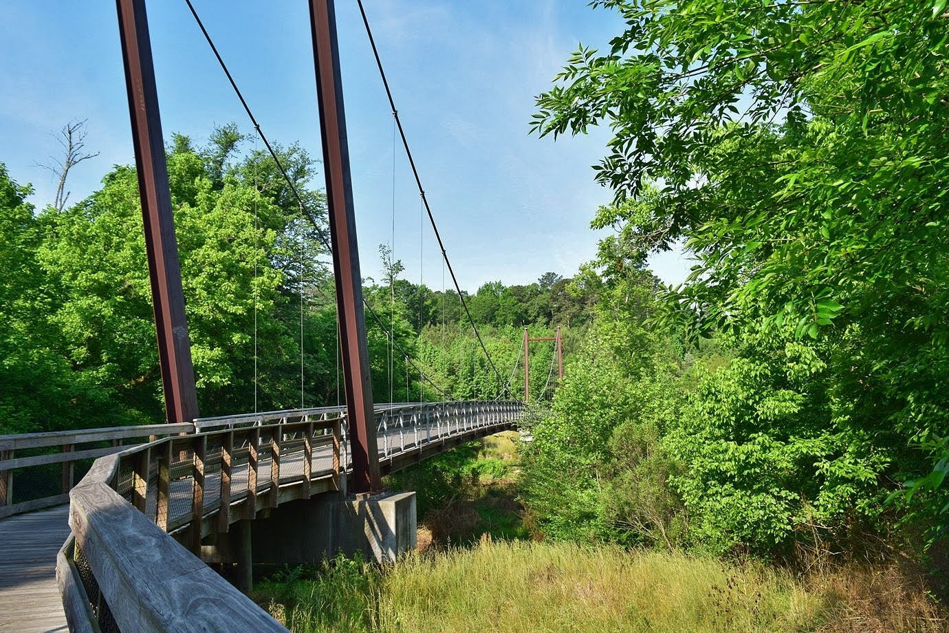
At the split, I went left on High Ridge Trail and took that down to the other end.  Across the wetlands boardwalk, I took Creekside Trail out to make a partial loop.


On the way back, I went out on the pond boardwalk and then followed the millpond back.


It seemed to be getting more crowded and it certainly wasn't getting any cooler so I took off and headed home.


Sunday, July 14, 2019

Dorothea Dix Sunflowers 2019

Sunday, Sandy and I took Alex for a hike to the see the sunflower field at Dorothea Dix Park in Raleigh.  We parked by the Farmers Market and hiked Centennial Bikeway Connector, part of the Capital Area Greenway.  We took Blair Drive into the park and walked around the sunflower field.  They definitely weren't blooming as much as last year - probably the hot and dry weather we've had lately.


But there were still plenty of sunflowers blooming.  Alex begrudgingly let us get a photo of him in the sunflowers.


And there were lots of bees gathering nectar.


By 830 in the morning, it was already hot so we didn't stay too long.  Alex and Sandy and headed back, while I continued hiking on the greenway.  I went as far as the Wetland Overlook near Rock Quarry Road and then turned back.


It was quite hot by this time and very humid.  The tunnels provided some relief from the sun.


I made it back to the car just before noon and stayed in air conditioning for the rest of the day.