Friday, June 12, 2020

Upper Wintergreen & Chub Line Falls

Friday, we met up with Justine early and headed to the mountains for a long weekend of hiking and waterfalls.  We arrived at the Frozen Creek Access of Gorges State Park around 930 to start our long hike to visit some of the most difficult waterfalls to access on Toxaway River.  We followed Augur Hole Trail for about 3 miles to the Wintergreen Spur and followed that another mile to the campground at the end.  From here, it was an unofficial trail along Toxaway River heading upstream.  Shortly, there was a nice waterfall along the river and we went out on the rocks to enjoy the view.


After crossing Panther Branch, we took an old road heading up a ridge.  In a short ways, it stopped heading up and began roughly following the contour line above the river.  Past the second drainage, we lost the trail and bushwhacked straight up until we found it again.  At the top was an open area, where a left turn followed a ridge down towards Toxaway River.  It was open and easy to follow at first, then got progressively steeper.  Towards the end were a couple of knife ridges that were tricky to climb down.  We got to the river level just below the base of Upper Wintergreen Falls.


It's a nice waterfall in three sections though only the lower two were visible from the base.  We climbed around on the rocks for a while but with bright sun, the lighting was poor for photos.


I climbed down a little further to the upper section of Wintergreen Falls, but couldn't find anywhere to get out for a clear view.


We then hiked back and it was much easier following the trail on the way back.  When we got back to Augur Hole Trail, we headed down the very steep scramble path to Chub Line Falls.  There were a bunch of burying beetles along the way down.


The path was fairly easy to follow but extremely steep.  As we got close to the river, we had navigate over a big downed tree that was covered in briers.  I inadvertently grabbed a devil's walking stick and got some barbs stuck in my hand.  I know how it got it's name.  At the base, we ran into Badger and Kitty!  We had to wade in the river to get out to a good view point.


The water in the river was not nearly as cold as expected and felt great on our tired feet.  There was a nice flat rock in the middle of the river to relax on.


We hung out down here for a while then made the excruciatingly steep climb back up.  And once up, it was a 3-mile uphill hike back to the car.  We took it slow and stopped to see a small tributary waterfall on the hike back.


There were some snowy hydrangeas flowering along the trail as well.


We made it back just after 7, completing a very long day.


Back at the cars, we headed to Lazy J's to check in and set up camp then headed to Headwaters Outfitters to get some dinner from Mama Bear's food truck and beer from the tap room.

Monday, May 25, 2020

Tanasee Gorge Hike

Monday, we broke camp and started making our way back to North Carolina.  We parked at the trailhead for Tanassee Creek Gorge on Wolf Mountain Road in Nantahala National Forest and started hiking down the old logging road.  A red eft newt was right on the trail.


There were some nice wildflowers blooming in the gorge.


At about 2 miles, we had to cross Tanasee Creek.  The water level was way up and it would have been difficult with Alex.  So we just headed back and enjoyed the beautiful forest.  Some flame azaleas were blooming along the trail.


In less than a mile, we got back to the crossing of the next tributary of Tanasee Creek.


When we reached the next tributary, we climbed up for a view of Horseshoe Falls.


It was really flowing in the high water.


After this, we hiked the rest of the way back and started making the drive home.


On NC-215, we headed up the to the Blue Ridge Parkway, making a couple stops on the way.  First, we stopped at View Pink Beds for a view down into Pisgah National Forest.


Then we stopped at View Stony Bald.


Mount Pisgah was visible to the north.


We followed the parkway to Asheville and got on I-40 to drive home.

Sunday, May 24, 2020

Big Creek Waterfall Hike

Sunday, we woke up and took Highway 28 into Georgia, parking right after the road crosses Big Creek just before the North Carolina state line.  From here, we hiked along FR-650 into the Three Forks area of Chattahoochee National Forest.  Almost immediately, we had to ford Talley Mill Creek.  The road ended in about 0.7 miles at a big jeep mound and we took a break here.  I descended the very steep path towards the Fourth Waterfall on Big Creek while Sandy waited with Alex.  It was steep but not too bad at first.  As I got towards the creek, it got progressively steeper and more difficult.  Ropes were tied to trees to assist in places.  The final descent was pretty much a full on rappel down a sheer rock face.  All that and the view wasn't very good anyway.


Maybe in lower water, it would have been possible to get a better view, but there was almost nowhere to get a picture from.  Then I had to get back up.  The first part was a full on rope climb until I get high enough for some footholds.  When I finally got back up, I recommended Sandy not bother going down.  Past the jeep mound, the road continued as Three Forks Trail.  There were some nice mountain laurels blooming along this section.


In another half-mile or so, there was a split and we went left to get on the rugged Big Creek Trail.  Initially, it was pretty easy to follow but there were a lot of downed trees and it got harder to follow.  The trail followed the creek more closely and it was pretty calm in this stretch.  As we approached the Third Waterfall on Big Creek, there were some nice cascades in the creek.


Just past here, the creek really got wild.  From the trail, the view was partially obscured but we could tell it was a big waterfall.


Most of the this upper section is not visible from the base.  We scrambled down to the creek and had lunch here.


This is probably the most spectacular waterfall on the hike even though most of it isn't visible from the base.


After lunch, we headed back up and continued on the trail.  It got really hard to follow in places and Alex was having trouble with crossing the trees.  Next up was the Second Waterfall on Big Creek and it was another steep path down to the base.


This one is smaller but the view from the creek was really good.  After this point, the trail became really hard to follow and was little better than a bushwhack.  There were down trees over almost the entire trail.  Finally, it became more of a trail and ended at Three Forks Trail.  Following the trail down to Three Forks, the First Waterfall on Big Creek was just upstream of the confluence.


I scrambled up Big Creek for a closer view but the sun wasn't really cooperating.


Some guys were camping across Big Creek and forded across Overflow Creek.


We chatted with them for a few minutes and had a break on the rocks at Three Forks, enjoying the view.


After a break down here, we followed Three Forks Trail to head back.  This was an actual trail and much easier to follow, especially for Alex.  There was a big snapping turtle right in the middle of the trail.


It rained a little on the hike back, but we were relieved to be on a real trail.  By the time we got back, it had stopped raining.


After leaving the area, we made a quick stop at the Lake Jocassee overlook from a scenic evening view.


 and then headed back to Oconee State Park for our last night of camping.  We got some dry firewood and made a big campfire before bed.

Saturday, May 23, 2020

Ellicott Rock Waterfalls

Saturday was my birthday.  We had breakfast at camp and then headed back into North Carolina and into the Ellicott Rock Wilderness in Nantahala National Forest.  We parked at the trailhead for Ellicott Rock Trail and headed into the wilderness.


Our target was Fowler Creek Falls.  We hiked about 2 miles on the trail and then bushwhacked down towards the creek.  The bushwhack was terrible and completely overgrown with a rhododendron hell.  Alex was having trouble and we needed to meet our friends so gave up and hiked back.


We then continued a short ways on Bull Pen Road and spotted Team Waterfall.  After parking, we hiked a short ways down the road and bushwhacked down to Upper Scotsman Falls.


It's a wicked bushwhack but thankfully short.  We came to the base of the waterfall and it was looking good in the high water, but the sun was shining right on it.  Then we scrambled back to the road and hiked down to the curve, where another steep path led to Scotsman Falls.  There was a hemlock varnish shelf on a tree on the hike down.


Soon we popped out along side the waterfall.


Clouds had finally come out and the waterfall was really beautiful.


I took off my boots and waded the creek to view the waterfall from different angles.


There were some cool potholes in the rocks here.


We had lunch down here and then headed up.


From here, we continued on Bull Pen Road.  In a couple miles, we spotted a waterfall from the road and had to stop.  The waterfall is on Upper Ammons Branch and was probably only flowing in the very high water.  But there was absolutely no trail.  The bushwhack was short but it didn't look like anyone had ever come back here.


The waterfall was about 15 feet and rather scenic.  We named it JBW Falls (Justin's Birthday Waterfall).


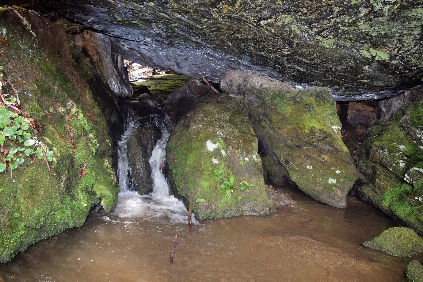
There was also a small waterfall flowing through a cave just downstream.


After some pictures, we returned to the car.


Our next stop was the trailhead for Cane Creek Falls.  Hiking down the old road, there was some flame azalea blooming.


In about a half-mile or so, we got off the trail and bushwhacked down to the waterfall.  Cane Creek is a really beautiful waterfall and it was really flowing.  The spray was intense.


After some pictures, we continued on the old road and little further and then made a sharp left on a path that headed back towards Cane Creek.  After crossing the creek the trail headed down past Lower Cane Creek Falls.  There was nowhere we could find for a decent picture.  This trail continued down to the Chattooga River and Badger and Scott found another waterfall on the creek further down.


It was starting to get late so we hiked back and said by to our friends before returning to camp.

Friday, May 22, 2020

Fall Creek Waterfalls

Friday morning, we woke up and had breakfast at camp and then headed to the trailhead for Yellow Branch Falls in Sumter National Forest.  This is a popular one, so we wanted to arrive early and beat the crowds.  Hiking down the trail, there was more beautiful mountain laurel blooming.


We crossed Yellow Branch on stepping stones a couple times and then the trail curved away from the creek.


In just over a mile, it wound around back to the creek at the base of Yellow Branch Falls.


It's such a beautiful waterfall, one of my favorites in South Carolina, especially in the high water.  I took of my boots and waded in the water to see it from different angles.


A little blackbelly salamander popped his head out of a log near the base of the falls.


After a little while, we headed back.  By the time we made it back to the parking lot, several more cars had arrived.


Continuing on, we drove to the trailhead for Fall Creek Falls.  After parking we hiked down along the first waterfall, which was right below the road.  There were some scenic upper cascades.


Then it was a steep scramble down to the base.


The upper falls is not actually on Fall Creek, but a tributary.


After some pictures, we continued on.  We saw some jack in the pulpit along here.


Continuing on, there was no official trail, but it was pretty easy following the tributary downstream to North Fork and then Fall Creek.  A little over a mile and we came to the second waterfall.


It's a big one and there was no mistaking it.  It was a really scenic waterfall and we spent some time here enjoying the view.


It was just a short ways further to Chattooga River and the third waterfall on Fall Creek, just upstream of the confluence.


There was a lot of rhododendron in the way for a good view.  As we made our way back to the car, it started raining.  Luckily, we had completed the hard parts before the rain.


Back at the car, we returned to Oconee State Park and went to the Foothills Trail parking.  From here, we took the combined Foothills Trail/Hidden Falls Trail.  After about 1.5 miles, the trails split and we followed Hidden Falls Trail.  There was a small Disappearing Falls near the start of the creek.


Not much water, but kind of cool how the water disappeared into the ground.  As the trail descended, there were more mountain laurel.


There were even a couple rhododendron starting to bloom.

The trail continued on around and back to the base of Hidden Falls, a tall waterfall in several sections.


I climbed up to the middle section for a close up view.


We stopped at the base for a snack and to enjoy the view.


Then we headed back.  Sandy and Alex drove and I took Oconee Trail back to the campsite.


We had another fire before bed.