
Gorges State Park is home to numerous waterfalls and due to high rainfall, has a temperate rainforest climate. Gorges and the surrounding area in Transylvania County has the highest rainfall and the greatest concentration of waterfalls in the eastern US. This is due to its location at the southern end of the Blue Ridge Escarpment. Gorges is also one of the newest of North Carolina's state parks and as such, is still in a state of development. The land that is now the park was flooded in 1916 when the Lake Toxaway dam broke and flooded the area. The land was bought by Singer Sewing Company and logged, then sold to Duke Energy in the 1940s and 50s for potential hydroelectric generation. In the 1990s, Duke Energy sold the land to conservation groups and the state and Gorges State Park was formed in 1999.
Contact Information:
976 Grassy Ridge Road
Sapphire, NC 28774
Phone: (828) 966-9099
Email: gorges@ncparks.gov
GPS Coordinates: 35.09600, -82.95100
Directions:
Frozen Creek Access:
Frozen Creek provides access to Augur Hole Trail and Foothills Trail. From Brevard, head west on US-64 for about 9 miles and turn on Frozen Creek Road. Go 3 miles and the parking area for the state park will be on the right.
Grassy Ridge Access:
Grassy Ridge is the main access point to the park, with the visitor center and access to the popular Rainbow Falls Trail. From Brevard, head west on US-64 for about 18 miles. After passing through Lake Toxaway, turn left on NC-281 south. Go under a mile and turn left into the park.
Map:
Hiking:
There are several miles of hiking trails within the park, most notably the Foothills Trail that winds through North and South Carolina. Like the Foothills Trail, many of the trails in the park continue outside the park the boundaries. See the list of trails below for information about individual trails.
Augur Hole Trail:
Length: 7.2 miles (one way)
Difficulty: Strenuous
Blaze: Orange Squares
Augur Hole Trail is a multi-use trail for hiking, biking, and equestrians. The trail starts at Frozen Creek Access and cuts through the heart of the park to Turkeypen Gap and terminates at Foothills Trail. A landslide in 2019 closed the trail from Wintergreen to Turkeypen Gap.

Rainbow Falls Trail:
Length: 1.5 miles (one way)
Difficulty: Strenuous
Blaze: Orange Circles
The Rainbow Falls Trail leads from the Grassy Ridge parking area to Rainbow and Turtleback Falls. About half way, the trail leaves Gorges State Park and enters Pisgah National Forest (Forest Trail #499), where it more closely follows the Horsepasture River. Along the way are some of the most popular waterfalls along the Horsepasture River, including Stairawy, Hidden, Rainbow, Turtleback, and Drift Falls. See the Waterfalls descriptions below for information about individual waterfalls. The trail ends at the National Forest boundary just before Drift Falls - do not attempt to go past the property line as No Trespassing is strictly enforced.

Wintergreen Trail:
Length: 1.1 miles (one way)
Difficulty: Moderate
Wintergreen Trail splits from Augur Hole Trail about 3 miles from the trailhead at Frozen Creek. The trail follows an old logging road upstream along Toxaway River, ending at a primitive camping area.
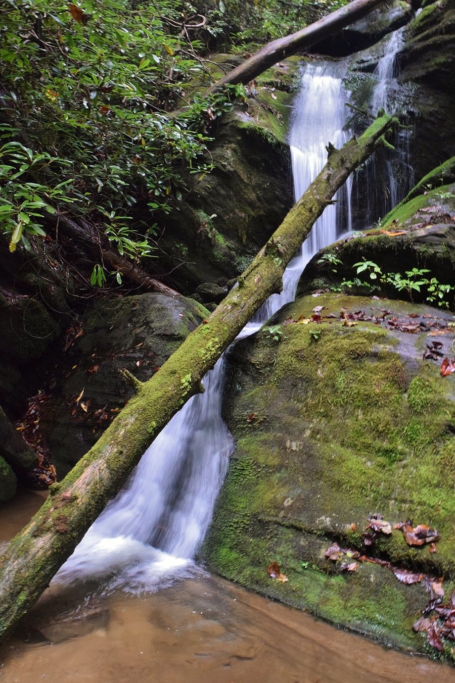
Waterfalls:
Gorges is best known for its many waterfalls. More than a dozen waterfalls are located in the park and several others just outside the park can be accessed as well.
Horsepasture River:

- Drift Falls is the furthest upstream waterfall along the the Horsepasture River before it crosses NC-281.
- Turtleback Falls is a 20-foot waterfall along the Horsepasture River that is popular for sliding.
- Rainbow Falls is a spectacular 125-foot tall waterfall along the Horsepasture River.
- Hidden Falls is a very small waterfall just downstream of Rainbow Falls.
- Stairway Falls is a series of cascades with a final plunge along the Horsepasture River.
- Sidepocket Falls is a lesser known waterfall in several sections.
- Windy Falls is a tall waterfall on Horsepasture River, but is very difficult to reach the base.

Bearwallow Creek:
Bearwallow Creek is a tributary of Toxaway River with a number of waterfalls along its course. They are listed in order from upstream to downstream.
Upper Bearwallow Falls:
Upper Bearwallow Falls is accessed from the Bearwallow Valley section of the park. The short Bearwallow Falls Trail leads about a quarter-mile to an overlook for the falls. The picture below is from the overlook - it's not a great view.

We tried to bushwhack down to the creek for a better view. We ended up at the very base of the waterfall as in the picture below and couldn't see any of the waterfall above. We'll have to come back and explore more!

Indian Camp Falls:
Indian Camp Falls is the first of four waterfalls along a short stretch of Bearwallow Creek, that were formerly known as Paw Paw Falls, collectively. To visit the falls, start at the Grassy Ridge Trailhead and begin the hike on the Rainbow Falls/Raymond Fisher Trails. At the split, turn left and follow the blue-blazed Raymond Fisher Trail across Chestnut Mountain Road and down to the pond and campground. Follow the service road to the right of the information kiosk for a quarter-mile and make a sharp right at the intersection. From here, follow the road for about a half-mile and go left at the intersection. In another quarter-mile, turn left again. The road is rather steep as it heads down to a ford over Bearwallow Creek. Once across the creek, get off the road and bushwhack downstream along the creek. Stay close to the creek and you'll reach Indian Camp Falls in about a quarter-mile from the ford. The creek slides down and makes a sharp left turn. For a good view of the falls, get on the rock ledge immediately in front of it.

Split Rock Falls:
Split Rock Falls is just downstream of Indian Camp Falls. Follow the directions to Indian Camp Falls and continue downstream a short ways. You'll have to go up a bit to get around some rocks and then come to the base of Split Rock Falls. The water slides down a split in the rock face, hence the name.

Chute Falls:
Chute Falls is downstream of Split Rock Falls. From Split Rock Falls, you'll need to climb up the ridge to continue downstream. I thought this was the most difficult part of the bushwhack and you'll be high enough that you can't see the creek. It's about 0.15 miles downstream from Split Rock Falls to Chute Falls. This was my favorite of the waterfalls along this stretch of creek, but a big tree had fallen at the base and made pictures difficult.

Bear Canyon Falls:
Bear Canyon Falls is upstream of the crossing on Augur Hole Road.

Lower Bearwallow Falls:
Lower Bearwallow Falls is the last waterfall on Bearwallow Creek before the confluence with Toxaway River.

The Toxaway River flows from Lake Toxaway through the park and into Lake Jocassee.
Toxaway Falls:
Toxaway Falls is a tall waterfall in several sections flowing under the bridge on US-64 below Lake Toxaway. The west side of the falls is private property but the east side is in Gorges State Park. There is a pull off just east of the bridge to park and view the falls from the road. A very steep scramble path leads down the waterfall. I have not made it all the way down yet.

Twin Falls:
Twin Falls is a scenic 20-foot waterfall just downstream of Toxaway Falls.

Upper Wintergreen Falls:
Upper Wintergreen Falls is waterfall in three sections just upstream of Wintergreen Falls.

Wintergreen Falls:
Wintergreen Falls is a huge waterfall on Toxaway River, roughly half way between the Lake Toxaway Dam and Augur Hole Trail.

Chub Line Falls:
Chub Line Falls is a 25-foot waterfall along the Toxaway River downstream of Augur Hole Road.

Augur Fork Creek is a tributary of Toxaway River. Augur Hole Trail roughly follows the creek downstream to Toxaway. There are several waterfalls on the creek and its tributaries.
Double Drop Falls:
Double Drop Falls is a 15-foot waterfall on Augur Fork Creek.

Augur Fork Falls:
Augur Fork Falls is located right at the confluence with Maple Spring Branch, which has its own waterfall as well. Two for the price of one!

Maple Spring Branch Falls:
Maple Spring Branch Falls is located at the confluence with Augur Fork Creek.


Burying beetles bury carcasses of small animals as a food source for their offspring.


12-Jun-2020: Upper Wintergreen & Chub Line Falls
13-Oct-2019: Gorges Waterfalls
12-Oct-2019: Gorgeous Gorges
08-Oct-2016: Sidepocket and Paw Paw Falls
28-Jun-2015: Turtleback Falls
20-Feb-2015: Wintergreen Falls
22-Oct-2014: Back to Brevard
16-Mar-2013: Hidden Waterfalls in Gorges
09-Mar-2013: Waterfalls along Horsepasture
07-Jul-2012: Horsepasture & Thompson Waterfalls
Lower Bearwallow Falls is the last waterfall on Bearwallow Creek before the confluence with Toxaway River.

Toxaway River:
The Toxaway River flows from Lake Toxaway through the park and into Lake Jocassee.
Toxaway Falls:
Toxaway Falls is a tall waterfall in several sections flowing under the bridge on US-64 below Lake Toxaway. The west side of the falls is private property but the east side is in Gorges State Park. There is a pull off just east of the bridge to park and view the falls from the road. A very steep scramble path leads down the waterfall. I have not made it all the way down yet.

Twin Falls:
Twin Falls is a scenic 20-foot waterfall just downstream of Toxaway Falls.

Upper Wintergreen Falls:
Upper Wintergreen Falls is waterfall in three sections just upstream of Wintergreen Falls.

Wintergreen Falls:
Wintergreen Falls is a huge waterfall on Toxaway River, roughly half way between the Lake Toxaway Dam and Augur Hole Trail.

Chub Line Falls:
Chub Line Falls is a 25-foot waterfall along the Toxaway River downstream of Augur Hole Road.

Augur Fork Creek:
Augur Fork Creek is a tributary of Toxaway River. Augur Hole Trail roughly follows the creek downstream to Toxaway. There are several waterfalls on the creek and its tributaries.
Double Drop Falls:
Double Drop Falls is a 15-foot waterfall on Augur Fork Creek.
Augur Fork Falls:
Augur Fork Falls is located right at the confluence with Maple Spring Branch, which has its own waterfall as well. Two for the price of one!

Maple Spring Branch Falls:
Maple Spring Branch Falls is located at the confluence with Augur Fork Creek.

Wildlife:
Snowy hydrangea (Hydrangea radiata) produces showy white flowers and the underside of its leaves are silver.

American giant millipede (Narceus americanus)

American giant millipede (Narceus americanus)

Burying beetles bury carcasses of small animals as a food source for their offspring.

Red eft or juvenile stage of eastern newt (Notophthalmus viridescens)

Blog Entries:
13-Jun-2026: Turtleback Falls
24-Jul-2021: Tight Squeeze at Windy Falls
29-May-2021: Bearwallow Creek Waterfalls
12-Jun-2020: Upper Wintergreen & Chub Line Falls
13-Oct-2019: Gorges Waterfalls
12-Oct-2019: Gorgeous Gorges
08-Oct-2016: Sidepocket and Paw Paw Falls
28-Jun-2015: Turtleback Falls
20-Feb-2015: Wintergreen Falls
22-Oct-2014: Back to Brevard
16-Mar-2013: Hidden Waterfalls in Gorges
09-Mar-2013: Waterfalls along Horsepasture
07-Jul-2012: Horsepasture & Thompson Waterfalls
06-Aug-2011: Big Brevard 2011
NC State Parks website: https://www.ncparks.gov/gorges-state-park
US Forest Service website for Rainbow Falls Trail: https://www.fs.usda.gov/recarea/nfsnc/recreation/hiking/recarea/?recid=48438&actid=50
Friends of Gorges State Park website: https://friendsofgorges.org/
External Links:
NC State Parks website: https://www.ncparks.gov/gorges-state-park
US Forest Service website for Rainbow Falls Trail: https://www.fs.usda.gov/recarea/nfsnc/recreation/hiking/recarea/?recid=48438&actid=50
Friends of Gorges State Park website: https://friendsofgorges.org/
No comments:
Post a Comment