
Hike Length: 5 miles
Estimated Time: 3 to 4 hours
Difficulty: Difficult
Location: Gorges State Park
Trail Users: Hiking only
Dogs: Only if on a ≤ 6 foot leash
Features: Waterfalls (2)
Crowds: Low
Warnings: Off-trail bushwhacking to get to the waterfall. The rocks around the waterfalls are very slippery.
Trailhead GPS: 35.10853,-82.88361
Waterfall GPS: 35.09210,-82.89614 (Augur Fork Falls); 35.09196,-82.89581 (Maple Spring Branch Falls)
Directions:
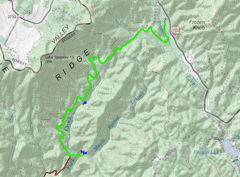
To visit the falls, head west from Brevard on US-64 for about 9 miles and turn left on Frozen Creek Road. Go 3 miles and the parking for the Frozen Creek access of Gorges State Park will be on the right.
Map:
Hike Description:
Hike the Augur Hole Trail for just under 2.5 miles. The trail will curve to the right; in the outside of the curve is a path leading down the ridge. There was flagging tape on my last visit. Follow the ridge down to Augur Fork Creek at the confluence with Maple Spring Branch. Augur Fork Falls is to the left and Maple Spring Branch Falls is to the right.

It's hard to see Maple Spring Branch Falls from the base. An obvious path to the right of the lowest drop climbs up to the top of this drop.

From here. there is a good view of the waterfall as well as Augur Fork Falls.

Blog Entries:
External Links:
NC State Parks website: https://www.ncparks.gov/gorges-state-park/home
Going next week to backpack and explore auger hole for a few. Thanks for the directions and tips
ReplyDelete