Monday, our plan was to hike to a couple nearby lookout towers. Colin thought Otter Creek Road up to Tellico Gap would be OK to drive so we headed out west on Wayah Road. Near Nantahala Lake, we saw a roadside waterfall and made a quick stop.


We got a couple pictures and continued to Tellico Gap and had no trouble getting up though there was some snow and ice as we got higher in elevation. Parking here, we got on the Appalachian Trail heading north towards Wesser Bald. There was a fair amount of snow left along the trail up here.
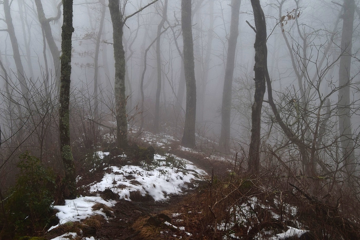
It was just over a mile to the lookout tower at the summit.

Unfortunately, it was too cloudy for much a view.

I climbed the tower but there wasn't much to see. So we just headed back.

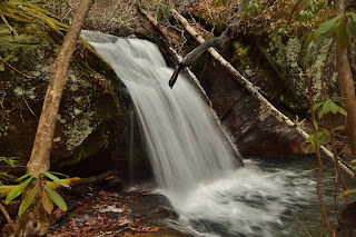
Since it was too cloudy for lookout towers, we decided to visit some waterfalls in Nantahala River Gorge in the high water and good lighting. Coming down Otter Creek Road, we turned right on Wayah Road and went a mile or so two a view spot for Camp Branch Falls.


We turned around here, and continued back on Wayah Road slowly. Our next stop was at the Cascades on Nantahala, just a mile or so up the road. There was a small parking area near the top of the falls.


More of a rapid than a waterfall, it was very pretty in the snow.


At the bridge over Whiteoak Creek, a path led up the creek to Whiteoak Falls.


Our next stop was just a short ways further where Old River Road split from Wayah Road. Right where Old River Road turns right, Jagged Rock Falls tumbled down.


In the snow, the jagged rocks around the falls were really beautiful.

After a few pictures we continued on.


The water tumbles down from Wayah Bald and drops over some pretty rocks.

Our next stop was just past Wayah Bald. In a sharp switchback, we pulled off and started hiking down the gated Forest Road 7165. In under a quarter-mile, we came to Shot Pouch Falls.


We got some pictures and headed on. A little further down Wayah Road, we turned on FR-388 and drove to the trailhead for Rufus Morgan Falls. We hiked the Rufus Morgan Trail (#27) loop counterclockwise. In about a half-mile, we crossed Left Prong Rough Fork.

There was a nice sliding waterfall just upstream.

Past here, we turned right at the split and it was just a short ways to Rufus Morgan Falls.

The waterfall looked beautiful in high water and framed in ice.

Soon, more people showed up so we took off. At the split, we went right to finish up the one-mile loop. We had one more stop before heading back to Franklin. Back on Wayah Road, we turned on FR-316 and parked at the gate. An old road headed upstream along Camp Branch.

There were two old concrete buildings, probably magazines to store explosives.

Right after the second, a path to the right led down to Camp Branch Falls.

It's small, maybe 10 feet, but very scenic with a nice pool at the base.

Just upstream was Upper Camp Branch Falls.

It would be a nice waterfall if not so covered in downfall. We got a couple pictures then headed back.

It was just a short ways back to Franklin and we stopped at Lazy Hiker for dinner from the food truck and some beers.
No comments:
Post a Comment