Showing posts with label Middle Prong Wilderness. Show all posts

Saturday, March 26, 2022

Middle Prong Waterfalls

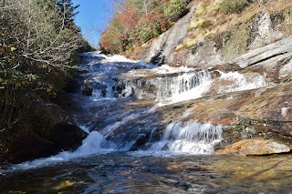
Saturday, we got breakfast and then headed towards Sunburst Campground to Forest Road 97.  It was gated after the ford, so we parked and hiked the road to the second switchback and got on FR-97H to head towards Middle Prong Wilderness.  There are several waterfalls along this gated road, but we continued to near the end and took an unnamed road that ended at Big Beartrap Branch.  From here, we followed a steep and narrow path for almost half a mile to Big Beartrap Falls.


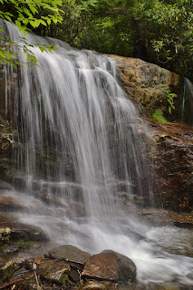
We came out at the base of the main upper drop that was very scenic though the lighting was not cooperating.


There were some cascades just downstream of the main drop and then it cascaded down some more.


We had to backtrack and climb back down for the base of the lower cascades.  The upper portion was not visible from here.


After some pictures, we headed back to the main trail.  At FR-97H, we first went right to the end of the road at Middle Prong.  The small but scenic Laurie Falls was right at this point, but the lighting was very poor by midday.


Heading back along FR-97H, we got off the trail and headed down a steep path to the top of Middle Prong Falls.  There was a little rainbow in the spray.


We took the steep scramble path heading towards the base.  A massive tree had fallen and we had to scale up and around on a cliff to get around.  We eventually made it to the base but the lighting was really bad, a shame as this is a really nice waterfall.


We headed back to FR-97H and continued back to Little Beartrap Falls.  Climbing up from the trail, there's a near little canyon above the main drop.


Just above the old road is another scenic cascade.


We then climbed down from the road to see the downstream cascades.  The sun was shining right on Berry Branch so no possibility of a picture of that one.


We then took the unnamed road here back to FR-97.  Some bloodroot were blooming along the trail.


Once at FR-97, we followed that back to our car past the gate to finish our hike.


Heading back to Waynesville, we had dinner at Bogarts and then retired for the evening.
Sunday, October 28, 2018

Yellowstone Falls

Sunday morning, I broke camp after waking.  The rest of the group was unsure of their plans so I took off towards Graveyard Fields on the Blue Ridge Parkway.  I managed to get a legal parking spot at the overlook; with little fall color left, Graveyard Fields wasn't as popular as usual.


Hiking down towards the Mountains-to-Sea Trail, I first stopped at Second Falls.  It was sunny and the lighting was poor, but it was really pretty in high water.


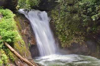
As this one is crowded, I moved on after a few pictures.  I finished up Mountains-to-Sea Access (#358B) and went right to go eastbound on MST.  In about a quarter-mile, I turned right off the trail to a campsite and headed down to the creek above Yellowstone Falls.  Crossing here was tricky in high water and I had to jump to avoid getting my feet wet.  Luckily, the rocks were dry.  On river right, a steep path led down along the falls.  It was little better than nothing and I had to crouch the entire way.  I first came out near the middle.


But there was more waterfall below and it got really steep from this point.  Monkey climbing down the rhododendron was the only way down to the base.


It was still sunny so not great for pictures but a little fall color was showing.  There was even a little rainbow in the spray.


I then made started making my way back.  I must have gotten off the path as it seemed to be even worse rhodos getting back up.  But soon I was back to the creek and then the MST.


My next stop was Bubbling Springs Cascade along NC215.  This is another great area for fall color, but most of the leaves had already fallen.  I climbed down from the road and rock hopped up to the base.


The water was way up, but the sun was shining right on it.  I then headed to the MST parking along NC-215.  Entering Middle Prong Wilderness, I followed Bubbling Springs Branch upstream, which was a little tricky.  I remembered this being easy in the past, but the water level was a lot lower.  Again, the sun was shining right on Lower Bubbling Springs Falls.


So I crossed the creek and climbed further up.  Most of Upper Bubbling Springs Falls was in the shade, so looked a lot better.


After a few pictures, I headed back.  I wasn't quite ready to leave yet, so hiked a short ways on MST eastbound towards Graveyard Fields.  The trail followed a small tributary upstream but it was too small for any major drops.


I took the Blue Ridge Parkway towards Asheville heading home and made a few stops on the way.  East Fork Overlook was right above Yellowstone Falls.


I could hear it down below but it was hidden from view.  Cradle of Forestry Overlook had nice views down the escarpment but color wasn't close to peak yet.


Mills River Overlook was similar.


I made one last stop at Bad Fork Overlook; at much lower elevation, there was little color change.


Then it was a long drive home.

Saturday, August 4, 2018

Flooded Falls

It had rained almost nonstop for the last week and there was flooding in the mountains so a great time to chase waterfalls.  We left at 5 and headed to NC-215 north of Rosman.  Our first stop was a gravel pull off 2.6 north of US-64.  We continued on the road a hundred feet or so to a smaller grassy pull off and then bushwhacked down towards Big Bearwallow Creek.  There was some semblance of a path, but it was very steep.  As we got close to the creek, we could see something upstream, but there was no path at all.  We had to cross the creek and wade through dig hobble to the base.


It was a fairly nice drop, though it was really covered in rhododendron and dead trees.  And this was not the waterfall, though it could be considered the upper section.  A little further downstream was the top of Big Bearwallow Falls.


It was very steep and slippery getting down to the base and across the creek, but it was a very nice waterfall, especially in high water.


A tree growing here had a number of mushrooms growing on it.


Our next stop was just up NC-215 off Macedonia Church Road.  Lemon Falls was just down from the road and some stone steps made a path down.  Not a high waterfall, but very scenic.


The water was too deep to cross for a picture.  From here, we continued north on NC-215 to Courthouse Creek Road (FR-140).  Along the way, we stopped at Sumney Cove Falls.  An unnamed tributary in Sumney Cove drops into North Fork French Broad River on the other side.


It was mostly obscured by summer foliage, but was really flowing in the high water.  North Fork was way too high to wade to the other side.


We then drove to the parking for Courthouse Falls.  A short hike along Courthouse Falls Trail (#130) and Sumney Cove Trail (#129) led to a split where Courthouse Falls Trail goes left and Sumney Cove Trail goes right.  We went straight and followed a scramble path down to Mill Station Creek near the base of Cody Falls.


Cody Falls is very similar in appearance to Courthouse Falls but smaller.  I waded the creek to the other side for some pictures but the sun had come out.  Climbing back up to the trail, we made a quick stop to see Courthouse Falls.


We've visited several times before but this was definitely the highest water.  Near the falls was a weeping rock with a number of downy lobelia blooming.


Butterflies were all about about, pollinating the flowers.


Back to the main road, we continued up to the parkway and went south about 3 miles to the pull off at Haywood Gap.  A lot of cutleaf coneflower were blooming along the parkway.


Heading eastbound on MST, the trail split almost immediately and we went left onto Haywood Gap Trail (#142) and into Middle Prong Wilderness.  The trail descended steeply eventually picking up Haywood Gap Stream and followed it downstream.  About half a mile down, we crossed the creek and the trail leveled off a bit.  Just over a mile from the parkway, the trail forded Middle Prong.   Here, we got off the trail and creek walked a shortways upstream to the confluence of Haywood Gap and Buckeye Creek.  It was another 1000 feet or so to Buckeye Falls, but the creek walking was tough in high water.  Three decent size cascades were quite challenging to climb up before we made it to the base of Buckeye Falls.


As we approached the waterfall, we could see the whole thing, but at the base we could only see the lowest section.


We decided not to try and climb any higher and turned around from here.  Along the hike back, we spotted some Indian Pipe, an interesting plant that does not photosynthesize.


It was all uphill back to the car, but only the last part was particularly steep.


On the way to Waynesville, we stopped for a couple easy waterfalls along NC215.  First, we stopped at Little Wildcat Falls.  An unnamed tributary drops under the road and flows into West Fork Pigeon River near the confluence with Bubbling Springs Branch.


Normally, there's not much to see, but it's a nice roadside waterfall in high water.  A pipevine swallowtail butterfly was next to the road here.


Next, we stopped at Sunburst Falls.  Upstream of the bridge, the river was raging.


So much so, that we couldn't get down to see the lower section.  Finally, we made one more stop where the road crosses Green Creek.


A lot of wildflowers were blooming here including beebalm and impatiens.


A short hike led to the scenic Little Bird Falls.


The water was higher than the last time I visited and the setting was reminiscent of a tropical rain forest.


By this time, it was getting late so we headed to Waynesville for dinner and checked in to the Econo Lodge.

Monday, July 3, 2017

Middle Prong Waterfalls

Monday, I headed to Middle Prong Wilderness for some waterfalls.  I took NC-215 south past Lake Logan and right after Sunburst Campground, I turned onto Forest Road 97.  It was gated right after the ford on Right Hand Prong so I parked before the gate.  It was just under 1.5 miles, in the second switchback where I got on FR-97H, which is more of a trail than a road and becomes Haywood Gap Trail (#142) as it enters the wilderness.  In a short distance the trail passed over the middle of Little Beartrap Falls, but the view from the trail is not great.  After crossing the creek, I bushwhacked up the river right side of Little Beartrap Branch to get to the upper section of the waterfall.  It was quite tricky to get out on the rocks for a good view, but it was a pretty nice waterfall.


Back on the trail, I continued about a half-mile and got off the trail again.  The spot to get off the trail is not obvious at all, but its between two big dirt mounds and I thought I could hear Middle Prong Falls from there.  At first, it was an easy bushwhack through a relatively open area.  Then it got real steep and I had to hold on to rhododendron going down.  I kept climbing down and eventually came out at the top of Middle Prong Falls.


I could tell it was a great waterfall, but there was no way down from here.  So I went back up just a little and followed the cliff downstream until I could make my way down to the creek.


Middle Prong Falls was a really impressive waterfall and I spent some time enjoying the view.  The powerful water flowing generated a nice breeze that kept the bugs away and it was a bit cooler.


But I had a rough climb back up so I didn't linger too long.  I continued on FR-97H into Middle Prong Wilderness to where the trail crosses Middle Prong.  Laurie Falls is right across the river.


It's a real scenic but smaller waterfall on the river at the crossing where Haywood Gap Trail picks up on the other side.


But my destination was Big Beartrap Branch, so I had to backtrack a bit and pick up a side path that led to the creek.  From here, I needed to bushwhack up to the waterfall, but after going almost a half-mile, I couldn't find it and gave up.  I was alone and didn't want to press my luck, so I started heading back to the car.  Along the way, I spotted some beebalm blooming along the trail.


And I ran into a nice couple who gave me an Off Wipe to repel the pesky bugs.  They were really bad in here.  At the first switchback on FR-97, I followed a path to the base of the lower section of Little Beartrap Falls.  I couldn't find a good spot for that waterfall, but the next tributary over - Berry Branch - had a nice little waterfall flowing over a rock in two streams.


There were some nice cascades downstream on Little Beartrap Branch as well.


Then I headed back to the car.  Back on NC-215, I headed south for about 2 miles and pulled off where the road crosses Green Creek.  A small path on river left led a short ways to Little Bird Falls, a small, but scenic waterfall.


It was such a lush, green setting; even though the waterfall is small, the mossy rocks and vegetation made it feel like a rain forest.


I got a couple pictures and then drove a little further to the pull-off for Sunburst Falls.  First, I headed to the upper sections upstream of the road.


The rocks were wet from recent rain so I didn't scramble too high.  Then, I scrambled down below the road to see the lower cascading section below the bridge.


Usually, I don't like man-made stuff in waterfall pictures - it distracts from the natural setting.  But this bridge is so scenic, it really brings out the scene.


Back at the car, I drove a little further a pulled off on the left.  I donned water shoes and found a super steep and overgrown path down to West Fork Pigeon River.  There was some flagging tape to indicate the best way down.  At the river, I scrambled upstream a short ways to get past a cascade and then crossed the river to the base of Lower Wildcat Falls.


Although short, it's rather difficult with the steep scramble down to the river and then creek-walking up to the waterfall.  But it looked really nice, especially in high water.  On the way back, it was easier to get past the cascades on West Fork Pigeon River on the river-right side.


When I had visited Wildcat Falls, the water level was really low, so I figured I'd try to hit that one up as well.  I drove further up NC-215, almost to the Blue Ridge Parkway and pulled off at the big MST parking area on the right.  From here, I got on the MST going westbound into Middle Prong Wilderness.  The trail paralleled the road for a ways then headed west through the woods and then a field.  It continued through a muddy area and then started switchbacking up the mountain.  After the second switchback, I found a spot to get a nice view of Mount Hardy Falls from a distance.


This one is on a very small stream, but in high water like today, it was quite impressive - more like a waterfall out west.


I went a little further on the MST and then turned back.  It rained a little here and there on the hike back, but not much.  The field part of the hike was overgrown and I got really wet hiking through here.  Back at the car, I started back down NC-215, making one more stop at the trailhead for Wildcat Falls.  After parking, I hiked past the campground and rock-hopped Bubbling Spring Branch and got on Flat Laurel Creek Trail (#346).  Right away, there were some small cascades just off the trail.


With the recent rains, they looked pretty nice.  It was another half-mile or so to Wildcat Falls.


It's a small tributary, but looked a lot better than my previous visit when it was just a wet rock.


After a couple pictures, I headed back and packed up to depart in the morning.