Tuesday, April 25, 2017

Waterfall in Raleigh!

With the significant rain we've had over the past couple days, creeks are swollen and many roads are closed due to flooding.  Another consequence of all this rain is waterfalls that normally don't exist are raging.  Before work this morning, Amanda and I went to find one along Raleigh's Capital Area Greenway.  We parked at the NC Museum of Art and followed Reedy Creek Trail towards downtown.  It was really raining when we started but we were prepared with waterproof clothing.  Across the pedestrian bridge over I-440, we turned left on House Creek Greenway and went about a mile to near Lake Boone Trail.  A small, unmarked tributary flows into House Creek here.


Normally, there's nothing to see here, but today, there was a roaring waterfall.  After a few pictures, we headed back as the rain died down.  The waterfall will probably be gone by tomorrow, but exciting to find one so close to home.

Saturday, April 22, 2017

Brumley Forest Grand Opening

For Earth Day, Amanda and I took Alex to the grand opening of Brumley Nature Preserve, Triangle Land Conservancy's newest preserve.  So many people came out, they had parking in the powerline right-of-way as the parking lots could not handle so many visitors.  A number of sponsors had booths set up, but Alex was anxious to go hiking so we first did a loop around Wood Duck Way.  Near the actual parking lot, we saw an old car that had been completely filled with rocks.


I don't think anyone's going to get away in this car!  After that we got on Springhouse Loop and did a short loop around Grand Oak Loop.  We continued on Springhouse Loop towards the pond and took Flat Tail Trail.  A beaver dam was visible along the creek here.


As we got to the pond, I spotted a beaver lodge, but no beavers.  We did see a family of Canada geese with goslings swimming in the pond.


There was a nice picnic area where we stopped for a snack and to let Alex have a drink and the pond is quite scenic.


Then we followed the powerline clearing and took Running Cedar Trail.  At the end, we did a loop around the manor, but the path to the ruins was closed.  So we took Buckeye Loop for a short ways, but Alex was getting hot so we didn't finish the loop.  Back at the main area, we got some tacos from the Bandidos food truck and some beer from Fullsteam and ate lunch in a shady spot.  We even got Alex a small cup of ice cream to cool off.


It was a really nice opening and we're looking forward to exploring this great new park again soon.


Sunday, April 16, 2017

Easter at Wilson Creek

Sunday, we broke camp at Price Park and headed towards Wilson Creek on the Blue Ridge Parkway.  Past Grandfather Mountain, we stopped at the overlook to view the mountain we had climbed yesterday.


We got off the parkway at NC-181 and followed it south to Forest Road 982.  Heading down this gravel road, we crossed Upper Creek on a narrow bridge and turned left to follow FR-197 to the end.  Surprisingly, it looks like the Forest Service fixed this road and extended it to the large campsite at Griffiths Branch.  Previously, we had to park about a half-mile back and walk this stretch of road.  After getting our stuff together, we started hiking the Greentown Shortcut Trail (#268A).  Our plan was to get off the trail in about 1.5 miles and canyoneer Upper Creek to Raven Cliff Falls.  Unfortunately, with recent rains, the water level in the creek was way too high to get through.  So instead, we continued the trail towards Burnthouse Branch Falls.  Greentown Shortcut is little-traveled and fairly overgrown in places.  But we had an enjoyable hike viewing the many wildflowers blooming along Upper Creek.  There were a number of trillium blooming along the trail.


One section of the trail had a mess of huge trees down and it was tricky climbing around and finding the trail on the other end.  Past Raven Cliff Falls, the trail heads back down to creek level, crossing Burnthouse Branch to a small campsite.  From here, we could see that Burnthouse Branch Falls was really flowing.  We climbed around on the rocks to get pictures of the waterfall.


I have been here several times before, but this was definitely the best it has ever looked.  The mossy rocks around the falls are really beautiful.


With the leaves still down, I could also see the upper section of the waterfall.  I had never been up before, so I made the exceedingly steep climb up.


The rocky area to get out for a view was treacherous and I made sure to hold on to rhododendron or rocks the entire time.


A fall from up here would be certainly fatal.  I got a couple pictures and then scrambled back down to the base.  From here, we started making our way back.  Along the way, I was surprised to see rhododendron starting to bloom - usually that's not until May or June.


We also found a nice patch of dwarf crested irises along the trail.


Amanda spotted a small snake just off the trail - I think he was a water snake.


She always finds the snakes!  Soon we made it back to the car, but we weren't quite done yet.


Driving back down FR-197, we turned left on FR-982 and headed further into the Wilson Creek area.  Coming out on Brown Mountain Beach Road, we turned left and parked at a bridge over Harper Creek.  From here, we picked up the Philips Branch Trail (#252) and followed it about a half-mile to Philips Branch Falls.  We could see the waterfall from the trail but a lot of vegetation was in the way.


We found a very steep scramble path down to the base for some pictures and then climbed back up.


Unfortunately, it's not possible to see the entire thing from the base.


Back at the car, we headed into Morganton for dinner at Las Salsas before making the drive home.

Saturday, April 15, 2017

Grandfather Mountain Profile Trail

Saturday, we were planning to hike up Grandfather Mountain via the Profile Trail.  We left Price Park and headed to NC-105 and the trailhead parking.  The weather forecast was calling for a chance of thunderstorms, so we had to keep an eye on the weather.  After getting our stuff together, we started our hike.  The first mile is pretty easy with little elevation gain, but we did stop frequently to see the beautiful wildflowers blooming.  There were a lot of trout lilies blooming at lower elevations.


Gaining a bit of elevation, we started to see a lot of trillium as well.


After a mile, the trail starts to really get steep.  We made a stop at the Foscoe Overlook to view the valley below.


Continuing on, we passed the Profile Campsite and made another stop at the Profile View.  Here, we had a nice view of the cliffs below Calloway Peak that resemble an old man's facial profile, hence the name of the mountain and trail.


Then we continued making the steep climb up, passing Shanty Springs before reaching Calloway Gap and the Grandfather Trail.  We had a snack here, and then turned right to follow Grandfather Trail towards MacRae Peak.  Soon, the trail got really fun.  There were some rocky areas with great views of Calloway Peak and mountains in the distance.


We had to scramble up some rocks before passing Indian House Cave.  Then it really became a climb as we headed up Attic Window.


There were a number of fixed ladders to climb down and a really steep chute.  Once in the saddle between MacRae and Attic Window, we had more ladders to climb up.  The first was a fixed ladder followed by a climb up a slick rock face using a cable.  Then one more ladder to get up to the summit of MacRae Peak.  The views were great up here - looking north we could see Attic Window and Calloway Peak in the distance.


People on the summit and climbing the chute looked as small as ants.  To the south, we could see the mile-high swinging bridge.


Originally, we planned to continue on to the bridge but it was a long ways down, meaning a steep climb back, and the weather didn't look like it would hold out.  We stopped for lunch here but could see the storm clouds rolling in.  We continued down the other side of the peak and took the Underwood Trail back around.  As we got back to the Grandfather Trail, we turned left to head back.  It started raining at this point, but started out as just a drizzle.  It started getting heavier so we sought shelter in Indian House Cave.


When the rain lessened, we continued back.  About the time we got to Calloway Gap, it started raining really hard.  We ran down Profile Trail a short ways and sheltered under a small overhand at Shanty Springs until the rain died down again.  It didn't last long and mostly cleared as we continued down the trail.  I found some Dutchman's Breeches along the trail.


Most were not quite ready to bloom but a few had flowers.  I also found some wild hydrangea, not quite in bloom, but very pretty nonetheless.


And of course there were lots of trillium.


A number of red efts had come out after all the rain and we had to be careful not to step on them on the trail.  Their bright orange colors makes them pretty easy to spot.

Near the end, we crossed over Shanty Spring Branch.  In the morning, it was barely a trickle but the day's rains had brought the little creek to life.


We had to cross the headwaters of Watauga River as well before returning to the trailhead.


Back at the car, we made the short drive up to Seven Devils and stopped at Otter Falls Trail.  The small parking area was full and we had to park on the street.  It's an easy half-mile hike down to Otter Falls, a very scenic little waterfall on Valley Creek.


Following a path upstream of the waterfall, we saw some nice cascades above the waterfall.


Then we headed to the overlook to see Otter Falls.


I climbed around on the rocks to get some pictures from different angles.


Then we headed back up to the car.


For dinner, we headed to The Peddlin' Pig, just past the Profile Trailhead parking on NC-105, for barbeque.  Then we made our way back to camp and built another campfire before retiring for the evening.

Friday, April 14, 2017

Blowing Rock Waterfalls

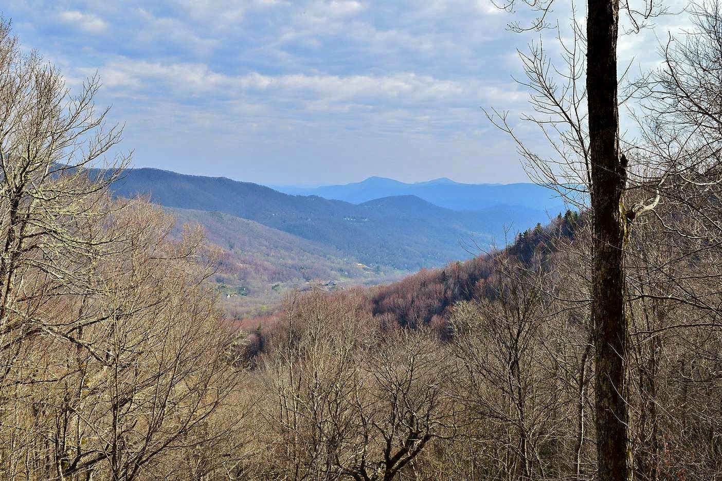
For the holiday weekend, Amanda and I headed to the Grandfather Mountain area.  We took US-421 towards Boone and got off in Wilkesboro on NC-16/18 to our first waterfall of the day - Moravian Falls.


We parked at the campground here and checked in, then walked across the street to view the waterfall.  It's a nice 40-foot sliding waterfall with a replica mill right next to it.  I kind of thought the mill distracted from the scene so got close enough to crop out any of the buildings.


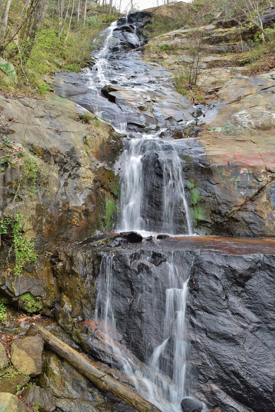
After a couple pictures, we got back in the car and continued on.  We took NC-18 to Lenoir and then took US-321 north towards Blowing Rock.  About half way, we got off the highway and took Waterfalls Road to a pull-off at Silvervale Falls.


Silvervale Falls is a nice roadside waterfall.  Unfortunately, it's a also a popular place for graffiti, which spoils the natural setting.


We got a couple pictures and then continued on to Blowing Rock.  We parked at the Annie Cannon Gardens and started hiking the Glen Burney Trail.  The trail follows New Years Creek downstream, passing several waterfalls.  The trail starts out as an old road and we could tell we were still in town.  Houses are visible on both sides of the creek and we could hear the noise of traffic.  In about a half-mile, the trail switchbacks down to the creek, passing the ruins of an old sewer plant that served Blowing Rock until 1929.


At this point, the trail starts to feel more like wilderness and less like city hiking.  About a quarter-mile further, we came to the Cascades, the first waterfall on the hike.


In relatively high water, this waterfall looked very nice.  There were some scenic drops and then a big lower drop.  I scrambled down to creek level for a good photo.


Then we continued following the trail downstream, passing an overlook of Glen Burney Falls.  The view was obscured by trees and not very good.  Further down, we came to a split and first went right to the base of Glen Burney Falls.


I scrambled around on the rocks to view the waterfall from different angles, but unfortunately, the bright sun was shining right on it.


After some pictures, we headed back to the split and continued to Glen Marie Falls at the end of the trail.  I scrambled around on the rocks to get a good picture, but there's nowhere to see the entire thing.


From the base, I could only see the lower parts of the falls.  Climbing back up, I found an overlook with a decent view of the upper part, but the lower part was hidden.


When we were done, we made the hike back up to the car.


From here, we went south from Blowing Rock on Globe Road for about 3.5 miles and turned right on Forest Road 4071.  It was steep in places, but we didn't have trouble in a 2WD RAV4.  We parked at the gate at about 2.5 miles and donned water shoes for this hike.  After crossing China Creek at a concrete ford, we turned left on a trail following the creek downstream.  A number of irises, foamflower, and other wildflowers were blooming along the creek.


In under a half-mile, the trail crossed China Creek.  Instead, we continued a short ways to Thunderhole Creek and crossed here.  A short path led upstream to a steep climb to the base of Thunderhole Falls.  A rope tied to a tree made the descent a bit easier.  Thunderhole Falls was a really nice waterfall.


The upper drop is split into two and then some smaller cascades below.  I climbed up to the lower drop for a great view of this waterfall.


After some pictures, we started heading back.  At the China Creek crossing, we crossed and followed the creek downstream.  After the confluence, it becomes Thunderhole Creek.  After two more water crossings, we climbed high up on a bluff and followed a steep path down to the Lower Thunderhole Falls.


Although not as scenic as the upper waterfall, there was one of the nicest swim holes I've ever seen here.  It was a little cold and I didn't have a swimsuit or towel, but the water was extremely tempting.


We got some pictures and then climbed back up and headed back.  Towards the car, we stopped to see some more wildflowers and were surprised to see some mountain bikers.


I think this is an extension of China Creek Trail (#250) that starts in Blowing Rock.


We drove back to Blowing Rock and got on the Blue Ridge Parkway to Julian Memorial Price Park, our home for the weekend.  Only A loop was open, but we found a nice site at A12.  After registering and getting set up, we took a hike around Price Lake.


The lake was really beautiful on this April afternoon.  Passing the Lakeview Overlook, we saw the boat rentals were open, but we decided to just hike around the lake.


There were a good number of people paddling on the lake and a few even had their dogs.


After finishing the loop, we headed into town and had dinner at Foggy Rock.  After dinner, we got some firewood and built a nice campfire before retiring for the evening.