Showing posts with label Otter Falls Trail. Show all posts

Saturday, June 10, 2023

Moses Cone Bass Lake Hike

Saturday, we took Alex to the mountains for the weekend to escape the heat in Raleigh.  Our first stop was in Seven Devils at Otter Falls Trail.  After getting our stuff together, we took Red-Blue-Orange Trails to Otter Falls.


It was a sunny day so it was hard to get a good picture, but it's a pretty waterfall and flowers were blooming around it.


We went upstream a bit to see some scenic cascades along Valley Creek and take a break.


On the hike back, we took the other direction of the loop trails.  The Orange Trail followed Valley Creek downstream past the falls for a short ways before looping back up.


Yellow Trail is a short one-way trail that splits from Blue Trail.


Mountain laurel and galax were flowering along the trail.


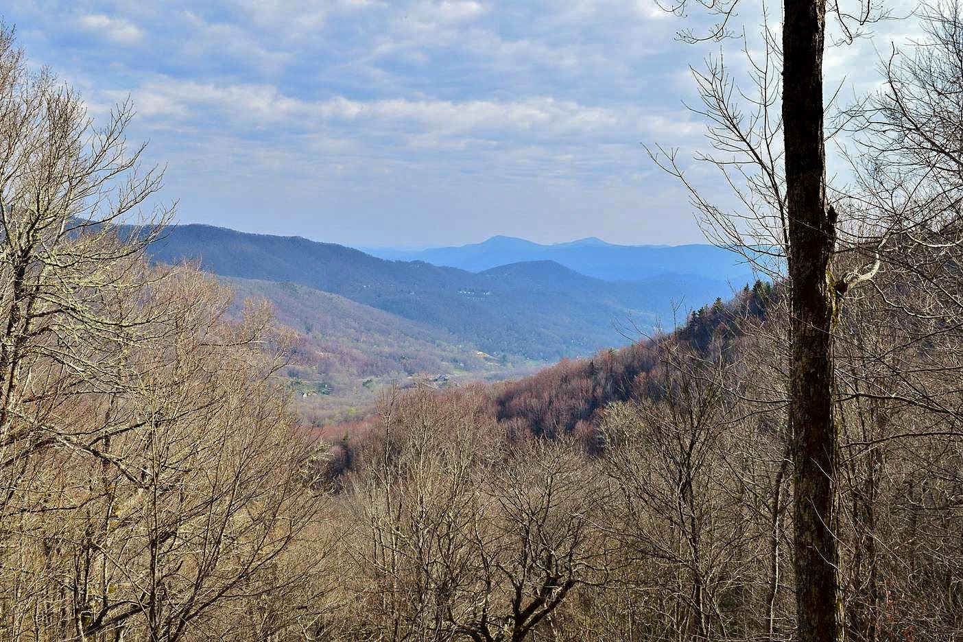
It ended at an overlook above Valley Creek but there was too much foliage for much of a view.


Then we took the other end of the Blue Trail loop back to Red Trail.


Some fire pink was flowering along the trail.


The Red Trail loop ended back at the parking lot.


From here, we headed up to the Blue Ridge Parkway and parked at the manor at Moses Cone Memorial Park.  We hiked past the manor on Duncan Trail and followed it down towards Bass Lake.


There were oxeye daisies and other wildflowers blooming in the open areas.


Some great spangled fritillary butterflies were enjoying the flowers as well.


Further down the trail, we some some big hemlock varnish shelf mushrooms growing.


More butterflies on a nice summer day.


Down towards the lake, we started to see mountain laurel blooming.


And there were a couple jack in the pulpits remaining.


Duncan Trail ended at Bass Lake and we took the trail around the scenic lake.


A lot of fragrant water lilies were floating in the lake.


At the north end of the lake was Heart Pond, a little double pond that the Cones built.


Finishing up the loop, there were great views of Flat Top Manor way above the lake.


On the way back up, we hiked around the Maze, a winding carriage road.


It ended up near the Apple Barn.


From here we took Deer Park Trail back up towards the parking area.


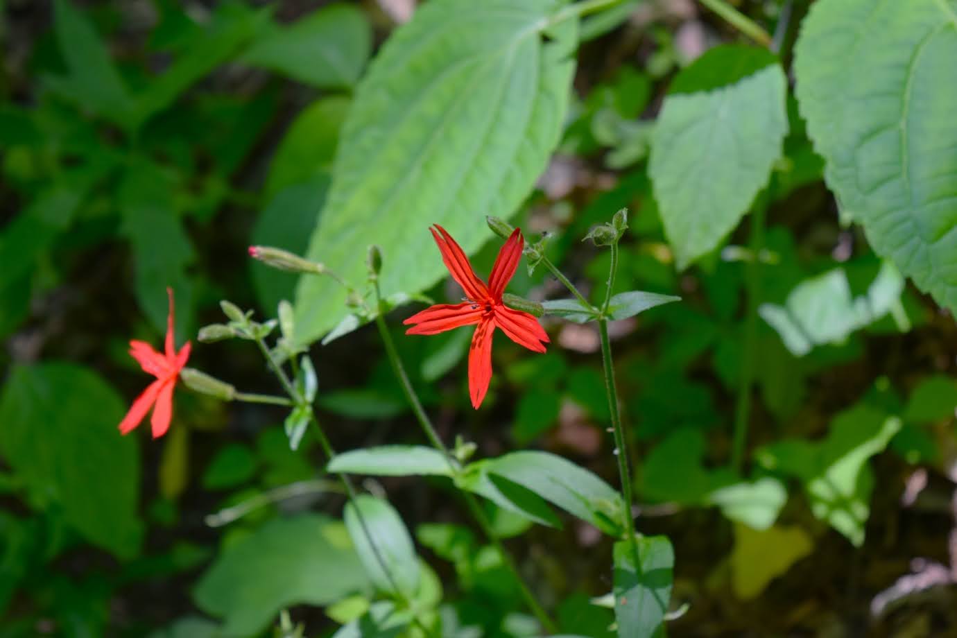
Some fire pink were blooming along the trail.


It was after noon by this point and we had worked up an appetite, so headed to Booneshine for an early dinner.  After dinner, we stopped at Brookshire Park to walk off the food and beer.  The South Fork New Greenway headed downstream along the river for just under a mile to the end.


There were some common ninebark flowering along the river.


On the hike back, I spotted some southern blue flag irises along the trail.


We finished back up at the park.


From here, we drove south on US-321 towards Lenoir with a short detour to see Silvervale Falls.


It's a scenic waterfall, but unfortunately has been heavily vandalized with graffiti.  We finished up the drive to Lenoir and checked into the Red Roof Inn.

Saturday, April 15, 2017

Grandfather Mountain Profile Trail

Saturday, we were planning to hike up Grandfather Mountain via the Profile Trail.  We left Price Park and headed to NC-105 and the trailhead parking.  The weather forecast was calling for a chance of thunderstorms, so we had to keep an eye on the weather.  After getting our stuff together, we started our hike.  The first mile is pretty easy with little elevation gain, but we did stop frequently to see the beautiful wildflowers blooming.  There were a lot of trout lilies blooming at lower elevations.


Gaining a bit of elevation, we started to see a lot of trillium as well.


After a mile, the trail starts to really get steep.  We made a stop at the Foscoe Overlook to view the valley below.


Continuing on, we passed the Profile Campsite and made another stop at the Profile View.  Here, we had a nice view of the cliffs below Calloway Peak that resemble an old man's facial profile, hence the name of the mountain and trail.


Then we continued making the steep climb up, passing Shanty Springs before reaching Calloway Gap and the Grandfather Trail.  We had a snack here, and then turned right to follow Grandfather Trail towards MacRae Peak.  Soon, the trail got really fun.  There were some rocky areas with great views of Calloway Peak and mountains in the distance.


We had to scramble up some rocks before passing Indian House Cave.  Then it really became a climb as we headed up Attic Window.


There were a number of fixed ladders to climb down and a really steep chute.  Once in the saddle between MacRae and Attic Window, we had more ladders to climb up.  The first was a fixed ladder followed by a climb up a slick rock face using a cable.  Then one more ladder to get up to the summit of MacRae Peak.  The views were great up here - looking north we could see Attic Window and Calloway Peak in the distance.


People on the summit and climbing the chute looked as small as ants.  To the south, we could see the mile-high swinging bridge.


Originally, we planned to continue on to the bridge but it was a long ways down, meaning a steep climb back, and the weather didn't look like it would hold out.  We stopped for lunch here but could see the storm clouds rolling in.  We continued down the other side of the peak and took the Underwood Trail back around.  As we got back to the Grandfather Trail, we turned left to head back.  It started raining at this point, but started out as just a drizzle.  It started getting heavier so we sought shelter in Indian House Cave.


When the rain lessened, we continued back.  About the time we got to Calloway Gap, it started raining really hard.  We ran down Profile Trail a short ways and sheltered under a small overhand at Shanty Springs until the rain died down again.  It didn't last long and mostly cleared as we continued down the trail.  I found some Dutchman's Breeches along the trail.


Most were not quite ready to bloom but a few had flowers.  I also found some wild hydrangea, not quite in bloom, but very pretty nonetheless.


And of course there were lots of trillium.


A number of red efts had come out after all the rain and we had to be careful not to step on them on the trail.  Their bright orange colors makes them pretty easy to spot.

Near the end, we crossed over Shanty Spring Branch.  In the morning, it was barely a trickle but the day's rains had brought the little creek to life.


We had to cross the headwaters of Watauga River as well before returning to the trailhead.


Back at the car, we made the short drive up to Seven Devils and stopped at Otter Falls Trail.  The small parking area was full and we had to park on the street.  It's an easy half-mile hike down to Otter Falls, a very scenic little waterfall on Valley Creek.


Following a path upstream of the waterfall, we saw some nice cascades above the waterfall.


Then we headed to the overlook to see Otter Falls.


I climbed around on the rocks to get some pictures from different angles.


Then we headed back up to the car.


For dinner, we headed to The Peddlin' Pig, just past the Profile Trailhead parking on NC-105, for barbeque.  Then we made our way back to camp and built another campfire before retiring for the evening.