Sunday, June 26, 2022

Haw River Hikes

Sunday, I headed to Alamance County for some hikes along the Haw River.  My first stop was at Saxapahaw Island Park.  The short Saxapahaw Island Loop was a short trail around the perimeter of the island.


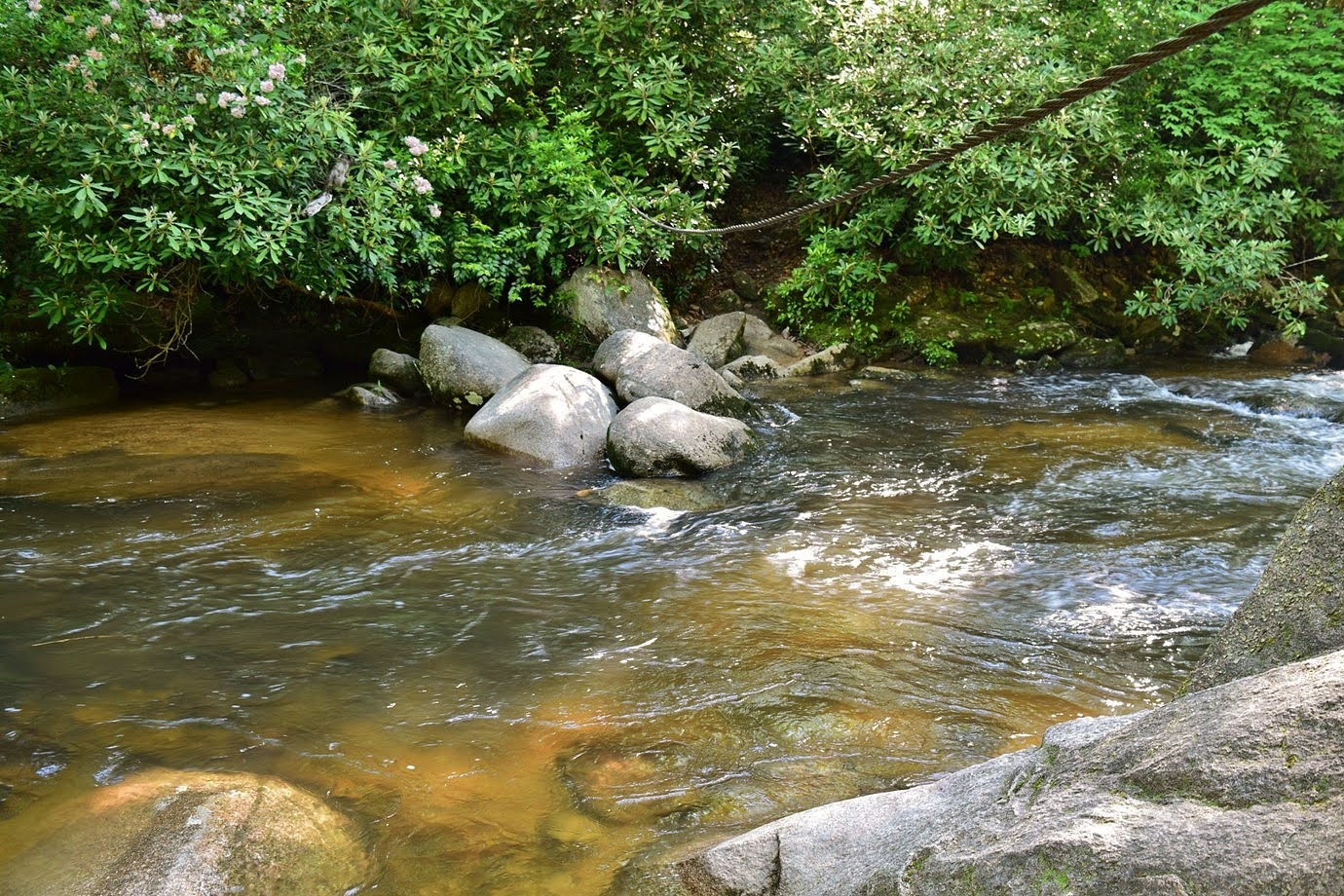
The river was very rocky and scenic in the vicinity of the island.


After finishing up the loop, I got on the Haw River Trail.  Heading northbound, the trail ran behind a private campground then ended before reaching the dam.  Going the other way, it passed behind the Saxapahaw Rivermill and continued following the river downstream for more than a mile.


The lower portion went through farm land that had been cleared to benefit wildlife.


After reaching the current end of the trail, I turned around and headed back.


From here, I drove a few miles north Swepsonville River Park and another access point to the Haw River Trail at Big Alamance Creek.  This section is about 1 mile along the west side of the river.


There were some rocky parts where I could get out in the river.


After hiking under the bridge to the end, I headed back.


There was one more section I wanted to visit before leaving and parked at the Longmeadow Trailhead in Graham.  This section is almost 2 miles, crossing under I-85/I40.


It looks like the northern terminus of this section is less than a mile from Red Slide Park, so hopefully the segments can be connected in the near future.


By the time I finished around noon, it had gotten quite hot and I was ready to return to air conditioning.

Sunday, June 12, 2022

Summer Hikes at Jordan Lake

Sunday, I went for a couple hikes at Jordan Lake.  My first stop was the Mason Point Trailhead in Jordan Game Land.  I followed the Horse Trail to the powerline clearing and then took that down to the point.  Some morning glory were blooming along the clearing.


The trail ends at the lake where the Durham-Duncan rail line used to cross New Hope Creek.  Across the lake was the terminus of Eagle Spur Trail.


It was a nice view from here, but a kayaker was birdwatching in the nude.


Giving the kayaker some privacy, I back to the mainland part.


Although an unofficial trail, the old rail line made a trail across Mason Point that I followed for several miles.


On one side of the trail, a prescribed burn had recently been performed.


There were a lot of lizard's tail blooming in the swampy area along the trail.


I also saw a patch of cornflower, a pretty but non-native flower.


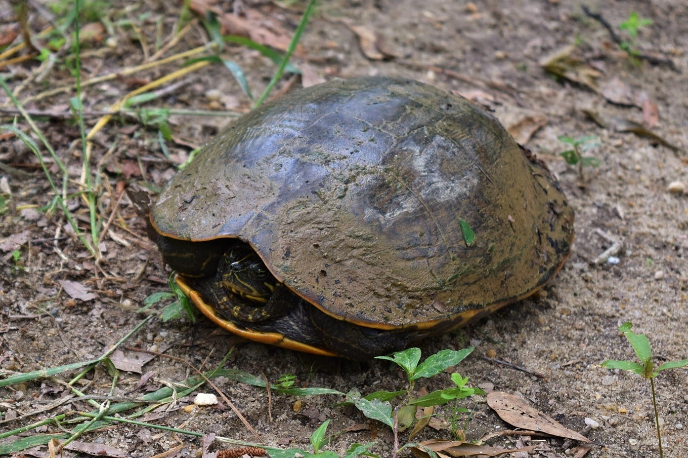
A yellow-bellied slider was right in the middle of the trail.  He retreated to the safety of his carapace as I passed.


After crossing the road, the trail became very overgrown, though easy to follow.  It ended abruptly back at the lake.


I turned around here and headed back.


There was a nice path of orange day-lily, another invasive species, flowering near the parking lot.


From here, I continued another 20 minutes to Jordan Lake Educational State Forest.  I started off on Forest Demonstration Trail that led around the peninsula with several spurs leading out to the lake.


At one, I saw a pair of osprey nesting over the water.


One was collecting sticks for nesting material while the other stood guard.


After finishing up the loop, I took the short Talking Tree Trail.


The Low Lands Trail led out to another scenic spot on the lake.


Wildlife Trail was the last in the forest and started from next to the parking lot.  I saw some butterfly weed along here.


After finishing the loop, I stopped to see the Forest Service helicopter.


It was after noon and really hot by this point, so I finished up my hike and headed home to air conditioning.

Monday, May 30, 2022

Coon Den Falls

Monday morning, we checked out of the hotel and headed to Dennis Cove Recreation Area.  After parking next to the bridge over Laurel Fork, we set off on Laurel Fork Trail (#39) that followed its namesake upstream.


After about half a mile, we came to the first crossing.  Once again, the water level was way up and it didn't seem safe with the dog.  We should have learned our lessen at Gentry Creek Falls.


So we headed back to the parking area and got on Coon Den Falls Trail (#37).  Some hoary skullcap was blooming along the trail.


The rerouted trail followed the road then headed up Coon Den Branch.  There were some nice cascades before reaching the falls.


A short spur led to the 50-foot Coon Den Falls.


The lighting wasn't great, but it was really flowing.


After some pictures, I continued on the trail up to the Appalachian Trail.  I could see the top of the waterfall from the trail but there was too much foliage for a good view.  Once at the AT, I headed back.


From here, we started making our way home.  We stopped for dinner at Dooley's Tavern in Wilkesboro, then finished up the drive.

Sunday, May 29, 2022

Margarette Falls

Sunday, we headed back into Cherokee National Forest to the Bullen Hollow Trailhead in the Bald Mountains area.  From the parking area, we followed Forest Road 5099 into the forest at an information kiosk.  Phillips Hollow Trail went left to cross Dry Fork, but we went right on Margarette Falls Trail (#189).


This trail followed West Fork Dry Creek upstream to its namesake.  There were some nice cascades and drops all along the creek.


At about a half mile on the trail, we crossed the creek on a steel footbridge.


Not long after, we had to cross back over, but this time without the aid of a bridge.  In high water, it was a little tricky to get across dry.


The trail ended at the spectacular Margarette Falls.


It's a beautiful 60-foot waterfall that fans out over layered rocks.  Unfortunately, the clouds were not cooperating.


The left section of the falls was mainly out of the sun.


It didn't look like any clouds were coming and more folks were showing up, so we made our way back.


From here, we headed to Round Knob Picnic Area.  As the crow flies, it's only a couple miles away, but was good thirty minute drive as Round Knob Road (FR-88) is quite rough.  We started off on the Davis Creek Trail (#19) that descended steeply from Round Knob.  Some fly poison was blooming on the hike down.


We followed a tributary down to Davis Creek, crossing it twice then another tributary before reaching the creek.


Since the water level was up, this was a wade to get across.  Once across, we went left on Artie Hollow Trail (#18) and followed a tributary up the hollow.  The trail was narrow and overgrown, but well blazed and easy to follow.  After a while, the trail got in the creek and we had to creek walk up a ways.  A few parts were tricky for Alex but he made it.  The trail then resumed and passed Mary Falls.


It was a steep scramble down to creek level for views of the waterfall.


But at least the clouds were cooperating for this one.


After some pictures, we scrambled back up and made our way back to Davis Creek and had lunch.  There was a big rat snake near the crossing.


The hike back up Davis Creek Trail was steep, but we went slow and stopped for wildlife.  I spotted a huge snail on a rhododendron leaf.


A little mushroom was popping up from a stump.


As we were almost back to the car, Sandy spotted a baby copperhead just off the trail.  Fortunately, Alex wasn't interested.


After all the uphill, we made it back to the car.


We headed back to Johnson City and stopped at Atlantic Ale House.  We got pizza from a food truck and had dinner and drinks.  Then we headed back to the hotel and started packing up.