Sunday, August 5, 2018

Boulderfield Falls Attempt

Sunday, we left Waynesville and headed to Shining Rock Wilderness.  Parking at the national forest area in Camp Daniel Boone, we got on Little East Fork Trail (#107) and headed into the wilderness.  The trail is all uphill following its namesake upstream but it was a gentle slope and very pleasant hike.  In about a mile, we followed a path down to the creek and took a break, enjoying views of the cascades.


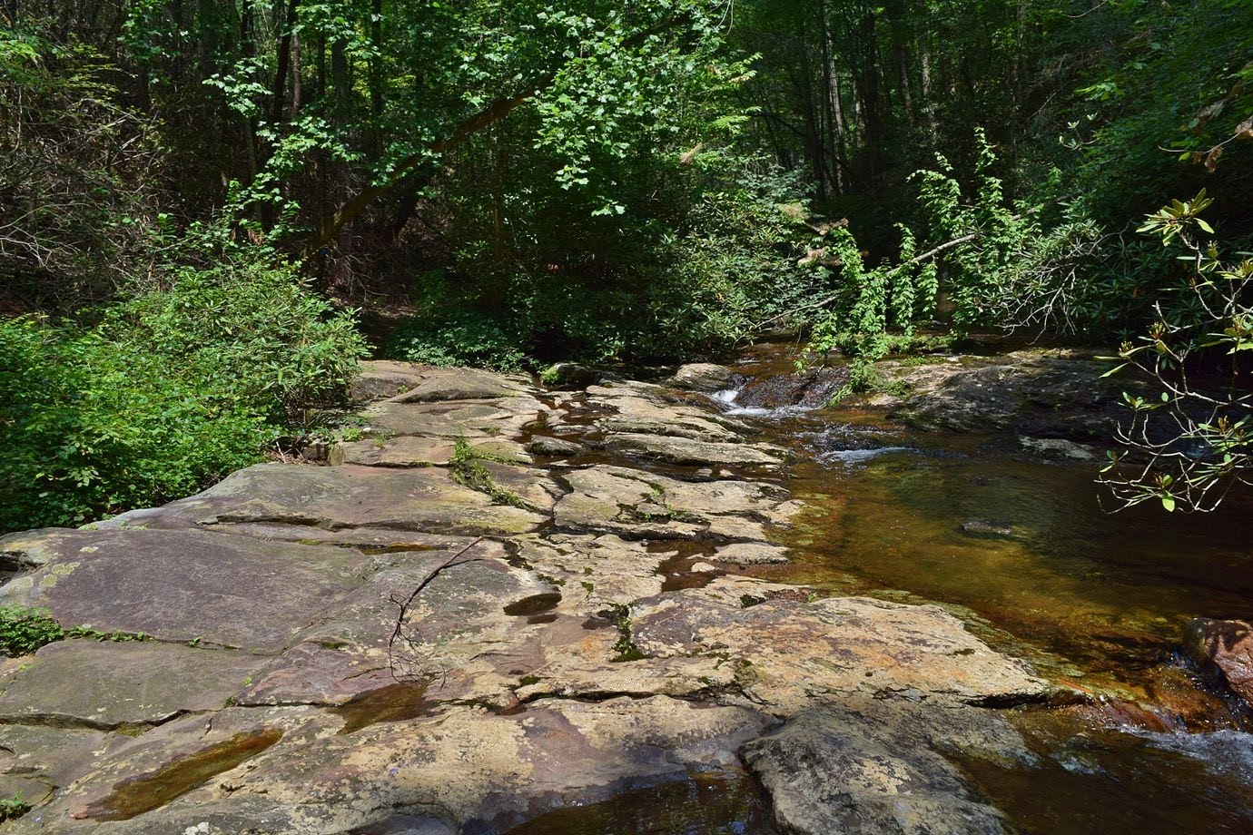
At 1.3 miles, there was a gnarled old tree and another path down to the creek.  This one was very steep and difficult but there was a nice little waterfall on Little East Fork Pigeon River here.


I was glad we got this one today as it probably wouldn't be worth the difficult descent in low water.  Continuing on the trail another mile, the unnamed tributary for Boulderfield Falls was across the river.  Getting down to river level, however, wad not so easy.  The bank between the trail and river was almost a sheer drop and totally overgrown with rhododendron.  After a few attempts, we found a way down just above the confluence.  We went downstream to just below the confluence and found a safe place to cross and then tried to bushwhack upstream along the tributary.  It was really steep and totally overgrown with rhododendron.  We tried several different routes, but kept getting stuck and eventually decided to give up.  The hike back was pleasant and we spotted a bunch of pipevine swallowtail butterflies on the way.


Soon we were back to the camp and parking area.


Heading back, we took NC215 to the parkway and went northbound to start the drive home.  We stopped at Pounding Mill Overlook for beautiful sweeping views of the Blue Ridge escarpment.


Looking Glass Rock was visible in the distance.  Further down, we made another stop at Walnut Cove Overlook.


After this stop, we got on the interstate to head home, stopping for Las Salsas on the way.

Saturday, August 4, 2018

Flooded Falls

It had rained almost nonstop for the last week and there was flooding in the mountains so a great time to chase waterfalls.  We left at 5 and headed to NC-215 north of Rosman.  Our first stop was a gravel pull off 2.6 north of US-64.  We continued on the road a hundred feet or so to a smaller grassy pull off and then bushwhacked down towards Big Bearwallow Creek.  There was some semblance of a path, but it was very steep.  As we got close to the creek, we could see something upstream, but there was no path at all.  We had to cross the creek and wade through dig hobble to the base.


It was a fairly nice drop, though it was really covered in rhododendron and dead trees.  And this was not the waterfall, though it could be considered the upper section.  A little further downstream was the top of Big Bearwallow Falls.


It was very steep and slippery getting down to the base and across the creek, but it was a very nice waterfall, especially in high water.


A tree growing here had a number of mushrooms growing on it.


Our next stop was just up NC-215 off Macedonia Church Road.  Lemon Falls was just down from the road and some stone steps made a path down.  Not a high waterfall, but very scenic.


The water was too deep to cross for a picture.  From here, we continued north on NC-215 to Courthouse Creek Road (FR-140).  Along the way, we stopped at Sumney Cove Falls.  An unnamed tributary in Sumney Cove drops into North Fork French Broad River on the other side.


It was mostly obscured by summer foliage, but was really flowing in the high water.  North Fork was way too high to wade to the other side.


We then drove to the parking for Courthouse Falls.  A short hike along Courthouse Falls Trail (#130) and Sumney Cove Trail (#129) led to a split where Courthouse Falls Trail goes left and Sumney Cove Trail goes right.  We went straight and followed a scramble path down to Mill Station Creek near the base of Cody Falls.


Cody Falls is very similar in appearance to Courthouse Falls but smaller.  I waded the creek to the other side for some pictures but the sun had come out.  Climbing back up to the trail, we made a quick stop to see Courthouse Falls.


We've visited several times before but this was definitely the highest water.  Near the falls was a weeping rock with a number of downy lobelia blooming.


Butterflies were all about about, pollinating the flowers.


Back to the main road, we continued up to the parkway and went south about 3 miles to the pull off at Haywood Gap.  A lot of cutleaf coneflower were blooming along the parkway.


Heading eastbound on MST, the trail split almost immediately and we went left onto Haywood Gap Trail (#142) and into Middle Prong Wilderness.  The trail descended steeply eventually picking up Haywood Gap Stream and followed it downstream.  About half a mile down, we crossed the creek and the trail leveled off a bit.  Just over a mile from the parkway, the trail forded Middle Prong.   Here, we got off the trail and creek walked a shortways upstream to the confluence of Haywood Gap and Buckeye Creek.  It was another 1000 feet or so to Buckeye Falls, but the creek walking was tough in high water.  Three decent size cascades were quite challenging to climb up before we made it to the base of Buckeye Falls.


As we approached the waterfall, we could see the whole thing, but at the base we could only see the lowest section.


We decided not to try and climb any higher and turned around from here.  Along the hike back, we spotted some Indian Pipe, an interesting plant that does not photosynthesize.


It was all uphill back to the car, but only the last part was particularly steep.


On the way to Waynesville, we stopped for a couple easy waterfalls along NC215.  First, we stopped at Little Wildcat Falls.  An unnamed tributary drops under the road and flows into West Fork Pigeon River near the confluence with Bubbling Springs Branch.


Normally, there's not much to see, but it's a nice roadside waterfall in high water.  A pipevine swallowtail butterfly was next to the road here.


Next, we stopped at Sunburst Falls.  Upstream of the bridge, the river was raging.


So much so, that we couldn't get down to see the lower section.  Finally, we made one more stop where the road crosses Green Creek.


A lot of wildflowers were blooming here including beebalm and impatiens.


A short hike led to the scenic Little Bird Falls.


The water was higher than the last time I visited and the setting was reminiscent of a tropical rain forest.


By this time, it was getting late so we headed to Waynesville for dinner and checked in to the Econo Lodge.

Sunday, July 29, 2018

South Mountains Day Hike

Sunday, we headed west to get away from the heat in Raleigh to South Mountains State Park.  The forecast was a high in the mid 70s and it was around 65 when we started.  Our first stop was the visitor center to get Alex's passport stamped.  From the Jacob Fork Parking area, we took High Shoals Falls Loop Trail to Chestnut Knob Trail and began a steep ascent.  Fortunately, it was still cool out so the climb wasn't too bad.  In just over a mile, we came to the Jacob Fork River Gorge Overlook.


The view from here was really beautiful of the gorges formed by Jacob Fork and Shinny Creek.  High Shoals Falls was partly visible even with summer foliage though just barely.


In another mile, the trail split and a left took us to Chestnut Knob Overlook.  This spot arguably has the best views in the park.


The overlook itself is a rocky outcrop below the summit of Chestnut Knob.


Heading back, we went straight to cross the high point of Chestnut Knob and then left on Sawtooth Trail.  About half way down was a nice open area with a picnic table, so we stopped here to eat lunch and take a break.


It looked like a fire had burned the area recently, providing more open views than on most of the trail.  Continuing on, we turned left on Horseridge Trail.  In a short ways, we caught up to a box turtle who seemed to be hiking along the trail, albeit slowly.


The trail passed by an open meadow where lots of goldenrod was blooming.


Further on, a single Carolina lily was blooming - the only one on our entire hike.


At Possum Trail, we turned left and started heading down the ridge towards Shinny Creek.  Sandy spotted a large grasshopper along the trail.


At the next junction, another left took us on Shinny Trail.  There were two crossings, the first had a footbridge and the second was over a rocky section.


In the water was a large blue crayfish.


When the trail reached the Shinny Creek backcountry campsites, we turned right on Headquarters Trail.  It was really steep heading up and we were starting to feel it.  A clearing provided nice views and we took a short break here.


Once we reached Upper Falls Trail, it was pretty much all downhill back to the car.  We followed Upper Falls Trail down to High Shoals Fall Loop and stopped to see some mushrooms growing along the trail.


Turning right towards High Shoals Falls, the trail came out near the top and some nice cascades are right above the waterfall.


The park has installed plenty of fencing to keep people away from the top of the waterfall, but it's not too effective.  We climbed down the stairs to the overlook for High Shoals Falls.


Being a nice weekend day, the area on the falls was packed, so after I got a couple pictures, we continued on.


It was about a mile from here back to the car.


Saturday, July 21, 2018

Lotus at Harris Lake

Saturday was a little cooler than the rest of the week, so we took Alex and headed down to Harris Lake County Park for a hike.  It was mostly overcast, but no rain and while the temperature was a little lower than it's been, it was still quite humid.  After parking, we started hiking the Peninsula Trail in the clockwise direction.  Several people were fishing and a few boats cruised by.  The water level was low but the lake was still very scenic.


About half-way through the loop, the Shearon Harris Nuclear Power Plant came into view.  I went out to the lake at one spot for pictures of the power plant.


A couple were taking pregnancy photos here - I thought a nuclear power plant was a rather unusual backdrop.  Towards the end of the loop, we started to see a lot of really American lotus in the lake and they were flowering.


Even in low water, it was too swampy to really get out and see them, but the flowers were beautiful.


The seed pods were really cool as well.


Finishing up the loop, it was still early so we got in one more short hike.


It was about 30 minutes to White Pines Nature Preserve, a Triangle Land Conservancy property.  We started off on White Pines Trail and took River Trail down to the Rocky River.  Here we took the short Schoolkids Loop out to the old cable bridge that once spanned the river.  With low water, the Rocky River was really living up to its name.


Back to River Trail, we followed the river downstream to the confluence with Deep River.


The sun finally poked out from behind the clouds, but this just made it hotter.  So we took River Trail to Gilbert Yager Trail and followed this back to the parking area to complete out hike.