Wednesday, July 24, 2024

Dick Creek Waterfalls

Wednesday, I headed to Rock Creek Recreation Area in Cherokee National Forest to find some waterfalls.  After paying the day use fee and parking by the swimming area, I got on the Rock Creek Falls Trail.  The trail soon split with the other trails and headed into Unaka Mountains Wilderness.  Following Rock Creek upstream, there were several crossings though all were easy rock hops in low water.


After a mile and a half or so, a scramble path led down to Lower Rock Creek Falls.


It's not as impressive as the main waterfall, but the rock that the water flows over is very scenic


There was another nice cascade above here.


Soon, I came to Rock Creek Falls.


With two drops in a massive rock amphitheater, it's a really nice waterfall.


I had been here before, but the lighting was poor, so glad to get some nice shots.


After some pictures, I headed back down.  After leaving the wilderness, I got on Bicycle Trail to Rattlesnake Ridge Trail and took that one up.  The trail climbed up to Dick Creek Gap where I got on Dick Creek Trail heading down towards its namesake.  In about 3/4 mile, I had to rock hop Dick Creek and then turn right on another old road.  In less than half a mile, a well-worn path turned right and led to a campsite with a scramble path leading down to Lower Dick Creek Falls.


The first waterfall on the creek, it's only about 20 feet and looked really nice despite the low water.


The little pool at the base was really scenic.


I scrambled on the rocks to get some pictures and then headed back up.  The old road continued through an open area and then made another crossing of Dick Creek, which I could rock hop again.  There was a campsite fire ring after the crossing and I got off the road and followed a path to the left.  It headed up and followed the creek upstream.  Despite bushwhacking, it was quite easy as I stayed on the most obvious path that was closest to the creek.  In a quarter-mile or so, I came to Upper Dick Creek Falls.


It was tricky getting down to this one and I would bring a rope if I came back.  Unfortunately, the water level was low and this one was not looking as good as possible.


I will definitely have to come back.  I couldn't get back up the way I went down and had to find another way back up.  The faint path continued another 1/10 of a mile or so and ended at another crossing of Dick Creek.  A path to the right went to Upper Upper Dick Creek Falls, a very impressive 60-foot drop through a narrow cleft in the rock.


This one too really needed more water to look its best.


Back at the creek crossing, a super steep path headed up along the waterfall.  After climbing up a ways, the last part was through a narrow notch at the top of the cliff.  Someone had tied a rope, though I don't think it was necessary.  Past the notch, it was just 100 feet or so through a very overgrown path to Upper Upper Upper Dick Creek Falls.


It was about a 20-foot drop and looked pretty nice despite low water.


It was just above the previous waterfall.  From here, I started making my way back, it was all downhill back to Dick Creek Trail and then a gradual climb back up to the gap.  There was some Indian pipe flowering along the creek.


It was still pretty early so I hiked a ways up on Rattlesnake Ridge Trail back into the wilderness.


There were a couple spots on the trail with decent views but it would need to be winter for good views.


After a couple miles, I turned back and headed back to the start.  I had gotten pretty sweaty with all the climbing and bushwhacking so changed into a bathing suit and took a dip in the outdoor pool, which was basically Rock Creek diverted into a concrete pool.  The water sure felt good.


After changing back, I headed into Erwin and got dinner at Red Fork.  They had a map of Unicoi County on the wall with numerous waterfalls marked.  I took it as a personal challenge.  After dinner, I returned to the hotel.

Tuesday, July 23, 2024

Paint Rock

Tuesday, I headed south to the Paint Creek Corridor in Cherokee National Forest.  Driving down Lower Paint Creek Road, I passed Kelly Falls and made a stop at Dudley Falls.


The roadside waterfall is only about 15 feet but scenic and had a very inviting pool.


I walked up the road a bit to view the waterfall up close.


Continuing on, I parked near the end of the road and first went out to see Paint Rock at the state line.


It was overgrown and there was a lot of graffiti, so I just got a couple pictures from the road.  Then I hiked a short ways up Paint Mountain Road and got on Paint Rock Trial (#154A).  It was very steep heading up and quite humid today.  In about a mile, there was a nice viewpoint that made a welcome break.


In a little over a mile, I got to the end at Chimney Rocks Trail, where there was a fantastic view of a horseshoe bend in French Broad River.


This view made the strenuous climb up worth it.  From here, I went left on Chimney Rocks Trail (#154) and started descending.  There were a couple spots with nice views, but nothing like above.


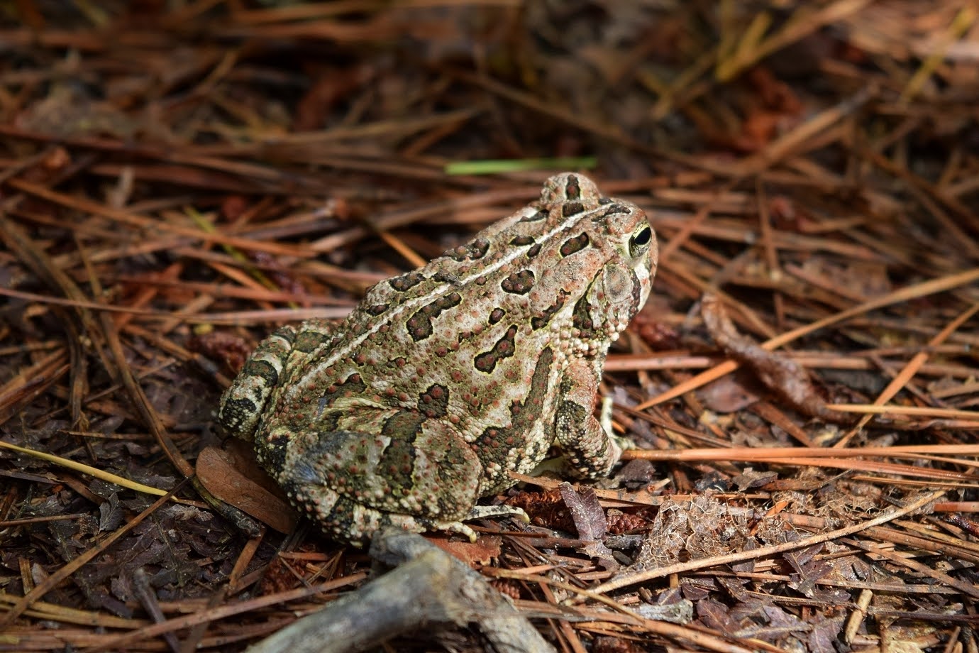
I spotted a cute little toad along the trail.


The trail descended past Chimney Rocks, though there weren't any real views.  Towards the end, it went though an open area before ending at Weaver Bend Road.


There was a campsite at the trailhead and I went down to the river for a view of the railroad bridge.


Hiking up the road, it was about a mile to Paint Mountain Trail (#7).  This trail headed steeply up... and up and up.  It was a bit overgrown and there were a lot of spiderwebs.  I continued a little ways past the intersection with Chimney Rocks Trail but the spider webs were really bad, so I just headed back.


On the drive back, I stopped again at Dudley Falls, this time to see Ricker Falls.


I guess I misses it the first time because there was almost no water.  The setting was cool and in higher water, I bet this would be nice.


There wasn't really anywhere to park at Kelly Falls, so I parked at the Overlook near another bend in the creek.


From here, I just walked the road back to the waterfall.


Kelly Falls was pretty nice and I went down to the creek for a nice view.


The view from the road wasn't bad either.


From here, I left and started heading back to Johnson City.  It was a little early for dinner, so I stopped and hiked a few miles on Tweetsie Trail.


The rails-to-trails project connects Johnson City to Elizabethton.


I hiked over the bridge across I-26 and just past the Carter County line and then headed back.


Since it was Tuesday, I went back to White Duck for some tacos and beer from Yee-Haw.

Monday, July 22, 2024

Dennis Cove Hike

Monday, I had breakfast at the hotel and headed towards Hampton and up into Dennis Cove Recreation Area in Cherokee National Forest.  I was determined to get the waterfalls up Laurel Fork.  We had been here more than once but had to turn back due to the difficult creek crossing.  I got my stuff together and set off once again on Laurel Fork Trail (#39).  In about half a mile, I got the first creek crossing which is as far as we had gotten in the past.


The cable is too high to be of use and the crossing was very deep and swift.  I scrambled upstream to a small cascade above the crossing and carefully crawled across.  The water has been low, so I don't see how this is possible in even normal water levels.  But I finally made it across.  The second crossing was right after and wasn't as bad.


The trail then climbed up through an area that had been blasted for the logging grade and then the third crossing.  This was also pretty tough and I had to scramble on the boulders.


All three of these had cables strung across that were way too high to be of use.  I think maybe they're the remnants of the old logging railroad maybe.  The trail then followed the creek on river right side with some scenic cascades.


In about a mile, a side path led down to the creek at the base of Lower Dennis Cove Falls.


It's about ten feet and nice, but probably wouldn't be worth the difficult crossings if the bigger one wasn't upstream.


I headed back to the trail and right where it passed the top of the lower falls, another side path led down to the base of Dennis Cove Falls.


I thought this one was really scenic and took a snack break to enjoy the falls.


Back on the main trail, it got really overgrown past the waterfall spur.  But it wasn't beautiful wildflowers this time, just rhododendron and dog hobble.  There were another five fords to cross as well, all requiring wading.  Unlike the first three, it was fairly shallow but no rocks.  I don't think the water level is ever low enough to rock hop the many fords on this trail.  After the eighth crossing, FR-50F came in from the left.  I followed this road up to the parking area past the gate.  A side trail led to Little Laurel Fork and Firescald Branch Falls.


This waterfall has three main sections.  The lowest section was just a short ways from the parking area.


A steep but obvious path on the left climbed up to the second and third section.


This waterfall would definitely have looked better with higher water, but coming in from Laurel Fork would mighty difficult.


But it's possible to drive to this one.  I climbed back down and hiked the road back to Laurel Fork Trail and continued on.  After the next ford, I came to Frog Level, a cleared area for wildlife.


There was another ford and then Lacy Trap Trail split to the right.  After two more crossings for a total of twelve, a short scramble path led down to Upper Laurel Fork Falls.


The water fell through a narrow rocky gorge and I thought it was really nice.


Glad it was worth all those water crossings.  On the way back, to make a loop and avoid the fords, I took Lacy Trap Trail, which headed steeply up.


There were a number of swallowtail butterflies puddling near the start.


It was only two fords to get back to this intersection.


The first part of Lacy Trap followed an old road for about two miles, then spit onto a single track and continued up to the Appalachian Trail.


From here, I followed the AT back down to Dennis Cove Road and took the road back to my car.


It was a tough hike, but glad I finally made it to the waterfalls.


I headed back to Johnson City and had dinner at Mulligans and then headed back to the hotel.