Showing posts with label Tanawha Trail. Show all posts

Saturday, October 23, 2021

Fall Tanawha Trail Hike

Saturday was a beautiful fall day.  The weather had finally cooled down and the leaves were changing so we took Alex for a day trip to the mountains.  Leaving early we headed to the Blue Ridge Parkway, arriving at Deep Gap not long after sunrise.  We made a quick stop at Stoney Fork Overlook for some sunrise photos.


Then we continued on to the Rough Ridge Parking close to Grandfather Mountain to access the Tanawha Trail.  Although we arrived early, it was already crowded at this popular trailhead.  It was just a short ways to Rough Ridge, with fantastic views of Grandfather Mountain and the Linn Cove Viaduct.


It was very windy here however, so we didn't stay long at the overlooks.  But the fall color was really fantastic.


From Rough Ridge, the trail descended, passing the headwaters of Wilson Creek and under Linn Cove Viaduct.  Past here, we crossed below the bridge over Stack Rock Creek.


Near the end, we crossed US-221 and there was beautiful fall foliage along the road.


It was just a short ways further to Beacon Heights.  We went out to the first overlook, but it was very crowded and the sun prevented good pictures.


So we continued on to the main overlook, which was surprisingly less crowded.  And the views here were just amazing.  We took a break here and had lunch enjoying the nice views without the wind of Rough Ridge.


From here, we hiked back.  We spotted a little garter snake just off the trail.


At Rough Ridge, the wind had died down but it was so crowded, we didn't stop.


The Blue Ridge Parkway was kind of a mess, so we took US-221 back towards Blowing Rock, making a quick stop at Green Mountain Falls.  The water level was low but it was still pretty with a splash of fall color, though most of the vegetation around the falls is rhododendon.


From here, we headed towards Blowing Rock.  The traffic got pretty backed up so we got back on the parkway to get back to Deep Gap.  We stopped for dinner at Dooley's in Wilkesboro and then headed home.

Saturday, February 15, 2020

Calloway Peak

For the holiday weekend, we took Alex out to Boone to finish the State Parks passport challenge.  First, we stopped at the interim park office for Grandfather Mountain State Park to get his passport stamped.


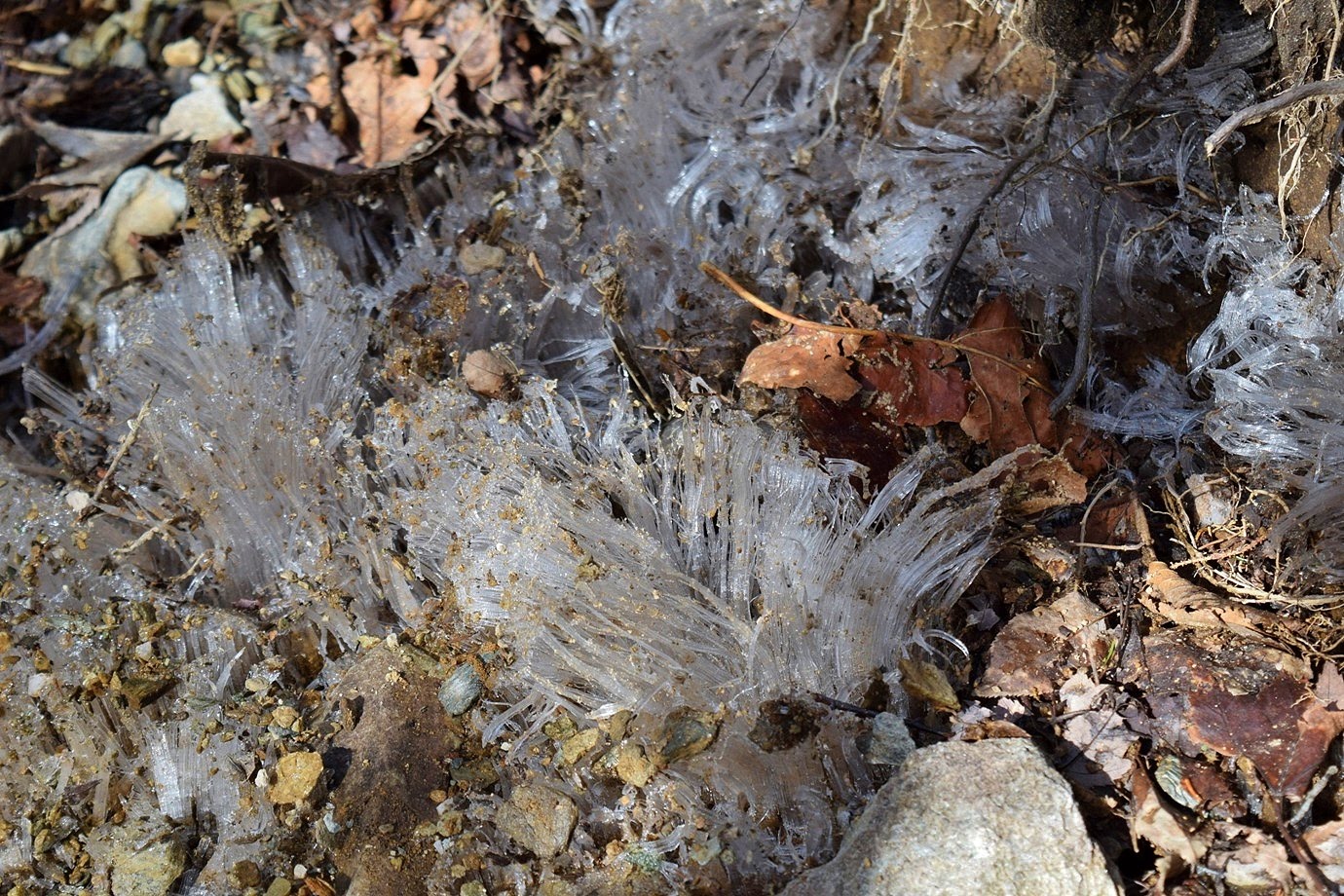
Then we headed up to the Blue Ridge Parkway and stopped at Boone Fork parking area.  Here, we took Tanawha Trail to Daniel Boone Scout Trail and started hiking up the mountain.  There wasn't much snow at first, but some little ice formations were popping out of the ground.


In about 1.5 miles, we came to Flat Rock View.


Scrambling out on the rocks, there were great views from here.


We stopped and had a snack up here and took a short break before the climbing really started.


Continuing on, the trail got steeper and there were some nice icicles along the trail.


The trail was pretty icy and there was a dusting of snow, but not as much as we hoped.


Near the summit, we came to the ladders.


It was tricky getting Alex up this part, but he's a good rock climber.  Soon we got to the summit of Calloway Peak, the highest point on Grandfather Mountain.


The views from up here were great.  There was rime ice on the north-facing portion of the summit.


I continued on to Watauga View with more great views, including Sugar Mountain.


We had lunch at the summit then started making our way back down.  At Flat Rock, we turned on Cragway Trail to make a loop going back.


There were cool views from Top Crag and we could see Calloway Peak towering above.


The trail was rocky, but at least we were heading downhill.


Where the trail ended, a turn on Nuwati Trail led back to Tanawha Trail.  At Boone Fork, we made a turn on Asutsi Trail and hiked below the parkway.  At the trailhead on US-221, we turned right along the road a short ways to Green Mountain Falls.


The water level was high and there were a bunch of icicles along the waterfall.  There was also a lower section below the road that was quite scenic.


It was visible from the road and I scrambled down to the base for a view straight on.


After some picture, we hiked back Asutsi Trail and Tanawha Trail.  Boone Fork was scenic as we crossed on the footbridge.


It was just a short ways further back to the car.


On the way to Boone, we called in a pizza at Mellow Mushroom then checked into the Quality Inn.  We brought the pizza back to the room for dinner then went to bed early.

Saturday, October 26, 2019

Boone Fork & Tanawha Trail

Saturday, I left early for a fall foliage hike in the mountains.  It was forecast for light rain, but nothing heavy.  I took US-421 north towards Boone and got on the Blue Ridge Parkway southbound right at 7.  It was still completely dark at this point.  As I drove southbound, the first rays of light were visible.  I stopped at Yadkin Valley Overlook about 10 minutes before sunrise and could see the first rays of light.


The twilight views of the Piedmont were great.


Then I drove a little further to Thunder Hill Overlook to watch the sunrise.


More great views over the foothills and Piedmont.


It was a perfect view from here and the parking area was full, so I was not the only one who woke up early for a beautiful sunrise.  I continued on to Julian Price Memorial Park and parked at the picnic area.  After getting my stuff together, I set out on Boone Fork Trail, going right to hike the loop counterclockwise.  The trail followed Boone Fork downstream and there was some nice fall color showing despite the foggy weather.  A little over a mile, the Mountains to Sea Trail crossed the creek on a new footbridge.


Shortly past here, a steep path led down to the base of Hebron Colony Falls.  It's hard to see much of the waterfall from the base as it flows under and around the rock colony.


So I climbed up the boulders for a nice view of the main drop.


Fall colors along the creek bank framed the falls nicely and the view downstream was beautiful.


Continuing on the trail, there were some more nice spots along the creek.


I also found another waterfall downstream on Boone Fork Creek, about 15 feet high.  It was a steep scramble down, but a scenic little unnamed waterfall.


The trail followed Boone Fork Creek through one last scenic section.


Then it started following Bee Tree Creek upstream.  There were some rocky sections along the trail.


As it approached the parkway, I turned onto Tanawha Trail and headed west.


Foggy weather prevented sweeping views but the fall color was beautiful, even in the clouds.


I took the short spur to Cold Prong Pond Overlook.


At Cold Prong, I did a short loop around the pond, but it was dried out.


Continuing on, I went as far as Daniel Boone Scout Trail and stopped for a lunch break.  There were some nice cascades on the headwaters of Boone Fork here.


Then I made the long hike back to Price Park.


On the drive home, I made a stop at Grandview Overlook for one last view of fall colors from the parkway.


Saturday, October 7, 2017

Fall Color along Tanawha Trail

Saturday, I headed to the mountains of the High Country for some early fall colors.  I left around 530, taking US-421 to the Blue Ridge Parkway at Deep Gap.  Driving south on the parkway, I parked at Beacon Heights.  I picked up the Tanawha Trail/Mountains-to-Sea Trail across the street and turned left to hike away from Beacon Heights, going eastbound on MST.  After crossing US-221, I came to Stack Rock Creek.


A footbridge crossed the creek, just below the parkway bridge.  I climbed up the rocks for a view of the bridge - it was very foggy but could still spot some fall colors.


Just past the bridge were some cool cliffs just below the parkway.


Continuing on, it was less than a mile to the Linn Cove Viaduct Visitor Center.  A short paved trail led to underneath the viaduct.


Although I've driven over the viaduct many times, this was my first time hiking beneath.  It is truly an engineering marvel.  The trail crossed under the viaduct and ran parallel next to some enormous cliffs.


It was a very rocky and scenic stretch of trail.


After climbing up a bit, the trail leveled off and I headed towards Wilson Creek.  Just before the parking area, was a balanced rock that looked like it could slide down the mountain at any moment.


A spur trail led below the bridge over Wilson Creek to the parking area.


A footbridge led across the creek for the Tanawha Trail.


Wilson Creek starts below Callaway Peak and here at the headwaters, it was barely a trickle.


The trail passed a rocky section and then gradually started heading up towards Rough Ridge.


I hadn't seen too many other people up to this point, but Rough Ridge was really crowded.  And for good reason - the colors up here were beautiful even if it wasn't the nicest weather.  Coming up from Wilson Creek, I came out at the top point of the overlook.


Unfortunately, the cloudy weather prevented good long-distance views from up here.


And from here, it started getting really crowded.  The fall colors made a break to let people pass enjoyable.


Further down the ridge, the views of Linn Cove Viaduct from a distance were great.


The whole area around Rough Ridge really had great color, and it was beautiful even in the poor weather.


But it was only at high elevations, almost all green at lower elevations.


The climb back down was crowded, but once past the Rough Ridge Trailhead, I didn't see too many more people.  I was surprised to see some nice wildflowers blooming.


In another half-mile or so, a spur trail led down to the parkway at Boulder Field Overlook.  Across the road, there were distant views of the viaduct.


It really put the hike in perspective.  Continuing on, I saw several more types of wildflowers blooming along the trail.


I went about another 2.5 miles to the intersection with Daniel Boone Scout Trail.  I took a break here and had lunch, then started making my way back.  This section of the trail was very peaceful and I didn't see anyone else for miles.


The weather had cleared a bit so I stopped for a few more pictures at Rough Ridge.


The summit of Grandfather Mountain was still hidden by clouds but it was a bit clearer than when I had passed a few hours earlier.


But there were a lot of people here now, so I didn't stay too long.


I made a quick stop at the summit, but the colors weren't as good as from the main overlook.


When I was almost back to the car, I took the short Beacon Heights Trail up to the overlook.  The rocky peak overlooks were separated by a forested section.  I went to the northern overlook first.


Looking west towards Grandfather Mountain, there was a lot of color at high elevations.


Looking east towards the Piedmont, not so much.


At the southern overlook, I had a nice view looking south towards Linville Gorge, with Table Rock just barely visible.


After some pictures, I headed back to the car and stopped for a view of the parkway before departing.


There were a lot more cars here than when I arrived in the morning.