Showing posts with label Glenwood-Pedlar Ranger District. Show all posts

Sunday, October 4, 2020

Appalachian Trail along Blue Ridge Parkway

Sunday morning, we woke up to another cold morning and packed up camp.  From here, we got on the Blue Ridge Parkway heading southbound.  We made a quick stop at View Porter Mountain for a view looking down into the Goose Creek Valley.


The we drove just a short ways further to VA-43 and parked here to access the Appalachian Trail.  Heading southbound, the trail climbed via switchbacks up to a ridgeline, then followed the ridge parallel to the parkway.  In a mile or so, the trail came out at Mills Gap.  Looking west, the James River Valley was completely below the clouds, despite beautiful blue skies at our elevation.


It was a really fantastic cloud inversion.  Ridges and mountains poked up like islands through a sea of clouds.  A little further on the trail, I found another spot on the parkway to view the inversion.


The trail stayed in the woods for a while then came out again on the parkway at Sharp Top Overlook.


Sharp Top was clearly visible from about 6 miles away.  But looking in the other direction, there were more low clouds.


We hiked along the AT for about 4 miles and right past Hammond Hollow Trail, we found a nice rock outcrop to take a break.


We had a snack here and then made a leisurely hike back.  Some Jack-o-Lantern mushrooms were growing at the base of a tree.


We also noticed some poisonous plants along the hike back.


White snakeroot and pokeweed are both poisonous to humans.


Back at Mills Gap, the clouds had cleared and the James River Valley was visible below.


We got one more view of Sharp Top from here to conclude our weekend at Peaks of Otter.


We finished our hike up back at VA-43 and started making our way home.


Saturday, October 3, 2020

Peaks of Otter Hikes

Saturday, we woke up and made the short drive over to the Flat Top Parking area at Peaks of Otter.  From here, we got on Fallingwater-Flat Top National Recreation Trail and headed towards the cascades.  Right after crossing the split, we went left to hike the loop counterclockwise.  The trail descended to Fallingwater Creek and we rock hopped at some scenic cascades.


Soon, we came to Fallingwater Cascades.


In high water, this one was looking very nice.  But we could only see the lower slide from the base and we could tell there was more waterfall above.


Back on the trail, as we climbed next to the waterfall, I spotted a path to go out near the top of the lower part.


Climbing around, we found a way to the top and could see the upper cascading portion of the waterfall.


I really liked this upper section and hadn't seen it on my previous visit.


The trail continued to the top of the waterfall, where there was a nice view.


The trail then crossed the creek back to the other side.  Some white wood aster was blooming.


Soon, the trail looped back around to the start and we got on Flat Top Trail and began a steady climb up the mountain.  There trail was almost all switchbacks, so wasn't too strenuous despite the steep climb.  The trail is very rocky and there were a lot of huge boulders as we got higher up.


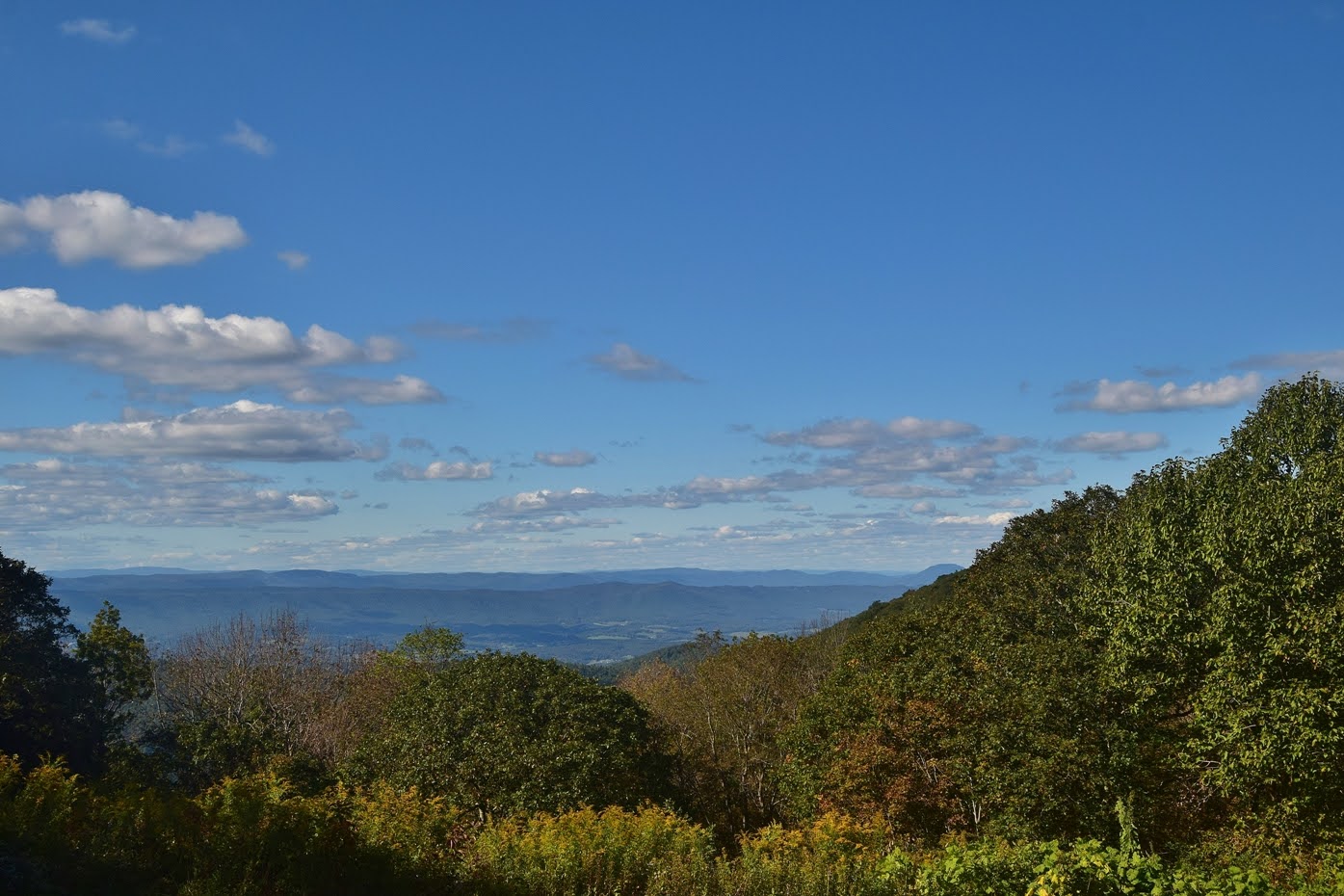
Near the top, we reached Cross Rock near the Pinnacle.


There were nice views looking east from here.  The top of Flat Top was pretty crowded, but we found a spot to sit and have a snack while enjoying the view.


I scrambled out to a couple different spots near the summit.


Lots of white snakeroot was flowering around here, even at the top.


Then we started making our way back down.  On the hike down, we spotted some jack in the pulpit berries.


Soon we made it back to the car, much easier going down than up.


From here, we drove down the mountain and headed to the Peaks of Otter Winery.  After parking, we got a couple samplers of their various wines, most made with apples.  They were very sweet and had some delicious flavors.  We picked up a bottle of apple cinnamon and apple dragonfruit wine to bring home.  And their apple cider donuts were fantastic.


We drove back to the campsite and made an evening hike up Sharp Top.  It was quite crowded and the trail is steep.  Near the top, we first went right at the intersection and hiked to Buzzards Roost.


Great views looking down to the Piedmont and up to Sharp Top.


Then we made the final ascent up to the summit of Sharp Top.


The summit is rocky so great 360 degree views.


Abbott Lake was visible far down below.


Flat Top was visible across the gap.


We took a break up here and then headed back down.  It was much easier going down and we could enjoy views through breaks in the trees.


Back at the base of the mountain, Sandy and Alex went back to camp while I went for a sunset stroll around Abbott Lake.  Flat Top was beautiful in the evening light.


Circling around the lake, Sharp Top and the reflection were really stunning.


I stopped to enjoy the view for a moment, then continued around the lake.


It was a little early for fall color but a few leaves had changed.


I finished up the loop and hiked back to camp.


We built a nice campfire to stay warm as it got cold once the sunset.  Alex got in the tent early and helped warm it up for us.

Friday, October 2, 2020

Natural Bridge

Friday, we headed north for a long weekend of hiking, camping and wine with Alex in the Virginia Blue Ridge mountains.  Our first stop was at Natural Bridge State Park.  Formerly a private attraction, the Natural Bridge became a state park in 2016.  Parking at the visitor center, we hiked down towards the creek, passing some scenic cascades on a little tributary.


The moss and vegetation was very lush.  At the bottom, we paid admission and hiked down the Cedar Creek Trail.


Almost immediately, we came to the natural bridge.


At 215 feet high, it was really spectacular.


US Highway 11 runs right over the bridge and Cedar Creek runs under.


We got some pictures and continued on the scenic trail.


The Monocan Indian exhibit was closed, so we crossed the low water bridge on the trail.


Just past the crossing, another bridge crossed the creek.


This one led to the saltpeter cave; Thomas Jefferson leased for the production of gunpowder.


Continuing on, there were some fall wildflowers blooming along the creek.


Lots of goldenrod and asters adding a splash of color.


Just off the trail was the Lost River.  Workers from the saltpeter mine discovered the underground river, but the source and destination has never been determined.


The trail ended at an overlook of Lace Falls.


It's a small but scenic waterfall in a very pretty setting.  We sat here for a while and enjoyed the view before heading back.


Passing back under the Natural Bridge, we returned to the visitor center.


Before leaving the park, we made the short drive to the Blue Ridge Trailhead further down US-11.  This loop trail runs through meadows and forest and was much less crowded than Cedar Creek.


We didn't see anyone else on our hike.  The open meadows along the trail were very scenic.


There was a lot of golden aster flowering.


About half-way through the loop was Red Knob Overlook, the highest point in the park.


The view was mostly overgrown.  Further on the trail, we passed by Lace Falls and Cedar Creek but high above.


By the time we finished, we were getting hungry.  We called in for a pizza at Scotto's in Glasgow and took it to Great Valley Farm Brewery and Winery and ate our pizza with some delicious beer and wine.  The views here were really great.  After lunch, we headed up to the Blue Ridge Parkway and stopped at Sunset Fields Overlook.


We hiked down Apple Orchard Falls Trail (#17) in Jefferson National Forest.  In about a mile, there is a really nice drop on Apple Orchard Creek just above the main waterfall.


This could be considered the upper section of the falls.


From here, the trail got steeper as it descended along the waterfall.  At one point, there was a break in the trees with a nice view of the surrounding landscape.


The trail came to a nice wooden overlook at the base of Apple Orchard Falls.


The water level was pretty high and the leaves were just starting to turn.


I continued down the trail a little further.  There are a few more drops down here, but nothing big.


We took a break down here and then headed back up.  Along the way, we saw a woolly bear caterpillar, signalling the start of autumn.


It was all uphill on the way back, but not too steep.


We made one stop along the parkway for evening views at View Black Rock Hill.


Then drove the rest of the way to camp at Peaks of Otter.  We set up and built a nice campfire as the temperature was really dropping.  Alex didn't seem to mind.