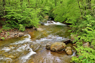
With the heavy rains, it was really flowing. I climbed up the side for a couple pictures and also from the road. Unfortunately, the view from the road is getting pretty overgrown.
There were some beautiful mountain laurel blooming as we continued down FR-5046.
The road curved around and crossed Toms Spring Branch again below the upper waterfall.
This one was looking really good in the high water.
Shortly after the waterfall, FR-5042 intersected Daniel Ridge Loop Trail and we turned right to follow the loop. There were some beautiful flame azalea growing along the trail.
Where the trail intersected with Farlow Gap Trail, we turned right to attempt to reach Twin Boulder Falls on Right Fork. The crossing of Right Fork, which is normally an easy rock hop, was a massive torrent.
There was no safe way to cross, especially with the dog. So we headed back, following Daniel Ridge Loop Trail down. Although we didn't get the waterfall we wanted, I did get to see some trillium.
Sandy also spotted some fairy wands.
Continuing down the trail, there were some nice cascades and small waterfalls along Right Fork.
There was the remains of an old bridge across the creek just above where Right Fork and Daniel Ridge Creek come together to form Davidson River.
Past the confluence, the trail split where left stayed on Daniel Ridge Loop and the right trail followed the river more closely, passing some primitive campsites. We took the right trail and found some more small waterfalls on Davidson River.
A little snail was crawling on the rocks here.
There was the remains of what looked like an old dam a short ways further.
A nice cascade was just downstream of the dam.
We spotted a nice jack in the pulpit along the river here.
The trails joined back together near the ruins of the old fish hatchery.
Soon we reached the end of the loop and bridge back over Davidson River.
We finished our hike up back at the car.
Back at the car, we made another quick stop at Lower Rockhouse Creek Falls.
It's a roadside waterfall, right where FR-475 crosses Rockhouse Creek just above the confluence with Davidson River. Then we left the forest and stopped to get take-out lunch from Hawg Wild and support our favorite BBQ restaurant in the area. Next, we drove to the trailhead for Thompson River along Brewer Road. We wanted to get Simon Falls, but with the high water, it would not be safe to cross Thompson River. So we followed the trail for just under a mile. Right before the turn for High Falls was a less conspicuous turn to the left that went down towards Reid Branch just below the waterfall. The path came out below the waterfall, but there was too many rhododendron in the way for a good view.
I waded through the water to the base for a good view. On the climb back up, we found another path that left to a great view of the falls from the side.
Then we hiked back to the car.
Continuing into South Carolina, we arrived at Oconee State Park and set up at rustic test site 5. After getting set up, I took a short hike on Oconee Trail. There were really a lot of mountain laurel blooming here.
The Oconee Trail went past the campsite lake that was really pretty in the evening light.
I followed the trail past the campground for a ways.
As the sun was beginning to set, I headed back.
After my hike, we built a fire and then went to bed.


No comments:
Post a Comment