This past weekend, we headed out to Peaks of Otter on the Blue Ridge Parkway in Virginia for a camping trip. Our plan was to enjoy some early fall foliage from the peaks, which provide fantastic views in nice weather. Unfortunately, as the weekend drew near, the weather forecast was not looking agreeable. But, we weren't going to let a little rain spoil our weekend. We left Chapel Hill around 730 and made it to Peaks of Otter around 1030. It was cloudy and drizzling along the way, but we were starting to see more fall color as we headed north and got higher in elevation. By the time we reached the park, the rain had stopped, but the clouds had moved in and the whole area was blanketed in fog. We checked in at the campsite and set up our tents, then headed to parking area for Sharp Top Trail. Driving even this short distance was a bit scary as it was so foggy, we could barely see six feet in front of the car. But we made it to the parking lot and started our hike up to the summit of Sharp Top Mountain.
The Sharp Top Trail is only 1.5 miles long, but gains roughly 1500 feet over its course, so its a very steep trail. And while the dreary weather didn’t provide good views of fall color, at least it was cool for the strenuous climb and we weren't sweating profusely.
Near the top, we made a quick detour to Buzzard’s Roost and climbed out onto the rocks here.
The outcrop was covered in fog and we couldn't see anything, even the nearby summit of Sharp Top, but it was a fun scramble to get out on the rocks.
Then, we continued on up to the summit of Sharp Top.
There is a shelter at the top, but it wasn’t raining, so we didn’t really need it.
Instead, we headed to the very top and ate lunch up here.
There were some markers in the boulders that indicated what mountains could be seen in the distance and how far away they were.
With the weather today, however, we couldn’t see 34 feet in front of us, let alone 34 miles. After lunch, we started making our way down.
Although the hike down was certainly easier than going up, the wet stone stairs were treacherous and we made our way slowly. Back at the bottom, we headed back to camp and then hiked towards Flat Top. We got on the Lake Trail, though we couldn’t see the lake even though it was only a few feet away and then passed Polly Woods’ Ordinary.
This small 19th century building was an Inn that provided “ordinary” amenities to weary travelers. Then we continued down the road past the picnic area and picked up the Flat Top Trail. It’s 1.8 miles to the summit and gains another 1500 feet of elevation along the way - another very strenuous trail. There was a section of the trail early on that ran through an area with decent visibility and we could actually see some changing leaves, but as we got higher, everything got more and more cloudy. At the summit, we could see almost nothing.
I found a pretty red maple leaf that had fallen and got a picture of it on a rock - about the best fall foliage picture I could get up here.
The trail continues on and ends at the parkway, but we just hiked to the summit and turned back. We made our way back down the mountain and returned to camp. For dinner, we headed over to the Peaks of Otter Lodge and ate at the restaurant. By the time we returned, a couple folks who had eaten at camp had built a nice roaring campfire. The sun had set by now and it was quite chilly, so the fire’s warmth felt good. After socializing for a while around the campfire, we headed to bed early.
Saturday, October 11, 2014
Monday, September 1, 2014
Labor Day Waterfalls
Monday morning, we woke up and broke camp. After breakfast, we got on the Blue Ridge Parkway from NC-181 and starting heading southbound towards Crabtree Falls.
About half-way there, we made a quick stop for pictures from Heffner Gap Overlook and then proceeded to Crabtree Falls. Sadly, the campground was closed as well as all the other amenities, likely due to budget cuts. It's a shame as this is a really nice campground and a beautiful area. We parked outside the gate near the closed visitor center and had to hike in to the trailhead. The extra quarter-mile walk to the trailhead was worth it, though, as we walked through a beautiful wildflower meadow just past the amphitheater heading to the campground.
At the campground, we got on the Crabtree Falls Trail and turned right at the junction to hike the loop in the counterclockwise direction. This is the shorter and steeper route to the falls with the more gradual hike back to finish up the loop. The trail heads steeply down to the base of the falls through a number of switchbacks and stairs. We headed down quickly, passing several groups so we could make it to the falls before anyone else. That gave me a good opportunity to climb up on the rocks and set up the tripod to get some nice pictures of the waterfall before the crowds arrived.
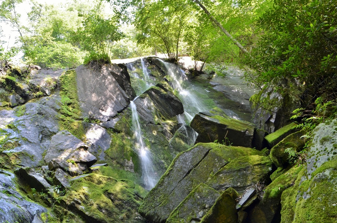
This 70-foot cascading waterfall is absolutely beautiful; certainly one of the most photogenic waterfalls along the parking and I was able to get some great pictures.
Sandy was waiting on a bench and talked to a nice older gentleman who was visiting the falls while his wife was out of town. She thought the hike was too strenuous and didn’t approve of him going, so he waited for her to go out of town before visiting.
Once the crowds started to arrive and we had gotten enough pictures, we continued on, climbing more stairs and then headed upstream along Crabtree Creek. I stopped at one point to scramble down to the creek and see a really pretty cascade a short ways upstream of the waterfall.
After the initial climb up, the hike was a nice scenic stroll along the creek we saw a large number of blooming wildflowers along the way.
It's about 1.5 miles heading back this way and before we knew it, we had finished off the loop and headed back to our car.
From Crabtree Falls, we continued south on the Blue Ridge Parkway for a few more miles, getting off at NC-80 and heading towards Black Mountain Campground in the Appalachian Ranger District of Pisgah National Forest. We turned off NC-80 onto South Toe River Road and made an immediate left and parked outside the Busick Work Center. Walking past the gate, we got on Roaring Fork Falls Trail (#195), which is also Forest Service Road 5520. It's only about half a mile along the forest road to the falls. At a bridge across Roaring Fork, we turned right just before the bridge on a short path that leads to the waterfall. The entire thing is probably at least 100 feet of cascades tumbling down, but it’s hard to get a picture of the entire thing.
Of course that doesn't mean I can't try. I hopped around onto various rocks and boulders at the base of the falls to get pictures from different angles. Then we hiked back to the car and continued on South Toe River Road to Black Mountain Campground, parking just outside. We hiked across the vehicle bridge over the river into the campground and got on Setrock Creek Falls Trail (#197). It's a short and easy trail, maybe a quarter-mile, to the waterfall. The waterfall is probably about 75 feet high and its a nice tiered waterfall.
Today, however, the water flow was pretty low and so the waterfall wasn’t that impressive. I had visited before in the spring when the flow was higher and the waterfall looked a lot nicer. We got a couple pictures and then started making our way back. I pointed out to Sandy the very steep path leading up Mount Mitchell. There is a power line right-of-way going straight up the mountain and I remembered crossing that on the trail up. It really puts the elevation gain of North Carolina's highest mountain in perspective. Leaving the area, we headed south on NC-80 to get on I-40 near Marion. Unfortunately, there was an accident blocking the road and we had to make a detour that took almost an hour. We were both very hungry at this point and determined to make it to Las Salsas in Morganton. Finally, we arrived and had an enormous portion of chicken fajitas, with plenty leftover to bring home - my dinner for the next couple of days.
Sunday, August 31, 2014
South Harper Creek Falls
It started raining quite heavily around 2 Sunday morning - heavy enough to wake me up from a dead sleep. By the time we got up in the morning, however, the rain had tapered off. We had breakfast and then headed into the main Wilson Creek area for more hiking and waterfalls. Driving north on NC-181, we made a quick stop at Brown Mountain Overlook. The skies had cleared after the overnight rain, but there were still fog and clouds lingering in the valleys and around mountain peaks. Looking west to the eastern rim of Linville Gorge, Table Rock and Hawksbill Mountain were partially covered in clouds and were quite beautiful.
Similarly, looking east, there were misty clouds all around Chestnut Mountain and Brown Mountain. After a quick stop here, we continued on, heading into the forest on FR 464 and then turning right on FR 58. It was about 4 miles to a parking area at the western trailhead for Harper Creek Trail (#260). We got our stuff ready and started hiking down the trail. In about a mile, we passed a clearing with a view of the Kanawa community and soon came to an intersection.
Turning right leads to Raider Camp Trail, but we went left to stay on Harper Creek Trail towards South Harper Creek Falls. We passed the top of the waterfall and then headed down towards the base, first through some switchbacks, then got off the trail and made the steep scramble down to the base. A couple who were ahead of us strung up rope, which made our descent a little easier. Once at the base, we ate our lunch down here, while the other couple were trying to get photos. Due to the full sun on the open rocks, photography was a little tricky.
After we ate, the gentleman trying to take pictures and I waded and climbed up further to the base of the waterfalls. He was braver than I and brought his DSLR camera; I stuck with the waterproof GoPro.
We got some pictures and videos from here with a good view of the lower section of the waterfall, then headed back down. Once back, the couple headed back up, taking their rope with them. We stayed for a little while longer, enjoying the views, then started heading back up. Even without rope, it wasn't too bad climbing back up to the trail - going up always seems a little easier than going down. Back on Harper Creek Trail, we continued to the split and went straight to get on Raider Camp Trail (#277). Almost immediately, there was a stream crossing over Harper Creek. Before crossing, however, we scrambled upstream a short ways to see a nice cascade on Harper Creek.
In higher water levels, this might be considered a waterfall, but the flow was light today. After a few pictures, we headed back to the creek crossing. I was sure we would have to get wet, but Sandy found a route to rock-hop across. We then followed Raider Camp Trail up a series of switchbacks and took a spur trail to the cliff overlook for South Harper Creek Falls.
This is the only spot where you can see both the upper and lower portions of the waterfall and get a good idea of the complete size of this waterfall. Far below, we could see the rocks at the base where we had eaten lunch. It was a long way down. After enjoying the view for a little while, we made the hike back to our car.
It was still early in the afternoon, so we headed over to the Mortimer Campground and drove to the back for one more short hike. It rained a bit on the ride over, but had stopped by the time we parked. We hiked along Thorps Creek Trail (#279) for less than a quarter-mile to see Thorps Creek Falls.
This is a small, but very scenic waterfall with three distinct drops, followed by a slide that was also split in three.
After stopping here, we made our way back to the car and headed back to NC-181. We got a pizza from the gas station and ate dinner at Brown Mountain Overlook, enjoying the views of the late day sun over Linville Gorge.
When we first arrived, clouds surrounded the distinctive peak of Table Rock. I got some pictures right away; by the time we finished eating, the clouds were gone.
After dinner, we headed back to our campsite for a campfire before bed.
Saturday, August 30, 2014
Repeat Adventure
For the Labor Day weekend, Sandy and I headed out to the Wilson Creek area to get some more waterfalls, mostly ones that I already had, but she did not. We left early Saturday morning and started heading west on I-40. We got off the interstate in Morganton and stopped at Subway to pick up a couple footlong subs - our lunch and dinner for the day. Then we continued on NC-181 into the mountains, turning right on Forest Road 982. After about a mile, we crossed Upper Creek and turned left on Forest Road 197. About half-way down this road, we spotted an open campsite and stopped to claim it. This was a lovely campsite across the road from Upper Creek with a decent parking area and a huge open, flat space for tents. It’s one of my favorite primitive camping sites in the forest. Unfortunately, whoever had camped here previously left a huge mess. We were in a hurry, so we set up our tent, and then continued up FR197 to the end. It seems that the Forest Road used to continue a little further, but part of the road washed out so the Forest Service built a jeep mound further back. We parked before the jeep mound and started hiking up road. In about a half-mile, there was another nice campsite and the road becomes more like a trail. Although there are no signs or blazes, I believe that this is Greentown Shortcut Trail (#268A). Although it may be an “official” trail listed on the Forest Service's website, it is clearly not maintained and has become very much overgrown with poison ivy, stinging nettle, and various other plants. And since this trail is not well-used, we also had to make our way through countless spider webs across the trail. The trail is rather scenic as it follows Upper Creek upstream past countless small cascades and tumbles, but we were too busy cutting through spider webs, trying to avoid noxious plants, and swatting at pesky insects to really enjoy the trail. The high temperatures and humidity didn’t make it any easier. The trail also becomes progressively more difficult. Initially, the trail seems to continue following an old and very overgrown logging road, then becomes more of a hiking trail. It becomes ever more steep and narrow and finally near the end, heads up to a ridgeline then back down to creek level, just before crossing over Burnthouse Branch. From here, we made our way through a mess of downed trees and then rock-hopped up to the base of Waterfall on Burnthouse Branch.
Sandy and I had attempted to visit this waterfall on Memorial Day, but were unable to find it. I had come back a few weeks later to get it, and now Sandy has gotten it too.
Good thing, as I was getting a little tired of hiking this very overgrown trail, now on my third time this summer. We climbed up onto some rocks near the base and ate half of our subs for a late lunch while enjoying the view of this waterfall. It’s a rather interesting waterfall. The water flows down a cliff face about 25 feet in two streams and then tumbles under and around a bunch of moss-covered boulders. In a few places, the water appears to be seeping out of the moss.
It’s hard to get a good picture, though. The cliff face that the water flows down is in the shadows while the top of the cliff is in direct sun. I might have to return early in the morning to try and get a better picture.
When we finished eating and getting some pictures, we started making our way back. Fortunately, the hike back gets progressively easier. We had to hike up to the ridgeline at the start, but it was all downhill from there. The trail got less steep and less narrow as we hiked, soon becoming an old logging road and then back to the car. The end of the Forest Road was surprisingly crowded with cars as quite a few families were here, enjoying the nice swimming holes on Upper Creek. We talked to a one man who asked about the waterfall and other swimming holes further up the creek. From here, we passed our campsite and drove back to NC-181, turning left and then an immediate right on Forest Road 228. It’s about 4 miles to the end of this narrow, gravel road. Towards the end, there are a bunch of big primitive campsites that were occupied by a very large number of campers. I’ve never really wanted to camp down here as the sites are just too overcrowded, each with five or six vehicles and probably more than a dozen campers. We parked at the end of the road and hiked along Steels Creek Trail (#237). In a quarter-mile, we came to a creek crossing at a nice swim hole. A guy here used the rope swing to dive into the pool at the base of a cascade. We were hot and sweaty, but the water looked a little shallow for diving. We crossed the creek and turned right on the Mountains-to-Sea Trail where the two trails join together.
The trail dips down to creek level, where we stopped to see some pretty cardinal flowers blooming on the water's edge, then climbs up to a ridge through dense stinging nettle.
We hiked cautiously to avoid any painful contact. Soon we reached the scramble path to Waterfall on Steels Creek. Due to recent rains, the rocks were wet and getting out to a good viewpoint for the waterfall was tricky, so we scrambled down slowly and cautiously.
We got a couple pictures of the waterfall and then made our way back. We were considering trying to figure out how to get to the lower section of the waterfall, but it was getting late in the evening and would likely be dangerous and everything was wet. As we got back to camp, two Forest Rangers stopped by our campsite. We explained to them that all the garbage was here when we arrived and we promised to clean up as much as we could. Not planning for a litter clean up, we didn’t have many trash bags, but we did try to pick up as much garbage as we could. We built a nice campfire and ate the second half of our subs for dinner before turning in for the night.
Sunday, August 3, 2014
Old Rag
Sunday morning, we woke early and broke camp. We were on the road by 8, arriving at the trailhead for Old Rag around 9. Despite our early start, the parking lot was already almost full. Old Rag is a very popular hike! Our initial 7-day admission receipt allowed us to hike Old Rag without paying another fee. From the parking lot, we walked down Nethers Road for just under a mile to the end and got on Ridge Trail to begin our ascent. The Ridge Trail wastes no time in heading up. For a couple of miles, it was switchback after switchback as the trail aggressively headed up the mountain. Although it was still fairly early and not too hot, this portion of the trail was very strenuous and we took several stops to rest and cool off from the humidity. Soon, the densely wooded trail gave way to the rocky open sections that Old Rag is so famous for.
It would be about a mile to the summit and it was almost all rock scrambling. Although the going was slow, this was an exceptionally fun scramble and made the strenuous hike up Ridge Trail all worth it.
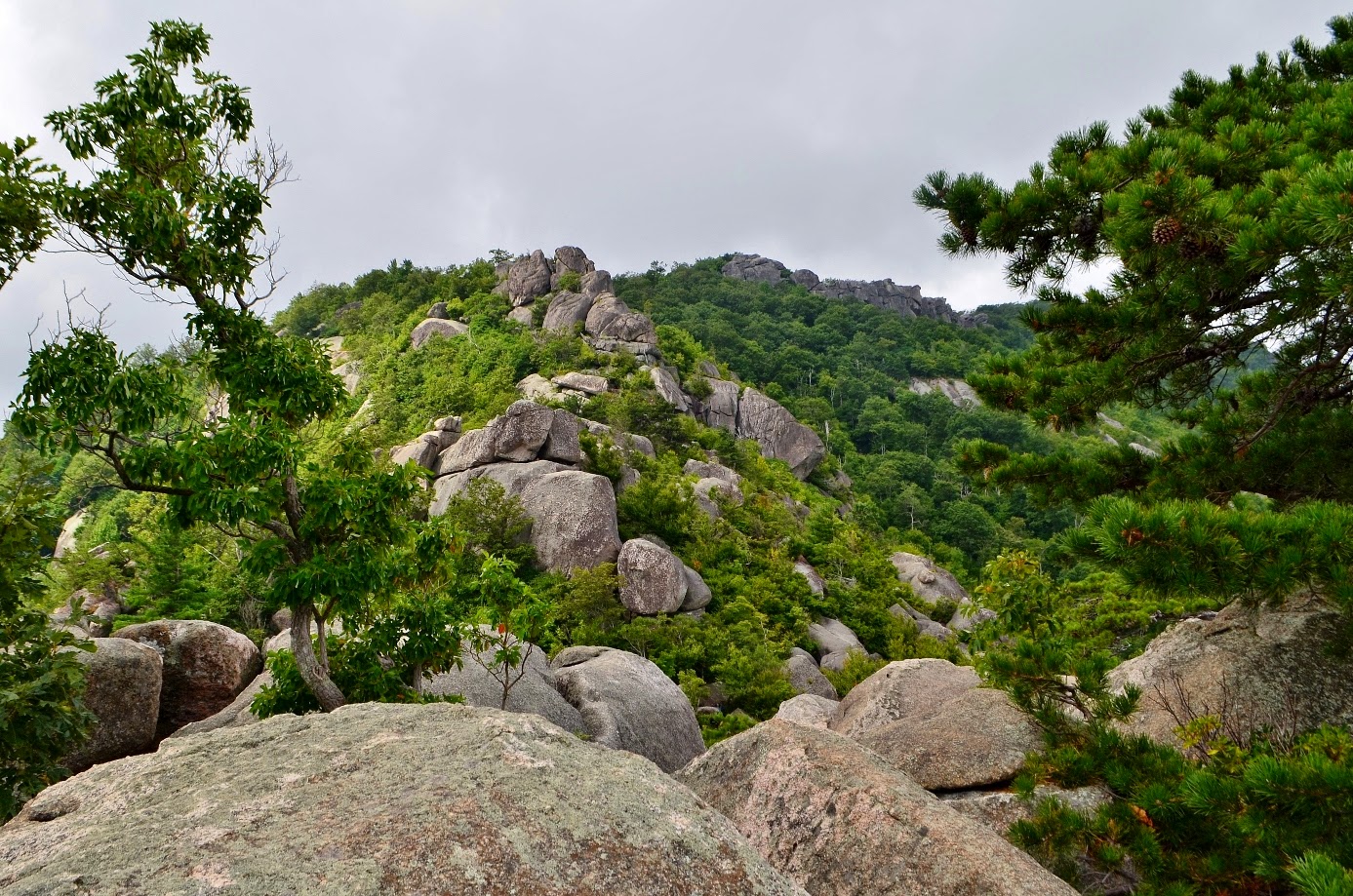
We climbed up, over, under, and through the giant boulders and rocky outcrops along Old Rag.
At some points, we had to squeeze through a narrow chasm, at others we had to jump across a ravine. The hike was tremendously fun and very beautiful.
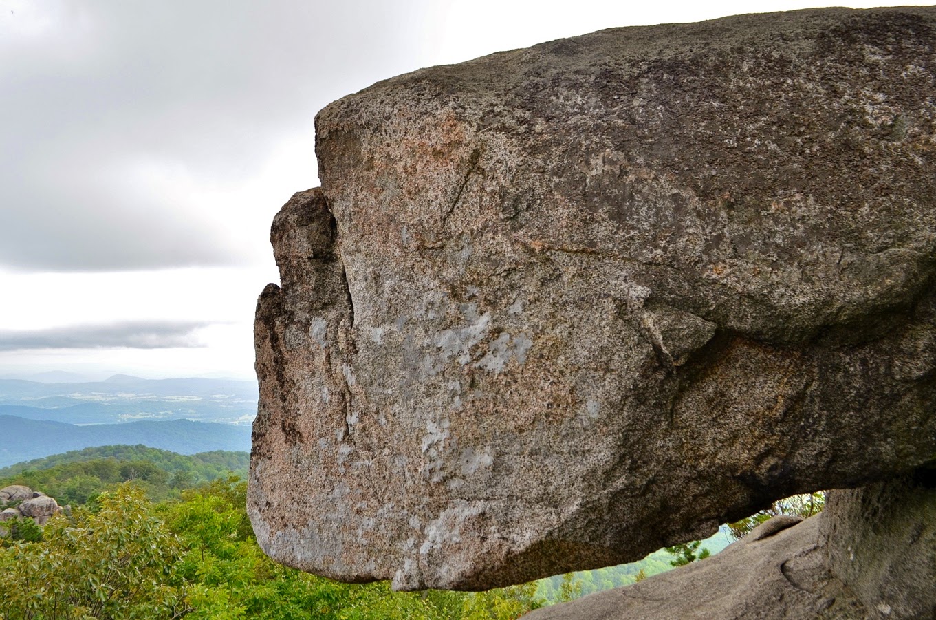
Some of the rocks we navigated around were positioned in such a way as to seem to defy gravity, looking like a giant dinosaur egg perched precariously on the cliff.
Soon, we made it to the summit of Old Rag and stopped here for lunch.
It was a brief lunch, however. Looking to the mountains in the distance, we could see storm clouds rolling in and it seemed likely to rain.
Old Rag is not a great place to be in the rain as wet and slippery rocks would be treacherous. So we quickly ate our lunch and continued on Saddle Trail, down from the summit and past Byrds Nest 1 Shelter and Old Rag Shelter. At Old Rag Shelter, we had a quick bathroom break at the privy and just as we were leaving, it finally started to rain. Fortunately, we were past the steep and rocky sections of the trail and now on an old fire road. In a short ways, we turned right on Weakley Hollow Fire Road and took this back to the trailhead. It rained pretty heavily the whole way back to the parking lot, but I wasn’t going to complain. The weather forecast had indicated rain the entire weekend and this was the first rain we had actually gotten. And hiking on a fire road in the rain isn’t so bad. Rock scrambling and hiking steep, rocky trails in the rain would have been dangerous and we were fortunate to have avoided that. Back at the parking lot, we changed into dry clothes and started making our way home. We stopped for dinner in Richmond at Mexico Restaurant for our usual post-hike dinner of fajitas and Mexican beer and then finished the drive home.
Subscribe to:
Posts (Atom)