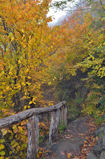
This past weekend, we headed out to Peaks of Otter on the Blue Ridge Parkway in Virginia for a camping trip. Our plan was to enjoy some early fall foliage from the peaks, which provide fantastic views in nice weather. Unfortunately, as the weekend drew near, the weather forecast was not looking agreeable. But, we weren't going to let a little rain spoil our weekend. We left Chapel Hill around 730 and made it to Peaks of Otter around 1030. It was cloudy and drizzling along the way, but we were starting to see more fall color as we headed north and got higher in elevation. By the time we reached the park, the rain had stopped, but the clouds had moved in and the whole area was blanketed in fog. We checked in at the campsite and set up our tents, then headed to parking area for Sharp Top Trail. Driving even this short distance was a bit scary as it was so foggy, we could barely see six feet in front of the car. But we made it to the parking lot and started our hike up to the summit of Sharp Top Mountain.
The Sharp Top Trail is only 1.5 miles long, but gains roughly 1500 feet over its course, so its a very steep trail. And while the dreary weather didn’t provide good views of fall color, at least it was cool for the strenuous climb and we weren't sweating profusely.
Near the top, we made a quick detour to Buzzard’s Roost and climbed out onto the rocks here.
The outcrop was covered in fog and we couldn't see anything, even the nearby summit of Sharp Top, but it was a fun scramble to get out on the rocks.
Then, we continued on up to the summit of Sharp Top.
There is a shelter at the top, but it wasn’t raining, so we didn’t really need it.
Instead, we headed to the very top and ate lunch up here.
There were some markers in the boulders that indicated what mountains could be seen in the distance and how far away they were.
With the weather today, however, we couldn’t see 34 feet in front of us, let alone 34 miles. After lunch, we started making our way down.
Although the hike down was certainly easier than going up, the wet stone stairs were treacherous and we made our way slowly. Back at the bottom, we headed back to camp and then hiked towards Flat Top. We got on the Lake Trail, though we couldn’t see the lake even though it was only a few feet away and then passed Polly Woods’ Ordinary.
This small 19th century building was an Inn that provided “ordinary” amenities to weary travelers. Then we continued down the road past the picnic area and picked up the Flat Top Trail. It’s 1.8 miles to the summit and gains another 1500 feet of elevation along the way - another very strenuous trail. There was a section of the trail early on that ran through an area with decent visibility and we could actually see some changing leaves, but as we got higher, everything got more and more cloudy. At the summit, we could see almost nothing.
I found a pretty red maple leaf that had fallen and got a picture of it on a rock - about the best fall foliage picture I could get up here.
The trail continues on and ends at the parkway, but we just hiked to the summit and turned back. We made our way back down the mountain and returned to camp. For dinner, we headed over to the Peaks of Otter Lodge and ate at the restaurant. By the time we returned, a couple folks who had eaten at camp had built a nice roaring campfire. The sun had set by now and it was quite chilly, so the fire’s warmth felt good. After socializing for a while around the campfire, we headed to bed early.


No comments:
Post a Comment