
We hiked the short Silver Run Falls Trail (#435) to this scenic waterfall and got some pictures from various angles.
But just one waterfall is not enough! Along the cliff face next to the waterfall, a bunch of roots and rocks made a steep scramble path up to the top. We climbed up here and followed a faint path upstream through dense rhododendron a short ways to Upper Silver Run Falls, a nice 15-foot cascading waterfall.

After a few pictures, we headed back.

Climbing back down the cliff, we got a couple of curious looks from others who were at the lower waterfall. I don't think they realized that there was another waterfall further upstream and probably had no intention of following in our footsteps.

Back at the car, we continued south on NC-107, turning right on Bull Pen Road, which becomes Forest Service Road 1178. We drove about four miles to a pull off on the side of the road, near the gated FSR 4564. Directly across from the gated road, we could hear and partially see a waterfall on Scotsman Creek below. There was some flagging tape, so we started a challenging, but short bushwhack down to the creek. Although it was really short, the hike was remarkably challenging. We barely walked on actual ground, having to walk and crawl along rhododendron branches and thick brush. There was a waterfall here, but it wasn’t the one we were looking for.

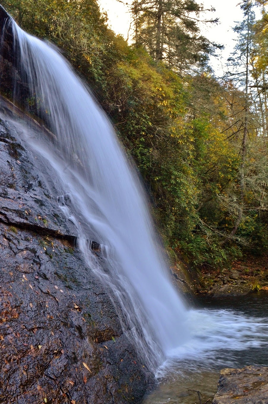
This is the Upper Waterfall on Scotsman Creek - it’s not a bad waterfall, though not necessarily worth the challenging scramble down to the creek. We headed back up to the road and hiked a short ways down the gravel road to a curve to the right and found more flagging tape. This was the right trail! We hiked down another short, but challenging bushwhack to Scotsman Creek, this time to the right waterfall.

This is a really cool waterfall. The water splits into two streams and falls over a cliff face, then cascades down.

The two streams go around a small island in the middle in the middle of the creek. We sat for a little while here and I took off my boots and socks to wade in the creek below the falls. The water was very shallow and I wanted to get pictures from different angles as well as head over to the island in the creek.

When we had enough, we climbed back up to the road and made our way back to the car. In another mile or so, we came to the Bull Pen Bridge (also called the Iron Bridge by locals) over Chattooga River and decided to make a quick stop.

First, we climbed down to river level downstream of the bridge.

From here, we could look upstream at the bridge and the Potholes, a series of cascades right under the bridge.

Then we went back up and headed upstream to some rocks for a nice view of the bridge amidst the fall color.

Several families were here at the rocks and we stopped to talk with them for a few minutes. Although the Potholes isn't a real impressive waterfall, the rocky area is great spot to enjoy the natural beauty. After a few pictures, it was time to head to some more real waterfalls. We continued driving down Bull Pen Road to Highlands and got on NC-106 to Glen Falls Scenic Area. There were quite a few cars in the parking lot, but we didn’t see a lot of people on the trail. The trail is about three-quarters of a mile and moderate as it heads down the waterfall. Our first view of the falls was from the top.

We couldn’t see much of the waterfall, but the fall foliage here was absolutely gorgeous. From here, we headed down to the base of the upper section, consisting of two free falls and some nice cascades.

Then we headed down even more stairs and switchbacks to the base of the middle section. The middle section is perhaps the most impressive, a 60-foot series of cascades.

We got some pictures here and ate our lunch at the base of the middle section. While we were eating, a group of ladies came down for some pictures then headed back up before we finished. When we finished our lunch and started heading back up, I spotted an iPhone on the ground near the waterfall. The group had a five or ten minute head start on us, but I figured I could hike a lot faster than them, especially uphill, so I grabbed the phone and headed back up. Near the base of the upper section, I saw a lady heading back down, looking distressed. Sure enough, she had dropped her phone and was very grateful that I had brought it up to her and she didn’t have to go all the way back down. We finished up our hike at the car and made our way back to Highlands, then going south on NC-28. We turned onto Blue Valley Road that eventually became Forest Service Road 79. In about 4 miles, or about a half-mile past Blue Valley Campground, we pulled over near a gated road. From here, we hiked up the gated road for about a half-mile to a clearing with nice views of the pretty fall color.
Right past the clearing, we reached a creek and headed upstream a short ways to reach Picklesimer Rock House Falls.

Similar to Moore Cove Falls earlier in the week, this waterfall has a freefall over a cliff with a large cave, or “rock house”, behind it. And the cave was certainly big enough to stay under for shelter from a storm, though I don’t think I’d necessarily want to live there.

Unlike Moore Cove Falls, however, this waterfall is fairly unknown and we didn’t see anyone else here. Another benefit of low crowds - there was no garbage carelessly discarded around the falls.

After a few minutes, we headed back to the car and made our way back towards Highlands. Picklesimer Rock House Falls was our last planned waterfall, but it was still early enough in the day that we decided to get a couple more. We stopped at the Satulah Overlook along NC-28 on the way back to Highlands. Across the gorge, we could see Lower Satulah Falls. Although it’s over 100 feet high, viewing it from across the valley is not too impressive.

As far as I can tell, there's no way to get across for a better view of the falls. However, the view from the overlook, including Satulah Mountain, was quite beautiful with all the fall colors and made the stop worthwhile.

We then continued into Highlands and got on US-64 west towards Cullasaja River Gorge for a couple more easy waterfalls. First, we drove under Bridal Veil Falls and then stopped to get a couple of pictures.

Then we went another mile or so and stopped at Dry Falls.

It’s a short walk to this huge 70-foot waterfall and not surprisingly, there were a lot of people here.

The name Dry Falls comes from the fact that normally, you can walk behind the waterfall and stay dry.

The water level seemed to be up a bit and I got misted walking behind the falls. Not always so dry.

After some pictures from different angles, we headed back through Highlands to Cashiers and had dinner and drinks at Gamekeepers’ Tavern, just up the road from our hotel. Eating at the bar, I had a cheeseburger and Sandy had venison meat loaf and we both really enjoyed our meals. I also had an Autumn Russian, a cocktail made with pumpkin-spice vodka, Kahlua, cream, and a dash of nutmeg. It was yummy! After dinner, we headed back to the hotel and took a dip in the hot tub before bed. Our next day in Little Canada was going to be a challenging one!
No comments:
Post a Comment