Saturday morning, we woke up and had breakfast at camp then headed to the visitor center at Mount Mitchell State Park to get Alex's passport stamped.
Then we drove to the top of the mountain. First, we hiked the Summit Trail up to the top of Mount Mitchell, highest point in the eastern United States at 6,684 feet above sea level.
It was too cloudy up here for much of a view though.
Then we hiked back down and got on the Deep Gap/Black Mountain Crest Trail. This trail follows the crest of the Black Mountains north through the park and continues through Pisgah National Forest. There's a lot of up-and-down, but the trail mostly stays above 6000 feet. It was really cloudy so no sweeping views, but the fog gave the spruce-fir forest an ethereal feel.
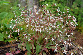
There were some cliff saxifrage along rocky sections.
And we saw lots of red elderberries.
As we got to Mount Craig, it started to rain. It was a pretty steady rain for the entire hike. We went as far as Cattail Peak, at which point it lessened to a light drizzle.
By the time we got back to the car, the rain had mostly dissipated. For dinner, we stopped at the restaurant and got take-out and ate it back up at the summit. The clouds had cleared and there were nice views now.
I took a short hike around the Balsam Nature Trail.
Then we headed back to camp. After building a fire, we got Alex's dinner ready, but he wanted to lay down in the tent. Being a stubborn husky, he really wanted to go in the tent, but we repeatedly told him he needed to eat dinner first. Finally, he relented and scarfed his dinner down and as promised we let him in the tent. I offered some water, but there was no getting between him and the tent.
I went for one last hike in the cool weather to Camp Alice Trail.
We enjoyed the fire for a while as it was a beautiful night.
Right after we got in the tent, it started to rain and continued through most of the night.


No comments:
Post a Comment