Saturday morning, we woke up early and started making our way north on Skyline Drive towards the Dickey Ridge Visitor Center. Along the way, we had to stop for some deer crossing the road.
Wildlife crossings are a common sight along Skyline Drive. We arrived at the visitor center and got ready for a short hike to warm up our legs. As we were getting ready, I walked behind the visitor center to enjoy a wonderful view of the valley beyond in the morning light.
Then we got started hiking across the street on Fox Hollow Trail. Initially, the trail passes through an open meadow with Queen Anne’s Lace and Bee Balm blooming.
Then, the trail headed into the woods and down into Fox Hollow.
We made a quick stop at the old cemetery, with graves of soldiers who had fought in the Civil War.
Then, we finished up the short loop back at the visitor center.
We stopped inside briefly and spoke with a couple rangers. After the disappointing waterfall yesterday, we inquired about Lands Run Falls. The rangers suggested that Little Devil Stairs would be more bang for the buck, so we skipped Lands Run Falls and headed towards the parking area for the longer hike. Sandy and I were a little behind the rest of the group driving south on Skyline Drive, when we had to stop suddenly for a bear crossing!
A juvenile black bear darted across the road and was poking around in the woods. I tried to get a picture of him, but he was far enough back in the woods that I couldn’t get a good shot. Then we continued on to the parking lot of Little Devil Stairs near mile post 19 to tell everyone why were late. After getting ready, we started off hiking down Keyser Run Fire Road, where we saw some beautiful wildflowers blooming along the trail and several Great Spangled Fritillary butterflies on the flowers.
At the intersection with Little Devil Stairs Trail, we continued straight on the fire road. In about 2 miles, we came to the Bolen cemetery, a much larger graveyard than the one we had seen previously.
We spent a few minutes browsing the cemetery, taking pictures and checking out the gravestones.
The young ages of many of the deceased were a reminder of how harsh life was in the mountains 100 years ago.
When we finished, we continued on the fire road to the end at a parking area, just outside the park, and got on Little Devil Stairs Trail. Almost immediately, the trail crossed a creek and we stopped here to eat lunch. While eating, we checked out some of the aquatic life that lived in this area. There were crawfish hiding in rocks and a surprising number of fish living in a pool below a small cascade.
Despite being so small, the pool hosted a surprising amount of life. After lunch, we continued on the trail as it ran parallel to Keyser Run heading upstream. The trail was gradual at first, but got more strenuous as we entered the Little Devil Stairs canyon.
The small creek flowed through a gorge with high cliff faces on either side.
Hiking through the gorge required climbing stairs, rock-hopping back and forth across the creek, and a few areas of rock scrambling.
Despite the challenge, the gorge was beautiful, and made for a very enjoyable hike alongside the steep cliffs and cascading creek.
Near the top was a small waterfall.
The twelve-foot waterfall on Little Devil Stairs wasn’t high, though it had much better flow than Overall Run Falls we had seen yesterday. Once at the top, the trail leveled off as it ended back at Keyser Run Fire Road.
A family who were just behind us had been attacked by yellow jackets. Fortunately, Sandy had some hydrocortisone cream in her bag to share with these people to help alleviate their stings. Back at the fire road, we turned right and hiked back to the parking area. We then headed back to camp, but it was still a little early, so Sandy and I headed to Skyline Drive to check out some of the overlooks. We went north and stopped at Rattlesnake Point and Little Devil Stairs overlooks.
From the latter, we could see the gorge that we had hiked through earlier in the day.
There was an old dead tree right at the overlook that looked quite ominous against the storm clouds on the horizon.
We then stopped at Mount Marshall Overlook and Gimlet Ridge Overlook, then started heading back.
Next, we stopped at Little Hogback and Hogback Overlooks, where clouds were rolling in over the mountains.
Back at camp, we ate dinner and then headed south on Skyline Drive. We made a quick stop at the tunnel parking for some pictures of Marys Rock Tunnel and then parked at Little Stony Man Parking.
From the parking lot, we hiked to the Appalachian Trail and turned left to go southbound. At the next intersection, we turned right to hike just a short ways on Passamaquoddy Trail to the Little Stony Man View Point.
Although there were some clouds in the sky, the late evening sunlight was beautiful.
Looking north, we could see Skyline Drive snaking along the ridgeline through the park.
After thirty minutes or so here, we backtracked to the last intersection and followed the AT as it switchbacked up to the top of Little Stony Man for even more phenomenal views.
Our plan was to watch the sunset from here, but clouds on the horizon prevented us from seeing the sunset.
However, before it went completely down, there were great views as the sun dipped behind the clouds before dropping below the horizon. A small pool of water below some rocks here created a beautiful reflection of the evening sky.
Once the sun was no longer visible, we hiked back down to the cars before it got completely dark. We drove back to camp and had a nice campfire, drinking tequila and beer and eating s’mores, before heading to bed.
Saturday, August 2, 2014
Friday, August 1, 2014
Overall Run Falls
This past weekend, we headed north to Virginia for a weekend of camping and hiking in Shenandoah National Park. The forecast for the weekend suggested a lot of rain and thunderstorms, but we hoped for the best. We met at Walmart in Oxford and caravanned to the park, taking the more scenic route of US-15 north most of the way. It drizzled most of the way up, but never rained heavily. And by the time we arrived at the park, the rain had stopped. We entered the park through the Thornton Gap entrance and after paying for admission, we headed north on Skyline Drive. In about 12 miles, we turned into Matthew Arm Campground, our home for the weekend. After checking in to the campground, we all quickly set up our tents in case the rain started again suddenly. Camping in the rain is a bit unpleasant, but setting up tents in the rain is really no fun, so we tried to get everything set up as quickly as possible. After everything was set up, we headed out on our hike for the day. We were headed to Overall Run Falls, the tallest waterfall in the park. Conveniently, the trailhead for this waterfall is located in the back of the campground, so we didn’t need to drive any more to reach it. We walked to the back of loop B and started off on the Matthews Arm Trail, which initially is an old fire road. Following this trail a short ways, we passed intersections with Weddlewood Trail and Beecher Ridge Trail, then coming to the terminus at Overall Run Trail. To the right, the trail links to the Appalachian Trail. We turned left, however, following the trail as it headed down through a series of switchbacks to a ridgeline above the creek, the only steep part of the trail. There was the 29-foot cascade, though it was barely a drip and then a short ways later, we came to a cliff overlook for Overall Run Falls.
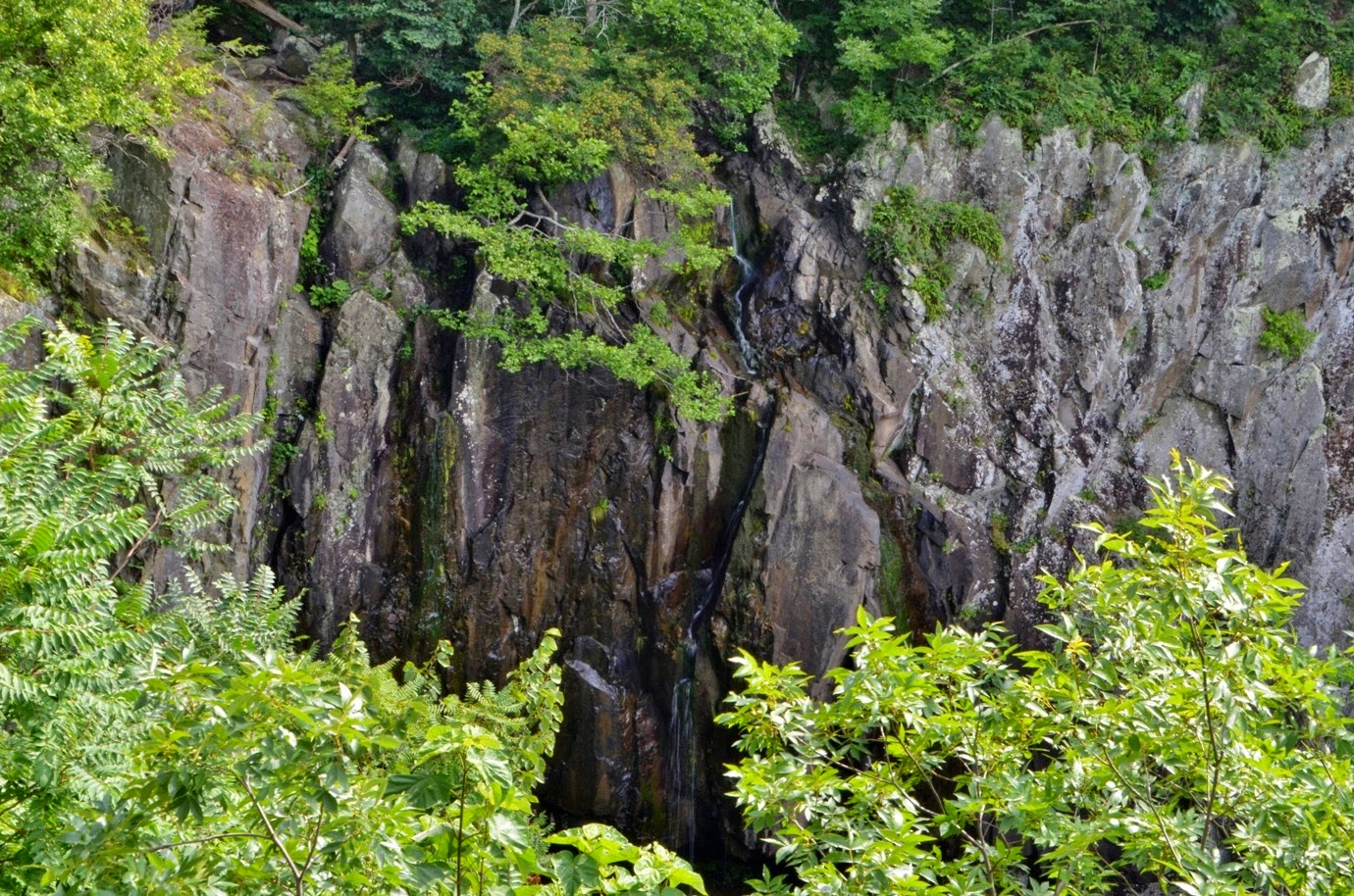
Well, we were supposed to be able to see the waterfall from here, but there wasn’t much to see. Due to the dry conditions of the summer, the waterfall was barely a trickle. But the hike wasn’t completely in vain.
The cliff overlook had phenomenal views of the surrounding mountains and we sat here for a little while to enjoy the views.
When we were ready, we made the hike back up to camp. For dinner, Sandy and I headed to the gift shop at Elkwallow Wayside and picked up some sandwiches to eat at camp. We built a small campfire and socialized for a few hours and then went to bed early.
Well, we were supposed to be able to see the waterfall from here, but there wasn’t much to see. Due to the dry conditions of the summer, the waterfall was barely a trickle. But the hike wasn’t completely in vain.
The cliff overlook had phenomenal views of the surrounding mountains and we sat here for a little while to enjoy the views.
When we were ready, we made the hike back up to camp. For dinner, Sandy and I headed to the gift shop at Elkwallow Wayside and picked up some sandwiches to eat at camp. We built a small campfire and socialized for a few hours and then went to bed early.
Saturday, July 26, 2014
Doughton Park Long Hike
This past weekend, I headed out to Doughton Park along the Blue Ridge Parkway for a challenging 17-mile circuit hike. I met up with Robin and we carpooled out, arriving at the trailhead on Long Bottom Road at about 930. We got ready and then headed out for our hike, starting out by passing the gate on Grassy Gap Fire Road. Almost immediately, we turned right on Cedar Ridge Trail and began making the strenuous climb up towards the parkway. The trail gains more than 2000 vertical feet in about 4.4 miles, so it was a good and steady climb. Warm temperatures, high humidity, and a lack of wind made the hike that much more challenging. Additionally, this trail is not well traveled. In fact, we didn’t see anyone else the whole way up. So there was no one else to clear the spider webs across the trail and I think I caught just about every one. It took us about 2 hours to get up to the top and once here, we made a short detour to Brinegar Cabin, following the Mountains-to-Sea Trail.
This historic cabin was built around 1880 by Martin Brinegar, who lived here with his wife Caroline and their family until the 1930s.
Next to the cabin was a garden and a young lady was getting bridal photos taken here. We took a quick stop in the cabin to see an old loom and other historic artifacts of mountain life in the past, then continued on our way.
We followed the MST back to the intersection and turned right onto Bluff Mountain Trail (which is also the MST) and headed towards the campground.
The Bluff Mountain Trail mostly parallels the Blue Ridge Parkway along its roughly 7.5-mile length. Along the way, we passed through some beautiful open meadows along the parkway with lots of wildflowers in bloom.
There were thousands of coreopsis in bloom, as well as Queen Anne’s lace, prairie gay feather, and other wildflowers.
We hiked through one flower-filled meadow, then passed through the campground, before crossing the Blue Ridge Parkway at Low Notch, which had lovely views down the Blue Ridge Escarpment.
Soon after, there was another big open meadow, though it didn’t have as many flowers as the previous one. However, there were a lot of Eastern tiger swallowtail butterflies here, taking advantage of what flowers there were.
Soon we came to what used to be the restaurant and gift shop that are now closed then crossed the parkway and walked past the also-closed lodge. Apparently budget cuts and a lack of private partnerships have shuttered these amenities. Past the lodge, we stopped at the Wildcat Rock Overlook and had lunch here.
This spot had perhaps the best views in the park. The basin creek gorge could be seen below, as well as the historic Caudill Cabin, which is 800 feet below this overlook. Due to the thick summer foliage, only a part of the cabin’s roof could be seen from above. After lunch, we got back on the Bluff Mountain Trail and continued our hike.
We continued past the picnic area through more beautiful open meadows with the occasional lone tree sticking up amidst the wildflowers and grasses.
At the old shelter, we turned right to stay on Bluff Mountain Trail, where the Bluff Primitive Trail headed down steeply into the gorge below. From here, we climbed up to the top of Bluff Mountain with great views of the parkway and Blue Ridge Mountains beyond.
Heading down from the summit was probably the steepest part on this trail with some steps added to help with the descent.
Once down, we continued on Bluff Mountain Trail past a couple more overlooks and soon made it to the end of the trail at the intersection with Flat Rock Ridge Trail. This trail would conclude our circuit hike, losing about 2000 vertical feet over the course of 5 miles. But it wasn’t all downhill from here – there is a saddle on the first half of the trail, so we would be going down and then back up, before making our final descent back to the parking area. Along the way, we saw some Indian Pipe growing along dark patches of forest floor where no sunlight penetrated the foliage.
There were no overlooks along this trail, but a couple of open spots allowed us to peer across the gorge. Far in the distance, we could see a lone tree standing as a sentinel atop the meadow.
We had passed this tree a couple hours ago, but now we could only barely see it in the distance. That tree really put the distance we had hiked in perspective. After the saddle, it pretty much was all downhill following Flat Rock Ridge Trail back to the bottom. As we approached the end, the sounds of cars and motorcycles on Long Bottom Road and flowing water along Basin Creek indicated our hike was almost complete. In the end, it took about 8 hours to complete our 17-mile hike. Not bad, considering the distance and elevation gain.
This historic cabin was built around 1880 by Martin Brinegar, who lived here with his wife Caroline and their family until the 1930s.
Next to the cabin was a garden and a young lady was getting bridal photos taken here. We took a quick stop in the cabin to see an old loom and other historic artifacts of mountain life in the past, then continued on our way.
We followed the MST back to the intersection and turned right onto Bluff Mountain Trail (which is also the MST) and headed towards the campground.
The Bluff Mountain Trail mostly parallels the Blue Ridge Parkway along its roughly 7.5-mile length. Along the way, we passed through some beautiful open meadows along the parkway with lots of wildflowers in bloom.
There were thousands of coreopsis in bloom, as well as Queen Anne’s lace, prairie gay feather, and other wildflowers.
We hiked through one flower-filled meadow, then passed through the campground, before crossing the Blue Ridge Parkway at Low Notch, which had lovely views down the Blue Ridge Escarpment.
Soon after, there was another big open meadow, though it didn’t have as many flowers as the previous one. However, there were a lot of Eastern tiger swallowtail butterflies here, taking advantage of what flowers there were.
Soon we came to what used to be the restaurant and gift shop that are now closed then crossed the parkway and walked past the also-closed lodge. Apparently budget cuts and a lack of private partnerships have shuttered these amenities. Past the lodge, we stopped at the Wildcat Rock Overlook and had lunch here.
This spot had perhaps the best views in the park. The basin creek gorge could be seen below, as well as the historic Caudill Cabin, which is 800 feet below this overlook. Due to the thick summer foliage, only a part of the cabin’s roof could be seen from above. After lunch, we got back on the Bluff Mountain Trail and continued our hike.
We continued past the picnic area through more beautiful open meadows with the occasional lone tree sticking up amidst the wildflowers and grasses.
At the old shelter, we turned right to stay on Bluff Mountain Trail, where the Bluff Primitive Trail headed down steeply into the gorge below. From here, we climbed up to the top of Bluff Mountain with great views of the parkway and Blue Ridge Mountains beyond.
Heading down from the summit was probably the steepest part on this trail with some steps added to help with the descent.
Once down, we continued on Bluff Mountain Trail past a couple more overlooks and soon made it to the end of the trail at the intersection with Flat Rock Ridge Trail. This trail would conclude our circuit hike, losing about 2000 vertical feet over the course of 5 miles. But it wasn’t all downhill from here – there is a saddle on the first half of the trail, so we would be going down and then back up, before making our final descent back to the parking area. Along the way, we saw some Indian Pipe growing along dark patches of forest floor where no sunlight penetrated the foliage.
There were no overlooks along this trail, but a couple of open spots allowed us to peer across the gorge. Far in the distance, we could see a lone tree standing as a sentinel atop the meadow.
We had passed this tree a couple hours ago, but now we could only barely see it in the distance. That tree really put the distance we had hiked in perspective. After the saddle, it pretty much was all downhill following Flat Rock Ridge Trail back to the bottom. As we approached the end, the sounds of cars and motorcycles on Long Bottom Road and flowing water along Basin Creek indicated our hike was almost complete. In the end, it took about 8 hours to complete our 17-mile hike. Not bad, considering the distance and elevation gain.
Saturday, July 12, 2014
Steels Creek & Burnthouse Branch Falls
Saturday, I headed back to the Wilson Creek area of Pisgah National Forest to find a couple of the more remote waterfalls in the area. I had attempted to find Waterfall on Burnthouse Branch on Memorial Day, but was unsuccessful. This time, I was heading back with Chris, who had already been, so was hoping for a more successful trip. We left the Chapel Hill area around 730 and headed west on I-40. We got off the interstate in Morganton and headed north on NC-181. In about 17 miles, we turned left on Forest Road 228 and proceeded to the end. Although this road seemed pretty remote, there were a lot of people camping at the spots near the end. After parking, we got our stuff ready and started hiking the Steels Creek Trail (#237). The trail was a continuation of the road for about a quarter-mile to a nice swimming hole below some cascades along Steels Creek.
We had to cross the creek here, and managed to stay dry, though rock-hopping was a bit tricky. Once across, the trail headed up and joined up with the Mountains-to-Sea Trail. Right after this, the trail headed down to the creek, then headed up again through a lot of poison ivy and stinging nettle. We passed through this area, trying to avoid the noxious plants, and soon came to the waterfall on Steels Creek. A short, but very steep, scramble path led down to a big rock with views of the upper portion of the waterfall. A rope was available to help us get out onto a big rock to view the waterfall. This waterfall is really cool and unique in that there are a bunch of big potholes in the rock.
Swimming here, however, was not a good idea as the rocks were too steep to easily climb back out of the water. We relaxed here for a little while and got some pictures. We hoped for a bit of cloud cover to improve the lighting, but it never came, and soon we headed back up. At the stream crossing on the way back, we decided to just get wet, rather than trying to rock-hop back across, and then take a dip in the nice swimming hole. The water was a little cold, but refreshing on a hot and humid day. After drying off, we returned to the car and headed to our next destination. We followed the forest road back to NC-181, turning left and then an immediate right onto Forest Road 982. After the road crosses Upper Creek on a one-lane bridge, we turned left on Forest Road 197, following the road as it parallels Upper Creek for about a mile and a half to the end and parking at the huge jeep mound. We got our stuff together and started hiking along the unofficial trail. It starts out quite easy, a continuation of the forest road, but gets progressively harder. In about a half-mile, there’s another primitive camping spot and then it starts to become more like a trail. This trail was also a bit overgrown with poison ivy and stinging nettle, but we were determined to make it to the waterfall. After a while, the trail becomes very narrow and steep as it hugs the cliff above Upper Creek. As we got near to the waterfall, it became even more steep , heading up via switchbacks, then down just as steeply to a spot where we had to rock-hop across Burnthouse Branch. Right across the stream, we met an older man who was camping out here. I don’t know who was more surprised to see other people in this remote area. From here, we could start to see the waterfall, but needed to rock-hop along the creek to get the best view from the base.
The waterfall is rather interesting. The water flows in two streams down a steep cliff face, then tumbles over huge moss-covered rocks, making its way into Upper Creek.
Right near the base of the falls, there was a crawfish clinging to the moss along a cascade.
He was not happy to have visitors and swung his claws around in displeasure. We had a late lunch/early dinner at the falls and then started to make our way back. Talking to the gentleman camping, he told us that if you bushwhack up to the top of the falls, there are even more moss-covered rocks that the water flows through, but it was too late for such a strenuous endeavor. So we started hiking back. Fortunately, on the way back, the trail gets progressively easier and we made it back in about an hour. Hot, tired, and sweating from the hike, we changed into bathing suits and took a dip in Upper Creek right by where we had parked. The water was quite cold, but it washed much of the dirt and sweat off. By the time we got out of the water, it was after 7, so we changed and headed back to NC-181 towards Morganton. We were all hungry, so a huge dinner at Las Salsas was in order. After dinner, it was dark and we could see the Super Moon on the drive home.
We had to cross the creek here, and managed to stay dry, though rock-hopping was a bit tricky. Once across, the trail headed up and joined up with the Mountains-to-Sea Trail. Right after this, the trail headed down to the creek, then headed up again through a lot of poison ivy and stinging nettle. We passed through this area, trying to avoid the noxious plants, and soon came to the waterfall on Steels Creek. A short, but very steep, scramble path led down to a big rock with views of the upper portion of the waterfall. A rope was available to help us get out onto a big rock to view the waterfall. This waterfall is really cool and unique in that there are a bunch of big potholes in the rock.
Swimming here, however, was not a good idea as the rocks were too steep to easily climb back out of the water. We relaxed here for a little while and got some pictures. We hoped for a bit of cloud cover to improve the lighting, but it never came, and soon we headed back up. At the stream crossing on the way back, we decided to just get wet, rather than trying to rock-hop back across, and then take a dip in the nice swimming hole. The water was a little cold, but refreshing on a hot and humid day. After drying off, we returned to the car and headed to our next destination. We followed the forest road back to NC-181, turning left and then an immediate right onto Forest Road 982. After the road crosses Upper Creek on a one-lane bridge, we turned left on Forest Road 197, following the road as it parallels Upper Creek for about a mile and a half to the end and parking at the huge jeep mound. We got our stuff together and started hiking along the unofficial trail. It starts out quite easy, a continuation of the forest road, but gets progressively harder. In about a half-mile, there’s another primitive camping spot and then it starts to become more like a trail. This trail was also a bit overgrown with poison ivy and stinging nettle, but we were determined to make it to the waterfall. After a while, the trail becomes very narrow and steep as it hugs the cliff above Upper Creek. As we got near to the waterfall, it became even more steep , heading up via switchbacks, then down just as steeply to a spot where we had to rock-hop across Burnthouse Branch. Right across the stream, we met an older man who was camping out here. I don’t know who was more surprised to see other people in this remote area. From here, we could start to see the waterfall, but needed to rock-hop along the creek to get the best view from the base.
The waterfall is rather interesting. The water flows in two streams down a steep cliff face, then tumbles over huge moss-covered rocks, making its way into Upper Creek.
Right near the base of the falls, there was a crawfish clinging to the moss along a cascade.
He was not happy to have visitors and swung his claws around in displeasure. We had a late lunch/early dinner at the falls and then started to make our way back. Talking to the gentleman camping, he told us that if you bushwhack up to the top of the falls, there are even more moss-covered rocks that the water flows through, but it was too late for such a strenuous endeavor. So we started hiking back. Fortunately, on the way back, the trail gets progressively easier and we made it back in about an hour. Hot, tired, and sweating from the hike, we changed into bathing suits and took a dip in Upper Creek right by where we had parked. The water was quite cold, but it washed much of the dirt and sweat off. By the time we got out of the water, it was after 7, so we changed and headed back to NC-181 towards Morganton. We were all hungry, so a huge dinner at Las Salsas was in order. After dinner, it was dark and we could see the Super Moon on the drive home.
Saturday, July 5, 2014
Independence Weekend at Gragg Prong
For the Independence Day Weekend, we headed out to the Wilson Creek area again for some more waterfall fun. Friday, we spent the day in Raleigh and went to Sandy’s parents for a cookout. Then very early Saturday morning, we headed out to Wilson Creek, arriving at the Lost Cove Trailhead on FR-981 right at 9 o’clock. We were meeting Josh and Marissa and the dogs, who had camped there the night before. They were arriving at the parking area right as we pulled up. We got all our stuff and backpacked in about a half-mile along Lost Cove Trail (#262) following Gragg Prong downstream. The campsite was just off the trail and was a really beautiful little spot, just above the creek with a small cascade nearby. After getting our tent set up, we donned our daypacks and continued along the trail about a mile to the Upper Waterfall on Gragg Prong.
Although we had visited this waterfall before, we never had a chance to play in the water. And arriving early, we had the waterfall to ourselves, at least for a little while. We set up along the big area of exposed bedrock, changed into swimsuits, and blew up the inflatable turtle we had picked up from Walmart for just $5. Although the turtle was for children only, with a maximum weight of 40 kg, it was quite large and we all were easily able to fit on it. The only downside was that it took a while to inflate and deflate. The lowest portion of this waterfall is a gentle slide and provides an opportunity for some easy waterfall-sliding.
Once the turtle was blown up, we took turns sliding down this lower section. The water level wasn’t high and the slope is not steep, so it’s not the most exciting waterfall to slide down, but it was still a lot of fun. After a few slow runs, we realized that we had to start at the top on the far side to slide the fastest. The water was quite cold and I think everybody was a bit relieved that we could stay mostly dry sliding down. Margo, the bull mastiff, also enjoyed playing in the waterfall, running down after us as we slid down on the turtle. We ate lunch here and spent the better part of the morning and afternoon here, then headed back to the campsite.
On the way back, Josh knew of a “high trail” that bypasses two of the stream crossings on Gragg Prong, so we could keep our feet dry heading back. On the last stream crossing, we were able to rock-hop across. Margo just waded across in the water, but Willie, the rescue hunting dog, didn’t want to get his feet wet, so he actually rock-hopped across following where Sandy had stepped. I had never seen a dog rock-hop before and was quite impressed. We relaxed at the campsite for a little bit, then headed into Boone and had dinner at Coyote Kitchen. Josh had gone to school at Appalachian State and was very familiar with the Boone area, so he suggested this restaurant. The food was very good and they had a nice outdoor seating area, so the dogs could join us. After dinner, we headed back to camp and managed to find quite a bit of firewood and built a nice fire when the sun went down. While we still had some daylight left, we sat down at the creek and enjoyed the lovely view.
The rosebay rhododendrons were blooming and all the flowers along the creek made for a beautiful sight.
And a nice cascade added to the scene and provided tranquil white noise as we slept. After sundown, we socialized around the fire for a while and then went to bed. Sandy had to work Sunday evening, so in the morning, we broke camp and headed home.
Although we had visited this waterfall before, we never had a chance to play in the water. And arriving early, we had the waterfall to ourselves, at least for a little while. We set up along the big area of exposed bedrock, changed into swimsuits, and blew up the inflatable turtle we had picked up from Walmart for just $5. Although the turtle was for children only, with a maximum weight of 40 kg, it was quite large and we all were easily able to fit on it. The only downside was that it took a while to inflate and deflate. The lowest portion of this waterfall is a gentle slide and provides an opportunity for some easy waterfall-sliding.
Once the turtle was blown up, we took turns sliding down this lower section. The water level wasn’t high and the slope is not steep, so it’s not the most exciting waterfall to slide down, but it was still a lot of fun. After a few slow runs, we realized that we had to start at the top on the far side to slide the fastest. The water was quite cold and I think everybody was a bit relieved that we could stay mostly dry sliding down. Margo, the bull mastiff, also enjoyed playing in the waterfall, running down after us as we slid down on the turtle. We ate lunch here and spent the better part of the morning and afternoon here, then headed back to the campsite.
On the way back, Josh knew of a “high trail” that bypasses two of the stream crossings on Gragg Prong, so we could keep our feet dry heading back. On the last stream crossing, we were able to rock-hop across. Margo just waded across in the water, but Willie, the rescue hunting dog, didn’t want to get his feet wet, so he actually rock-hopped across following where Sandy had stepped. I had never seen a dog rock-hop before and was quite impressed. We relaxed at the campsite for a little bit, then headed into Boone and had dinner at Coyote Kitchen. Josh had gone to school at Appalachian State and was very familiar with the Boone area, so he suggested this restaurant. The food was very good and they had a nice outdoor seating area, so the dogs could join us. After dinner, we headed back to camp and managed to find quite a bit of firewood and built a nice fire when the sun went down. While we still had some daylight left, we sat down at the creek and enjoyed the lovely view.
The rosebay rhododendrons were blooming and all the flowers along the creek made for a beautiful sight.
And a nice cascade added to the scene and provided tranquil white noise as we slept. After sundown, we socialized around the fire for a while and then went to bed. Sandy had to work Sunday evening, so in the morning, we broke camp and headed home.
Subscribe to:
Posts (Atom)