Showing posts with label Pettigrew State Park. Show all posts

Sunday, April 7, 2019

Pettigrew Hike

Sunday, we woke up and broke camp.  It had rained overnight but was just foggy by morning.  The Pettigrew State Park office is closed on weekends but they have pre-printed stamps for Alex's passport.


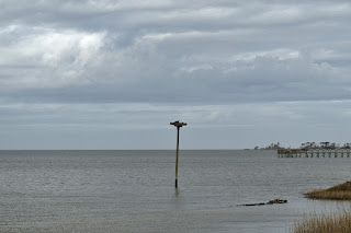
Then we followed the Lake Shore boardwalk back to Somerset Place and started hiking the Bee Tree Trail.  In about a half-mile, there was a parking area at Bonarva Canal and a boardwalk here went out to a view on the lake.


Looking northeast, I could see the boat ramp where I had watched the sunset the night before.  Back on the main trail, we headed back into the woods and crossed paths with a cute box turtle.


Then we came to the split shortly and went straight to the Bee Tree Overlook.  Unfortunately, there was construction and the overlook was closed.  So we went back to the split and turned right to hike to the Pettigrew Cemetery.


James Johnston Pettigrew, for whom the park is named, was a Confederate General who was mortally wounded in the retreat from Gettystburg.  After the war, his remains were returned to the family plantation.  Back at Somerset Place, we stopped to check out the nice gardens, then returned to the start.


Before we left, we hiked up Mocassin Trail, going the other way along the lake.  Along the way were some nice views of the lake at a break in the forest.


I also spotted an atamasco lily starting to bloom.


Sandy had to be at work in the afternoon so we didn't make it all the way to the Mocassin Overlook.  We turned around at a nice spot on the lake where a large amount of pink sorrel and daffodils were blooming.


Like the daffodils, the sorrel are not native, but were really pretty - blanketing the ground with pink.


After some pictures we headed back and made the drive home.

Saturday, April 6, 2019

Jockeys Ridge Hikes

Sandy had Saturday off so we took Alex to the coast for some beach hiking and camping.  We left early in the morning, arriving at Jockey's Ridge State Park just before 10.  The first order of business was getting Alex's passport stamped.


Then we started hiking the Tracks in the Sand Trail that led through a small maritime forest to the dunes.


This area is somewhat of a surreal landscape hiking across the dunes.


The harsh environment is mostly devoid of life.  For a moment, it was easy to imagine being in the desert.


The short trail turns around at the sound.


We saw a pair of ospreys in their nest over the water.


The trail led along the sound a short ways before looping back to the dunes.


Back at the dunes, we ran Alex around, up and down the steep sandy ridge.  He really loves playing in the sand, I think it reminds of him of the snow.  We also made a detour to go up to the highest point on the dune.


We could see the hang gliders and people flying kites and both the ocean and sound are visible.  Finishing up our hike, we headed to the beach access at Hollowell Street and went for a walk on the beach.  It was a really beautiful day at the beach, partly cloudy skies and big waves.


Again, we let Alex run and play in the sand and chase the waves.  He tried to get as close as possible without getting wet but a few sneaky waves got him.  We hiked north about a mile and a half and found a nice place to rest and enjoy the view.


Then we headed back.  Our next stop was the Soundside access back at Jockey's Ridge State Park.  It was about lunch time so we had a light lunch and then walked the short Soundside Nature Trail.  There were nice views of the other side of Jockey's Ridge from here.


At the far end of the loop there was an enormous live oak, sheltered by the massive dunes.


With the huge ridge in the background, the hike was reminiscent of a mountain hike, though we couldn't be further from the mountains.  Hiking back, there were some longleaf pine with their pollen cones formed.


Allergy season will be coming soon.  Although there were no views of the sound from the trail itself, a number of side paths led to nice views.


Swimming and other water activities in the sound are available from this end of the park.  The trail is short and we finished up soon.


After finishing the hike, we started making our way back to the mainland with a stop at Roanoke Island Marshes Game Land.  Most of this area is impenetrable marshland, but there is a 1 mile loop around an impoundment.   As we left the parking area of NC-345, there were a lot of yellow jessamine blooming along the canal.


Soon we approached the waterfowl impoundment.


Near the middle was a wooden overlook where we took a short rest to enjoy the views.


Just behind this overlook was an an enormous osprey nest in a tree.  The ospreys were flying around way above.


Continuing on, we could see the bridge connecting Roanoke Island with Whalebone Junction.


This area was really scenic, though it was too late in the year for many birds on the impoundment.


There was also some Canadian serviceberry flowering here.


We finished back up at the parking area.


After finishing, we continued west on US64 to the mainland and got takeout from China King in Columbia and had a picnic dinner at Pettigrew State Park.  We then set up camp and made a short evening hike to Somerset Place.


A couple goats were in a pen  - Alex was very interested in them so we kept him away.


Somerset Place is an old antebellum plantation near the lake.


Heading back, we took the Lake Shore Trail boardwalk.


A boardwalk went out to the swim area.


Then we went out to the boat launch for a nice view of the lake in the evening light.


Back at camp, we built a fire.  Right before sunset, I walked down to the boat ramp for some pictures.


It was a a really beautiful one.  Then back at camp, we enjoyed the fire before going to bed.

Saturday, December 28, 2013

Pocosin Lakes

I had to use up some PTO from work, so for the last weekend of the year, Sandy and I headed out to the Outer Banks for some hiking and wildlife photography. We left before 6 Saturday morning and made our way east along US-64 towards our first destination – Pocosin Lakes National Wildlife Refuge. The sun was coming up as we reached Plymouth and took NC-45 towards the entrance to the Pungo Lake unit of the refuge. From the turn off NC-45, we took Refuge Road to the maintenance compound and turned left on Van Staaldulnen Road. At the end we turned right on South Pungo Road and then left on Hyde Park Road. At this time of year when the migratory waterfowl are in the refuge, this is the only route to Pungo Lake. The other roads are gated. If you are visiting, I would highly recommend bringing a map from the Fish & Wildlife Service that shows which roads are open and which are closed. It would be easy to get lost in the refuge with all the gated roads and Google Maps or GPS are of no real help. At the end of Hyde Park Road, we stopped at the Pungo Lake Observation Platform and Charles Kuralt Trail Site and got our first view of Pungo Lake.


There were a tremendous amount of tundra swans on the lake and even though they were mostly on the other side of the lake, the sounds of their honking was quite loud. We got some pictures from here and then drove to down South Lake Road to the trailhead for Duck Pen Wildlife Trail. This half-mile trail follows a gravel road out to Pungo Lake Observation Point, a photo blind on the lake.


We were a little closer to the birds from here and got some pictures hidden from view. Although there were a lot of birds here, I don’t think it had quite peaked yet.


I did manage to get some nice pictures, including a few of the swans running along the surface of the water as they took flight.


We headed back along the trail and Sandy saw something move in the distance. Bears are very common in the refuge, but using the zoom lens, I could see this was a deer.


We walked ahead especially carefully, but as we got closer, she took off into the swamp. From here, we left the refuge and got back on the highway.


It was getting towards lunch time by now and we had woken up very early, so we headed to Pettigrew State Park and had lunch in the picnic area.


We walked down to the boat dock on Lake Phelps and could hear the swans, but they were quite far away.


So we hiked along the Moccasin Trail west to the overlook to try and get a better look. This trail runs along the north shore of the lake, but there is a dense swampy forest between the trail and the lake, which blocked views of the lake for most of the trail.


There were a couple of openings with views of the lake and some very large cypress trees. But these openings were few and far between. In a couple of places along the trail, the flora is so dense, it creates a completely covered tunnel to hike through.


In just under three miles, we reached the Moccasin Overlook.


A boardwalk leads from the trail out to the lake through a beautiful swamp of bald cypress trees draped in Spanish moss.


At the overlook, we were a bit closer to the swans, but still a good ways.


We rested for a bit at the overlook and got some pictures of the swans and the beautiful trees and Spanish moss and then headed back.


From here, we headed to the rest of the way to the Outer Banks. Just over the bridge, we stopped in Nags Head at Wings. Normally, they’re a bit overpriced, but in the off season, everything was 50% off or more so we picked up some bathing suits and beach hats that we won’t have to buy this season when they’re much more expensive. I called D, our Airbnb host, and told him we would be on the way. We checked in with him, unpacked our stuff, and chatted for a bit. Then we headed into town to Pigman’s Bar-B-Que for dinner. We both had pulled pork and it was very good. After dinner, we got to bed early after a very long day.