Showing posts with label Coweeta Hydrologic Lab. Show all posts

Thursday, December 30, 2021

Coweeta Hydrologic Lab

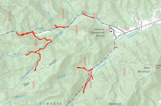
Thursday, we decided to head back to Coweeta Hydrologic Laboratory and explore the area a little more.  We first drove up Ball Creek Road and parked at the gated FR-83E.  Across the road, a short road headed up Henson Creek, but it fizzled out and the bushwhacking would have been tough.  So we followed 83E upstream along Ball Creek.


There were some weirs along tributaries and other research equipment but this road ended shortly too.  We drove up a ways further on Ball Creek Road and then headed down to Shope Fork Road and parked at the gated FR-83D.  We hiked a mile or two along this road as it followed Cunningham Creek upstream.


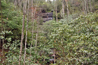
Eventually, there wasn't much more elevation gain for this creek and we turned around.  There was one nice little cascade on the creek, but it was cluttered with rhododendron.


There was another weir on Mill Creek and some other research going on here.


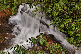
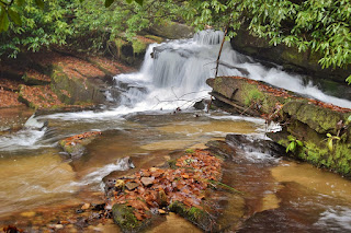
Back at Shope Fork Road, we hiked along the road as there were some nice cascades and drops on the creek.


It was quite steep getting down to creek level for a picture though.


We made one more stop at the Shope Fork weir before taking off.


From here, we headed back towards Franklin.

We stopped at Lazy Hiker and got dinner from the food truck and had an early dinner at the brewery.  There was still some time before sunset when we finished eating, so made a quick stop to see Camp Branch Falls just off Wayah Road.


We took a little break down here and then climbed back up to the main trail.  In winter there was a view of the falls and a cave high above.


It was just a couple hundred feet to Upper Camp Branch Falls.  It would be a nice waterfall, but it's covered in downfall.


We made it back to the car just before sunset and headed back to Franklin.

Wednesday, December 29, 2021

Lake Rabun Waterfalls

Wednesday, we made another trip south into Georgia.  Driving through Clayon, we took Stonewall Creek Road into Chattahoochee National Forest and parked at the trailhead for Stonewall Falls and White Twister Mountain Bike Trails.  Hiking down Stonewall Falls Trail (#59) towards the creek to the scenic Stonewall Falls.


It's only about 20 feet, but pretty and very easy to visit.


On the hike back, we turned on White Twister Trail (#48) to follow the creek further downstream.  There were some nice cascades all along Stonewall Creek.


Soon, we could here a waterfall down below and found a steep scramble path to get down to Upper Stonewall Creek Falls.


I climbed down to the creek to get some pictures of this small but scenic waterfall.


Just a little ways further was the Lower Waterfall on Stonewall Creek.  I climbed down a couple different places but was unable to find a good view from the creek.


So I settled for a picture from the trail and then we headed back.


Our next stop was at Lake Rabun Beach Recreation Area.  The campground was closed so we parked at a trailhead along Lake Rabun Road and started hiking Angel Falls Trail (#55).  In under a half-mile, we reached the campground and the main trailhead.  Right at the start was Joe Creek First Falls, a small but scenic stairstep waterfall.


The trail follows the creek upstream along the waterfall and past the ruins of an old springbox from the CCC days.


In about a half-mile, we reached Panther Falls.


I think this is the most scenic one along the trail and we stopped for a snack here.


Continuing on the trail, it climbed up along the waterfall, passing the upper section.


Middle Falls on Joe Creek was just past here, but was hard to see with the foliage blocking a view of the creek.


There were some pearl oyster mushrooms on a dead tree.


As we approached the end, the trail split to make a small loop.  Angel Falls was visible but the view was not good at all.


The trail ends at a wooden boardwalk where the two sides of the split come together at the base of Angel Falls.  There's so much rhododendron growing, it's hard to see the waterfall at all.


So we headed back down.  From here, we drove to the other side of the lake for the short hike to Minnehaha Falls.  The short Minnehaha Falls Trail (#147) followed Falls Branch up past some nice cascades.


The trail ends in under a quarter mile at the base of the beautiful Minnehaha Falls.


This one is really beautiful, but popular since its so easy.


Since a lot people were here, we didn't stay long.


From here, we drove up along Seed Lake on Crow Creek Road.  Where the road crossed Bad Branch, we parked and hiked back on the road a short ways to an old road that entered the forest and led to Bad Branch Falls.


It's the site of an old quarry, so it's not completely natural, but still rather pretty despite all the downfall at the base.


After some pictures, we headed back to the car and continued to where the road crossed Crow Creek and parked.  An old road led up along the creek and there was a nice little cascade right off the bat.


It was just a short ways further to Crow Creek Falls.


It's only about 25 feet, but quite pretty and very easy to visit.


After some pictures we headed back.


Driving back into North Carolina, we made one quick stop in Coweeta Hydrologic Laboratory for one more waterfall.  We parked at gated FR-7277 and followed a short path upstream to Camprock Branch Falls.


I had to scramble up the rocks for a good view.


Then we headed back down.


Heading back to Franklin, we got pizza to-go from Papa's Pizza and took it to Currahee Brewing to have dinner and beers with Alex.  Then we headed back to Gooder Grove.