
Hike Length: 8 miles
Estimated Time: 6 hours
Difficulty: Difficult
Location: Three Forks (Chattooga River District of Chattahoochee National Forest)
Trail Users: Hiking only
Dogs: Yes, but many of the paths are not dog friendly.
Features: Waterfalls (4)
Crowds: Low
Warnings: The scramble path to the fourth waterfall is extremely steep and dangerous. Use of ropes is necessary to rappel to the base and climb back up. The Big Creek Trail is highly overgrown and difficult to follow. The rocks are round all waterfalls are very slippery.
Trailhead GPS: 34.98414,-83.19381
Waterfall GPS: 34.97926,-83.19934 (Fourth Waterfall), 34.97358,-83.20844 (Third Waterfall), 34.97100,-83.21151 (Second Waterfall), 34.96843,-83.21359 (First Waterfall)
Directions:
To visit the falls, head east from Clayton on Warwoman Road for 13 miles. Make a sharp left onto GA-28 north and drive 4.4 miles. Just after crossing Big Creek, there is a pull-off on the left side of the road.
Map:

Hike Description:
From the parking, follow the dirt road down and ford Talley Mill Creek. Continue hiking FR-650 for 0.7 miles to the end of the road at a big jeep mound. An obvious path to the left leads down to the Fourth Waterfall. This path is extremely steep. It starts out reasonable but gets more steep. About half way down, there are ropes to assist with the descent. The last six feet or so is a sheer drop and you'll have to rappel down and then climb back up. This part is very DANGEROUS so keep in mind your ability before attempting. If you can't climb the rope, you won't be able to get back up. The path drops out at the creek near the base of the waterfall. The view is not particularly good and the water was too high when I visited to find a better spot.

From here, climb back up to FR-650. Continue past the jeep mound following Three Forks Trail. In 0.6 miles is a split. Go left to get on Big Creek Trail, which is difficult to follow in places and there are many down trees over the trail to climb over. At about 0.7 miles on Big Creek Trail, you can start to see the upper sections of the Third Waterfall from the trail.

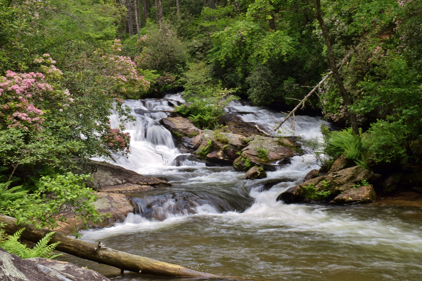
This is another very dangerous area; do not get close to the edge. Continue on the trail a short ways and a steep path down to the left leads to the base of the Third Waterfall. It's a huge waterfall and you can't really see the upper sections from the base.

Climb back up to Big Creek Trail and continue following it downstream. The trail gets really hard to follow in places. After about 0.3 miles from the third waterfall, listen for the sound of falling water and look for a path leading down to the base of the Second Waterfall on Big Creek.

From here, go back to the trail and continue downstream. Almost the entire trail is covered in downed trees and rhododendron and its very difficult to follow. But in about 0.1 miles it comes to a primitive campsite and connects with Three Forks Trail. Go left to head down to Three Forks, where Big Creek, Overflow Creek and Holcomb Creek come together.

The First Waterfall on Big Creek is just upstream of the confluence.
From here, rather than follow Big Creek Trail and backtrack, go left on Three Forks Trail. It climbs up a ridge and at both forks, go right. Eventually, it connects back up between the Third and Fourth Waterfalls. Go left to return to the trailhead.
Blog Entries:
24-May-2020: Big Creek Waterfall Hike
No comments:
Post a Comment