Sunday, we left Clear Lake and headed east to Decorah and parked by the Upper Iowa River to access Malanaphy Springs State Preserve. Early on a Sunday morning, there was only one other car here and we set off on the Malanaphy Springs Trail.

The trail was high on the bluff above Upper Iowa River. There were a number of cliffs and rock outcrops along the trail.

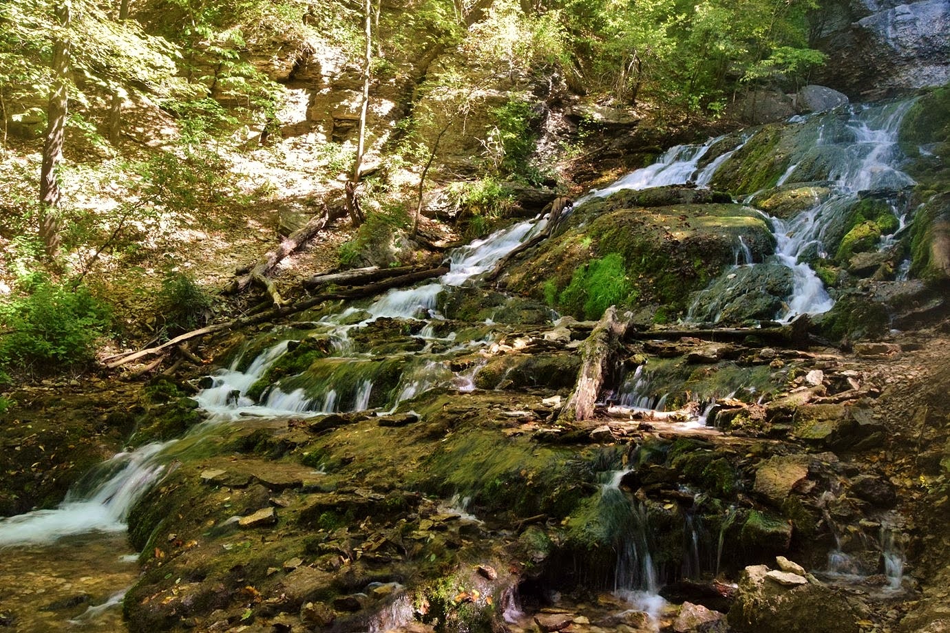
It was about a mile to the end of the trail near the top of Malanaphy Springs Waterfall.

Not much was visible from up here and since it dropped directly into the river, there was no easy way for a good view. I found a way to climb down river right side.

There was a small patch of land to stand on at the base of the falls.

I climbed around to see another stream of the waterfall that flows under the rocks.


The views of the river were really nice too.

Then I climbed back up and held Alex so Sandy could take a turn. When she climbed back up, we climbed a little further up to Malanaphy Springs, the source of the waterfall.


We got some pictures then climbed back down and headed back on the trail.


From here, we headed into Decorah to Dunning's Springs Park and Ice Cave. It was very crowded, but we found a place to park. It was just a short hike up a paved trail to Dunning's Spring Waterfall.

There were some nice cascades just above the waterfall.

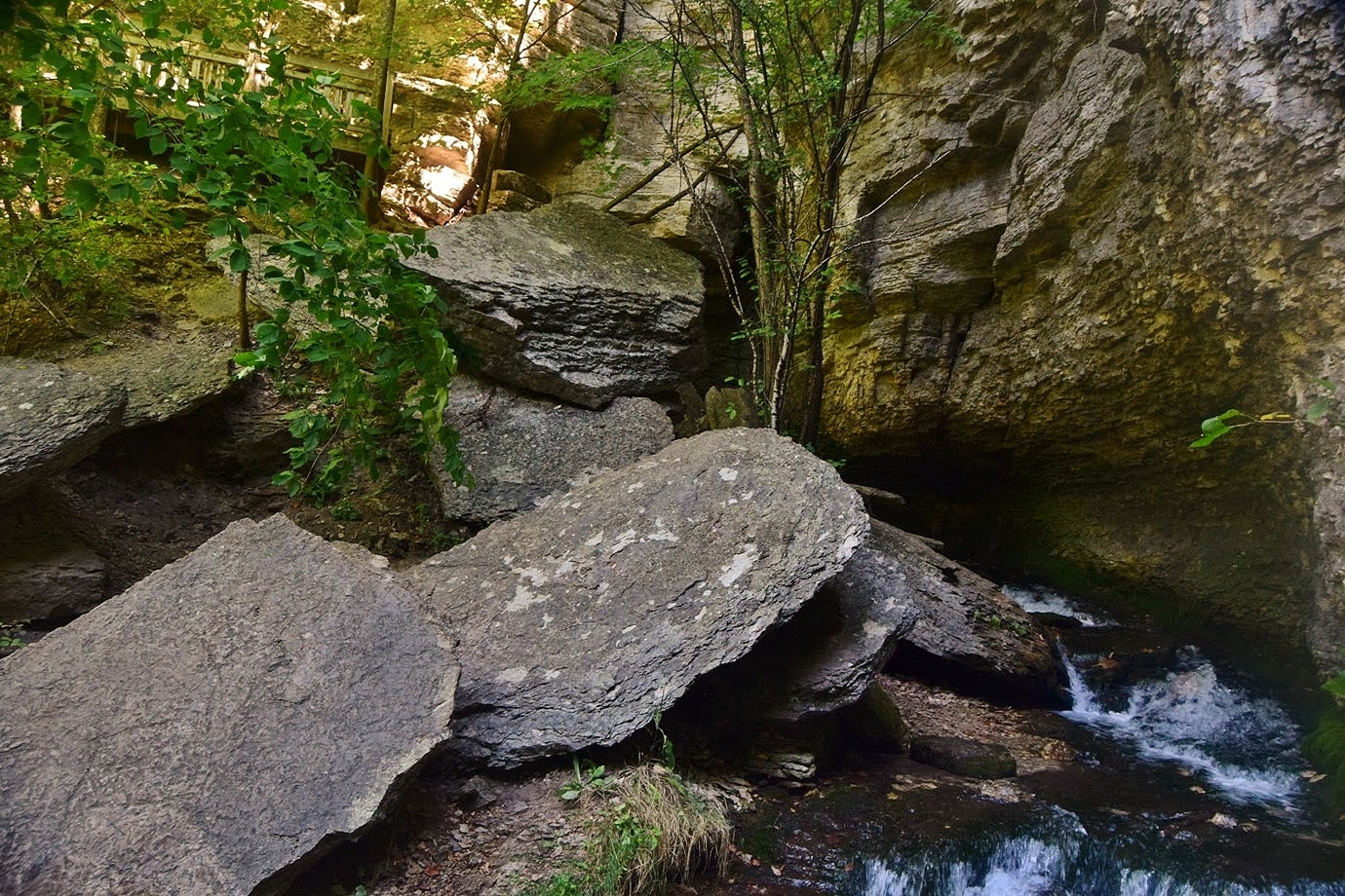
It was crowded so we didn't stay long. Next we hiked down Ice Cave Road that was closed to vehicles for under a mile to the Decorah Ice Cave State Preserve.

We hiked a short ways through the cave using a flash light. However, due to a partial collapse, we could only go 10 feet or so into the cave.


On the way out, I talked to a couple locals who said that 50 years ago, the cave went all the way to Dunning's Spring, but had since collapsed in. About 10 years ago, you could still go 30 to 50 feet in, but more recent collapses had very limited how far we could go in. On the way back, I stopped for a view of the Upper Iowa River.

Then we took off from Decorah.


We drove south to Pike's Peak State Park along the Mississippi River at the confluence with the Wisconsin River.


Then we got on Bridal Veil Trail and hiked down to Crow's Nest, another overlook with great views.


Bridal Veil Falls is a small waterfall on this tributary.

It's a small waterfall on a low-flow tributary but was scenic nonetheless.


Bridal Veil Trail ended at East Hickory Ridge Trail where we turned right.

There were some cool rocks at Hickory Ridge, but too much vegetation for any views.

On the hike back, we took West Hickory Ridge and Weeping Wall Trails to make a loop. I ran out to the Lower Overlook for one more view before we left the park.


Then we took off.


We drove back to MacGregor and had a late lunch at Latinos, then started making our way to Illinois. We stayed at the La Quinta Inn in Peru and some drinks and dessert at Jalapenos before retiring for the evening.
No comments:
Post a Comment