Saturday, Sandy and I took Alex for a social distancing hike along the Uwharrie Trail in Uwharrie National Forest. We left very early to arrive around sunrise. Passing the Pisgah Covered Bridge on the way, we made a quick stop.
It was still open and no one was there.
We got a few pictures of the bridge and then continued on to the Joe Moffitt Trailhead along King Mountain Road. First, we hiked up to Little Long Mountain. The open bald provides some of the best views in the Uwharrie Mountains.
No one was here yet, so we got some pictures and then headed back down. There were a lot of rocks along the trail.
Across the street, we picked up the trail to head up towards King Mountain. There were some birdsfoot violets blooming.
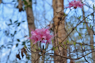
I also spotted some pinxster azaleas starting to bloom.
It was already warm and humid so the hike up was feeling strenuous. King Mountain is the highest point on the Uwharrie Trail at 1020 feet above sea level. Continuing on, the trail descended to a ridge and eventually came to a split, where left followed a yellow-blazed spur to Luther Parking. We stayed on the Uwharrie Trail and followed it to Eagles Field Road. It was really rocky as we approached the road.
This made a good turnaround point. We saw two groups on the hike back, the only other people we saw on this stretch of trail.


No comments:
Post a Comment