
I stopped at a couple overlooks for views of the fall foliage, before heading into the clouds where visibility dropped to zero. At lower elevations, I was below the clouds so still had good views. I stopped quickly at Tanbark Ridge Overlook with nice views of the clouds lingering in the valleys.

Then I stopped a couple miles ahead at View Lane Pinnacle.

After leaving here, I drove into the clouds and there were no more views to see. I stopped at the Glassmine Falls overlook, but I couldn’t see a thing. So I continued on to Mount Mitchell State Park.

Driving up NC-128, I finally broke through the clouds and got some clear skies. Ironically, the clouds were hovering at about the elevation that deciduous trees reach, so only evergreen trees were visible – no fall foliage. I parked up at the top and made a quick hike up the tower at the summit of Mount Mitchell.

Way up here, the skies were clear. All around were low-lying clouds blocking out views of the land, except for where the Black Mountains poked up through.

I thought that they looked like islands emerging from a sea of clouds. I got some pictures and then headed back down to the parking lot and started hiking the Deep Gap Trail, which becomes the Black Mountain Crest Trail when it leaves the park and heads into Pisgah National Forest.

This trail follows the crest of the Black Mountains for about 10 miles; I was only going to hike for an hour or so, however. The trail initially descends fairly steeply heading down to the saddle between Mount Mitchell and Mount Craig and then starts heading back up. The rocky summit of Mount Craig is marked as an environmentally-sensitive area and so hikers are asked to stay on the trail through this section.

I was still able to get a nice view looking back towards Mount Mitchell as well as looking ahead along the ridge line.

Then I started to descend again. Shortly, I had to go back up to get to the summit of Big Tom, the next Black Mountain peak. There was a plaque at the summit, but no good views due to all the spruce and fir trees. From here, the trail started to get more difficult. The descent from the summit of Big Tom was quite steep and rocky and those rocks were wet from all the rain we had gotten. There were some ropes at various points to assist in descending through the most difficult portions.

There was another saddle area and then I started heading up to the summit of Balsam Cone. There was no plaque here and I was unable to find a survey marker, though I was sure I made it to the summit. From here, I decided to turn back. Upon reaching the saddle between Big Tom and Balsam Cone, I turned left to get on Big Tom Gap Trail (#191A). This extremely steep trail headed down and terminated at Buncombe Horse Range Trail (#191). At this point, I turned right and followed the trail along the flank of the Black Mountains. Initially, the visibility was pretty good but I hiked through a couple sections where the clouds rolled in and visibility was poor. The trail was very wet and swampy and I got pretty muddy hiking this trail. There were a couple of points where small waterfalls were tumbling down from the high peaks above.

I imagine that these only exist after periods of heavy rain. In about 3 miles, I met up with the Mount Mitchell Trail (#190). I turned right here and made the steep climb back up to the summit of Mount Mitchell, gaining over 1000 more feet before making it back to the summit. Near the top, I turned right on Balsam Nature Trail and took that back to the parking area. Although I was just one of only a few cars in the parking lot when I arrived, it was now nearly full. Before I left, I headed back up to the tower at the summit for views after the clouds had broken.

What a difference a couple hours makes. Far to the north, I could see Grandfather Mountain rising above the other peaks.

From here, I departed and headed back down the mountain. At the base, I turned right on Blue Ridge Parkway and headed back to Glassmine Falls Overlook, hoping the clouds had cleared.

And sure enough, they had. Glassmine Falls is probably the highest waterfall in North Carolina, 800 feet according to the sign at the overlook, but it usually doesn’t have much flow, especially in the fall. Today, after all the rains, it was looking pretty good.

And with the beautiful fall foliage, it was quite a sight. After a couple of pictures, I headed north on the Blue Ridge Parkway, stopping at a couple more scenic overlook on the way. First, I stopped at Ridge Junction Overlook near the turn for NC-128 with nice views of Potato Knob.

The next stop was at Green Knob Overlook.

Then, I stopped at Laurel Knob Overlook.

Finally, one more stop at Hewat Overlook.
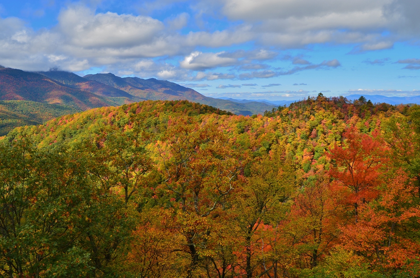
From here, I could see the Black Mountains across a valley, though the summits were shrouded in clouds. The fall color here was just fantastic.

Continuing on, I turned on NC-80 and headed down the mountain towards Marion. I went north on US-221 and turned on Huskins Branch Road for one more waterfall. It’s less than half a mile to Toms Creek Falls, a scenic 60-foot waterfall. They must not have gotten as much rain down here as the waterfall was not flowing as much as I expected.

But it was still pretty. The old mica mine that used to be next to the falls appears to have caved in and the Forest Service has placed signs warning people of the danger. The area was pretty crowded so after a couple pictures, I headed back and made my way home.
No comments:
Post a Comment