For the first week of March, I headed to the Gulf Coast region. Sounds a bit crazy, but I was going there to find some waterfalls! I flew out of RDU on Saturday to New Orleans. After getting my rental car, I drove north to Natchez, Mississippi and stayed at the Hampton Inn. Sunday morning, I headed back into Louisiana to JC Sonny Gilbert Wildlife Management Area. Formerly known as Sicily Island Hills WMA, this unique area is an oasis of hills in a desert of flat. I took US-425 across the river and into Louisiana to Sicily Island and then followed LA-8 past Leland. The terrain along the drive could not have been flatter and it seemed remarkable that I would soon be hiking steep hills to waterfalls. The turn was hard to spot and I initially passed it and had to make a U-turn. Fortunately, there's not much traffic around here. On the second pass, I spotted the sign and turned onto a gravel road. Immediately, there was a fork and I went left where right went to a flea market. The road was quite steep but easy to drive. I stopped at the check station to fill out a self-clearing permit and went about another mile to the Rock Falls Trailhead. A kiosk and shelter make the trailhead easy to spot. From here, I started hiking the red-blazed trail. It headed steeply down to the rim of a small ravine and soon I could hear the waterfall and spotted it from the trail. I scrambled down into the ravine to get some pictures of this small but scenic waterfall.

At 17 feet, it's the highest in Louisiana.

The watershed for this little tributary is very small and I imagine it completely dries up at times.

But it was flowing pretty good today and I knocked another state off the 50 States Waterfall Challenge.

I finished up the surprisingly steep trail back at the road and headed back to the car. From here, I backtracked to LA-8 and turned left on LA-913 and then again on LA-915. The turn for the northern entrance was easier to spot and I headed back into the WMA. In about 2 miles was the trailhead for St. Mary's Falls. This green-blazed trail is another loop of about a mile. Almost immediately, there was a split and I went right. The trail headed steeply down and came to another small ravine with two tributaries.

St. Mary's Falls was visible directly across, so I climbed down to get some shots.
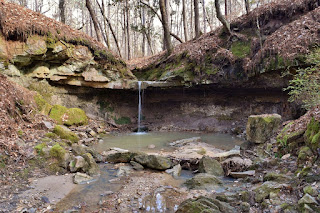
St. Mary's Falls drops about 10 feet and there was a small grotto behind the falls.

I climbed around to get behind the waterfall.

After a couple pictures, I noticed the other tributary that flows into Sandy Bayou also has a small unnamed waterfall just upstream.

It's about a 5-foot cascade over a rock face and had a big pool in front of it. Continuing on the trail, it followed Sandy Bayou downstream. Despite the name, the creek was very rocky with some nice cascades and didn't seem like a "bayou" to me.

Then the trail departs the creek and heads back up to finish the loop. Although well-blazed, there wasn't much of a trail and it was more like a bushwhack. Back at the car, I drove about another half-mile down the road to the trailhead for Big Creek Trail. This is the longest hiking trail in the WMA - a 7 mile loop. The trail split shortly and I went to the left. For less than a mile, the trail follows an old road then heads into the woods. The remainder of the trail, if you can call it that, was mostly a bushwhack, but with plentiful blazes, it was easy to follow.

But it was quite steep in places, really surprising for Louisiana. Initially, it was a lot of downhill, but that means plenty of uphill at the end. And there were numerous creek crossings, though most were very easy. Being early March, the wildflowers were not at their peak, but I did see a lot of little violas.

I also saw some pretty yellow wildflowers, some type of ragwort, but I think it's still too early for them to really pop. Eventually, I got to a swampy area at one of the main tributaries to Big Creek.

Following this downstream, the trail leveled off and soon I was following Big Creek.

There were a couple of really scenic cascades along Big Creek and I stopped at one for lunch.

The trail followed Big Creek for a couple of miles and then follows another major tributary of the creek upstream. Heading downstream, the floodplain along big creek got more and more swampy.

At one point, the blazes were along submerged trees but I was able to bushwhack along the side and stay dry.

Then I came to a crossing of the tributary where there was no getting across dry. So I took off my boots and started to wade, but realized it would be at least waist deep so turned back. I was way over half-way through the loop and didn't want to turn around. So I bushwhacked up a steep bluff and was able to get around the crossing - should have tried that first! A little further was another real nice cascade along this tributary and I stopped for some pictures here.

Continuing to follow the tributary upstream, the little creek soon petered out and then trail then started to get really steep heading back up to the start.

Back at the car, I started making my way back towards Natchez. It was still relatively early, so near Ferriday, I stopped at Bayou Cocodrie National Wildlife Refuge. Being Sunday, the headquarters were closed, so I hiked the short trail to the Cypress Creek Boardwalk. This trail was a lot flatter and more like I would expect in Louisiana.

The trail runs through an interesting forest of palmetto along the hike to the boardwalk. The boardwalk leads out to a viewpoint of Bayou Cocodrie.

The observation deck itself was built around a huge cypress tree and it seemed like a good place to take a rest beneath this ancient giant.

After a couple pictures, I headed back. I believe there are more trails in the refuge, but it's kind of confusing and the visitor center was closed, so I just headed back to Natchez. Plus I was getting hungry so stopped for fast food in Vidalia.

After dropping my stuff back at the hotel, I took a walk through Natchez. There are a number of beautiful old historic homes in town.

It was too late for a tour of Rosalie Mansion, so I followed the winding road down to the river then took Silver Street up. I walked along the Nature Trail below the bluff down to the casino and then the Bluff Trail above to the Natchez Gazebo.

Heading back, I stopped at Under the Hill Saloon for a beer and sat outside to watch the sunset.
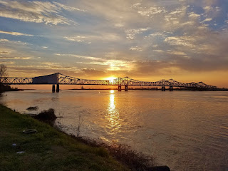
It was a really beautiful one over the river and the bridge. After finishing my drink, I headed back to the hotel.

At 17 feet, it's the highest in Louisiana.

The watershed for this little tributary is very small and I imagine it completely dries up at times.

But it was flowing pretty good today and I knocked another state off the 50 States Waterfall Challenge.

I finished up the surprisingly steep trail back at the road and headed back to the car. From here, I backtracked to LA-8 and turned left on LA-913 and then again on LA-915. The turn for the northern entrance was easier to spot and I headed back into the WMA. In about 2 miles was the trailhead for St. Mary's Falls. This green-blazed trail is another loop of about a mile. Almost immediately, there was a split and I went right. The trail headed steeply down and came to another small ravine with two tributaries.

St. Mary's Falls was visible directly across, so I climbed down to get some shots.

St. Mary's Falls drops about 10 feet and there was a small grotto behind the falls.

I climbed around to get behind the waterfall.

After a couple pictures, I noticed the other tributary that flows into Sandy Bayou also has a small unnamed waterfall just upstream.

It's about a 5-foot cascade over a rock face and had a big pool in front of it. Continuing on the trail, it followed Sandy Bayou downstream. Despite the name, the creek was very rocky with some nice cascades and didn't seem like a "bayou" to me.

Then the trail departs the creek and heads back up to finish the loop. Although well-blazed, there wasn't much of a trail and it was more like a bushwhack. Back at the car, I drove about another half-mile down the road to the trailhead for Big Creek Trail. This is the longest hiking trail in the WMA - a 7 mile loop. The trail split shortly and I went to the left. For less than a mile, the trail follows an old road then heads into the woods. The remainder of the trail, if you can call it that, was mostly a bushwhack, but with plentiful blazes, it was easy to follow.

But it was quite steep in places, really surprising for Louisiana. Initially, it was a lot of downhill, but that means plenty of uphill at the end. And there were numerous creek crossings, though most were very easy. Being early March, the wildflowers were not at their peak, but I did see a lot of little violas.

I also saw some pretty yellow wildflowers, some type of ragwort, but I think it's still too early for them to really pop. Eventually, I got to a swampy area at one of the main tributaries to Big Creek.

Following this downstream, the trail leveled off and soon I was following Big Creek.

There were a couple of really scenic cascades along Big Creek and I stopped at one for lunch.

The trail followed Big Creek for a couple of miles and then follows another major tributary of the creek upstream. Heading downstream, the floodplain along big creek got more and more swampy.

At one point, the blazes were along submerged trees but I was able to bushwhack along the side and stay dry.

Then I came to a crossing of the tributary where there was no getting across dry. So I took off my boots and started to wade, but realized it would be at least waist deep so turned back. I was way over half-way through the loop and didn't want to turn around. So I bushwhacked up a steep bluff and was able to get around the crossing - should have tried that first! A little further was another real nice cascade along this tributary and I stopped for some pictures here.

Continuing to follow the tributary upstream, the little creek soon petered out and then trail then started to get really steep heading back up to the start.

Back at the car, I started making my way back towards Natchez. It was still relatively early, so near Ferriday, I stopped at Bayou Cocodrie National Wildlife Refuge. Being Sunday, the headquarters were closed, so I hiked the short trail to the Cypress Creek Boardwalk. This trail was a lot flatter and more like I would expect in Louisiana.

The trail runs through an interesting forest of palmetto along the hike to the boardwalk. The boardwalk leads out to a viewpoint of Bayou Cocodrie.

The observation deck itself was built around a huge cypress tree and it seemed like a good place to take a rest beneath this ancient giant.

After a couple pictures, I headed back. I believe there are more trails in the refuge, but it's kind of confusing and the visitor center was closed, so I just headed back to Natchez. Plus I was getting hungry so stopped for fast food in Vidalia.

After dropping my stuff back at the hotel, I took a walk through Natchez. There are a number of beautiful old historic homes in town.

It was too late for a tour of Rosalie Mansion, so I followed the winding road down to the river then took Silver Street up. I walked along the Nature Trail below the bluff down to the casino and then the Bluff Trail above to the Natchez Gazebo.

Heading back, I stopped at Under the Hill Saloon for a beer and sat outside to watch the sunset.

It was a really beautiful one over the river and the bridge. After finishing my drink, I headed back to the hotel.