Saturday, February 10, 2018

Goldsboro Hikes

Saturday, Sandy and I took Alex for a couple hikes out near Goldsboro.  Sandy had to work in the evening so we left early, arriving at Cliffs of the Neuse State Park around 830.  It rained a bit on the drive down and was raining lightly when we started hiking, but fizzled out after twenty minutes or so.  After getting our stuff together, we swung by the overlook of the Neuse River, way down below at the base of the cliffs 90 feet below.


With the rain and warmer temperatures, the river was really steamy.  We started hiking the 350 Yard Trail along the rim of the cliffs.  I found one spot to go out with a view of the cliffs themselves.
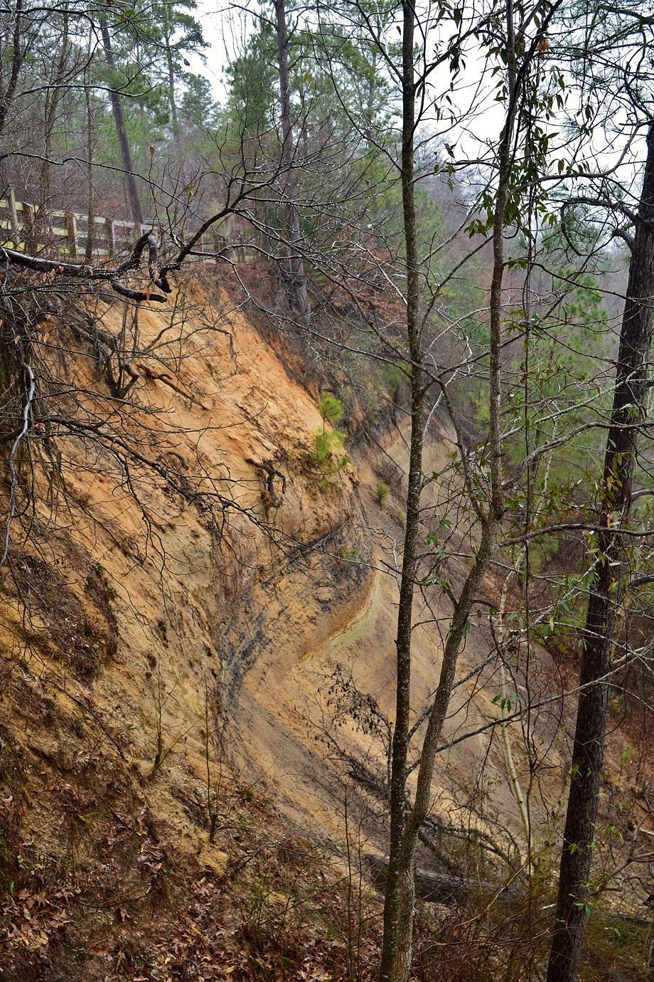

Other than that, I think the only way to actually see the cliffs is from a boat on the river.  The trail then headed down to river level and I went out to a fishing spot.


The rain had picked up a bit and I couldn't see much on the river.  This is the the point where Mill Creek and Still Creek flow into Neuse River and there was a Cypress swamp here.


Finishing up this trail, we turned left and took Bird Trail.  At the split, there was a scenic little cascade on Still Creek.


This trail makes a half-mile loop around the creek.  Next we hiked Galax Trail, another half-mile loop and passed another Cypress swamp.


After finishing up this loop, we tried to get on the Lake Trail.  The park map shows a connector between Galax and Lake Trails, but not sure if we actually found it.  It's a short ways and we just bushwhacked down to the lake spillway and picked up the Lake Trail along the shore.  I first crossed the spillway on stepping stones and got some pictures of the lake.


With some fog, it was really beautiful.  Then we headed the other way towards the visitor center.  I spotted some interesting orange mushrooms along the trail.


And for the first time today, we actually saw other people out on the trail as we approached the visitor center.  Next, we crossed the street and took Longleaf Trail to the end and turned right on the Sand Path to the Group Camping site.  Then we made a loop around Spanish Moss Trail.


It's a short loop but rather steep as it goes up a cliff and then loops back around along the floodplain.  I followed a path out to the river.  It was very muddy but the foggy views of the river were great.


There were more cypress trees here - they were such a contrast with the steep terrain just feet away.


I thought that this contrast really made Cliffs of the Neuse a unique and interesting state park.  We finished back up at the parking and I stopped for one more picture from the overlook as the fog had cleared a bit.


Then we took off.


On the way out, we stopped at the visitor center.  Alex has been having so much fun hiking at state parks, I picked him up a NC Passport!


Then we headed back towards Goldsboro and went to Old Waynesborough Park.  This used to be a state park, but is now managed by the Old Waynesborough Commission.  Waynesborough was the original Wayne County seat.  With the advent of railroad, Goldsboro grew and many homes and businesses relocated.  The last of Waynesborough was destroyed by Union troops during the civil war.  We parked at the trailhead parking and started out on the Orange/Yellow/Blue Trail, hiking through some fields to Cogdell Cemetery.


It's a really pretty old cemetery and the only thing remaining of the original Waynesborough.


Continuing on the trail, we went all the way out on the Orange Loop to an overlook at Little River near the confluence with Neuse River.


Looping back around, we followed along the river most of the way back.


We could see and definitely hear, people riding ATVs across the river.  We also passed by another small cypress swamp before getting back to the cemetery.


Without the steep cliffs, this one seemed a little more expected.  Then we went out to the floating dock with nice views of a bend in the Neuse River.


We finished up the Red Loop and then took the combined trail to the Historical Village to see some of the old buildings.  Right in the woods was an old hay barn.


Then the trail opened up a bit more and there were several more buildings.
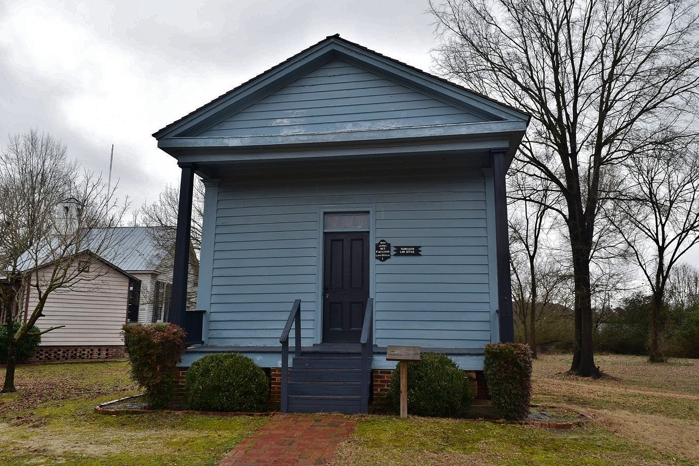

They're not from the original Wayneborough, but from throughout Wayne County.
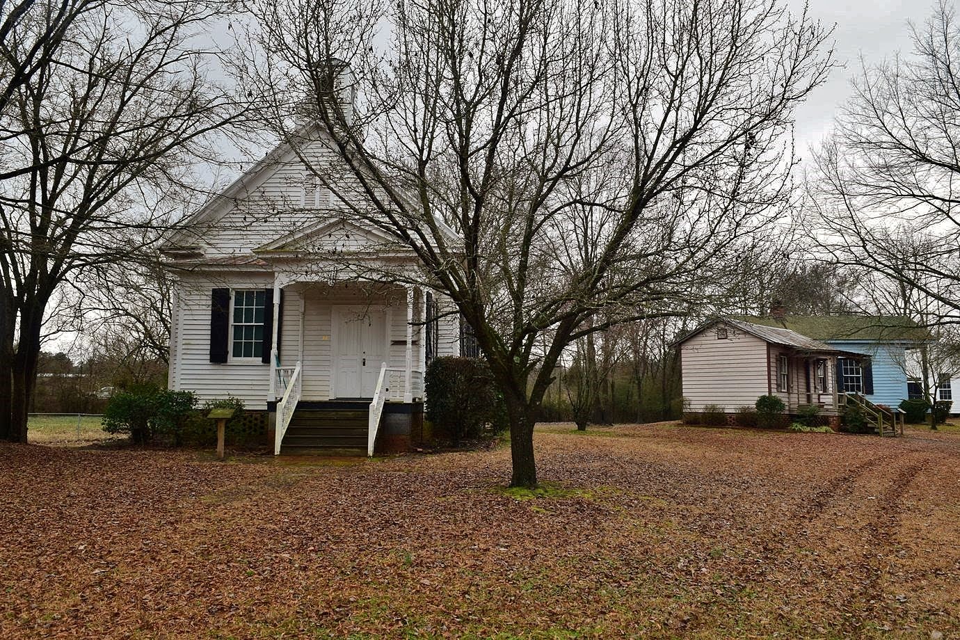

There were a couple of one-room schools, a law office, a general store, a doctor's office and several homes.


It was a cool little village to walk through.


After some pictures of the old buildings, we headed back to the car.


We stopped at Cook Out before leaving Goldsboro to get lunch and a hot dog for Alex and then made the drive home.

Sunday, January 7, 2018

Frozen Falls Lake

Sunday, I was continuing my hikes along the Falls Lake Trail.  This week was Section 14 from Rolling View to Little Lick Creek.  It was very cold when we started just after 9 from the trailhead parking just before the entrance to Rolling View Recreation Area, part of Falls Lake State Recreation Area, on Baptist Road.  We followed the blue-blazed spur trail to the MST and then headed westbound.  With the leaves down, we soon had views of the lake from the trail and it was frozen.  After a mile or so, the trail passed next to a small beach on the lake so we headed down to check it out.  And sure enough, the lake was frozen, pretty much solid.


I wouldn't have walked on it, but it looked thoroughly frozen.  George tossed a rock out on the lake and it made a weird echoing sound.  Further along the trail, we passed by a pasture where some horses were grazing.


They were wearing jackets too!  This section of the trail ends at Little Lick Creek where a bridge crosses the creek.  Past the bridge, an elevated boardwalk crosses a normally wet area.


The water level at Falls Lake is so low, this is all dry ground.  We took a quick break and turned around here.  Across the bridge, I went out on the normally submerged area to get a couple pictures of the bridge.


Heading back a little ways, I took an old road down to lake level to get a couple more pictures of the frozen Falls Lake.


I've been hiking here for years and this is the first time I've ever seen it freeze like this.


Saturday, January 6, 2018

Snow at Eno River

After the snow this week, most was gone near where I live in North Raleigh.  So on Saturday morning, I took Alex for a hike at Eno River State Park, hoping to see more snow.  We were not disappointed as there was a lot of snow on the trails and river.  We started at the Fews Ford section on Cox Mountain Trail, crossing Eno River on the suspension bridge.  At the split, we turned left to head up the mountain.


The trail has been rerouted in the last year or so.  Before, it was quite steep and headed straight up, but the slope had been reduced by adding switchbacks.  After passing near the summit, the trail heads back down and follows the river downstream.  Although not completely solid, the Eno was pretty well frozen.


I wouldn't have walked on it though.  We continued on the trail and at the next split, went left to follow Fanny's Ford Trail.  This trail passes the campsites and follows the river more closely.  We climbed out on the rocks at one spot to get some pictures of the rocks in the water.


Crossing back over the suspension bridge, we hiked north to Buckquarter Creek Trail and followed that loop.  On the way back, just before climbing some steps at the end of the loop, there was a cascade on the river.


It was flowing pretty well, but all covered in ice and just beautiful.  Almost back at the parking lot, we did a short loop around Eno Trace Trail to see the icy river one more time.


Alex really enjoyed getting to hike in the snow.


He's a husky, but living in North Carolina, he doesn't get to see snow much.


Saturday, December 23, 2017

Redwood Road Detour

Saturday, we took Alex for a hike at Falls Lake Trail.  Last year on my Falls Lake hike, a sinkhole had formed in Redwood Road.


It was closed to traffic, but we could hike it to connect sections 17 and 18.  Since then, the road has been completely removed and there is no way to cross, on foot or otherwise.  Initially, there was a 7 mile road walk to detour around for the Mountains-to-Sea Trail.  Now, there is a 2-mile trail hike for a detour, so we went out to check it out.  We parked on Hereford Road at the east trailhead for section 17.  This section is a little over a mile and we came out at Redwood Road.  To the right, the road was barricaded, but a blue-blazed trail picked up across the street.  The trail was very well blazed and easy to follow heading upstream on Panther Creek.  About a mile up at the creek crossing, there was no reasonable way across.


So we bushwhacked upstream to just past an island in the creek and found an easy to cross and stay dry.  Continuing through the woods a short ways, we came to an old abandoned railway and turned right.  This old railway went all the way to Redwood Road on the other side of the gap.


Part of the way down, was the remains of an old bridge - much safer to just go around this one.


As we got to Redwood Road, I went out to the lake, since the water was so low to get a picture of Redwood Road.


We continued on sections 18 and 19 and went as far as the tunnel under I-85 before turning around.


Friday, December 22, 2017

Lower Haw River Hike

I had Friday off for the holiday weekend, so Sandy and I took Alex to Lower Haw River State Natural Area for a hike.  We took US-64 west past Jordan Lake and once across Haw River, made a U-turn, crossing the river again in the eastbound direction.  A small pull-off was on the right immediately back across the river.  We parked here and followed a trail down towards the river and under the highway.  There's no official trail, but the "social" trail was very easy to follow the river upstream.  The Haw is very rocky and the water level was low so there were a number of spots to head out into the river for a picture.


Soon we came to the first of three tributary crossings.  The water level was low, but the banks were steep so we had to go upstream a little ways to find a way across.  There were a lot of downed tree over the trail, which I would have expected given the trail is not maintained.  But there's another reason there are so many trees down - beavers.


The beavers had clearly been busy taking down trees along the river here.  A little further up, we came to a real scenic cascades in the river next to an island.


Continuing north, we reached the last creek crossing at Pokeberry Creek.  Unlike the previous ones, this creek had a good amount of water.


We followed the path upstream a ways to where we could get down to creek level and rock hop across.  From here it was only another mile or so to the north trailhead in Bynum.  When we got here, we continued a little further to the Old Bynum Bridge.  In the past, cars could drive over, but the barricaded it so only pedestrians can cross now.  We went out on the bridge to where we could see the US-15/US-501 bridge over the Haw River.


A little further back, there was a nice view of the river where the road was not visible.


We had a snack and then started making our way back.


All three of us had worked up an appetite by the time we got back, so we stopped at Grill and Go and got lunch, including a hot dog for Alex.