Saturday, April 2, 2016

Hampton Area Waterfalls

The first week of April, Sandy and I headed to Tennessee for a week of waterfalls in the Cumberland Plateau region. We left before 6 on Saturday morning and headed west. In Winston-Salem, we took US-421 north through Boone. After turning on US-321 past Boone, we made our first stop for a couple quick waterfalls in North Carolina before crossing the state line. Our first stop was Laurel Creek Falls, also called Trash Can Falls. We parked along US-321 near where Laurel Creek drains into Watauga River, crossed the street and followed a short path up along Laurel Creek. Laurel Creek Falls is a 15-foot waterfall in two streams over some large boulders.


There’s a nice swim hole at the base and then a series of cascades and slides leading back down to the road. I got some pictures of the main drop and then scrambled down to see the lower part. It's a nice waterfall, despite the nickname.


Then we backtracked to the car and drove less than a quarter-mile further up US-321 to another pull out. A very steep scramble path led down from the road to the Watauga River. Watauga Falls is here, but it’s a stretch calling it a waterfall – more of a rapid.


But it was marked on the topo map and we were right here, so we made a quick stop. After this, we returned to the car and headed into Tennessee. A few miles past the state line, we turned left on Poga Road and went three miles or so. We made a right turn on Clawson Road and then right on Dark Ridge Road and drove a short ways to a parking area on the left after it turned to gravel. Our next waterfall was Twisting Falls, also called Compression Falls, on Elk River. Once we got our stuff together, we started hiking down the path to the powerlines and then the very steep hike down to the river. I got almost all the way to the bottom and realized I forgot my camera, so ran back up to get it. It was quite a strenuous trip back up. After retrieving the camera, I headed back down and followed Elk River a short ways upstream to the waterfall.


From here, we could only see the lowest 30-foot drop of the waterfall as well as a second stream flowing down in parallel. The river level was way up and everything was soaked from spray. I got as close as possible to get a picture of the falls, but could only see the main drop. So I headed back a ways to get a picture of both streams.


Then I went a little further back to get a shot of the falls from a distance with the river in the foreground.


Overall, this is a very nice waterfall and extremely popular swim hole in the summer. Then, we had to make the steep climb up, a second time for me. Back at the car, we continued back to US-321 and continued towards Hampton. We pulled off at the parking area long US-321 at the trailhead for Laurel Fork Falls. We got our stuff together and started hiking down the blue-blazed Hampton Blueline/Laurel Falls Trail (#501). The trail headed up to a ridgeline and followed Laurel Fork upstream, soon entering the Pond Mountain Wilderness. Shortly, we went right at the fork to follow the low-water route and hike along the creek through a beautiful gorge area. High rocky cliffs rose along the bubbling creek.


About a mile into the hike, we came to the Appalachian Trail (#1) and followed this southbound by bearing right at the fork. There were a few sections with some elevation gain, but overall a pretty easy section of trail. As we approached the waterfall, we had to scramble over some rocks through another beautiful gorge section and then made it to the base of the Laurel Fork Falls.


This is a beautiful 60-foot waterfall that is nearly as wide as it is tall. We took a break down here and had a snack, enjoying the view of the waterfall. I got some pictures from different angles and then we started making our way back.


The hike back along the AT and Blueline Trail was just as scenic on the way out as it was on the way in.


I think there's a shorter way to get to the waterfall coming the other way on the AT, but this was such a nice hike, there was no reason to shorten it. We drove just a short ways further on US-321 and then turned onto Dennis Cove Road. This road is paved, but very steep and windy. It was about 4.5 miles to the pull-off for Coon Den Falls. The parking spot is very small – only big enough for one car, and we initially passed it and had to turn around. Only a metal stake indicated the trail started here. It’s only a half-mile to the waterfall, but it’s uphill the entire way, gaining over 400 vertical feet. We followed the trail up along Coon Den Branch to the waterfall for a couple pictures.


It’s a fairly tall waterfall, with the water sliding down through a narrow crack in the rock. There was too much vegetation in the way to get a good picture though.
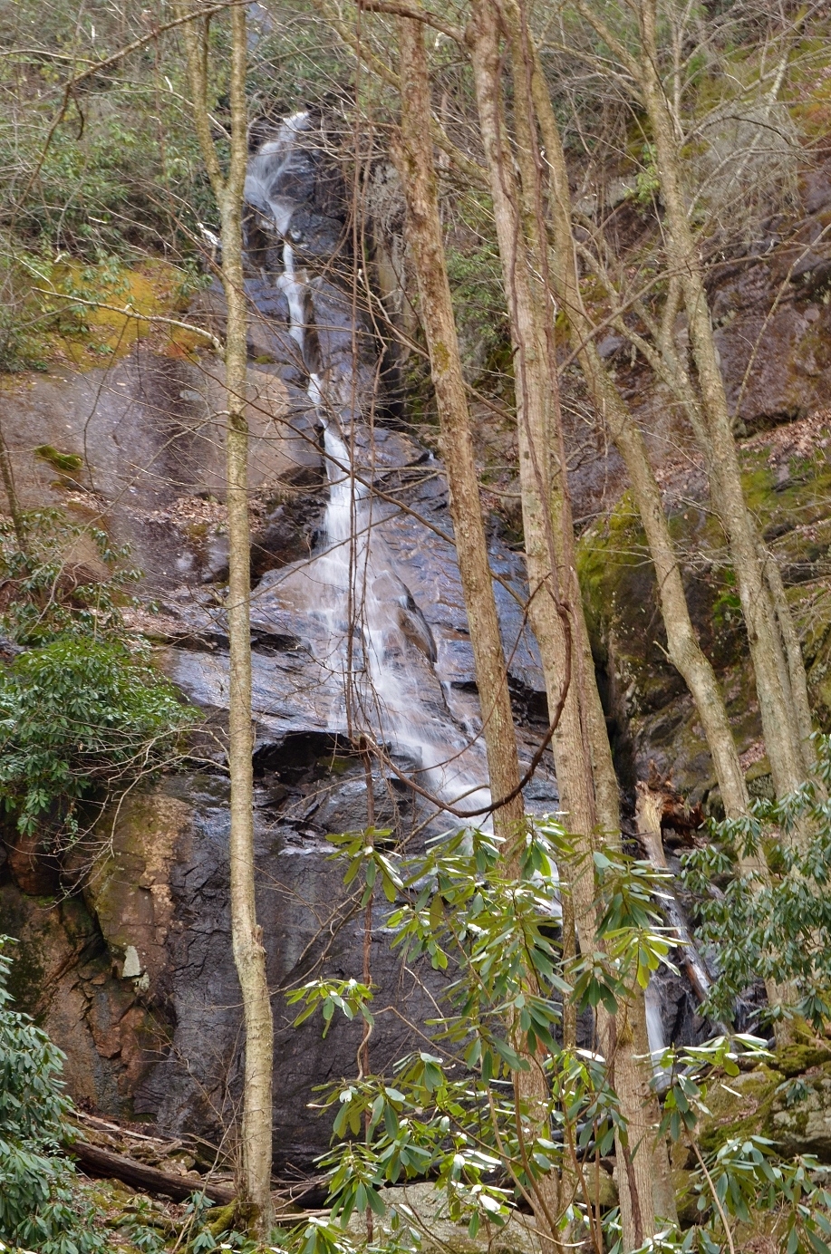

So we headed back down to the car and drove about a quarter-mile further to park outside the closed Dennis Cove Campground. We were going to hike to Dennis Cove Falls, which is about a mile up Laurel Fork Trail from here. There are a couple fords on the way to the waterfall, so we hiked in water shoes. In about a half-mile, we came to the first crossing. There was a cable strung across, but the water was so deep and fast-moving, it didn’t look safe. We decided to turn around and give up. From here, we drove into Johnson City and had dinner at Firehouse Restaurant. They had some pretty good barbeque. Then we checked into our hotel for the evening – the Red Roof Inn. It was a cheap option since we were only staying one night before heading further into Tennessee.

Sunday, March 27, 2016

Nellie's Falls

Sunday morning, it was lightly raining when we woke up. Sandy and I quickly packed up all our gear and ate breakfast in the car to stay dry. The others from our group were going into Brevard for breakfast, but we had already eaten, so we decided to go get one more waterfall before leaving the area - Nellie's Falls, also called Hidden Falls, a relatively unknown waterfall on Flat Creek upstream from where we had camped. We waded across Flat Creek and turned left almost immediately on an old logging road that headed gradually up. This turn was before the big campsite on the way to Flat Creek Falls. In about a half-mile, we turned left and followed the path closest to the creek. There was another path that led down to the creek and crossed, but we continued straight. At one point, a huge tree had fallen over the path and we had to bushwhack to get around, though it was not too difficult. Finally after about a mile, the trail mostly ended and we saw some marking tape indicating a path heading down to the creek towards the base of the waterfall.


There was a small cascade we couldn’t really see from this side of the creek and the main waterfall was just upstream. We waded across the creek just below this cascade and then headed around a big rock to the base of Nellie’s Falls.


It was bigger than I expected and quite scenic. I got some pictures from different angles and then we started heading back.


Two more creek crossings on Flat Creek and we were back to the car. Everyone else had departed by this time - ours was the only car left. From here, we got back on paved roads. We took NC-281 to US-64 and drove into Brevard and met everybody at the Hub, a new outdoors store near the entrance to Pisgah Forest. We hung out with our friends for a while and then started heading back home. Sandy and I stopped at Las Salsas in Morganton for a big fajita dinner on the way.

Saturday, March 26, 2016

Crash and Burn

This past weekend, we headed out to the mountains of Nantahala National Forest for a weekend of waterfalls. Sandy and I left after work on Friday, making it to Brevard around sunset. We continued west on US-64 to Lake Toxaway and then took NC-281 north to Rock Bridge Road. It was interesting driving on this gravel road in the dark, but fortunately there was no other traffic. In about 2 miles, we went right on FSR 4662 and followed to the end. A few from our group were already here at the nice campsites along Flat Creek. We set up our tent and socialized around the campfire for a little while before going to bed. In the morning, we started getting ready for our hike. Some people were rappelling and I was going to try to fly the drone to get a video of the descent. The drone case was too big to fit in my backpack, so I had to strap it to the outside, which was a little awkward to carry. After everybody was ready, we crossed Flat Creek to the primitive campsite on the other side of the creek and followed the path towards the waterfall. The trail is a bit overgrown, which made the hike much more difficult carrying a drone on my back. After about a mile or so, we came to the old road and went right. Sandy volunteered to carry the drone for a while. We went about a mile and turned left on a faint path that led to the top of Flat Creek Falls.


Here Casey and Mike set up the ropes for those who were going to rappel to the base. Those that weren’t rappelling headed to the base via hiking. We went back to the old logging road and continued a short ways to right about where the trail leaves National Forest property. From here, we followed a faint path to the right for a few hundred feet and then got off the trail and bushwhacked down to Flat Creek. There was absolutely no trail and it was incredibly steep. Especially carrying the drone, it was slow-going and difficult. We did spot a little garter snake at one point, well camouflaged against the dead leaves.


Eventually, we made it down to a path that follows Flat Creek upstream to the waterfall. We had one wet crossing of Flat Creek and came out at the base of this spectacular waterfall.


This is probably my favorite one in North Carolina and that’s saying a lot.


After a couple pictures, I got the drone out and ready to fly. Almost immediately after taking off, a gust of wind blew the drone into a tree and it crashed! Fortunately, it wasn’t very high up and landed on dry ground. One of the propellers broke, but other than that, no serious damage from the crash. It could have been a lot worse. But I was disappointed not to get any aerial video of the waterfall and rappelling. And carrying that heavy drone all this way was for nothing! I got a couple more pictures and then Sandy and I packed up the drone and decided to start heading back.


The bushwhack straight up the mountain was brutal and took nearly an hour. When we got to the top, Sandy was kind enough to carry the drone for a ways. At the turn to get off the logging road, I took it back and carried it the rest of the way back to camp. We were the first ones back to camp, so we ate dinner and then built the bonfire. The rest of our group started arriving after dark. Everyone made it out safely with only a few minor injuries. I was so tired after carrying the drone, I fell asleep shortly after everyone got back.

Saturday, March 19, 2016

Summits & Waterfalls in Hanging Rock

This past weekend, we headed out to Hanging Rock State Park for an early spring hike. March had been unseasonably warm up until this point, but the weather took a turn this weekend and it was very cold. Highs reaching less than 40°F, wind, and a light rain made for a very chilly hike. We left Chapel Hill around 7, arriving at the park just before 9. After getting ready, we started out on the Indian Creek Trail, following its namesake creek downstream past the picnic area. It was less than half a mile to our first waterfall of the day. Hidden Falls is a small 10-foot tiered falls just off the trail.


Normally, this one isn’t too exciting, but with the rain and higher water level today, it was quite scenic. After a couple pictures, we continued on another quarter-mile to Window Falls. We first stopped to see the peculiar hole in the side of the cliff just above the waterfall – the “window” for which the falls is named. Then we headed down to the base of the waterfall.


The water flows over a cliff with a small grotto behind. It’s possible to climb back behind the falls for a picture behind the veil of water; it’s even possible to climb up to another waterfall behind the window. But it was rainy and the rocks were wet and slippery so we didn’t try this today. From here, we turned around and hiked back up Indian Creek Trail back to the parking lot. Jean had come from Greensboro and met us as we finished this first warm-up hike. Back at the parking lot, we got on the Hanging Rock Trail to head up to the park’s namesake peak. The trail is initially paved, but turns to gravel and becomes progressively steeper. As we got up to the ridgeline before the final climb up to the top, the rain picked up. There were a couple outcrops to shelter under along the way, but the cold rain and wind made for a treacherous hike.


At the top, it was too cloudy to see much – Moore’s Knob was barely visible to the west. We didn’t spend much time here and started making our way back to the park office. Sandy and I grabbed some warmer clothes out of the car and then we headed over to the historic bathhouse to eat our lunch.


The building provided some shelter from the rain, but cold wind blowing off the lake made for a chilly lunch. We ate quickly and started hiking again to warm up. We followed Moore’s Wall Loop Trail past the lake and crossing some intersecting trails. As we approached Huckleberry Ridge, we turned right to stay on Moore’s Wall Trail and hike up the mountain. The trail is moderately steep but a brisk pace helped keep us warm. By the time we made it to the top, the clouds had cleared somewhat.


Pilot Mountain was visible to the west and looking east, we could see Hanging Rock, the Visitor Center, and the lake and bathhouse.


We didn’t stop for too long as it was chilly.


The wind wasn’t too bad on the summit of Moore’s Knob, but was strong at the top of the lookout tower.


I stopped quickly for a picture of Balanced Rock and then we started hiking back down.


Once back at the campground, we followed the road back to Visitor Center. The rest of the group was finished, but Sandy and I wanted to get some more waterfalls. We first hiked behind the Visitor Center to Upper Cascade Falls. The views from the observation deck are somewhat blocked by branches, so I climbed down to the base for some pictures.


Then I scrambled further downstream to get a shot of another cascade below the main drop.


Then we returned to the car and drove to the trailhead for Lower Cascade Falls. This one is my favorite in the park. In the past, it was very difficult to reach, but the park service has constructed a trail making it a much easier hike.


After a short hike along an old road, we took the steep stone steps down to the base of the falls and got some pictures here.


In warmer weather, this is a great spot to wade in the pool below the falls. But it was way too cold today. So we got a couple pictures and then headed back.


There was one more waterfall to get, the only one in Hanging Rock that I haven’t been to. We continued on to the Tory’s Den parking area off Charlie Young Road. From here, it’s only a quarter mile to the falls. As an added bonus, there’s even a cave! We hiked down the short trail and turned left to view the waterfall. Tory’s Falls is only a very small stream and, although it’s the highest in the park, in dry conditions its barely a trickle.


Fortunately, today was rainy and the waterfall was flowing well. Then we headed back to the split and continued on to Tory’s Den, a cave that’s about 25 feet deep.


After a couple pictures, I looked around to see if there was any way to see more of the waterfall. Given the wet conditions, this didn’t seem like a good idea, so we just hiked back to the car.


On the way home, we stopped at Rio Grande in Oak Ridge for Mexican dinner and then made the easy drive home from Greensboro.

Saturday, February 27, 2016

Late Winter Pilot Mountain Hike

It was the first time this year I had the opportunity to hike outside of the Raleigh area. We met in the Chapel Hill area at 8 and carpooled out to Pilot Mountain, parking at the Corridor Trailhead parking along Pinnacle Hotel Road. We arrived a little after 930. Once everyone used the restrooms and got their stuff together, we started off on the trail around 10. Hiking across Pinnacle Hotel Road, we started on the red-blazed Mountain Trail. At the first intersection, we turned left to hike around the mountain.  This was my first time hiking Pilot Mountain in the winter, though it didn’t feel much like winter. The temperatures were in the 60s and it was unseasonably warm. But the lack of leaves made for lovely winter views. It had also been a while since I had hiked at Pilot Mountain. The last time I was here, several years ago, the Mountain Trail was different. Back then, it led from the Corridor Trailhead parking to Ledge Springs Trail. Now, the Mountain Trail wrapped further around the mountain, intersecting with Grindstone Trail, a half-mile or so below the split with Ledge Springs Trail. Additionally, another part of the loop leads from the Visitor Center at the end of Grindstone Trail back around to the Corridor Trailhead parking lot. Hiking up the flank on Mountain Trail, we could see the distinctive monadnock peak high above. There were also great views of the surrounding countryside.


In about 2 miles, we came to the rocky portion of the trail, below the cliffs of Ledge Springs Trail.


In the past, the Mountain Trail had terminated near here, but now it went another mile or so to end at Grindstone Trail. When we made it to the end, we turned right on Grindstone Trail to head up to the summit. Most people in the group continued on Grindstone Trail, but John and I took the more scenic Ledge Springs Trail.


Hiking below the massive cliffs and climbing over large rocks and stairs, I think this is the best trail in the park.


We saw a handful of rock climbers scaling the rocky cliffs and soon made it to Jomeokee Trail at the saddle between the Big and Little Pinnacle. We turned right on Jomeokee Trail and once over to the Big Pinnacle, we found a nice rock outcrop to sit and eat lunch. Across the saddle, we could see the Little Pinnacle Overlook with people enjoying the view.


After lunch, we made a quick loop around the Big Pinnacle. There are great views of the surrounding Piedmont landscape. The massive cliffs that make up the Big Pinnacle are quite impressive close up.


From a distance, you don’t get a good idea of how big they are.


We could see, but not hear, a raptor roosting high above. I also found a really cool tree growing out of the side of the cliffs.


Once we finished the loop, we started heading back. We made a quick stop at Little Pinnacle Overlook for great views of the Big Pinnacle and the Sauratown Mountains in the background.


Then we headed to the summit parking lot to take the Grindstone Trail back down. I stopped for one more picture from an overlook, then we started hiking down.


We followed Grindstone Trail all the way back down to the visitor center, briefly got on the Grassy Ridge Trail and then picked up the Mountain Trail back to our cars. Total distance was about 10.5 miles. The weather had been so nice, it was great to feel like spring was finally on its way.