The weather forecast was calling for a winter storm in the mountains on Saturday, so I wanted to head out and see the first snow of the season! I met up with Chris early in Chapel Hill and we started heading west. It was raining most of the way out, but started getting crispy as we headed up in elevation. As we approached Boone on US-421, it became undeniably snow. The snowplows were out and the relatively warm ground kept much snow from sticking to the roads at least. We continued on, getting on US-19E in Elk Park and made a quick stop at Elk Falls near the Tennessee state line. Surprisingly, Elk River Road leading to the falls was pretty clear of snow, even the last stretch of gravel forest road. We parked at the end and made the short hike along Big Falls Trail (#172). Even most of the trail was clear of snow, though the trees and plants around the were pretty well covered and it made for a lovely scene.
We hiked down to the base of the falls and carefully crept out onto the big rock to get some pictures of this beautiful waterfall in the snow.
It was a really beautiful sight and despite the snow, wasn't too terribly cold.
Then we headed back to the car and got back on the highway to Tennessee. In Roan Mountain, we turned on TN-143 and drove past Roan Mountain State Park up to Carver’s Gap. As we rose in elevation, the snow became heavier, the visibility decreased, and the road conditions deteriorated. But even at the high elevations, the road conditions were good enough and we didn’t have any trouble getting up the mountain by driving slowly and cautiously. As we reached Carver’s Gap, the weather seemed to get worse and it was almost whiteout conditions.
A Forest Service sign here had a thermometer attached, indicating the temperature was a chilly 18°F. With strong wind gusts, it felt even colder. There was also a sign notifying AT through-hikers of the storm and suggesting that they take shelter. Rangers were patrolling the area looking for people in distress as this storm had come about rather quickly and those on the trail might be completely unaware of the danger. Fortunately, Chris and I were prepared with very warm clothing, so once we got our stuff together, we set out on the Appalachian Trail heading northbound towards Round Bald. The wind was brutal but we were able to get a bit of shelter hiking through a section of spruce forest, where the trees absorbed most of the wind.
We went a little further past the forested area and got a couple pictures of the snowy scenes but the wind gusts were strong and so after a few pictures, we quickly made our way back to the car.
From here, we headed back into North Carolina. By the time we got to Bakersville, the snow was mostly gone and by Spruce Pine, there was no snow on the ground or in the trees. We continued to NC-181 and took that highway south towards Morganton. By this point, it was looking like fall again, not winter.
We made a quick stop at the Brown Mountain Overlook, which had fantastic views of fall color looking towards the Wilson Creek area.
Past the overlook, we took Brown Mountain Beach Road into the Wilson Creek area. I’ve been to this area countless times hunting for waterfalls, but I’ve never taken the time to stop and enjoy Wilson Creek itself.
We stopped at two spots along the road and scrambled down to the creek to get some pictures of the beautiful fall foliage on the creek. Ten Foot Falls is a small waterfall on the creek.
It was truly amazing to me what a difference there was between this area and the Roan Mountain area. We saw two distinct seasons within the period of a couple hours!
Saturday, November 1, 2014
Sunday, October 26, 2014
One More Waterfall!
At this point, everybody was ready to quit. But Sandy and I are true waterfall heroes and we weren't done yet - there's always time for one more waterfall. So just the two of us, continued heading east on the highway and got off I-40 in Morganton and headed to South Mountains State Park. Fall color was peaking at these lower elevations, so it wasn’t surprising that the park was very crowded. After finding a parking spot at the Jacob Fork parking area, we hiked the High Shoals Falls Loop Trail to the waterfall.
The trail starts out following an old road and becomes more of a trail as it follows Jacob Fork upstream. As we approached the falls, the trail crossed the creek and headed up via stairs and rocks. This last section was a bit strenuous after all the climbing and elevation gain we had done for the week. After one last climb, we made it to the wooden platform at the base of the falls and got a couple of pictures of this scenic 50-foot waterfall.
We didn't linger too long as it was very crowded and we were both getting quite hungry. Back at the car, we headed into Morganton for a delicious meal of fajitas at our favorite Mexican restaurant - Las Salsas. A fitting end to a heroic week of hiking and waterfalls.
The trail starts out following an old road and becomes more of a trail as it follows Jacob Fork upstream. As we approached the falls, the trail crossed the creek and headed up via stairs and rocks. This last section was a bit strenuous after all the climbing and elevation gain we had done for the week. After one last climb, we made it to the wooden platform at the base of the falls and got a couple of pictures of this scenic 50-foot waterfall.
We didn't linger too long as it was very crowded and we were both getting quite hungry. Back at the car, we headed into Morganton for a delicious meal of fajitas at our favorite Mexican restaurant - Las Salsas. A fitting end to a heroic week of hiking and waterfalls.
Soco and Catawba Falls
Sunday was our last day of adventure. We woke up early and broke camp for the last time and left Smokemont. We were heading east, but to avoid traffic in Cherokee, we got on the Blue Ridge Parkway to bypass tourist traffic. The early morning views along the parkway were very pretty. We got off the parkway at US-19 near Soco Gap and backtracked about a mile and a half to the pulloff for Soco Falls. Sandy and I had visited this waterfall several years ago in the snow and it was quite pretty, but we weren’t able to get down to the base, so this was our goal today with the nicer weather. We stopped briefly at the wooden overlook, but the views here are partially obscured by foliage and we could only see the larger of the two falls on Soco Creek.
A scramble path leads down to the base and there was rope tied to trees for assistance. At the base, we could see both of the beautiful waterfalls after a steep climb down.
After a couple minutes, we headed back up and continued driving east. From I-40 near Old Fort, we took exit 73 and made a sharp right onto Catawba Falls Road, following it to the end. The bridge to the Forest Service parking area is still under construction so we had to park on the side of the road here. And we weren’t the only ones visiting Catawba Falls today - there were more than a dozen other cars here. We got our stuff together and started hiking across the bridge and the parking lot that will hopefully soon be open. Almost immediately, we had to cross Catawba River. A few in the group were concerned about getting wet on this crossing so Shung stood in the middle of the river and moved some rocks around to make the crossing easier.
We continued up the trail as it followed Catawba River upstream, with another crossing over Clover Patch Branch just before a small waterfall at the ruins of an old dam and power station. Then there was another crossing over Chestnut Branch before reaching Catawba Falls.
Even before the falls, there were some very pretty cascades and small falls on the river. Catawba Falls is a big cascading waterfall, probably over 100 feet tall.
It’s not possible to see the entire thing and the fall foliage, while beautiful in color, made seeing the falls more difficult. After a couple of pictures, we then climbed the very steep trail alongside the falls that eventually reaches Upper Catawba Falls. Personally, I think this is the more beautiful of the two, though both are quite impressive.
Also, the difficult climb up to reach it reduces the number of other people and we had the falls to ourselves. We played around at the base of the falls, getting pictures and goofing off, then started making our way back to the cars.
A scramble path leads down to the base and there was rope tied to trees for assistance. At the base, we could see both of the beautiful waterfalls after a steep climb down.
After a couple minutes, we headed back up and continued driving east. From I-40 near Old Fort, we took exit 73 and made a sharp right onto Catawba Falls Road, following it to the end. The bridge to the Forest Service parking area is still under construction so we had to park on the side of the road here. And we weren’t the only ones visiting Catawba Falls today - there were more than a dozen other cars here. We got our stuff together and started hiking across the bridge and the parking lot that will hopefully soon be open. Almost immediately, we had to cross Catawba River. A few in the group were concerned about getting wet on this crossing so Shung stood in the middle of the river and moved some rocks around to make the crossing easier.
We continued up the trail as it followed Catawba River upstream, with another crossing over Clover Patch Branch just before a small waterfall at the ruins of an old dam and power station. Then there was another crossing over Chestnut Branch before reaching Catawba Falls.
Even before the falls, there were some very pretty cascades and small falls on the river. Catawba Falls is a big cascading waterfall, probably over 100 feet tall.
It’s not possible to see the entire thing and the fall foliage, while beautiful in color, made seeing the falls more difficult. After a couple of pictures, we then climbed the very steep trail alongside the falls that eventually reaches Upper Catawba Falls. Personally, I think this is the more beautiful of the two, though both are quite impressive.
Also, the difficult climb up to reach it reduces the number of other people and we had the falls to ourselves. We played around at the base of the falls, getting pictures and goofing off, then started making our way back to the cars.
Saturday, October 25, 2014
Mingo and Enloe Creek Falls
Saturday morning, we woke up fairly early. This was the one time this week that we didn’t have to break camp first thing in the morning as we were staying here for two nights. From camp, we headed towards Cherokee on US-441 and turned onto Big Cove Road right past Oconaluftee Visitor Center. In about 5 miles, we turned onto Mingo Falls Bridge Road and parked at the trailhead for the waterfall. It’s only a quarter-mile to the falls, but requires climbing more than 100 stairs. It was quite cold this morning so a quick climb helped warm us up. The trail ends at an overlook across Mingo Creek with a view of the falls. Mingo Falls is probably over 100 feet.
It didn't have a high water flow this morning, but is quite beautiful nonetheless. The main flow of water was cascading down the left side of the rock face, but there were a number of thin streams of water on the right side with a delicate, stringy look. It was really beautiful. We climbed out on the rocks to get some pictures then headed back.
We continued up Big Cove Road back into Great Smoky Mountains National Park and parked at the trailhead for Hyatt Ridge Trail. Our goal was Enloe Creek Falls. We tried unsuccessfully to get this waterfall two years ago. There’s no trail to the falls and it’s not shown on any maps. But this time, I had a GPS waypoint and we were determined to get it. We started off by hiking up Hyatt Ridge Trail. It was still cold when we started our hike and I was wearing a sweatshirt to stay warm.
Hyatt Ridge Trail is quite steep and it wasn’t long before I paused to delayer. The trail leads for just under two miles to the intersection with Enloe Creek Trail and it’s all uphill. The foliage along the trail was showing great colors and we took several much-appreciated breaks along the hike to rest and enjoy the pretty leaves. At the top, we turned left to get on Enloe Creek Trail and started hiking down, which made for a much quicker hike, eventually reaching Raven Fork at the point where Enloe Creek flows into it.
Raven Fork Falls, an 8-foot waterfall, is located just downstream of the bridge. Although it's not a big waterfall, the bridge in the background makes for a nice picture.
We crossed the footbridge over Raven Fork and started following Enloe Creek upstream. We were only about a quarter-mile from Enloe Creek Falls and I carefully watched the GPS as we got closer and closer. For a short ways, it would have been difficult to get off the trail due to dense rhododendron, but then there was an opening and we got off trail and started bushwhacking towards the creek. Soon, we could see the waterfall through the trees and I knew we would be successful this time. As we approached the waterfall, we had to go down a bit and cross the creek on a huge log and then climb some rocks up to the base for a good view. A few people who didn’t feel comfortable crossing the log bushwhacked along the side and made it to the top of the falls.
We got some good pictures of the waterfall and played around a bit on the rocks, then started making our way back. We stopped at the campsite by the bridge over Raven Fork to eat lunch and I climbed down on the rocks to get some pictures.
Besides Raven Fork Falls, there are some nice cascades along the creek here.
After lunch, we started hiking back. The climb back up Enloe Creek Trail was strenuous, but the pretty fall colors provided an opportunity for frequent breaks. Once back on Hyatt Ridge Trail, it was all downhill back to the car. It was still early in the afternoon as finding Enloe Creek Falls took less time than expected. So on the way back to camp, we stopped at Oconaluftee Visitor Center.
We browsed the gift store for a few minutes then took a stroll around the Mountain Farm Museum and got some pictures of the old buildings and farming equipment.
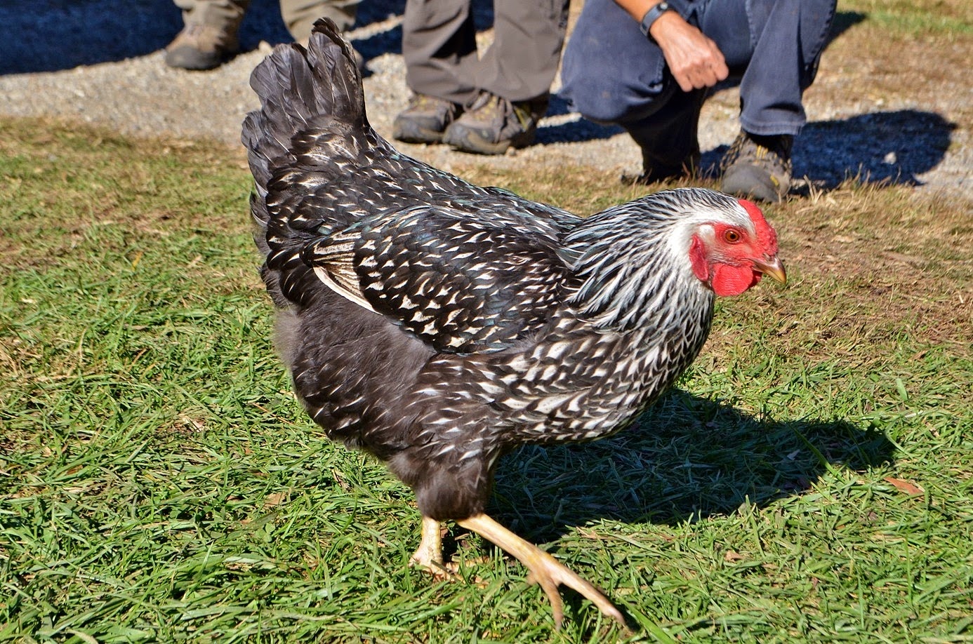
The buildings here were originally constructed throughout what is now the park and were taken apart and re-assembled at this site so visitors can get a feel for early life in Appalachia. Across the big open field, we could see a couple of bull elk grazing but they were too far away to get a good picture. I also saw a couple of chickens running around and stopped to get some pictures.
Suddenly, I heard through a megaphone a ranger scream “Step away from the wild animal!” Surely, she couldn’t have been scolding me about getting too close to a chicken. They’re certainly not wild! No, it was some idiot getting too close to the elk. And he was completely ignoring the ranger. She repeated her command to back away from the elk, but he didn’t listen. Finally, another ranger in a vehicle with sirens and flashing lights sped across the field, ultimately scaring the elk back into the woods. I couldn’t see how it was resolved, but I certainly hope the guy got a citation for that. After that, we headed back to camp and made an early dinner, then headed to Clingmans Dome with a plan to watch the sunset from the highest point in the park. We drove up Newfound Gap Road and turned onto Clingmans Dome Road. As we approached the peak, it got cloudier and cloudier and by the time we parked, we could barely see five feet in front of us. So much for a nice sunset. But we were already here, so we made the short hike up to the summit and climbed to the top of the tower.
There were no panoramic views from up here, but it had a spooky feel being right in the dense clouds. We stopped at the top of the tower for a few minutes, but there was no point in waiting until sunset since we certainly wouldn’t see it, and so headed back to the car. Driving back to camp, we got out of the clouds and could view the sun’s last moments in the sky as we drove back down US-441. We made a nice big campfire to stay warm and had drinks with our friends for the evening and then went to bed.
It didn't have a high water flow this morning, but is quite beautiful nonetheless. The main flow of water was cascading down the left side of the rock face, but there were a number of thin streams of water on the right side with a delicate, stringy look. It was really beautiful. We climbed out on the rocks to get some pictures then headed back.
We continued up Big Cove Road back into Great Smoky Mountains National Park and parked at the trailhead for Hyatt Ridge Trail. Our goal was Enloe Creek Falls. We tried unsuccessfully to get this waterfall two years ago. There’s no trail to the falls and it’s not shown on any maps. But this time, I had a GPS waypoint and we were determined to get it. We started off by hiking up Hyatt Ridge Trail. It was still cold when we started our hike and I was wearing a sweatshirt to stay warm.
Hyatt Ridge Trail is quite steep and it wasn’t long before I paused to delayer. The trail leads for just under two miles to the intersection with Enloe Creek Trail and it’s all uphill. The foliage along the trail was showing great colors and we took several much-appreciated breaks along the hike to rest and enjoy the pretty leaves. At the top, we turned left to get on Enloe Creek Trail and started hiking down, which made for a much quicker hike, eventually reaching Raven Fork at the point where Enloe Creek flows into it.
Raven Fork Falls, an 8-foot waterfall, is located just downstream of the bridge. Although it's not a big waterfall, the bridge in the background makes for a nice picture.
We crossed the footbridge over Raven Fork and started following Enloe Creek upstream. We were only about a quarter-mile from Enloe Creek Falls and I carefully watched the GPS as we got closer and closer. For a short ways, it would have been difficult to get off the trail due to dense rhododendron, but then there was an opening and we got off trail and started bushwhacking towards the creek. Soon, we could see the waterfall through the trees and I knew we would be successful this time. As we approached the waterfall, we had to go down a bit and cross the creek on a huge log and then climb some rocks up to the base for a good view. A few people who didn’t feel comfortable crossing the log bushwhacked along the side and made it to the top of the falls.
We got some good pictures of the waterfall and played around a bit on the rocks, then started making our way back. We stopped at the campsite by the bridge over Raven Fork to eat lunch and I climbed down on the rocks to get some pictures.
Besides Raven Fork Falls, there are some nice cascades along the creek here.
After lunch, we started hiking back. The climb back up Enloe Creek Trail was strenuous, but the pretty fall colors provided an opportunity for frequent breaks. Once back on Hyatt Ridge Trail, it was all downhill back to the car. It was still early in the afternoon as finding Enloe Creek Falls took less time than expected. So on the way back to camp, we stopped at Oconaluftee Visitor Center.
We browsed the gift store for a few minutes then took a stroll around the Mountain Farm Museum and got some pictures of the old buildings and farming equipment.
The buildings here were originally constructed throughout what is now the park and were taken apart and re-assembled at this site so visitors can get a feel for early life in Appalachia. Across the big open field, we could see a couple of bull elk grazing but they were too far away to get a good picture. I also saw a couple of chickens running around and stopped to get some pictures.
Suddenly, I heard through a megaphone a ranger scream “Step away from the wild animal!” Surely, she couldn’t have been scolding me about getting too close to a chicken. They’re certainly not wild! No, it was some idiot getting too close to the elk. And he was completely ignoring the ranger. She repeated her command to back away from the elk, but he didn’t listen. Finally, another ranger in a vehicle with sirens and flashing lights sped across the field, ultimately scaring the elk back into the woods. I couldn’t see how it was resolved, but I certainly hope the guy got a citation for that. After that, we headed back to camp and made an early dinner, then headed to Clingmans Dome with a plan to watch the sunset from the highest point in the park. We drove up Newfound Gap Road and turned onto Clingmans Dome Road. As we approached the peak, it got cloudier and cloudier and by the time we parked, we could barely see five feet in front of us. So much for a nice sunset. But we were already here, so we made the short hike up to the summit and climbed to the top of the tower.
There were no panoramic views from up here, but it had a spooky feel being right in the dense clouds. We stopped at the top of the tower for a few minutes, but there was no point in waiting until sunset since we certainly wouldn’t see it, and so headed back to the car. Driving back to camp, we got out of the clouds and could view the sun’s last moments in the sky as we drove back down US-441. We made a nice big campfire to stay warm and had drinks with our friends for the evening and then went to bed.
Friday, October 24, 2014
Deep Creek Waterfalls
We headed to the Deep Creek area of Great Smoky Mountains National Park to hike the short three-waterfall loop. We started off along the Deep Creek Trail heading upstream along its namesake creek. In just a couple of minutes, we passed Tom Branch Falls, which flows into the creek from the other side. The waterfall is pretty high, probably around 60 feet, but the water level was a little low and much of it was obscured by foliage.
Nonetheless, it was a pretty waterfall that doesn’t require much effort to see it at all. Continuing on the trail for about a half-mile, we came to a split and turned right on Indian Creek Trail. Almost immediately, there was a spur trail to the left that led down to a view of Indian Creek Falls. It’s a 20-foot cascading waterfall that was split into two streams.
It's not a big waterfall, but quite scenic. After a couple of pictures, we went back to Deep Creek Trail and then turned left on Deep Creek Horse Trail. This trail was a bit steep heading up initially and then back down. I guess horses don't mind the elevation gain too much. When we were almost back to the parking lot, we turned onto Juney Whank Falls Trail and made a quick stop at the waterfall. This is another small but scenic waterfall.
Split into multiple sections, we got some pictures from the footbridge that crosses it in the middle. It was getting late in the day, so we didn’t spend a lot of time here. A couple quick pictures and then we headed back to the car and started making our way towards Smokemont. We stopped for fast food in Bryson City and then continued past Cherokee to Smokemont Campground. After finding the group sites, we set up our tent as darkness began to fall on the mountains. Once we were set up, we made some drinks and socialized around the campfire before heading to bed.
Nonetheless, it was a pretty waterfall that doesn’t require much effort to see it at all. Continuing on the trail for about a half-mile, we came to a split and turned right on Indian Creek Trail. Almost immediately, there was a spur trail to the left that led down to a view of Indian Creek Falls. It’s a 20-foot cascading waterfall that was split into two streams.
It's not a big waterfall, but quite scenic. After a couple of pictures, we went back to Deep Creek Trail and then turned left on Deep Creek Horse Trail. This trail was a bit steep heading up initially and then back down. I guess horses don't mind the elevation gain too much. When we were almost back to the parking lot, we turned onto Juney Whank Falls Trail and made a quick stop at the waterfall. This is another small but scenic waterfall.
Split into multiple sections, we got some pictures from the footbridge that crosses it in the middle. It was getting late in the day, so we didn’t spend a lot of time here. A couple quick pictures and then we headed back to the car and started making our way towards Smokemont. We stopped for fast food in Bryson City and then continued past Cherokee to Smokemont Campground. After finding the group sites, we set up our tent as darkness began to fall on the mountains. Once we were set up, we made some drinks and socialized around the campfire before heading to bed.
Subscribe to:
Posts (Atom)