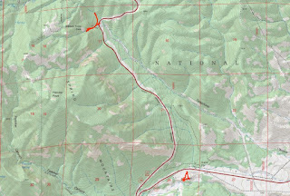
Saturday, we headed to the desert for a week in Death Valley. We flew to Las Vegas, arriving around 930. At Enterprise, we got upgraded to a 4Runner with 4WD and high clearance, which would prove helpful for our adventures. We stopped at a grocery store in Las Vegas to get water, gatorade and snacks and got tacos for lunch. Then we headed to Spring Mountains National Recreation Area. Being a Saturday with good snow, it was very crowded. We planned to hike to Mary Jane Falls but the road into Kyle Canyon was blocked by police and we had to go up Deer Creek Road. After a ways, we pulled off where we could to check out the snow.
Then we went a little further to the Robber's Roost Trailhead and managed to get a parking space. There were lots of people here, but most were just playing in the snow. We crossed the street and started hiking steeply up Robber's Roost Trail in the thick snow.
The trail is short and soon we made it to the top, where it wasn't possible to go further.
It was really scenic up here and we had gotten away from the mad crowds that were just a quarter-mile down the mountain. Snow in southern Nevada is apparently irresistable.
The views were really nice so we hung out for a bit before heading down.
The cave is near the top. According to legend, bandits robbed travelers on the Mormon Trail between the Utah and California and stashed their stolen goods in the caves here.
We slowly headed back down the mountain in the snow.
The forest here was full of pine and juniper trees and it was hard to believe we were less than an hour from Las Vegas.
We took a short detour then followed the trail back down to the road.
From here, we drove to the visitor center where there was plenty of parking. We just did a short walk around here to admire the views.
The snow on the mountains was really beautiful.
We saw some cool caves up on the cliffs.
After some pictures, we headed back.
From here, we drove back down Kyle Canyon passing through Red Rock Canyon National Conservation Area. We stopped at one point along the road for some views of some cool rock outcrops along the highway.
There were a lot of Joshua trees along the road.
We walked around to check out the cool rocks and then took off.
Back to US-95, we went north and passed by a collision between a vehicle and a small airplane, but fortunately no serious injuries. And it was the other side of the road so didn't affect traffic for us. Shortly before reaching Beatty, the sun was beginning to set and the sky lit up with beautiful colors. We had to pull off.
Continuing on to Beatty, we checked into the Death Valley Inn. As we got to our room, there were some "locals" trimming the palm trees.
For dinner, we went to Smokin' J's and got some barbecue, then went to bed after a long day.
Friday morning, we had breakfast at the hotel and checked out. Leaving Springdale, we had to stop for the construction zone one more time. While waiting, we spotted a mule deer along the side of the road.
Driving back towards Las Vegas, we headed to Red Rock Canyon National Conservation Area. After paying admission, we stopped at the visitor center. We first walked around the outdoor viewpoints - the panoramic views of the canyon and colorful rocks were beautiful.
The Calico Hills were very red and appeared to have stripes of color.
The bright red really popped against the desert landscape.
I was hoping to see the park's most famous resident - Mohave Max, a desert tortoise, but he has gone underground for the winter. I spoke with a ranger and she suggested we hike the White Rocks Loop Trail after making a couple scenic stops. So we continued on the one-way scenic drive around the canyon. We first stopped at Calico I with closer views of the colorful Calico Hills.
Our next stop was Sandstone Quarry. Here there was a nice view of the distinctive Turtlehead Peak.
The northern end of the Calico Hills were here and the red-striped rock was really fantastic.
Finally, we made one more short stop at High Point Overlook, the highest point on the scenic drive. This overlook had great views of the entire canyon.
Looking to the west, I could see the White Rock Hills that we would be hiking around next.
Continuing on a short ways, we turned right on the road for Willow Spring Picnic Area and parked here at the end. After getting our stuff together, we first did the very short Petroglyph Wall Trail. This short trail led across the wash to a wall where some ancient petroglyphs and pictographs were visible.
We got a couple pictures and headed back. Following Rocky Gap Road past the picnic area, we went just over a half-mile and turned right on a trail that entered La Madre Mountains Wilderness and we began the loop around White Rock Hills.
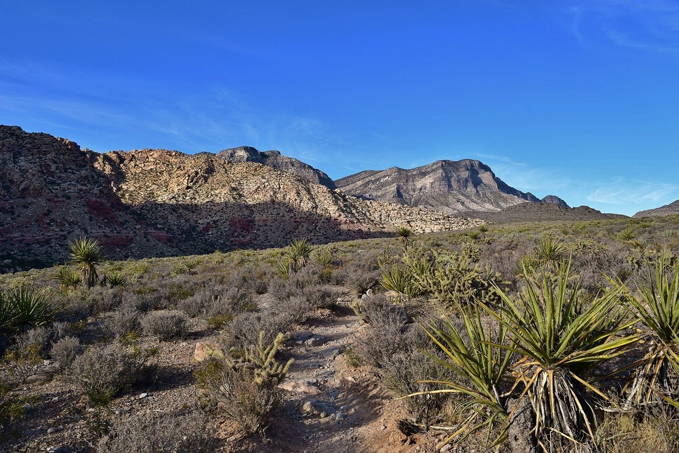
Despite the name, they weren't necessarily all white; there were some patches of red similar to Calico Hills.
I was surprised by the amount of green out here in the desert. We did spot quite a few cacti though.
In about another half-mile there was a split. First, we went left on La Madre Springs Trail. Along this trail, we had more nice views of the not-so-white White Rock Hills.
In about a mile, we made it to the namesake spring. The water level was low and the area had not had rain in months, but there was still some water flowing.
The area immediately around the spring was very lush - a stark contrast to the dry landscape elsewhere. Heading back, we quickly returned to desert terrain and the lush green gave way to more cacti.
I was impressed with the spines on some of these cacti. Besides the prickly pears, we also spotted some hedgehog cacti.
Following La Madre Spring Trail back, we turned left to continue on White Rock Loop.
The trail got moderately steep and headed up to a ridge where we had great views of the valley we had hiked up from.
The trail turned right to the right to loop around White Rock Hills, leading to a gap where we could see Las Vegas in the distance.
Past the gap, the trail gradually descended and we saw more interesting cacti along the trail.
Passing by the Upper White Rock parking area, we made a quick detour to White Rock Spring.
Unlike La Madre Spring, there was no water flowing here. After a few pictures, we continued on the loop. I spotted some nice silver cholla along the trail.
We continued heading south as the sun was getting lower in the sky and the wind picked up.
At one point, we had a very nice view of the whole Red Rock Canyon area, with the scenic drive below and Calico Hills across the valley.
At this point, the trail turned to the right one more time, passing the southeast corner of White Rock Hills.
Past the parking for Lost Creek Trail, we soon came back to Willow Springs.
At the parking lot, we got our stuff arranged and then headed back to Vegas to return the car.
From the rental car center, we took a cab to our hotel - the MGM Signature. We had a room on the 36th floor, so the evening view over the strip was great.
In the distance, we could just see the sun setting over Red Rock Canyon where we had been hiking earlier. After checking in, we got dinner and walked around the Strip for a while. We stopped in front of Bellagio and watched the fountains a couple times.
The we headed back to our room.
Only staying here one night, I wanted to get take advantage and get some night time pictures of the strip from high above.