Pictured Rocks National Lakeshore is a protected area on the Lake Superior shore in Alger County in the central Upper Peninsula of Michigan. The park protects 42 miles of shore and over 73,000 acres of land. The might of Lake Superior has created beautiful natural features, including colorful sandstone cliffs, sand dunes, waterfalls and inland lakes. There are more than 100 miles of hiking trails, water activities, and camping available in the lakeshore.
P.O. Box 40
Munising, MI 49862
Phone:
(906) 387-3700
Wild bergamot (Monarda fistulosa)
Map:
Trails:
Beaver Lake Trail:
Beaver Lake Trail makes a loop around Little Beaver Lake and Beaver Lake in the Beaver Basin Wilderness. The trailhead is at Little Beaver Lake Campground.
Points of Interest:
Beaver Basin Wilderness:
Beaver Basin Wilderness is an 11,740-acre wilderness in the middle of the lakeshore.
Miners Beach:
Miners Beach is a scenic mile long sandy beach northeast of Munising.
Miners Castle:
Miners Castle is a rock formation along the Pictured Rocks with two overlooks.
Miners Falls:
Miners Falls is a 50-foot waterfall on Miners River upstream a mile or so from the beach.
Camping:
There are three drive-in campgrounds and numerous backcountry campsites.
Little Beaver Lake Campground:
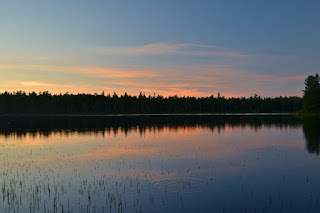
Little Beaver Lake Campground is a small site with 8 campsites on Little Beaver Lake along the edge of Beaver Basin Wilderness. The lake is a great place to watch sunrise while camping here.
Wildlife:
Orange jewelweed (Impatiens capensis)
American giant water bug (Lethocerus americanus), also called "toe biter" can cause a painful bite if provoked.
Blog Entries:
25-Aug-2020: Pictured Rocks
24-Aug-2020: Tahquamenon Falls
External Links:
National Park Service website: https://www.nps.gov/piro/index.htm


No comments:
Post a Comment