
Directions:
From Brevard, head east on US-64 and then turn left on US-276. Drive 15.1 miles and turn right and then left to get on the Blue Ridge Parkway southbound. In 7 miles, turn right into the Graveyard Fields Overlook. Note this is a very popular spot and parking fills fast.
Map:
Trails:
Art Loeb Trail (#146)
Art Loeb Trail crosses the Blue Ridge Parkway towards the area and piggybacks on Mountains-to-Sea Trail to the trailhead on FR-816. The trails split and Art Loeb Trail heads up to Black Balsam Knob and towards Shining Rock Wilderness.

Graveyard Fields Loop Trail (#358):
Graveyard Fields Loop Trail makes a 1-mile loop around Yellowstone Falls.

Graveyard Ridge Trail (#356):
Graveyard Ridge Trail splits from Mountains-to-Sea Trail and leads up to Graveyard Ridge.

Mountains-to-Sea Trail (#440):
The statewide Mountains-to-Sea Trail runs for about 6 miles through the area.

Upper Falls Trail (#358A):
Upper Falls Trail splits from Graveyard Fields loop and leads about 3/4 mile to its namesake waterfall.

Points of Interest:
Black Balsam Knob
Black Balsam Knob, at 6,214 feet above sea level, is the 23rd highest peak in North Carolina and second highest in the Great Balsam Range. It is a true grassy bald with an open, treeless summit with panoramic 360° views. The peak is accessed from Art Loeb Trail.

Second Falls:
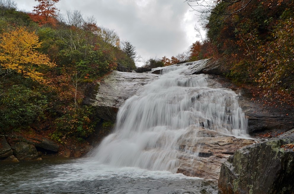
Second Falls is a popular and easy to visit waterfall in Graveyard Fields.
Skinny Dip Falls:
Skinny Dip Falls was a waterfall and swimhole near Looking Glass Rock Overlook that was damaged from flooding after Tropical Storm Fred.

Upper Falls:
Upper Falls is the uppermost waterfall on Yellowstone Prong.

Yellowstone Falls:
Yellowstone Falls is the largest waterfall in the area but also the most difficult to reach.

Wildlife:
White snakeroot (Ageratina altissima) thrives in woodland openings, clearings, and the edges of high-elevation balds. The plant is poisonous and causes milk poisoning if dairy cows ate it.

Asters (Aster spp.) are common in the area and bloom in late summer and fall.

Roan mountain goldenrod (Solidago roanensis) is found in woods, clearings, edges of balds, rocky ridges, and openings at elevations up to 6000 feet.

Appalachian gentian (Gentiana austromontana)

Common puffballs (Lycoperdon perlatum) have a distinctive reticulate (net-like) pattern on the skin after their spines fall off.

Grisettes (Amanita vaginata) are are mycorrhizal mushrooms that while sometimes considered edible, should be avoided due to several poisonous lookalikes.

Western honey bees (Apis mellifera) are extremely common visitors to goldenrod in late summer and early fall across the Southern Appalachians.

Blog Entries:
04-Sep-2026: Black Balsam Hike
08-Oct-2022: Graveyard Ridge MST Hike
28-Oct-2018: Yellowstone Falls
10-Oct-2015: Torrential Rain at Graveyard Fields
23-May-2015: Birthday Waterfalls
18-Oct-2014: Pisgah Forest Waterfalls

No comments:
Post a Comment