
Hike Length:
Estimated Time:
Difficulty: Moderate
Location: Panthertown Valley (Nantahala Ranger District in Nantahala National Forest)
Trail Users: Hiking only
Dogs: Yes
Features: Waterfalls (2)
Crowds: High
Warnings: The rocks around the waterfalls are very slippery.
Trailhead GPS: 35.15766,-82.99869
Waterfall GPS: 35.14480,-82.99454
Directions:
To visit the falls, head east on US-64 from Lake Toxaway and turn left to get on NC-281 north. In just under a mile, bear left to get on Cold Mountain Road. Go 5.7 miles to the end of the road and turn left onto the gravel road. Go a short ways and turn right to reach the parking area. This is the Cold Mountain Gap access to Panthertown Valley.
Map:

Hike Description:
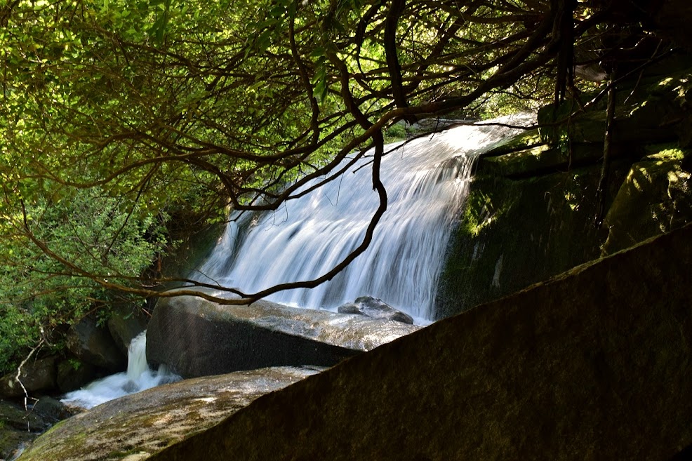
Pick up Mac's Gap Trail (#482) at the start of the parking area and descend through the powerline clearing towards Greenland Creek. Where Greenland Creek Trail (#488) goes right, continue straight on the combined trail. Mac's Gap Trail splits right to cross the creek; stay left on Greenland Creek Trail for about 0.3 miles to the end at Greenland Creek Falls.

An obvious path leads up the waterfall on river right side. It's steep but easy to follow. At the top, the trail continues following Greenland Creek upstream on a very windy path. In about 3/4 mile from Greenland Creek Falls, the trail comes out at the base of Carlton Falls.

There's a big cave on the river left side at the base, the burnt kitchen I presume.
From the base, the view of the upper section is poor. The path climbs up the river right side to the rocks around the upper section. If the rock is dry, it's possible to climb out on the rocks for a close up view.

US Forest Service website: https://www.fs.usda.gov/recarea/nfsnc/recarea/?recid=48686
No comments:
Post a Comment