Sandy had Saturday off, so we decided to take Alex to the beach. We left around 630 in the morning and made it to Fort Fisher State Recreation Area a little after 9. First, we got Alex's passport stamped at the visitor center.

Then we set off on the Basin Trail, starting off through a maritime forest. The dense trees, stunted by the harsh environment made a tunnel to hike through.

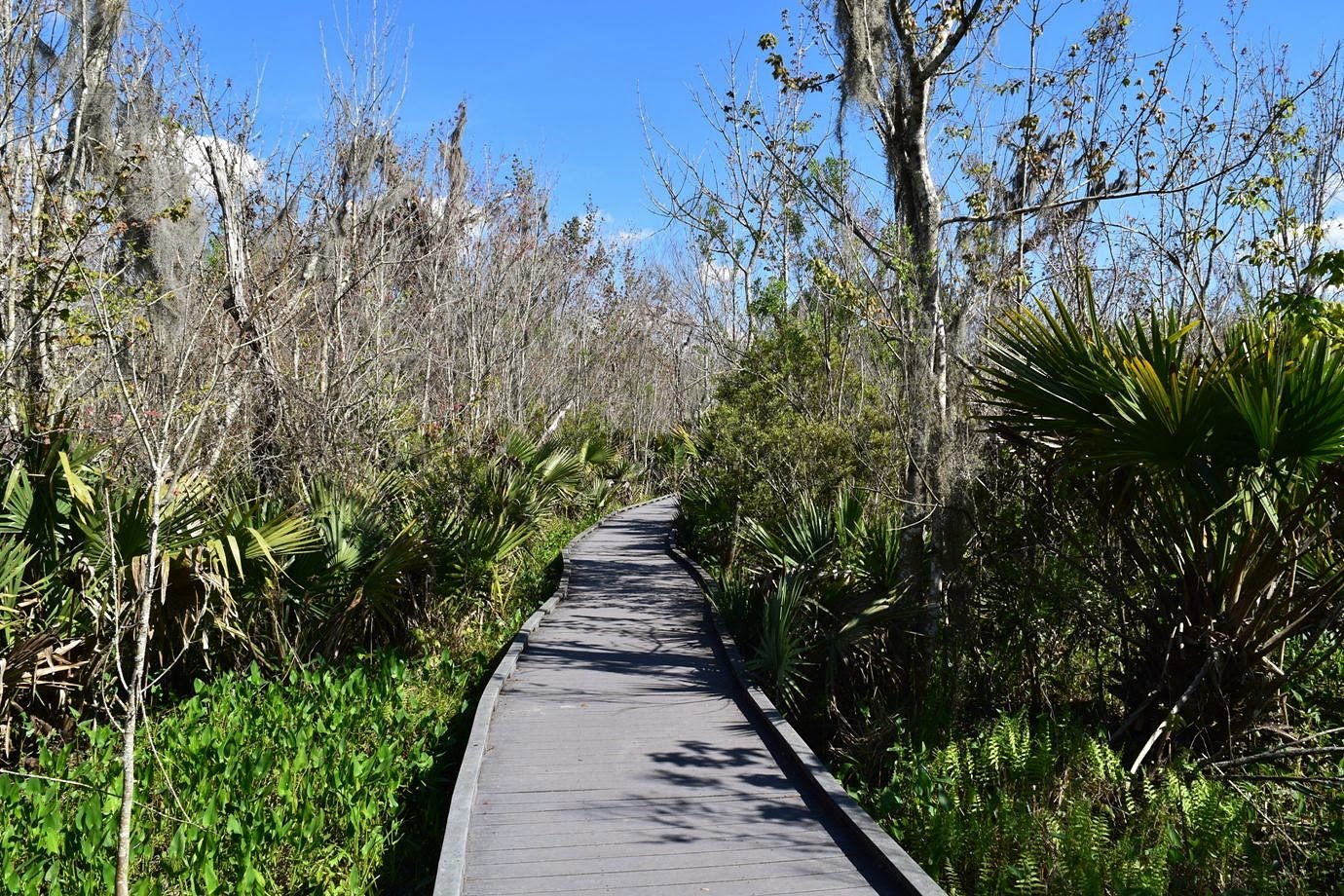
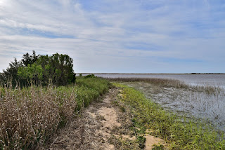
The trail then popped out at an open beach area adjacent to where 4WD vehicles can access the beach. It was really windy in this open area and kind of a relief when the trail headed back into the woods. The trees and shrubs really made a difference. We passed through a beautiful salt marsh, traversing much of it on a long boardwalk.

After the second boardwalk, we made it to the WWII bunker.

From 1956 to 1972, Robert Harrill, the Fort Fisher hermit, lived in this bunker, surviving off oysters and other food he could scavenge and his death is still a mystery. Right past here, Sandy spotted some yaupon holly with its bright red berries.

Continuing on, we had more nice views of the salt marsh.

Several birds were flying over head, having some difficulty in the strong winds.

It was another quarter-mile or so to the end of the trail and an overlook into Zeke's Island Reserve.

We enjoyed the view from here and then started making our way back.
Heading out onto the beach, it was really windy, but aside from that, it was a really beautiful day.

It was close to high tide, so we walked close to the water. Alex had fun chasing the waves - he tried not to get his paws wet, but got as close as possible.

He also tried to catch some sea foam whipping about in the wind. We went about 2 miles down and then turned back as it was so windy.

Then we set off on the Basin Trail, starting off through a maritime forest. The dense trees, stunted by the harsh environment made a tunnel to hike through.

The trail then popped out at an open beach area adjacent to where 4WD vehicles can access the beach. It was really windy in this open area and kind of a relief when the trail headed back into the woods. The trees and shrubs really made a difference. We passed through a beautiful salt marsh, traversing much of it on a long boardwalk.

After the second boardwalk, we made it to the WWII bunker.

From 1956 to 1972, Robert Harrill, the Fort Fisher hermit, lived in this bunker, surviving off oysters and other food he could scavenge and his death is still a mystery. Right past here, Sandy spotted some yaupon holly with its bright red berries.

Continuing on, we had more nice views of the salt marsh.

Several birds were flying over head, having some difficulty in the strong winds.

It was another quarter-mile or so to the end of the trail and an overlook into Zeke's Island Reserve.

We enjoyed the view from here and then started making our way back.

Heading out onto the beach, it was really windy, but aside from that, it was a really beautiful day.

It was close to high tide, so we walked close to the water. Alex had fun chasing the waves - he tried not to get his paws wet, but got as close as possible.

He also tried to catch some sea foam whipping about in the wind. We went about 2 miles down and then turned back as it was so windy.

Back at the car, we made the short drive to Carolina Beach State Park. Again, we stopped at the visitor center to get Alex's passport stamped and then parked at the Flytrap Trail parking.

It was really crowded here as the weather was beautiful. We started out on the Flytrap Trail and I took Sandy to see the Venus Flytraps as she had never seen them here before.

Also made a quick stop to see the pitcher plants.

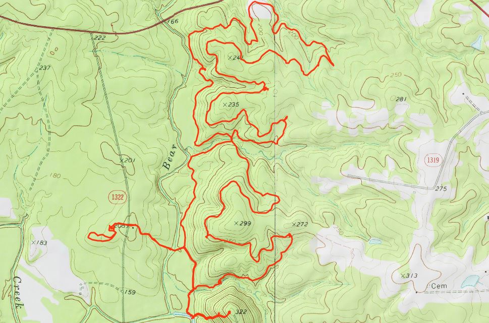
Then we took Swamp Trail to Sugarloaf Trail to start a big loop around the park. The trail was really sandy and it was a beautiful white sand.

Soon, we passed three aptly-named limesink ponds. The first was Grass Pond and this one was more grass than pond.

Shortly after, we came to Lily Pond. This pond had more water though most was covered in water lilies, through it was too early for blooms.

Next, we came to Cypress Pond, which was more of a swamp with many cypress trees.

All three were close to one another yet very distinct. After passing the ponds, we continued a ways and turned onto Sand Live Oak Trail, the newest trail in the park. This looping trail had some surprisingly steep sections heading up and over the dunes. There were several spots with nice views of the river and I spotted some young longleaf pines with candles growing out of the top.

They'll soon hit a growth spurt and really gain some height. Near the end of Sand Like Oak Trail, we went out to a nice spot on the river.

Looking upstream an old barge had washed up against the beach, perhaps in one of the recent storms.

Then we climbed up to the top of Sugarloaf Dune.

Heading back, we continued on Sugarloaf Trail and made a detour on Oak Toe Trail.

This short trail leads out to Marsh Overlook on Cape Fear River.

Continuing on, where Sugarloaf Trail intersects with Swamp Trail, we turned left and followed the combined trails past a beautiful tidal swamp.

Right past here was another scenic spot on Cape Fear River and we took one last little break here to enjoy the view.

We continued towards the marina and saw some yellow jessamine flowering.

From here, it was just a short walk from the marina back to our parking area.

On the way home, we stopped for dinner at Rucker Johns in Wilmington and had dinner outside with Alex.

It was really crowded here as the weather was beautiful. We started out on the Flytrap Trail and I took Sandy to see the Venus Flytraps as she had never seen them here before.

Also made a quick stop to see the pitcher plants.

Then we took Swamp Trail to Sugarloaf Trail to start a big loop around the park. The trail was really sandy and it was a beautiful white sand.

Soon, we passed three aptly-named limesink ponds. The first was Grass Pond and this one was more grass than pond.

Shortly after, we came to Lily Pond. This pond had more water though most was covered in water lilies, through it was too early for blooms.

Next, we came to Cypress Pond, which was more of a swamp with many cypress trees.

All three were close to one another yet very distinct. After passing the ponds, we continued a ways and turned onto Sand Live Oak Trail, the newest trail in the park. This looping trail had some surprisingly steep sections heading up and over the dunes. There were several spots with nice views of the river and I spotted some young longleaf pines with candles growing out of the top.

They'll soon hit a growth spurt and really gain some height. Near the end of Sand Like Oak Trail, we went out to a nice spot on the river.

Looking upstream an old barge had washed up against the beach, perhaps in one of the recent storms.

Then we climbed up to the top of Sugarloaf Dune.

Heading back, we continued on Sugarloaf Trail and made a detour on Oak Toe Trail.

This short trail leads out to Marsh Overlook on Cape Fear River.

Continuing on, where Sugarloaf Trail intersects with Swamp Trail, we turned left and followed the combined trails past a beautiful tidal swamp.

Right past here was another scenic spot on Cape Fear River and we took one last little break here to enjoy the view.

We continued towards the marina and saw some yellow jessamine flowering.

From here, it was just a short walk from the marina back to our parking area.

On the way home, we stopped for dinner at Rucker Johns in Wilmington and had dinner outside with Alex.