Prior to European settlement, Cape Fear Native Americans lived in and around the lower Cape Fear peninsula. Initial attempts at settlement were unsuccessful due to conflict with the Native Americans and piracy. In 1730, the Port of Wilmington was settled and became a bustling port, exporting naval stores, such as tar, pitch, and turpentine derived from the longleaf pine. Fort Fisher was built in 1862 to protect to the Port of Wilmington from Union forces.
There are several miles of beach at the park, a short hiking trail, and the NC Aquarium at Fort Fisher. With free public parking and amenities, such as restrooms, shower rinse stations, grills for cooking, and concession stands, the park is very popular with beach-goers. It's a good idea to arrive early to get a parking space, because the parking lot fills up quickly on nice beach days.
Contact Information:
1000 Loggerhead Road
Kure Beach, NC 28449
Phone: (910) 458-5798
Email: fort.fisher@ncdenr.gov
GPS Coordinates: 33.9534, -77.929
Directions:
From points north, take I-40 east until it ends in Wilmington, becoming NC-132. Continue south on NC-132 through Wilmington to where it merges with US-421 and follow US-421 south through Carolina Beach and Kure Beach. After Kure Beach, turn left onto Loggerhead Road at the sign to enter the recreation area. From points south, take the ferry from Southport-Fort Fisher ferry across the Cape Fear River. From the ferry port, turn left on US-421 and then right on Loggerhead Road to enter the recreation area. Use the map below to generate customized directions.
Map:
Beach:
With about six miles of pristine, undeveloped beach, Fort Fisher is a great place to enjoy a day at the beach. A boardwalk from the parking area over the dunes provides access to miles of sandy beach to enjoy. Lifeguards are on duty from Memorial Day through Labor Day to provide a safe beach experience. Rip currents are always a possibility, so swim with caution and pay attention to the warnings and flags. No swimming is permitted under red flag conditions.
Hiking:
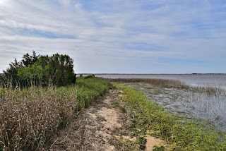
For hiking, there is a 1.1-mile trail that runs through soundside habitats including maritime forests and salt marshes in the recreation area. And with five miles of beach, there is plenty of opportunity for beach hiking. It's possible to walk all the way to Cape Fear at Bald Head Island by heading south along the beach for about 8 miles, passing through Zeke's Island Reserve before reaching Bald Head Island.
Basin Trail:
Length: 1.1 miles (one way)
Blaze: Orange
Difficulty: Easy
The Basin Trail, also called the Hermit Trail, is a 1-mile trail that leads visitors through soundside habitats in the recreation area. Although only a mile, it leads through some really diverse habitats. From the parking area near the visitor center, the trail crosses the 4WD road and heads into a dense maritime forest where the trees have created a tunnel to hike through.
Shortly, the trail comes out of the woods and passes through a sandy open area adjacent to the 4WD road. Then, the trail traverses a salt marsh on several long boardwalks.
At about three-quarters of a mile from the start, the trail passes the WWII bunker, where "Fort Fisher Hermit" Robert Harrill lived from almost 20 years. The trail continues through the salt marsh, terminating at the Basin Overlook at Zeke's Island Reserve.
Points of Interest:
Aquarium:
The North Carolina Aquarium at Fort Fisher is one of three North Carolina Aquariums and is just a short distance from the beach, within easy walking distance. This makes it a great opportunity to get a break from the sun and heat and enjoy the shade and air conditioning of the aquarium. And if rainy weather threatens to spoil a day at the beach, the aquarium provides an opportunity to escape the storm and still enjoy sights and sounds of the sea. The theme of the aquarium is from the Cape Fear River to the Sea, and features exhibits of freshwater and sea life.
Basin Overlook:
Basin Overlook is located at the far end of Basin Trail and provides scenic views into Zeke's Island Reserve estuary. The Rocks is an artificial jetty south of Fort Fisher built in the late 19th century to prevent shoaling in Cape Fear River. Construction of the Rocks closed New Inlet and formed the Basin, the lagoon that is visible from the overlook.
WWII Bunker:
During World War II, the area around Fort Fisher was used as a firing range. Closed in 1944, the bunker along Basin Trail is the only evidence of the range. From 1955 to 1972, Robert E. Harrill, the "Fort Fisher Hermit", lived in the bunker. Surviving off nature, the hermit ate oysters, fish, and anything he could grow. He became a celebrity of sorts due to his lifestyle until his mysterious death in 1972.
Wildlife:
Southern live oak (Quercus virginiana)
Yaupon holly (Ilex vomitoria) is a shrub found in the maritime forest environment. Their bright red berries provide food to many birds.
A jellyfish washed up on the beach, possibly a cannonball jellyfish (Stomolophus meleagris).
Cape May warbler (Setophaga tigrina)
Chestnut-sided warbler (Setophaga pensylvanica)
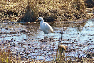
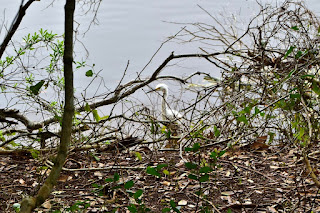
Great egret (Ardea alba)
Snowy egret (Egretta thula)
American white ibis (Eudocimus albus)
Brown pelican (Pelecanus occidentalis)
Willet (Tringa semipalmata)
Sanderling (Calidris alba)
Forster's tern (Sterna forsteri)
Blog Entries:
22-Dec-2023: Winter Beach Day
28-Jan-2023: Fort Fisher Beach Hike
20-Mar-2021: Carnivorous Plants
31-Mar-2018: Spring Beach Day
06-May-2017: Hike to Bald Head Island
04-Jul-2013: Beach & Blast 2013
04-Jul-2012: Beach and Blast 2012
04-Jul-2011: Beach and Blast 2011
NC State Parks website: https://www.ncparks.gov/state-parks/fort-fisher-state-recreation-area
External Links:
NC State Parks website: https://www.ncparks.gov/state-parks/fort-fisher-state-recreation-area


No comments:
Post a Comment