Monday, May 29, 2017

Tanasee Creek Gorge

After checking out of the hotel, we started heading back east towards Charleys Creek Road where we had started our adventure.  We met up with Badger, Andy, and Spencer at the trailhead for Tanasee Creek Falls and carpooled to the lower trailhead along Tanasee Gap Road.  From here, we started hiking along an old logging road following Tanasee Creek upstream.  All along the trail, the mountain laurel were in full bloom and quite beautiful.


We had really lucked out this weekend in seeing these beautiful flowers.


There were also a few flame azaleas blooming as well.


In about a mile or so, we came to a small tributary.  We crossed the tributary and then started bushwhacking upstream along the tributary.  It was steep, but not too overgrown so wasn't real difficult.  Near the top, we had to navigate around some cliffs and then came to Horseshoe Falls.


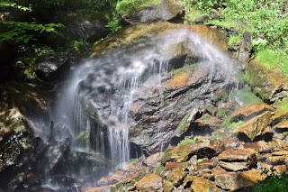
The water flows over a horseshoe-shaped rock and free falls about 80 feet down, crashing onto the rocks below.


Even in high water, the flow wasn't real high, but this was a really nice waterfall.  I found a great spot on this one rock where the water was falling all around me but didn't get wet.


It appeared that the water was coming right out of the overhanging rock.


We played around here for a while and then headed back down to the old logging road.  In another mile or so, we had to wade across Tanasee Creek and then another crossing in another half-mile.  At this point, Sandy and I decided to head back as it was starting to get late and we had a very long drive home.  After saying good-bye to our friends, we started making the trek back.  I found an old cooler near tributary with Horseshoe Falls and carried it back to dispose of it properly.  After carrying it about a mile, my arms were getting quite sore, but at least one less piece of garbage in the woods.  Driving home, we stopped at Las Salsas for dinner and made it home around 9.

Sunday, May 28, 2017

Murphy Area Waterfalls

Sunday, we headed to the far western part of North Carolina to visit some waterfalls in the area.  We headed west from Franklin on US-64 to Hayesville and headed into the Fires Creek area of Nantahala National Forest.  Our first stop was at the picnic area, where we could see Leatherwood Falls across Fires Creek.  The view from across the creek was rather poor as there was a lot of foliage in the way.


The water level was way up, so no safe way to cross Fires Creek for a better view.  There was a bridge across the creek that led to a picnic area, but no way to get to the base of Leatherwood Falls.  So we gave up and continued down FR-340 following Fires Creek upstream to the split with FR-340C where the road was gated.  After parking, we continued hiking down FR-340 past the gate, crossing a bridge over Long Branch and continuing about a mile to the point where Bald Springs Branch flows into Fires Creek.  It was a steep, but short scramble down to Fires Creek.  Since the water level was up, there was no dry way to cross, but the crossing wasn't too bad.  At this point, the hike got really difficult.  Lower Bald Springs Falls was just a short was upstream and it was easiest to creek walk to this one.


It's a real scenic waterfall even with a lot of deadfall covering it.  Then we had to make an excruciating bushwhack up the side through dense rhododendron to get above the waterfall and then headed back down to creek level to get to Bald Springs Falls.


This is a really cool waterfall with a lot steps.  We climbed up a little ways along the waterfall until it got to steep and overgrown with rhododendron and then bushwhack up the side.  It was just a short ways further to the last waterfall on this creek, but incredibly difficult.  We could hear the waterfall from high above, but it was very tough to get back down to creek level.  Backtracking a bit, we finally found a safe way to get back down to the base of Rain Forest Falls.


At only 15 feet, it's the smallest falls on Bald Springs Branch, but really scenic, even with several huge trees fallen down on it.  After a couple pictures, we bushwhacked back up and found some semblance of an old logging road that we could follow back down to Fires Creek.  After crossing the creek and climbing back up to the forest road, it was just a mile back to the car.  Hiking back on the road, I spotted two trees near Fires Creek with shelf fungi growing out of them.


The one tree had purple fungi and the other had orange fungi.


Back at the car, we continued driving west past Murphy and Hiwassee Dam to Appalachia Lake.  We turned on the unpaved Prospect Road and drove to the property line to park on National Forest property and made an easy bushwhack down to lake level.  From here, there was a trail following North Shoal Creek up to the beautiful North Shoal Creek Falls.


In high water, this was a really beautiful waterfall.


There were also some really nice cascades on the creek downstream of the waterfall.


After a few pictures, we headed back.


We had planned to go to Tellico Falls as well while we were way out here, but with the high water level, we knew we'd never make it so headed back towards Franklin.  As we got towards Standing Indian, we got off the highway and took FR-67 past the campground for about 6 miles to the trailhead for Mooney Falls.  After the really tough hikes today, it was nice to visit an easy waterfall.  Mooney Falls is in two sections, though you can't see both from one point.


First we went to the upper section which is a long cascade with some mountain laurels blooming near the top.


Then we went down to the lower main section, a 20-foot drop.


Throughout the area, there were a lot of mountain laurel blooming.  So before heading back to Franklin, we made a quick stop at Big Laurel Falls, just a short ways back on FR-67.  From the parking area, we got on Big Laurel Falls Trail (#29) and crossed Mooney Creek on a footbridge.


Across the creek, we turned right to stay on Big Laurel Falls Trail.  We soon entered Southern Nantahala Wilderness and followed Nantahala River upstream towards its headwaters.


The Nantahala is formed at the confluence of Big Laurel Branch, Gulf Fork, and Kilby Creek.  We followed Big Laurel Branch just a short ways to the falls.


A better name would be Big Rhodo Falls as there were no mountain laurel here, just rhododendron.


It's still a beautiful waterfall and worth the easy hike since we were in the area.  After a couple pictures, we quickly hiked back as it was getting late.


After that, we headed back to Franklin.  Since it was late on a Sunday, most places were closed so we had dinner at Fatz before heading back to the hotel.

Saturday, May 27, 2017

Beech Creek Loop HIke

Saturday, we woke up early, had breakfast at the hotel and started driving south on US-441 into Georgia.  After crossing the state line, we followed back roads west to Tallulah River and drove upstream through Chatahoochee National Forest and back into North Carolina, parking at the trailhead for Beech Creek Trail (#378) in Southern Nantahala Wilderness.  The trail started off steep, heading up a ridgeline and then back down Beech Creek where we had to cross and pick up the trail on the other side.  I spotted some cute little orange mushrooms growing out of a log here.


It was just another half-mile or so to Bull Cove.  After crossing Bull Cove Creek, we followed a path upstream a short ways to Bull Cove Falls.


In high water, it was a very scenic waterfall though a big log had fallen right across it and I don't think that's going anywhere any time soon.


There were also some very scenic cascade on Bull Cove Creek downstream from the waterfall.


After some pictures, we got back on main trail and continued following Beech Creek upstream to a wade across Beech Creek.


We picked the trail back up on the other side and followed Beech Creek upstream into a gorge-like area.  Several of the small, unnamed tributaries flowing into Beech Creek had a lot of water, including one that was very scenic.


I think this is Bear Creek Falls, though the tributary is unnamed.  There were a number of wildflowers blooming along the trail, including some narrow-leaved sundrops.


Down below, Beech Creek was really flowing.


Shortly, we passed a rock wall and the trail cut sharply to the left to begin a switchback.  We followed a path going straight that led a short ways to a small waterfall on Beech Creek way below High Falls.


Although dwarfed by the much larger high falls, this was a pretty scenic waterfall.  A lot of downfall on it, like just about everything in this area.


Back at the main trail, it began climbing very steeply via a couple switchbacks.  At the next one turning left, a sign indicated going straight led to High Falls.  We followed the trail to the base of the beautiful waterfall and had lunch here.


High Falls is a really cool waterfall and we spent some time here enjoying the view.


I took off my boots to wade in the water and get pictures from different angles.


The sky grew dark and I thought it was going to start raining, but it never did.  After a bit, we headed back to the main trail and continued to follow it up.  The next half-mile or so was gruelingly steep.  I stopped to see some red efts that had come out in the wet weather, a welcome relief from the climb.


We also spotted a large snail crossing the trail.


In a bit, the trail leveled off as it passed the headwaters of Beech Creek.  In about a mile, a blue-blazed spur trail cut to the left and we followed this up towards the summit of Big Scaly Mountain. Throughout the hike, we had seen evidence of recent wildfires, but nowhere so obvious as up here.


The first part of the spur trail ran through an area where the forest was recovering and a tremendous number of ferns were growing along with many wildflowers.  As we approached the summit, it was mostly dead rhododendrons.


Even here though, a few had survived and were flowering.  We climbed up a rocky outcrop for lovely views from Big Scaly.


After a short rest, we started back down.  And it would be all downhill from here.  The Beech Creek Trail led another 2.5 miles down the mountain to the junction with Deep Gap Trail, where we turned left to head back to Tallulah River Road.  Back at the road, it was another mile or so back to where we parked.


On the way out, we made a quick stop at the Tallulah River Fishing Pier.  The views of the Tallulah River were really nice here, especially with the mountain laurel blooming along the river.


Heading back towards Franklin, we had enough time for one (or two) more waterfalls, so drove west on US-64 to Wayah Road and went about five miles to a right turn on FSR-316.  We parked right before the gate at a ford of Camp Branch.  A short path led past two concrete buildings, presumably to store explosives, and then to Camp Branch Falls.


This is a small, but very scenic waterfall and very easy to reach.


And, there's another one just upstream from the first one.


There was some deadfall over Upper Camp Branch Falls, but I thought it was just as scenic as the lower one.


After a couple pictures, we headed back into Franklin and had dinner at Thai Basil and then returned to our hotel.

Friday, May 26, 2017

Waterfalls along Charleys Creek Road

Sandy and I spent the Memorial Day weekend in the far western part of North Carolina chasing waterfalls.  We left very early Friday morning and drove to Asheville and then took the Blue Ridge Parkway south to NC-215.  We went south a short ways and turned onto Charleys Creek Road, making several stops along the way to visit waterfalls.  Our first stop was a small pull-off just a couple miles from NC-215.  From here, we hiked a short distance back up the road and got on an old gravel road that crossed Pinhook Creek.  Pinhook Falls is about a quarter-mile upstream from the crossing, but there's no trail whatsoever, so it was easiest to just creek walk.  In a couple spots, there was some semblance of a trail and we used that to get around some cascades on the creek.  It was a short, but difficult trek to the falls.


Pinhook Falls is a small, cascading waterfall.  Unfortunately, the sun was shining right on it, so couldn't get any good pictures, but this wasn't a real impressive waterfall anyway.  Next to the falls was the remains of some wooden structure, probably a grist mill.


After a couple pictures, we headed back.  Our next stop was just another quarter of a mile up the road at a small gravel parking lot with a picnic area a fire pit.  We followed a path on river-left going downstream along Tanasee Creek and crossed the creek when the trail became overgrown.  But the other side of the creek was even worse - it was a bushwhack with no semblance of a trail.  We crossed back over and got to the point of the confluence of Pinhook Creek and Tanasee Creek and at this point, we had to cross back over to river-right.  This was very close to the top of Tanasee Creek Falls.  At the falls, there was an old road and we followed it a short ways to a scramble path down to the base of Tanasee Creek Falls.


This is a real scenic waterfall in two sections, but again the lighting was poor.  There were a lot of beautiful mountain laurel blooming next to the falls that made up for the bad lighting.  We got a couple pictures and then headed back.


Continuing down Charleys Creek Road a couple miles, we turned right on the gravel Harris Cemetery Lane just before the road crossed Gage Creek on a bridge.  This rather sketchy gravel road led to a split where we went right onto FR-4648 and followed to a split where the road forded Gage Creek.  From parking spot, we hiked the old road to the right and crossed Gage Creek in a short distance.  It was less than a half-mile to the scenic Gage Creek Falls.


This waterfall was mostly in the shade so finally some decent photo opportunities.  The small cascades just downstream of the falls were really nice.


After a couple pictures, we made our way back.


Back on the main road, we continued to the road's namesake creek and parked just before the bridge.  We hiked FR 4655 following the creek upstream.  Although most of the route was along an old road, it was very confusing as there were a number of forks in the road.  We tried to stay close to the creek, following it upstream, but at some point, we had to just bushwhack.  Although not terribly steep, the bushwhack was extremely difficult as the banks of the creek are totally overgrown with dense rhododendron.  We crossed the creek and continued bushwhacking up to another old road on the other side and eventually came to Charley Creek Falls.


Even in high water, this waterfall is so overgrown that it's not terribly scenic.  After a couple pictures we made our way back - and it was no easier getting back.  At Charleys Creek Road, we could hear a waterfall flowing right under the road, but couldn't see much from up here.


So I scrambled down the steep embankment to get to the base of Charleys Bridge Falls - much more scenic than the main waterfall in my opinion.


It was starting to get late, but we wanted to get one more waterfall while we were here, so continued on and pulled off just past a bridge over Sols Creek.  Roy Taylor Falls was probably the easiest waterfall of the day.  We hiked the road back a short ways and picked up an old logging road following Sols Creek upstream.  In about a quarter-mile, the waterfall was easily heard and partially visible from the old road.


It was a short but steep bushwhack down to creek level to see the waterfall, which was very scenic, a nice waterfall to finish up the day.  After a couple pictures, we headed back and finished up Charleys Creek Road at NC-281.


From here, we drove to Franklin and checked into the Hampton Inn for the weekend.  Driving in, we saw a barbecue place right in front of the hotel, so after unpacking the car, we headed down to Willys for some barbecue and then headed back to the hotel for showers and to get some sleep.