Sunday, December 16, 2012

Foggy Hike on Neusiok Trail

On Sunday, we headed to the coast for a hike along the Neusiok Trail in Croatan National Forest. I met with the group at 7 and rode with Casey and Steve from Garner heading east along US-70. We arrived at the Pinecliff Picnic Area just before 10 and shuttled some cars to the trailhead at NC-101. Once everyone was back at Pinecliff we started our hike.


There was a dead ray on the beach that was very foul smelling, so instead of starting we down the beach, we followed the trail proper through the woods for a ways and then popped back out on the beach. The first mile or so along the beach on the Neuse River is my favorite part of the trail. The shoreline of the beach is receding as seen by the dead and uprooted trees and cypress knees along the shoreline, some actually in the water.


These ghostly-looking trees, some draped with Spanish moss, make for a beautiful and unique landscape.


It had been raining a little on the drive down, but mostly stopped while we were hiking.


But the weather was still very cloudy and a little foggy, which contributed even more to the spooky atmosphere among the trees.


We stopped and regrouped at the end of the beach where the trail heads up stairs to get back in the forest. From here on, the trail mostly alternates between mixed forest of pine and hardwoods and swampy areas.


Although the swampy parts have boardwalks to traverse them, the wet wood was extremely slippery. After falling and hurting my wrist the day before, I made sure to be extremely careful and slow moving over the boardwalks. A few people did slip on these boardwalks, but luckily no one was hurt seriously. Interestingly, leaves and pine needles that had fallen on the boardwalks provided the best traction to get across safely. After a couple miles we stopped at Copperhead Landing shelter to eat lunch and rest for a bit. Then, we continued on to the road crossing at NC-306 and regrouped before hiking the last couple miles of the trail. This last section has a significant amount of boardwalk so the going was slow.


Two boardwalks in particular, "Cotton-Mouth Spa" and "Toad Wallow" must be close to a quarter mile each. But shortly after crossing these, we arrived at NC-101 and the cars we had left here to shuttle. A few people were going to take the Cherry Branch-Minnesott Beach ferry from across the Neuse River, but the rest of us decided to head to dinner instead. We had taken the ferry the year before (and it's still free), but on a cloudy day, we wouldn't be able to watch the sunset from the ferry. And we were getting hungry too. So we headed into New Bern and had dinner at Morgan's Tavern and Grill for dinner before heading back to the Triangle.

Saturday, December 15, 2012

Winter Hike at Stone Mountain

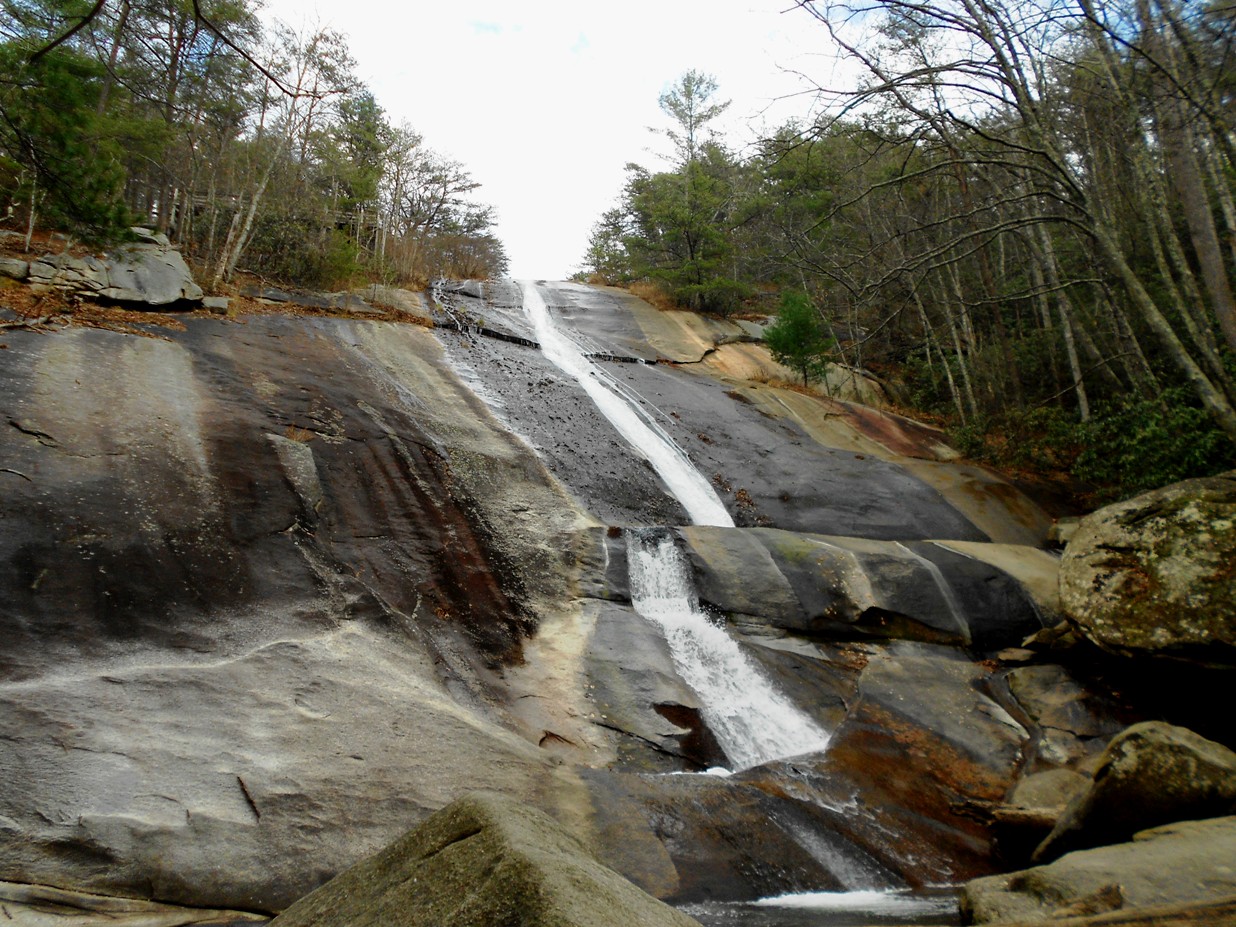
This past Saturday, Sandy actually had a weekend day off of work, so we decided to take advantage and plan a day trip out to Stone Mountain State Park. We met up with friends in Chapel Hill and carpooled out to the park, arriving at around 930. After donning our hiking gear, we set out on the Stone Mountain Loop Trail in the counterclockwise direction.  The trail initially heads up a bit before coming to the first granite outcrop, the trademark of Stone Mountain. With only a few small trees on these outcrops, they provide great views of the area surrounding Stone Mountain, including the Blue Ridge escarpment just to the west. Continuing on a bit, we came to the summit of Stone Mountain at 2305 feet above sea level.


Again, the summit is a large granite outcrop with beautiful views of the surrounding landscape.


I had originally planned to stop and have lunch here, but it was only about 1030 at this point, so we decided to hold off on lunch and eat at another spot. From the high point of our hike, we began our descent back down the mountain. Along the way we saw some holly in bloom, looking very festive for the holiday season, even though the weather was unseasonably warm. At the base of the mountain, we passed the road that leads to the Hutchinson Homestead and exited the Stone Mountain Loop Trail to take the Wolf Rock Trail. Shortly, we reached Wolf Rock, another granite outcrop facing west.


Although there are no views of Stone Mountain from here, there are great views of the Blue Ridge Mountains. We stopped here for lunch as it was past noon and had a chat with some other hikers from the Triad region. Apparently, more than 20 people had signed up for the hike but only three showed up. One had previously lived in the Triangle and reminded us how much better the hiking groups are in our area.


After lunch we continued on the Wolf Rock Trail and turned off to hike the Cedar Rock Trail. Cedar Rock, another granite outcrop, faces Stone Mountain and is one of the best spots for views of the mountain.


Finishing up the Cedar Rock Trail, we got back on the Stone Mountain Loop Trail and backtracked just a bit to see the Hutchinson Homestead. Although it is closed during the winter, it is still possible to walk the grounds and check out the numerous restored buildings, including a log cabin, barn, blacksmith shop, corncrib, and meathouse.


The homestead is located right at the base of Stone Mountain and is a very scenic location. Not a bad place to live in the 19th century. And being so close to the mountain, we could see rock climbers scaling the face of the mountain. After a bit, we headed back on the Stone Mountain Loop Trail to the Middle Falls/Lower Falls Trail. This trail is less well-maintained than the others and included a couple stream crossings without bridges.


About half way down the trail, we took the short spur over to Middle Falls and then finished the trail out to Lower Falls.


Both of these required a bit of bushwhacking and and rock-hopping to get to a good spot for viewing the falls and I managed to fall and sprain my wrist. But it didn't hurt at first and I really didn't notice. Taking the trail back to the Stone Mountain Loop, we finished up the trail with a stop at Stone Mountain Falls and then the 340 stairs up to the top of the falls and back to the parking lot.


I didn't actually count the stairs, but some people at the top claimed that they had and the number was 340. Back at the parking lot, we headed back to the Triangle with a stop in Greensboro for Mexican on the way back. By the time we got back to the Triangle, my wrist was starting to bother me, but its not a real adventure unless you're a little beat up at the end.

Saturday, November 24, 2012

Carolina Tiger Rescue

Today, my mom and I went to Carolina Tiger Rescue in Pittsboro for a tour. Our tour started with an overview of the organization by our guide Julie - originally, it was used for breeding to protect species from extinction; now it was primarily focused on rescuing wild cats from private owners and giving them a happy life. The first cats we saw were the caracals, two females and a male.


One of the females was sleeping in her box and the other was sleeping next to it. The male was walking around a bit, leaving his scent on the fence to make sure we knew that this was his territory. After a bit, he laid down as well and we continued on to see Collins, a bobcat. Although he is a native species, we couldn't be released into the wild because he was originally owned as a pet and declawed. He came out for a bit as Julie offered him a treat and then we moved on to see Elvis, a serval. He had been dropped off at the "doorstep" in poor condition, but had been nursed back to health and looked like he was doing well. And he was very excited when offered a treat. Next we saw our first tiger - Rajaji, a big male.


He clearly enjoys seeing visitors, coming over to greet us and even try to spray us with scent (urine). Then Julie gave him a treat and after eating it, he smelled where he had urinated earlier, making a funny face from the smell.


Apparently, this is a fairly common tiger behavior, although more commonly with the scent of a potential mate in the wild. Next we saw a trio of lions. But as lions sleep 20 or more hours a day, not surprisingly these three were all sleeping the day away. Next we saw a cougar, who initially was resting in her box, but came out for a treat.


I think she initially was checking out a child in the tour group for an afternoon snack, but settled for a piece of chicken. Next, we saw a beautiful white tiger named Jellybean. He was quite gregarious and enjoyed greeting visitors.


After getting a treat, he laid down, scratched himself to satisfy and itch, and plopped down, clearly tired from a long day of greeting visitors. Next, we saw Tristan, a binturong, rain forest carnivoran (though not a cat) who plays an important ecological role by spreading strangler fig seeds.


He primarily eats fruits and was quite demanding for his bananas. After two bananas, he continued clamoring until he got a third. Finally, we headed back and saw two more lions on the walk back. A female was sleeping near the fence, while a powerful-looking male stood guard, perched on top of a shelter.


Upon heading back to the visitor center, Julie explained a little about their skeletons. Tigers have additional holes in their skulls below their eyes for nerves and blood vessels that run to their canine teeth. This allows them to sense when their victim's pulse has stopped and it is safe to let go of the prey.

Saturday, November 10, 2012

Rod's Raven Rock Hike 2012

This morning I went with Rod Broadbelt to hike at Raven Rock State Park. I was a little late arriving at the park due to construction on NC-55 driving down there, so as soon as I arrived, we headed out on the Campbell Creek Loop Trail. Starting the hike, I was at the back of the group, since I arrived late and as we reached the footbridge about half a mile in, the people ahead of me turned left, so I followed. In the back of my mind, I thought that Rod usually goes the other way, but continued following. We went about 2 miles through the loop, past the Family Wilderness Camp and to the Lanier Falls Trail. Arriving here, we saw Rod and the others coming from the other direction. So we had gone the wrong way. But luckily, its about the same distance either way, so we met up and headed down to the "falls" for a quick view, then back up to the main trail. I led the group coming back the other way, so we didn't have to backtrack. When we got to where Campbell Creek feeds into the Cape Fear River, we stopped for a quick view of the river, then followed the trail upstream along its namesake creek. This was a particularly scenic stretch of trail, with quite a bit of fall color showing along the creek. When we got back to the bridge and finished up the loop, we took the trail back up and stopped at the Visitor Center to use the facilities and regrouped at the parking lot. Heading down the Raven Rock Loop Trail, we went straight on Fish Traps Trail and almost immediately turned on Northington Ferry Trail. About half-way down this trail, there is a grave marker for Jesse Northington just off the trail. Mr. Northington had owned the lock and dam that provided transportation across the Cape Fear River on the route between Raleigh and Fayetteville. Eventually a bridge was built and the lock and dam were destroyed in a hurricane. Continuing on, we stopped briefly at the end of the trail for another view of the Cape Fear River then backtracked along the trail and turned right to go down to Fish Traps. I went down and was able to jump across to the first rock on the FIsh Traps, but couldn't get any further. The water level of the river must be up, because I had easily been able to get our further on past visits. I went back up and met up with everyone at the end of the trail where there were good views of the Northington Dam and Lock remains stretching across the river. We headed back up Fish Traps Trail and turned onto Raven Rock Loop Trail and briefly stopped at the overlook to enjoy the views and take some pictures, then headed down to Raven Rock and had lunch on the rocks. By this time, we had been hiking for close to four hours so I was quite hungry and ready to eat. After that we headed back up the steps and did the Little Creek Loop Trail. We stopped at the Canoe Camp for one last view of the Cape Fear River and then headed back, skipping the spur trail to the Group Camp. Along the way back, the Little Creek Loop Trail follows its namesake creek and was another particularly scenic section of trail. We picked a good weekend to visit. While the foliage may have been just a bit past peak foliage, it was a very beautiful hike.

Sunday, October 21, 2012

Boogerman Trail

Sunday morning, we woke up and packed up camp as soon as possible to get in a nice hike before heading back home. We moved our cars to the trailhead for Caldwell Fork & Boogerman Trails hiked across the first of many footbridges. Hiking on the Caldwell Fork Trail, we passed the first turn for Boogerman Trail. I had hiked this trail in March and two of the bridges were out requiring stream crossing and butt-sliding across a narrow log. But the park had replaced one bridge and stream crossing could be accomplished by walking across a very large tree that had been cut down. So we didn't have to get out feet we this time. At about 2.7 miles, we came to the second junction with the Boogerman Trail and turned left to begin a gradual climb. Along the way, we saw some artifacts from before the area was a park - an unknown metal device, an old foundation, and some stone walls, including one that is still in very good shape.


We also stopped at the big tulip poplar tree with a hole so big, at least two people can fit inside. After some amusing pictures, including handstands and yoga poses at the tree, we continued along the trail. But we didn't go too fast, because there were just too many opportunities for beautiful pictures of the fall foliage.


Leaves in every shade of red, orange, yellow, pink, and peach brightened the landscape and made for a very relaxing and enjoyable hike.


We even found another giant tulip poplar, this one with a hole in the back, so it was not as obvious from the trail. And the hole went all the way up with light coming in at the very top. Continuing on, the trail twisted around before starting to head back down and joining back up with the Caldwell Fork Trail.


When we got back to the car we didn't leave immediately. Instead, we headed back towards the group camp and stopped at the Palmer House were two male elk were grazing near the road.


We walked around the old barn and headed up to the cemetery for more pictures and stopped again at the Cataloochee overlook for some last fall foliage views before heading back home to Raleigh.