Saturday morning I had breakfast at the hotel and checked out, then drove back to Illinois. My first stop was at the visitor center at Midewin National Tallgrass Prairie. I spoke with a ranger to get an idea if and where I might see the bison. They have a webcam on the prairie and it looked like they were in the north of the pasture, but might be difficult to see. He suggested I hike from the Iron Bridge Trailhead. Before I left, I looked through the scopes they had set up to see a bald eagle nest. I could see one parent in the nest and the other on a nearby tree. A young eagle was also in the nest; he had not yet developed white feathers on his head. Then I made the short drive to the Iron Bridge trailhead up the road. Right off the bat, there was a view of Iron Bridge Prairie, one of the areas being restored to natural tallgrass prairie.

It was full of golden Alexanders in waves of yellow.

I like the name of these. I first hiked Henslow Trail to Route 53 Trail toward the overlook. Near the northwest corner of the pasture was a huge bison bull, right next to the fence.

I stopped for a couple pictures of this magnificent beast then continued on. The bison herd was established in 2015 to study the effects they had on prairie restoration. I did notice a lot of birds and butterflies in this area.

The red-winged blackbirds were striking.

At the southwest bison overlook, I saw a pair of deer but they took off quickly.

The view from the overlook was nice, but I couldn't see the main bison herd.

I continued on Route 53 Trail almost back to the visitor center, but turned around when it started to sprinkle. It never really rained, but drizzled most of the way back. The lone bison was in the same spot so I got a couple pictures under better light.

With the herd far off, I was lucky that one chose to graze over here.

Near the start, I got on Group 63 Trail heading northeast. There were some nice views of wildflower fields along the trail.

It's is named for a group of bunkers used to store munitions when this was a military facility. Bunker Group 63-1 on the eastern end was open and it was nice and cool inside, as the sun had come back out.

It was interesting to see one of the bunkers up close.

I also saw some silverberry flowering near the entrance.

On the way back, I inadvertently took the spur trail back and could see several more bunkers from the trail, but don't think any were open.

Back at the start, I realized I hadn't taken the main trail back and went a short ways along the southern end of the loop. Another bunker was open along, but I don't know the number.

I also spotted the Bison herd but they were too far away for a picture. It was getting pretty hot out now, so I headed back to the car.

Heading west, my next stop was at Matthiessen State Park. Although not as popular as Starved Rock, the parking here was almost full and it was very crowded. I hiked down to the big bridge over the creek at Cascade Falls. The bridge was very muddy so I crossed on the railing. Going upstream, I hiked to the lake.

Then, I took the interior trail down into the Upper Dells. Lake Falls was just upstream.

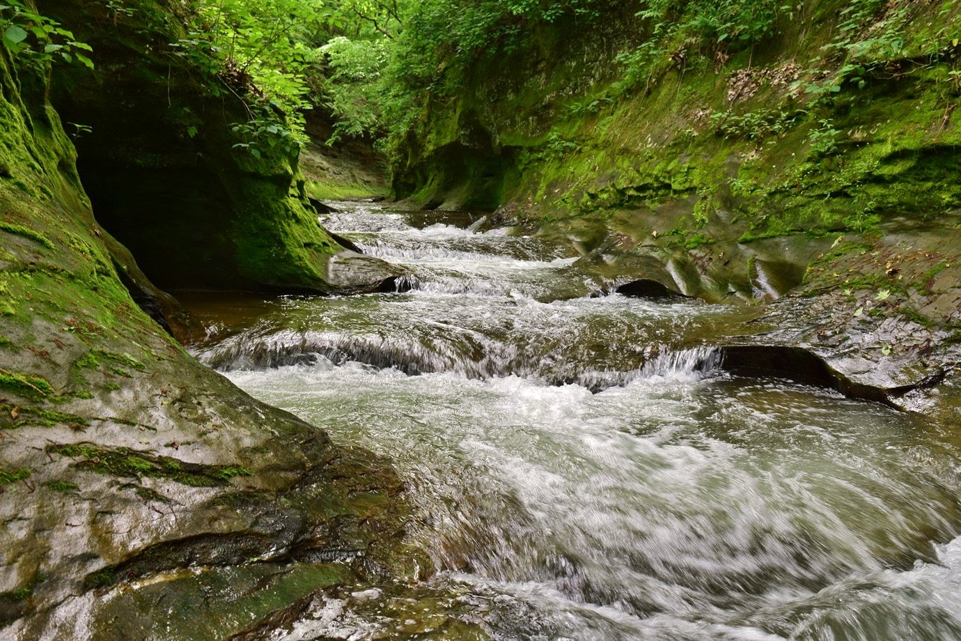
The lighting was poor, but it was really going. But there were a lot of people here, so I didn't linger too long. With the high water, heading downstream was mostly creek walking. The Giant's Bathtub was another very scenic small waterfall.

The sandstone cliffs in the canyon were really beautiful; unfortunately, vandals had carved the rock.

At Cedar Point, where a small tributary flows in, the trail led back up to the top and continued around the Bluff Trail loop.

Past Matthissen Lake, I saw some late spring wildflowers.

Wild geranium and wild blue phlox were blooming.

The trail looped around and crossed the little tributary on a small stone bridge.

The loop went around and down to the Lower Dells, but the the trail to Cascade Falls was closed due to flooding.

Unfortunately, there's no way to see it from the rim. So I headed back to the car and headed to Peru.
After checking into the La Quinta Inn, I took a dip in the pool to relax a bit and then had dinner at Jalapenos.

It was full of golden Alexanders in waves of yellow.

I like the name of these. I first hiked Henslow Trail to Route 53 Trail toward the overlook. Near the northwest corner of the pasture was a huge bison bull, right next to the fence.

I stopped for a couple pictures of this magnificent beast then continued on. The bison herd was established in 2015 to study the effects they had on prairie restoration. I did notice a lot of birds and butterflies in this area.

The red-winged blackbirds were striking.

At the southwest bison overlook, I saw a pair of deer but they took off quickly.

The view from the overlook was nice, but I couldn't see the main bison herd.

I continued on Route 53 Trail almost back to the visitor center, but turned around when it started to sprinkle. It never really rained, but drizzled most of the way back. The lone bison was in the same spot so I got a couple pictures under better light.

With the herd far off, I was lucky that one chose to graze over here.

Near the start, I got on Group 63 Trail heading northeast. There were some nice views of wildflower fields along the trail.

It's is named for a group of bunkers used to store munitions when this was a military facility. Bunker Group 63-1 on the eastern end was open and it was nice and cool inside, as the sun had come back out.

It was interesting to see one of the bunkers up close.

I also saw some silverberry flowering near the entrance.

On the way back, I inadvertently took the spur trail back and could see several more bunkers from the trail, but don't think any were open.

Back at the start, I realized I hadn't taken the main trail back and went a short ways along the southern end of the loop. Another bunker was open along, but I don't know the number.

I also spotted the Bison herd but they were too far away for a picture. It was getting pretty hot out now, so I headed back to the car.

Heading west, my next stop was at Matthiessen State Park. Although not as popular as Starved Rock, the parking here was almost full and it was very crowded. I hiked down to the big bridge over the creek at Cascade Falls. The bridge was very muddy so I crossed on the railing. Going upstream, I hiked to the lake.

Then, I took the interior trail down into the Upper Dells. Lake Falls was just upstream.

The lighting was poor, but it was really going. But there were a lot of people here, so I didn't linger too long. With the high water, heading downstream was mostly creek walking. The Giant's Bathtub was another very scenic small waterfall.

The sandstone cliffs in the canyon were really beautiful; unfortunately, vandals had carved the rock.

At Cedar Point, where a small tributary flows in, the trail led back up to the top and continued around the Bluff Trail loop.

Past Matthissen Lake, I saw some late spring wildflowers.

Wild geranium and wild blue phlox were blooming.

The trail looped around and crossed the little tributary on a small stone bridge.

The loop went around and down to the Lower Dells, but the the trail to Cascade Falls was closed due to flooding.

Unfortunately, there's no way to see it from the rim. So I headed back to the car and headed to Peru.

After checking into the La Quinta Inn, I took a dip in the pool to relax a bit and then had dinner at Jalapenos.