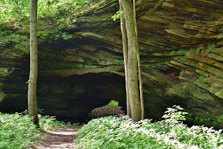
For Memorial Day weekend, I had United miles that would expire so I flew to Chicago to get waterfalls in a couple more states. Being United, my flight was delayed, Avis was incredibly slow in getting my rental car, and Chicago traffic was terrible. But finally, I made it to Indiana. My first stop was at Fall Creek Gorge Nature Preserve, near Williamsport. A short trail led into the preserve. Soon I came to a crossing of a tributary of Fall Creek at a little chute.

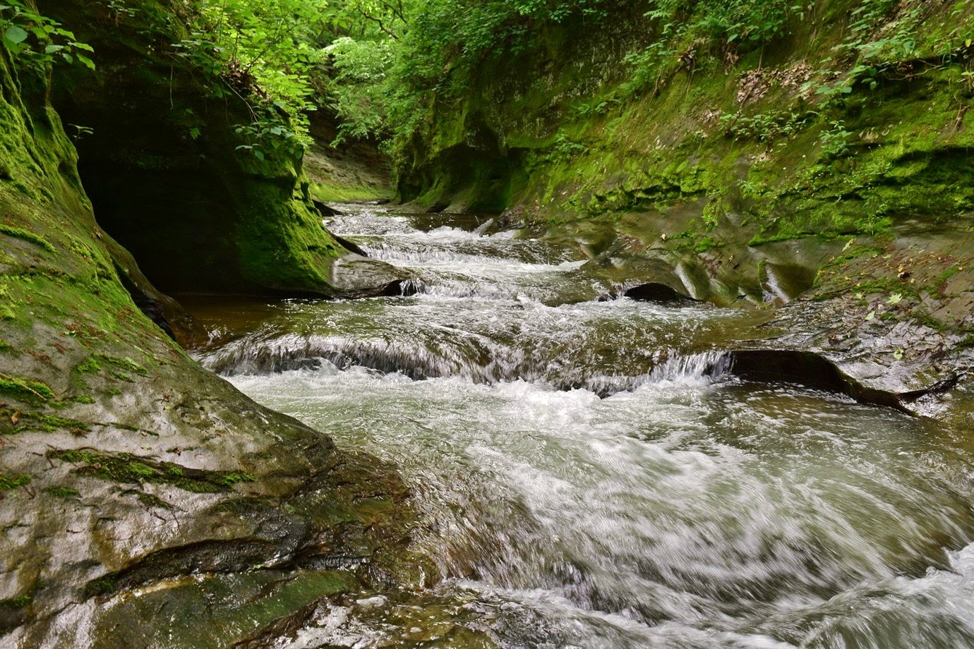
Just upstream on Fall Creek was the most narrow section of the gorge.

There were a lot of potholes in the creek here and it was really scenic.

And very out of place here in rural Indiana - the drive in had been farmland as far as the eye could see.

The trail continued a little further to a small waterfall on Fall Creek.

Although it wasn't very high, it was creek wide and scenic.

The gorge began just downstream of the waterfall.

There were some pretty wildflowers blooming here as well.

I saw some great waterleaf and wild geraniums along the creek.

After some pictures, I headed back.

My next stop was Williamsport Falls, the highest in Indiana at 90 feet, or so the sign at the parking area said. It was right in the center of the little town of Williamsport. The overlook was right next to the parking area, but the view from here was partly obscured by trees.

The falls were definitely flowing well. I continued past the fence and found a place to scramble down to the base for a better view.

The lighting wasn't great but the waterfall was really nice.

Hard to believe such a big waterfall exists in such an otherwise flat area. After some pictures, I climbed back up.

My next stop was across the Wabash River at Portland Arch Nature Preserve. I first parked at the north parking area off Scout Camp Road. The North Trail led from the parking area down to Portland Arch, one of the only natural arches in Indiana.
In high water, the small tributary was flowing under the arch.

Right past here were the ruins of an old dam on Bear Creek.

I saw some Virginia waterleaf blooming along the creek.

The trail lead right along base of the cliffs.

There were nice views of the canyon down here.

The trail then headed back up to loop back to the parking lot; I saw a cute raccoon as I was finishing up. Just a short drive further was the trailhead for South Trail. This trail led down to the bear creek and followed it around to the confluence with Rattlesnake Creek.

It was a scenic little trail through the forest.

Near the parking area, a bunch of ragwort were blooming.

That was my last hike for the day.

After finishing up, I drove to Lafayette and checked into the Hampton Inn. The hotel and room were very nice. Just across the street was Tapawingo Park and the John T. Myers Pedestrian Bridge across Wabash River.

The Wabash Heritage Trail, a national recreation trail led along the river here. I followed this trail southbound passing the wastewater treatment plant where there was a little garter snake along the trail.

Past here were some beautiful fields of butterweed.

I had seen a couple of these fields driving in but nowhere to stop. So this was a good opportunity to get some photos of all the yellow flowers.

The paved West Lafayette section ended shortly and I got on the unpaved Tippecanoe County portion. Flooding on the Wabash River prevented going much further.

So I turned around and headed back. The river was really scenic in the evening light.

A fountain was right at the base of the pedestrian bridge.

I was close to the hotel now, but wanted to find a restaurant before heading back.

I was getting really hungry by this point so went to Scotty's Brewhouse for dinner then back to the hotel.

Just upstream on Fall Creek was the most narrow section of the gorge.

There were a lot of potholes in the creek here and it was really scenic.
And very out of place here in rural Indiana - the drive in had been farmland as far as the eye could see.

The trail continued a little further to a small waterfall on Fall Creek.

Although it wasn't very high, it was creek wide and scenic.

The gorge began just downstream of the waterfall.

There were some pretty wildflowers blooming here as well.

I saw some great waterleaf and wild geraniums along the creek.

After some pictures, I headed back.

My next stop was Williamsport Falls, the highest in Indiana at 90 feet, or so the sign at the parking area said. It was right in the center of the little town of Williamsport. The overlook was right next to the parking area, but the view from here was partly obscured by trees.

The falls were definitely flowing well. I continued past the fence and found a place to scramble down to the base for a better view.

The lighting wasn't great but the waterfall was really nice.

Hard to believe such a big waterfall exists in such an otherwise flat area. After some pictures, I climbed back up.

My next stop was across the Wabash River at Portland Arch Nature Preserve. I first parked at the north parking area off Scout Camp Road. The North Trail led from the parking area down to Portland Arch, one of the only natural arches in Indiana.

In high water, the small tributary was flowing under the arch.

Right past here were the ruins of an old dam on Bear Creek.

I saw some Virginia waterleaf blooming along the creek.

The trail lead right along base of the cliffs.

There were nice views of the canyon down here.

The trail then headed back up to loop back to the parking lot; I saw a cute raccoon as I was finishing up. Just a short drive further was the trailhead for South Trail. This trail led down to the bear creek and followed it around to the confluence with Rattlesnake Creek.

It was a scenic little trail through the forest.

Near the parking area, a bunch of ragwort were blooming.

That was my last hike for the day.

After finishing up, I drove to Lafayette and checked into the Hampton Inn. The hotel and room were very nice. Just across the street was Tapawingo Park and the John T. Myers Pedestrian Bridge across Wabash River.

The Wabash Heritage Trail, a national recreation trail led along the river here. I followed this trail southbound passing the wastewater treatment plant where there was a little garter snake along the trail.

Past here were some beautiful fields of butterweed.

I had seen a couple of these fields driving in but nowhere to stop. So this was a good opportunity to get some photos of all the yellow flowers.

The paved West Lafayette section ended shortly and I got on the unpaved Tippecanoe County portion. Flooding on the Wabash River prevented going much further.

So I turned around and headed back. The river was really scenic in the evening light.

A fountain was right at the base of the pedestrian bridge.

I was close to the hotel now, but wanted to find a restaurant before heading back.

I was getting really hungry by this point so went to Scotty's Brewhouse for dinner then back to the hotel.
No comments:
Post a Comment