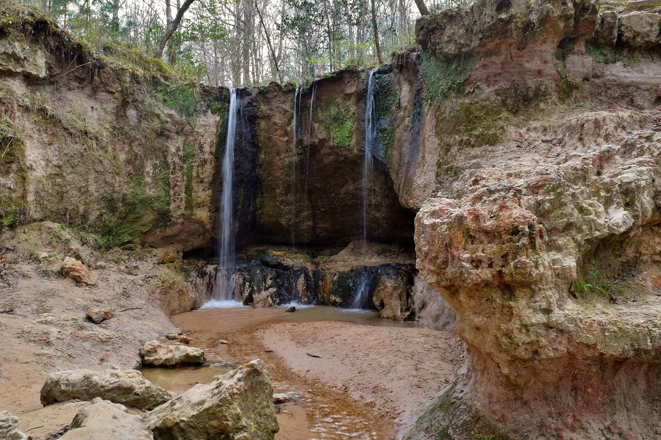
Monday, I was going to get some waterfalls in Mississippi. After checking out of the hotel, I drove south from Natchez on US-61 to Woodville and headed west on Pinkneyville Road to Clark Creek Natural Area. Although it's just a couple miles from the Mississippi River, this area is extremely hilly and contains a number of waterfalls. After paying the day-use fee, I started down the Clark Creek Trail. It's an old road but heads down steeply, so I knew it would be a steep hike back up on the way out. Soon I made it to spur to the 1st waterfall, flowing down in three ribbons.

Although it didn't have high water flow, it was taller than I expected and the small gorge was really scenic.

Next I headed to the 2nd waterfall.

Mississippi really needs to work on waterfall naming. The trail ended at an overlook and I had to climb down a rope to reach the base.

I was really amazed at how rocky this little tributary was.

Some of the boulders were huge. From here, I got back on the main trail and spotted some pretty butterweed blooming next to a wet area.

I finished up the Clark Creek Trail at a tributary, downstream from the first two waterfalls. No waterfalls here, but there were some nice patches of wild blue phlox.

From here, I took the Waterfall Trail towards the northern part of the park. At a graffiti-covered shelter, I found a path that headed down to the gorge at the 6th waterfall.

It was a fairly easy climb down to this one and there were some wildflowers blooming in the creek by the falls.

Next, I creek-walked downstream a short ways to the 5th waterfall. This one was pretty big and I wouldn't be able to just climb down. A scramble path along the wall of the gorge led to a rope tied to a tree and I was able to climb down into the gorge using the rope.

The 5th waterfall was a big one and very scenic though all of these waterfalls were pretty low flow. It would have been tough to climb back up so I just creek-walked down this tributary.

Where it flowed into Clark Creek, I turned right and creek-walked up to the 4th waterfall. This was my favorite in the park.

It may have been the biggest one and the setting was just beautiful with lots of wildflowers blooming all around.

I was also able to walk behind this one. Creek-walking back, I got on the Primitive Trail and continued following Clark Creek downstream on dry land.

In under half a mile, the trail forded a creek near the property boundary and then headed steeply up to a summit with a shelter, but it was so overgrown, there were no views from here. I did spot some beautiful red buckeye blooming along here.

Continuing down, the trail shortly passed two unnamed waterfalls, I'm calling them 7th and 8th. The trail passed right over the top of the 7th waterfall and it was a small one, so easy to climb down to see it.

Then the trail passed the 8th, which is just downstream of 7th. This one was a bigger falls in two sections and it was quite strenuous getting down.

I didn't go all the way down to the creek, but had a decent straight-on view from the steep slope. Soon I reached the southwest corner of the park and the trail turned to the east following another tributary upstream. Where the trail turned north away from the tributary, I tried creek-walking further up but didn't find another waterfall. There was one on another tributary where the trail turned, which I'm calling the 9th, and I was able to get up to the base of this one.

From here, the trail got really steep heading up. I really couldn't believe how steep these Mississippi trails were. In under a mile, the trail crossed the top of the 3rd waterfall. This one had another really steep descent into the gorge.

I had almost completed the loop and this would be my last waterfall in the park, so I had a snack down here enjoying the views.

Then I made the steep ascent back up to the trail and finished up the Primitive Trail near the 1st Waterfall. The rest of the hike back was just a half-mile, but it was steep and I was definitely feeling it in my legs by now. Not expected for Mississippi.

Back at the car, I had a long drive ahead of me. I had gotten waterfalls in Louisiana and Mississippi, so my next target was Florida. I took back roads back into Louisiana and got on US-61 south to Baton Rouge. Then it was I-12 to I-10 and the long drive east. After three and a half hours or so, I needed to stretch my legs so got off I-10 at exit 61 in Mississippi for Mississippi Sandhill Crane National Wildlife Refuge. The visitor center was closed on Monday, so I just hiked the C.L. Dees Nature Trail.

The trail makes a three-quarter mile loop through a wet pine savanna, the habitat of the critically endangered Mississippi subspecies of sandhill crane. This subspecies is non-migratory and lives year round in these savannas.

I didn't see any cranes, but did spot some pitcher plants and wildflowers blooming, like these yellow jessamine.

There was also a lot of saw palmetto in the understory.

Looping back towards the start, the trail runs along Bayou Castille.

Towards the end, there was a marsh overlook at a swampy portion of the bayou.

A cypress tree draped in Spanish moss was just past the overlook. Then I finished the trail back up to the parking lot.

I reluctantly got back in the car and continued east for about another 3 hours to Chipley, Florida and stayed at the Comfort Inn.

Although it didn't have high water flow, it was taller than I expected and the small gorge was really scenic.
Next I headed to the 2nd waterfall.

Mississippi really needs to work on waterfall naming. The trail ended at an overlook and I had to climb down a rope to reach the base.

I was really amazed at how rocky this little tributary was.

Some of the boulders were huge. From here, I got back on the main trail and spotted some pretty butterweed blooming next to a wet area.

I finished up the Clark Creek Trail at a tributary, downstream from the first two waterfalls. No waterfalls here, but there were some nice patches of wild blue phlox.

From here, I took the Waterfall Trail towards the northern part of the park. At a graffiti-covered shelter, I found a path that headed down to the gorge at the 6th waterfall.

It was a fairly easy climb down to this one and there were some wildflowers blooming in the creek by the falls.

Next, I creek-walked downstream a short ways to the 5th waterfall. This one was pretty big and I wouldn't be able to just climb down. A scramble path along the wall of the gorge led to a rope tied to a tree and I was able to climb down into the gorge using the rope.

The 5th waterfall was a big one and very scenic though all of these waterfalls were pretty low flow. It would have been tough to climb back up so I just creek-walked down this tributary.

Where it flowed into Clark Creek, I turned right and creek-walked up to the 4th waterfall. This was my favorite in the park.

It may have been the biggest one and the setting was just beautiful with lots of wildflowers blooming all around.

I was also able to walk behind this one. Creek-walking back, I got on the Primitive Trail and continued following Clark Creek downstream on dry land.

In under half a mile, the trail forded a creek near the property boundary and then headed steeply up to a summit with a shelter, but it was so overgrown, there were no views from here. I did spot some beautiful red buckeye blooming along here.

Continuing down, the trail shortly passed two unnamed waterfalls, I'm calling them 7th and 8th. The trail passed right over the top of the 7th waterfall and it was a small one, so easy to climb down to see it.

Then the trail passed the 8th, which is just downstream of 7th. This one was a bigger falls in two sections and it was quite strenuous getting down.

I didn't go all the way down to the creek, but had a decent straight-on view from the steep slope. Soon I reached the southwest corner of the park and the trail turned to the east following another tributary upstream. Where the trail turned north away from the tributary, I tried creek-walking further up but didn't find another waterfall. There was one on another tributary where the trail turned, which I'm calling the 9th, and I was able to get up to the base of this one.

From here, the trail got really steep heading up. I really couldn't believe how steep these Mississippi trails were. In under a mile, the trail crossed the top of the 3rd waterfall. This one had another really steep descent into the gorge.

I had almost completed the loop and this would be my last waterfall in the park, so I had a snack down here enjoying the views.

Then I made the steep ascent back up to the trail and finished up the Primitive Trail near the 1st Waterfall. The rest of the hike back was just a half-mile, but it was steep and I was definitely feeling it in my legs by now. Not expected for Mississippi.

Back at the car, I had a long drive ahead of me. I had gotten waterfalls in Louisiana and Mississippi, so my next target was Florida. I took back roads back into Louisiana and got on US-61 south to Baton Rouge. Then it was I-12 to I-10 and the long drive east. After three and a half hours or so, I needed to stretch my legs so got off I-10 at exit 61 in Mississippi for Mississippi Sandhill Crane National Wildlife Refuge. The visitor center was closed on Monday, so I just hiked the C.L. Dees Nature Trail.

The trail makes a three-quarter mile loop through a wet pine savanna, the habitat of the critically endangered Mississippi subspecies of sandhill crane. This subspecies is non-migratory and lives year round in these savannas.

I didn't see any cranes, but did spot some pitcher plants and wildflowers blooming, like these yellow jessamine.

There was also a lot of saw palmetto in the understory.

Looping back towards the start, the trail runs along Bayou Castille.

Towards the end, there was a marsh overlook at a swampy portion of the bayou.

A cypress tree draped in Spanish moss was just past the overlook. Then I finished the trail back up to the parking lot.

I reluctantly got back in the car and continued east for about another 3 hours to Chipley, Florida and stayed at the Comfort Inn.


