Monday, November 24, 2014

Ringing Rocks

Monday morning, we had breakfast with Sandy’s dad again and then packed our stuff up and started making our way to Pennsylvania. We would be spending Thanksgiving with her other aunt and uncle in Doylestown, north of Philadelphia. Along the way, we stopped at the mall in King of Prussia, so Sandy could get in a little holiday shopping and take advantage of Pennsylvania’s lack of sales tax on clothing. We had lunch at Rock Bottom, a brewery and restaurant, where I tried their Ichabod’s Pumpkin Ale, complete with a cinnamon-and-sugar-rimmed glass. It was yummy! Leaving King of Prussia, we headed towards Doylestown, but stopped for another waterfall just outside of town. We headed north of Doylestown on PA-611 and headed to Ringing Rocks County Park. Not only is there a waterfall at this park, but there are also musical rocks! After parking, we hiked down the short trail past the rock field to Ringing Rocks Falls.


We came out at the top of the waterfall and had to scramble down to the base for good views of the waterfall. The water flows over a rock face and falls about 18 feet in two streams. It’s not a particularly exceptional waterfall, but rather unexpected in the rolling hills of Bucks County.


After some pictures, we headed back on the trail and then headed out to Ringing Rocks. Having planned for an excursion here, I remembered to pack a hammer to bring with us. There were several other people here, so we climbed out to an unoccupied area and began hitting the rocks.


Due to an unusual resonance of the rocks, they ring like a bell when hit with a hammer. We spent a while here, banging on the rocks and making “music”. It was a really unique experience. When we were finished, we headed to Doylestown and unpacked. Sandy’s uncle told us people had been banging those rocks since he was a child.

Sunday, November 23, 2014

Rocks and Wolves

Sunday morning, we woke up and went to breakfast with Sandy’s dad. After breakfast, we started heading north. There was a detour on MD-24 at Rocks State Park and we had to go a little out of the way. We followed MD-23 to MD-165 and took the short gravel drive to the Falling Branch area of the park. We arrived just before 10 and had to wait a couple minutes for the gates to open. Once the park opened, we headed out on the short hike to Kilgore Falls, the second highest free-falling waterfall in the state of Maryland.


At 18 feet, it’s not a particularly high waterfall, but very pretty with three distinct streams flowing over the rock face. As we approached the waterfall, we realized that we would have to rock hop across Falling Branch to get a good view of the waterfall. Not expecting a challenging hike, neither of us had worn hiking boots or brought trekking poles. But we found a couple of sticks on the ground to act as poles and made it across and headed up to near the base of the waterfall. It was a chilly morning and there was ice around the waterfall, making the waterfall that much more scenic.


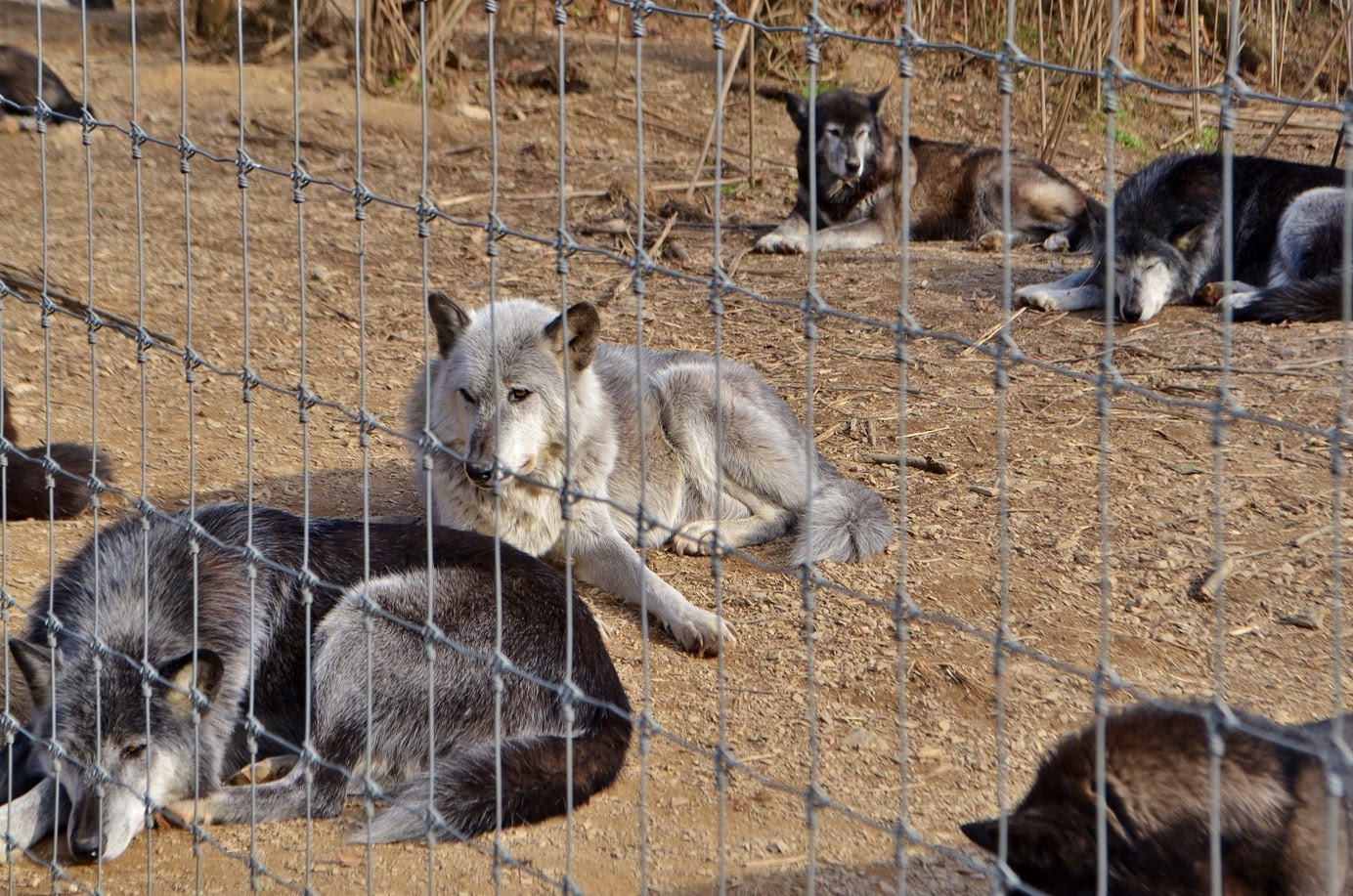
It’s my understanding that this is a popular waterfall and swimming hole in the warmer months, but early on a November morning, we had the place to ourselves. We didn’t linger long, however, as we had to get up to Pennsylvania. We drove for a little over an hour through Lancaster to the Wolf Sanctuary of PA. Sandy’s mom had suggested we visit while we were in the area. We arrived right at 12, purchased our tickets, and started the tour. There were a lot of people here and our tour group was fairly large, but our tour guide, Denny, did a great job and the tours still felt personal. For about 2 hours, Denny took us around to meet the different packs.


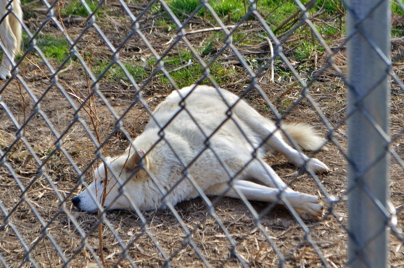
The first pack we visited was Merlin’s pack, including him, Keisha, and his son Tioga. Merlin was the alpha, but he wasn't interested in food or visitors today. Tioga, was very interested in food, however. If Merlin had been interested, Tioga would have had to wait for his treats. At one point, Tioga peed in his enclosure. Almost immediately, Merlin jumped up, ran across the enclosure, peed over Tioga’s spot, then ran back and went back to sleep! It was amazing how he showed his dominance.


Later, we visited the large pack with about a dozen wolves, some who were hungry and excited for treats, others who didn’t bother getting up.


Sandy’s favorite wolf was Winston, an older wolf who lived in this pack. Denny said he had to specially give Winston his food as the others sometimes bullied him.


At one point on the tour, Denny made howling sounds. Soon, one wolf joined in howling, then a couple more, and pretty soon, just about all the wolves were howling! It was a beautiful sound.


We had a really good time on this tour and it was great to see how these people were taking care of these beautiful animals.


Our tour finished up a little after 2 and we started heading back to Maryland. But before we headed back to her relatives’ house, we stopped back at Rocks State Park and went to the Rock Ridge Picnic Area. It was getting late and we didn’t have a lot of time, so we quickly hiked the short red trail to King and Queen Seat.


This huge rock outcrop above Deer Creek provided great views in the waning daylight. It’s believed to have once been a ceremonial meeting place for the Susquehannock people. We climbed around on the rocks for a bit and got some pictures of the lovely views over the Deer Creek valley and then headed back to the in-laws.


We had dinner with her family again and then started getting our stuff packed up in preparation to head to Pennsylvania.

Saturday, November 22, 2014

Great Falls and Billy Goat Trail

For the Thanksgiving holiday, Sandy and I had to head up north to visit her relatives. So of course, we had to get some waterfalls on the way! We would first be heading to Forest Hill, Maryland to visit her aunt and uncle. We left early Saturday morning and started heading north on I-85 and I-95 through Virginia. Near Washington, DC, we got on I-495 and took Clara Barton Parkway to the Great Falls Tavern area of Chesapeake & Ohio Canal National Historic Park. After paying admission and parking, we headed out past the old tavern along the towpath following the canal. After passing the Mercer canal boat that was propped up in the canal, we turned right to head towards Great Falls. The Olmsted Island Bridges are a series of wooden bridges and boardwalks that extend from the towpath to the far end of Olmsted Island.


The Potomac River is turbulent here, tumbling down cascades and rocky falls as it flows past the island. We followed the bridges out to the far end of Olmsted Island at a viewing platform for Great Falls.


Great Falls is a surprisingly large waterfall on the Potomac River at the fall line - where the Piedmont transitions to the coastal plain. Even more surprising is its close proximity to Washington, DC, only about 15 miles. The falls consists of a series of cascades totaling about 76 feet in height with a huge volume of water.


We had a nice panoramic view of the falls from the overlook, but it was from a distance. Visitors are not allowed off the wooden viewing platform for a closer look. It was also quite crowded, so we got a few pictures and then headed back. We had forgotten to pick up lunch, so we quickly headed back to the car and got some snacks, then headed back down the towpath.


Right before the stop gate, we turned to get on Billy Goat Trail A, which heads out onto the rocky Bear Island. This trail is a lot of fun as it involves much scrambling over rocks and boulders and even a section where we would have to scale a cliff. The trail starts off moderate - rocky ground, but mostly flat and not too hard to follow.


There were a couple nice spots with great views of Mather Gorge and Potomac River and the Virginia park on the other side.


About half-way, we got to the cliff. The main path up and down goes through a crevasse in the cliff to provide some footing. There were a bunch of people coming down and we didn’t really want to wait, so we just climbed up along the side to make it to the top. We continued along, eventually descending down to river level at Purplehorse Beach.


I climbed out onto the rocks for some more pictures of the river, but there was a good bit of ice out here and very slippery. Then, we finished up the trail, arriving back at the towpath about a mile down from where we had gotten off of it near Widewater.


As we started hiking back, we stopped at a little pond to see a beaver walking across.


The pond was partially frozen and the beaver was making his way across, slipping and sliding as he went. At one point, the thin ice broke and he splashed into the water, then made his way to the edge. He was poking around looking for food and eventually climbed up to the towpath to nibble on vegetation right alongside the trail.


We got some pictures and video of this beaver, who didn’t seem to be afraid of humans at all. Then we finished walking back up the towpath to the tavern and returned to our car. This is a great little park, right outside Washington, DC, and I’m glad we made it here. We’ll have to come back to explore more again some time soon when we have more time. From here, we finished the drive up to Forest Hill and had dinner with Sandy’s family before going to bed early.

Saturday, November 15, 2014

Goose Creek Hike

This past Saturday, I headed to the coastal plain of eastern North Carolina for some hiking at Goose Creek State Park. I met up with Jason, Anna, and Shawna in Durham at around 7 and we carpooled out to the park, arriving just after 9. There was a trail race at the park and it was quite crowded. The parking lots were full, so we had to park along the side of the road just past the picnic area then waited for a while at the visitor center for everyone else in the group to arrive.


Once everyone was ready, we headed off hiking down the Palmetto Boardwalk Trail. This trail is only about a half-mile and nearly the entire trail is a boardwalk over a swampy area.


The trail race was almost finished, but we passed a few stragglers hiking down the boardwalk. At the end of this trail, we turned left to start hiking the Tar-Kiln Trail.


This is the newest of the park’s trails and leads from the boardwalk towards Mallard Creek. There are the remains of several old tar kilns along this trail.


At the first, we stopped for a few minutes and Bill gave a brief history lesson about how tar kilns work and the importance of the logging industry and specifically, tar and pitch, to the area. We also learned where the term "tar heel" came from. From here, we continued on a to the end of the trail and turned left onto Mallard Creek Trail.


It was only about a quarter-mile to the end of the trail at its namesake creek, but it was a particularly scenic section of trail with the trees draped in Spanish moss.


The trail ends at an overlook on Mallard Creek with nice views of the wide marshy creek.


We returned on the trail and took the short Huckleberry Trail to Live Oak Trail, passing an old cemetery dating to the late 19th century.


Not much is known about the cemetery or those who are buried there, but it's believed that there was a disease outbreak across the Pamlico River and people buried there loved ones across the river to prevent the spread of disease.


Past the cemetery, the Live Oak Trail runs along the shore of Pamlico River and there were some beautiful spots along the narrow sandy beach.


Although it was a little cool out, the sky was clear and the river was beautiful from the beach, lined with Live Oaks and Cypress trees draped in Spanish Moss.


One tree had the beautiful orange leaves of autumn with much Spanish Moss draped in between - I had never seen the combination of fall color and Spanish Moss before and it was gorgeous.


We ate lunch at the picnic area here and then got on Goose Creek Trail heading northwest.


The trail was mostly a sandy path heading through a pine forest with a couple spots of boardwalk traversing black gum and cypress swamps. As we approached the campground, we turned left onto Flatty Creek Trail and hiked the loop out to the overlook near where Flatty Creek joins Pamlico River.


Heading back, we turned left back on Goose Creek Trail and followed it to the end past the campground where Goose Creek feeds into Pamlico River. There was a really cool tree here at the edge of the water.


Much of the earth that anchored the tree in place had eroded and the roots were clearly visible. Vertical roots went straight down into the sandy soil and horizontal roots went across, connecting to the edge of the ground. There was several feet between the river bank and the base of the tree where the roots emerged and we climbed up onto the tree. After getting some pictures here, we hiked back along the campground road and turned left onto Ivey Gut Trail and followed this trail back to the start.


Where the trail crossed the main road, there were cute little stop signs at the trail crossing. Back at the Palmetto Boardwalk, we turned left to follow this back to the visitor center and finish our hike.

Saturday, November 8, 2014

Clemmons Forest Hike

This past Saturday, I headed over to Clemmons Educational State Forest near Clayton for an afternoon hike. Betsy was leading the hike and there were about 15 of us participating. The forest doesn't open until 11, so we got started around 1130. We started off from the Water Quality Deck near the pond and got some pictures of the nice fall color on the pond.


The still waters on the pond made an almost perfect mirror, reflecting the vibrant colors of the tress along the shore. Walking past the pond, we got on the Talking Rock Trail and listened to some of the interpretive displays describing the geology of the area. We also saw the oldest loblolly pine in the forest along this trail.


After finishing the short loop, we started hiking the Demonstration Trail, making a quick stop to see an old pine straw baler just off the trail.


Shortly after this detour, we hiked through an area near Beddingfield Creek where a large number of ferns were growing in the floodplain of the creek.


The Demonstration Trail makes a double loop and at the far end, we got on the Watershed Extension Loop that runs along the northern perimeter of the forest. There was some nice fall color along this area as we hiked along creeks and through powerline clearings.


Much of the best fall color to be seen was along these clearings with bright orange and red leaves lining the edges of the clearings.


Betsy was planning to do a “scavenger hunt” hike to find mushrooms in the forest. However, with the cold weather, there weren't a lot of fungi growing, though we did see some pretty turkey trail right in the middle of the trail.


Over half-way through the Watershed Extension Loop, there was a stream crossing over Mike's Creek and I saw a guy that looked an awful lot like Bill hiking up the other way. Turns out it was Bill! He decided to join us and caught up by hiking the trail in the opposite direction. When we finished out the loop and got back on the Demonstration Trail, we made a stop for lunch and snacks, then finished up the loop back at the parking area. After our hike, about half of us were a little thirsty so we headed to Deep River Brewing Company in Clayton for some after-hike drinks!