Hike Length: 0.4 miles
Estimated Time: < 1 hour
Difficulty: Easy
Location: Hawks Nest State Park
Trail Users: Hiking only
Dogs: Yes
Features: Waterfalls (1+)
Crowds: Low
Warnings: The rocks around waterfalls are very slippery.
Trailhead GPS: 38.13461,-81.10099
Waterfall GPS: 38.13209,-81.09935
Directions:
From Fayetteville, head north on US-19 for about 3 miles and turn left on Amos Heights Road. Go a total of 4.7 miles, the road turning to Old Mill Creek Road, then turn left to stay on Old Mill Creek Road. Go another 0.4 miles to parking for Ansted Rail Trail.
Map:
Hike Description:
Hike down the gravel road to a bridge over Rich Creek. Ansted Rail Trail starts across the bridge. Don't cross, instead follow a path on river left past a fenced off utility structure staying close to Rich Creek. In less than 0.1 miles, come to the ruins of an old mill.
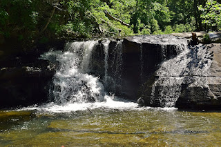
Turn left and go down to creek level to see Upper Mill Creek Falls. Westlake Falls is to the right.
Blog Entries:
25-May-2025: Hawks Nest Waterfalls
External Links:
WV State Parks website: https://wvstateparks.com/park/hawks-nest-state-park/


No comments:
Post a Comment