
Length: 2.8 miles (loop)
Estimated Time: 1 hour
Difficulty: Easy
Location: Lake Johnson Park
Trail Users: Hiking, dog walking, bicycles and other non-motorized uses are permitted
Dogs: Must be on a leash
Features: Lakes, Forest, Birding
Crowds: High
Warnings: None
Trailhead GPS: 35.75861,-78.71690
Directions:
The trailhead is at the Lake Johnson parking on Avent Ferry Road. From I-40 in Raleigh, take exit 295 for Gorman Street. Go south on Gorman Street for 0.4 miles and turn right on Tryon Road. In 0.9 miles, turn right on Avent Ferry Road and drive 0.7 miles to the parking lot on the right.
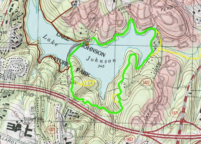
Map:
In the following map, the hike is shown in green and follows the loop in the counterclockwise direction.


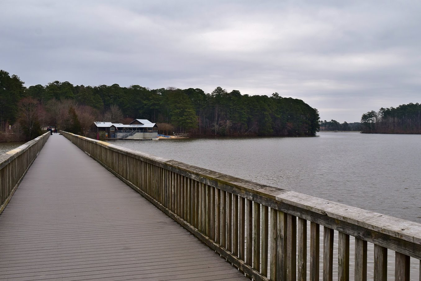
In about 2.5 miles the trail passes the Waterfront Center where restrooms and boat rentals are available. Cross Lake Johnson on the pedestrian bridge running parallel to Avent Ferry Road and the trailhead is just beyond the bridge.

27-Jun-2020: Lake Johnson and Yates Mill
From the parking area, go right on Lake Johnson East Loop. A spur to an overlook splits off but stay on the main trail. The trail runs close to I-40 through a hilly section of the park.

At about 0.7 miles, a short scenic loop splits to the left and then rejoins. At about 1.5 miles, Walnut Creek Trail splits to the right and leads to the parking on Lake Dam Road. The trail crosses the dam right after.

There are nice views of the lake from here and this is a popular hang-out spot.

The trail then turns west to head across the north shore of the lake, staying close to the shore.

The trail runs closely between the lake and adjacent subdivisions.
In about 2.5 miles the trail passes the Waterfront Center where restrooms and boat rentals are available. Cross Lake Johnson on the pedestrian bridge running parallel to Avent Ferry Road and the trailhead is just beyond the bridge.
Blog Entries:
27-Jun-2020: Lake Johnson and Yates Mill
External Links:
City of Raleigh website: https://raleighnc.gov/places/lake-johnson-park
No comments:
Post a Comment